

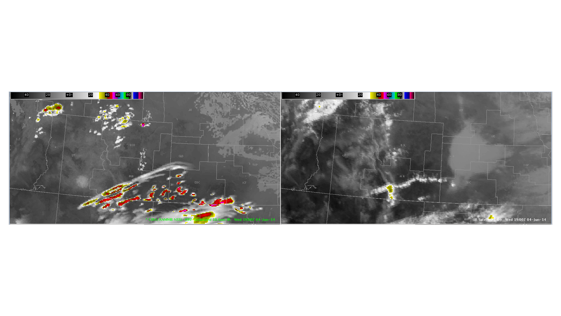
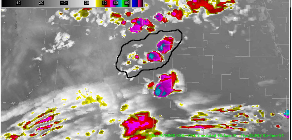
 The image at the top shows the comparison of the simulated IR imagery vs the actual IR satellite image. Based on the performance of the simulated imagery, I would expect the best chance for strong convection to occur in the area outlined in black, as shown in the second image. The second image is the forecast for 02Z Thursday, so as that time approaches, would be fairly excited for storms going up in that region.
-KP
-D. Satterfield