A moderate risk for severe storms was forecast for the Southern Plains with hail, wind, and tornadoes as significant threats. Storms quickly initiated in southwest Kansas (See Figure 2) and were ongoing when the testbed started at around 19z. Primarily used during warning operations were ProbSevere, LightningCast, and radar. Thrown in for good measure I used OCTANE to aid in storm motion and direction. ProbSevere was helpful in issuing warnings but was vital in assisting in the hail size mentioned in the warning text.
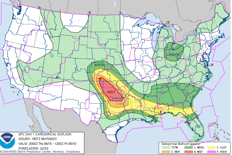
Figure 1: SPC Day 1 Outlook for June 15, 2023.
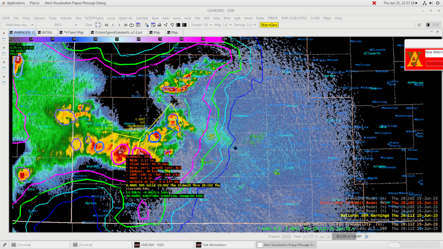
Figure 2: 2011z showing ProbHail with a MESH of 2.17” provided the confidence to mention 2-inch hail in the text. There were two separate storms that eventually merged later in the afternoon.
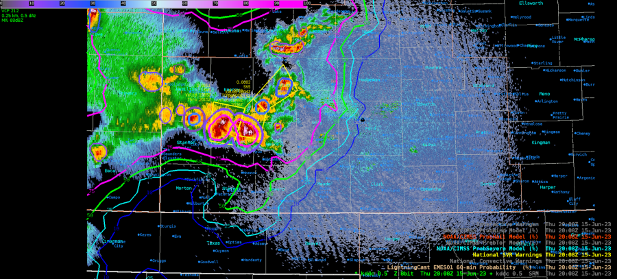
Figure 3: storms were beginning to merge and ProvSevere was as well and thus prompted just one warning instead of two.
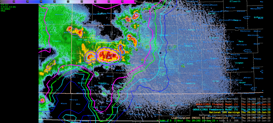
Figure 4: New warning with ProbSevere now depicting just one storm.
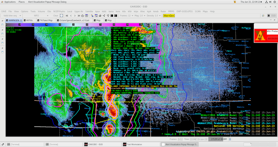
Figure 5: Storms continued to merge and evolved into a wind signature more than a hail producer. Thus the ProbWind had a nice uptick to 68% at 2133z. Before this time it never rose bout 40%.
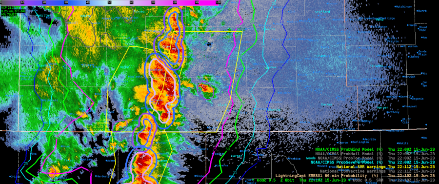
Figure 6: Once the convection evolved into a linear wind producer, LightningCast became helpful in how far east to extend the polygon. I used the 75% contour and issued a 60-minute warning.
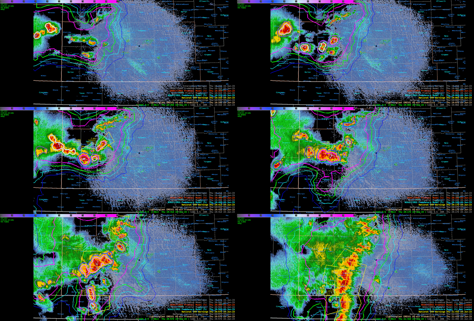
Figure 7: Captured much of the event to show the evolution of convection and ProbSevere.
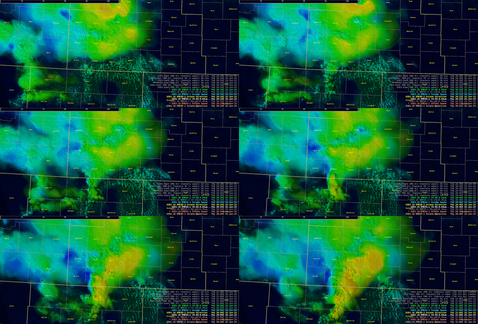
Figure 8: OCTANE aided in determining the area of cell merger in southern Grant and portions of Stevens Counties.
– Podium
