
Today, I took on the role of mesoanalyst during operations. I first looked at PHS fields (mainly MUCAPE and bulk shear) and compared them to the SPC mesoanalysis of said fields. The two agreed well, though I do have a suggestion – PHS bulk shear fields are given in m/s, but knots or mph would be better for quick comparison to SPC mesoanalysis and most model output.
I then looked at OCTANE imagery and immediately took note of the divergence signature associated with an especially robust storm over western DDC (Figure 1). This signature was easy to identify as the environmental winds aloft were relatively light.
Figure 1
As the operational period wore on, LightningCast indicated a high likelihood of convection over the southwest portion of DDC well before any radar returns actually appeared (Figure 2). My group used this information to create a DSS graphic that highlighted this area for likely storm development later (which did in fact end up happening).
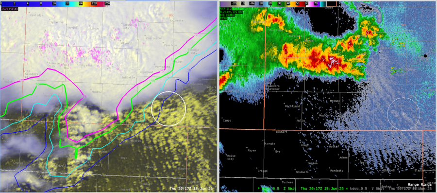
Figure 2
OCTANE Direction later captured what at first glance appeared to be a couple divergence signatures over southwestern DDC (Figure 3). Upon closer inspection, however, these signatures were co-located with relative minima in OCTANE Speed. The proximity of these signatures to areas of missing pixels (where winds are likely <5 kts) in OCTANE Direction suggests very light winds and/or lower quality data, per the developer.
Figure 3
– Vort Max