
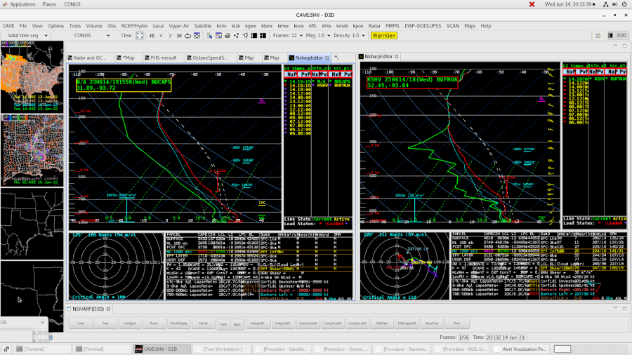
NUCAPS
Noticed the SHV special sounding was very similar to the NUCAPS sounding done an hour later. NUCAPS on the left and SHV on the right. The surface and near surface environment did not match as well.
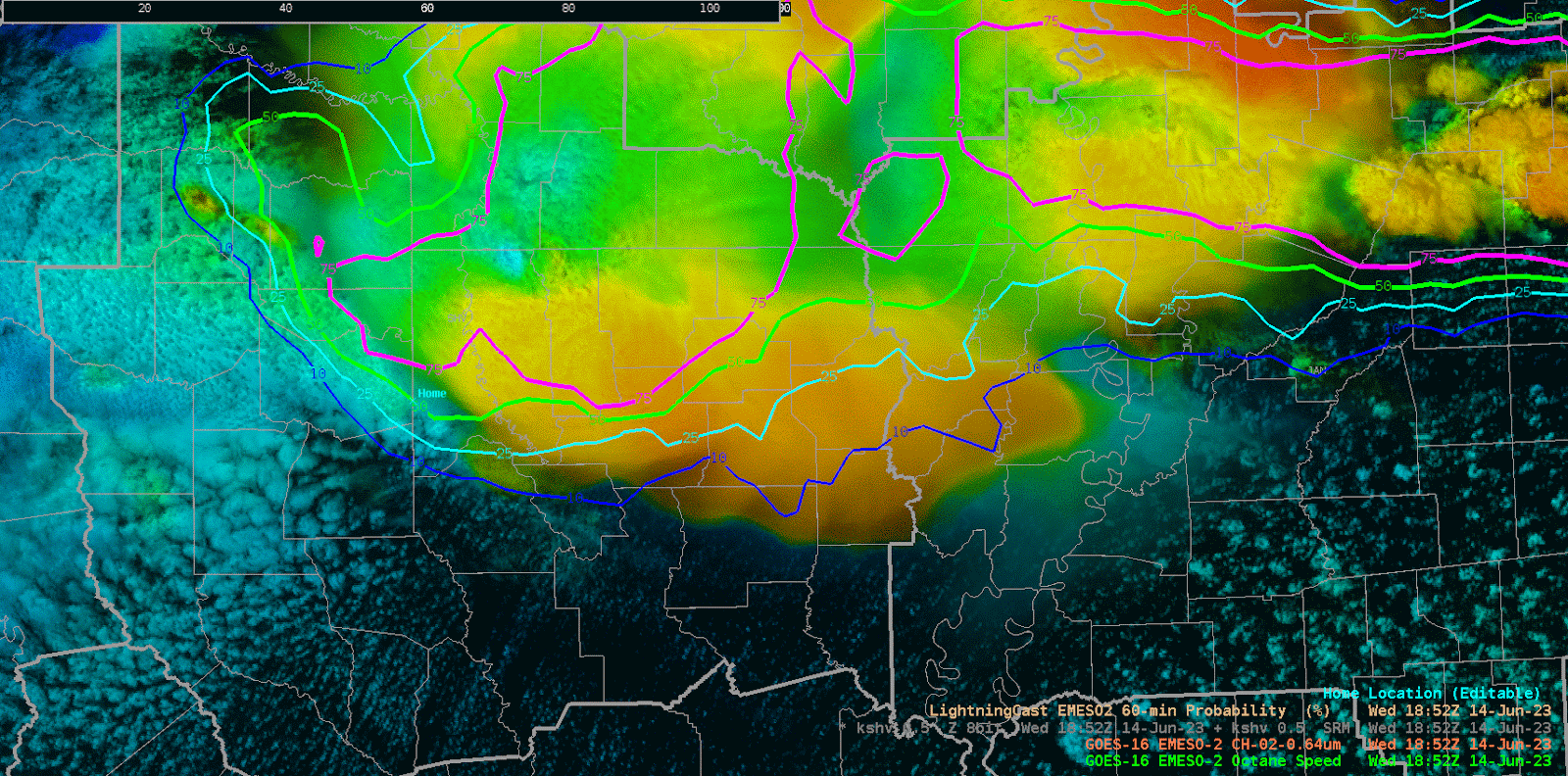
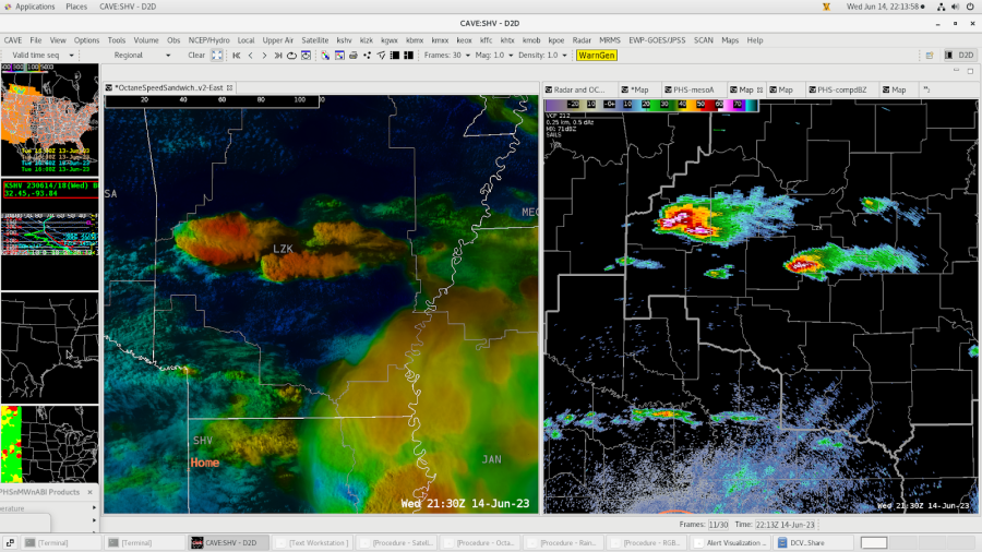
OCTANE
Neat to see OCTANE highlight the taller clouds that are developing behind the main storm activity over the western CWA. Lightning Cast started highlighting this area too for a lightning threat.
Very nice divergent signature on the updraft. However, the 80 kts of divergence seems underdone given the MESH of 1.51”. I know the speeds are dependent on the environmental winds, but just seemed odd given the hail potential. Calibration would be helpful to help determine the hail size potential based on updraft divergence.
OCTANE captured two updrafts from a splitting storm over LZK’s CWA. This helped to see the potential split earlier than when viewable on Radar.
Here is when OCTANE first denoted the split vs. what radar had at the same time.
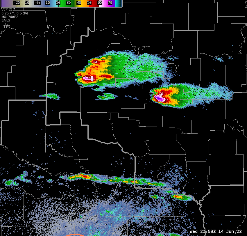
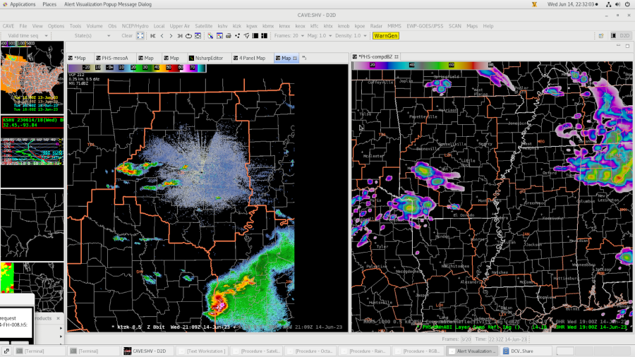
PHS
Handled the storm location and timing rather well at the start of the exercise for SHV.
Noticed for the LZK CWA PHS was about 2-3 hours early with the storm activity, but had the location correct. Radar image at 21z, PHS image at 19z
– Rainman