
OCTANE-Direction
- Distinguish different air masses when they are characterized by different advection regimes
- Stable cloud streets in magenta (Figure 1)
- Agitated Cu and deep, moist convection in yellow/green (Figure 1)
- Locate boundaries
- Identify areas of convergence based on the depicted flow directions
- Suggestion: it would be great to be able to sample the cardinal direction (i.e. NW, SE) in AWIPS in addition to the direction already given in degrees
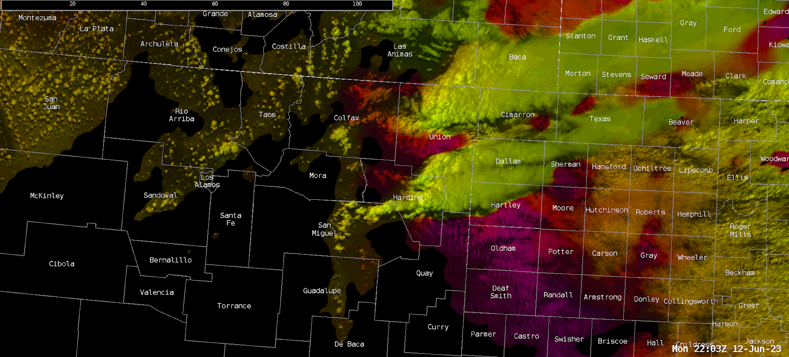 Figure 1
NUCAPS & PHS
- Attempts at convective initiation failed over Guadalupe County and De Baca County… but why? Isobaric analysis revealed supportive dynamics for ascent south of the already-occurring convection.
- 700 mb relative humidity and 850 mb humidity data (Figure 2) reveal a sharp moisture gradient across northeastern New Mexico
- SPC 850 mb Td mesoanalysis verifies this (Figure 3)
- Dry air was already moving across both counties from the west and was progged to continue over the next few hours, thus hindering convective initiation
- 700 mb relative humidity and 850 mb humidity data (Figure 2) reveal a sharp moisture gradient across northeastern New Mexico
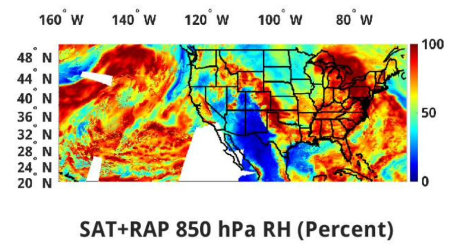 Figure 2
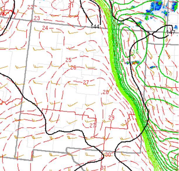
Figure 3
– Vort Max