Near the Idaho/Oregon border, we observed splitting cells on the afternoon of Wednesday, June 7. We believe we were able to see the first hints of this process get underway with the help of the OCTANE product. Subtle gradients were observed on the left side of the main storm prior to the ultimate cell merger.
In the image on page 2, we see a nice comparison using LightningCast between an environment characterized by cirrus contamination vs an environment that was not contaminated. On the eastern side of the CWA that was characterized by cirrus contamination, LightningCast probabilities peaked at 50% on a storm that ultimately produced lightning. In contrast, two thunderstorms to the west (developing in a clear, cloud-free environment) both saw LightningCast values exceed 80% on two storms that ultimately produced lightning.
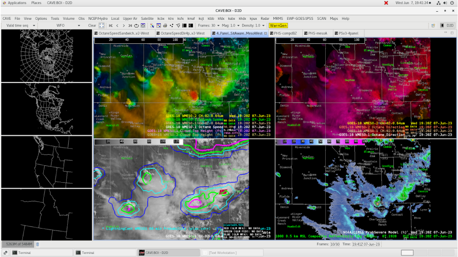
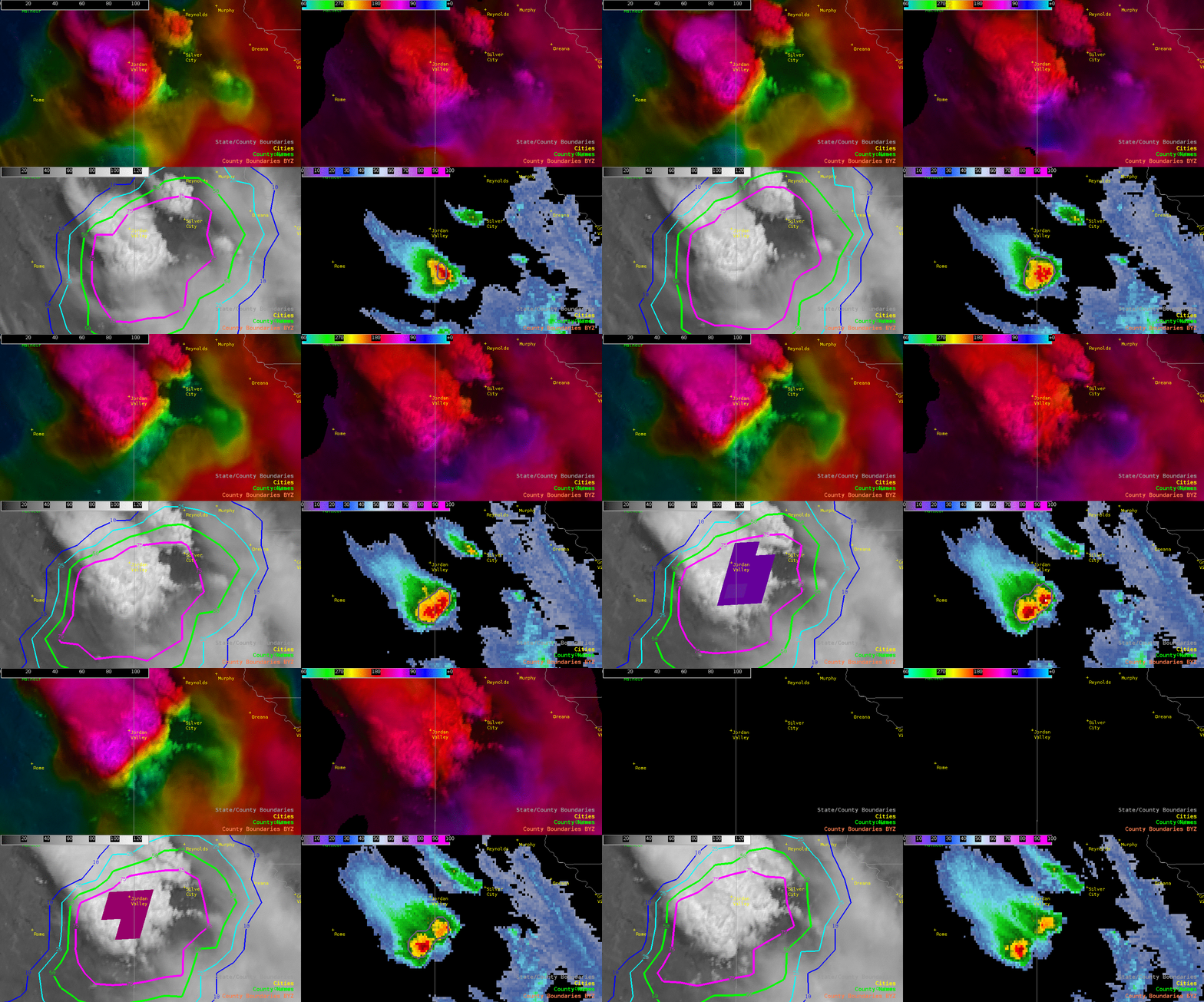
Above, we see perhaps the first instances of a splitting cell in progress, and OCTANE helped give us a first indication of the split (upper left in particular)
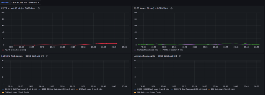
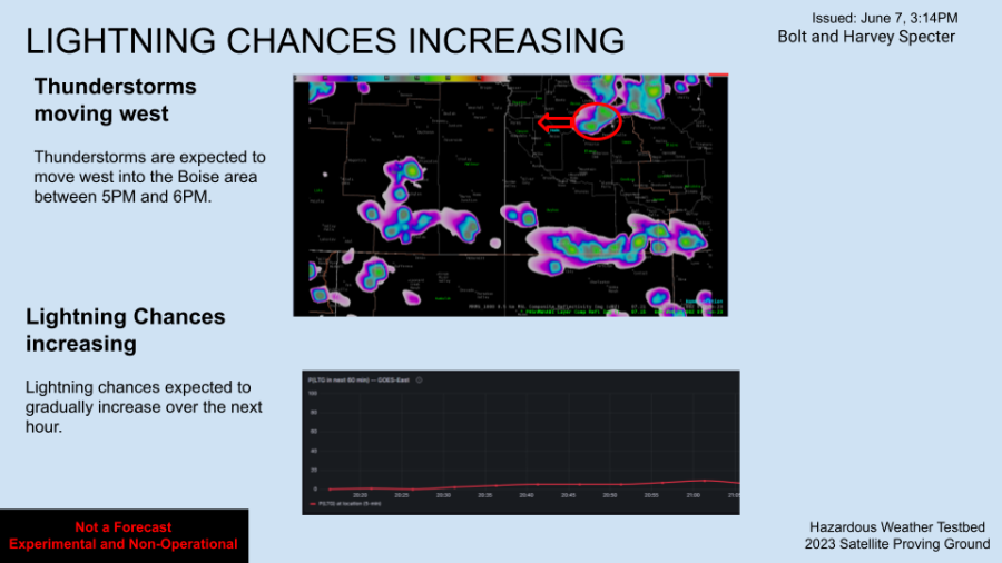
Above: LightningCast Meteogram as of 2053z, depicting a small trend upwards, albeit extremely minimal, within the next 60 minutes for some lightning impacting the American Aquarium at Hayden Beverage in Boise (DSS location).
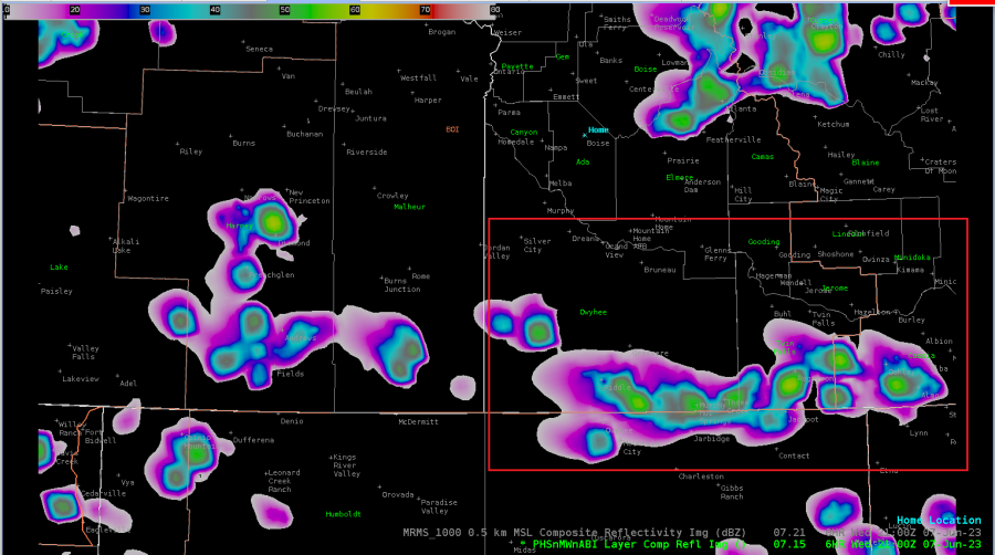
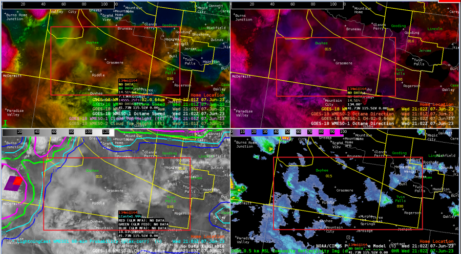
Above: 21z PHS shows development of convection in Owyhee and Twin Falls counties (southern BOI CWA) depicted by a red box; however, the 4 Panel Situational Awareness is indicating that doesn’t seem to be the case, with mere cirrus cloud development. Perhaps the timing is off?
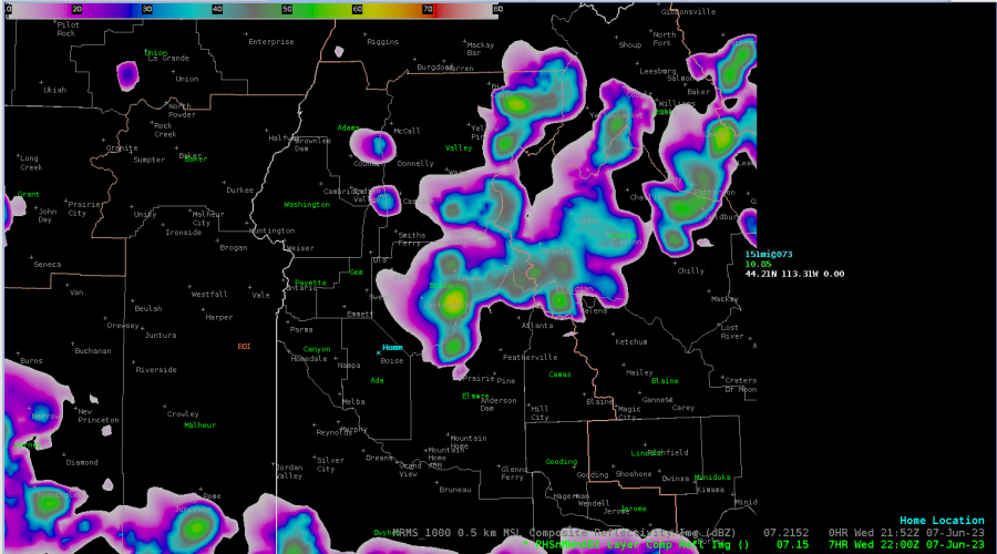
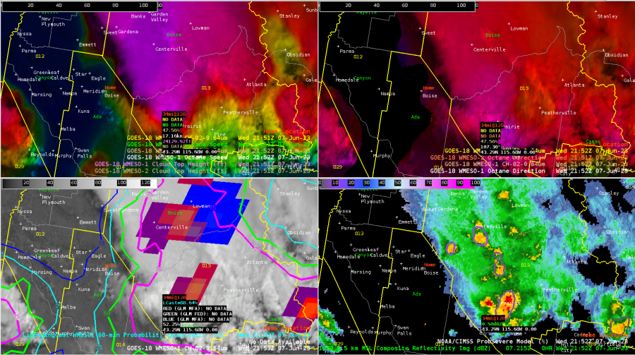
Above: On the other hand, PHS is doing a fairly good job depicting the convection just east of the DSS site. Currently (almost 22z), a few decent cells depicted by ProbSeverev3 (right around 15-18% probability, where MESH values are just over 0.50”)
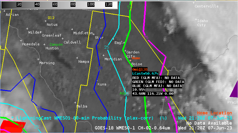
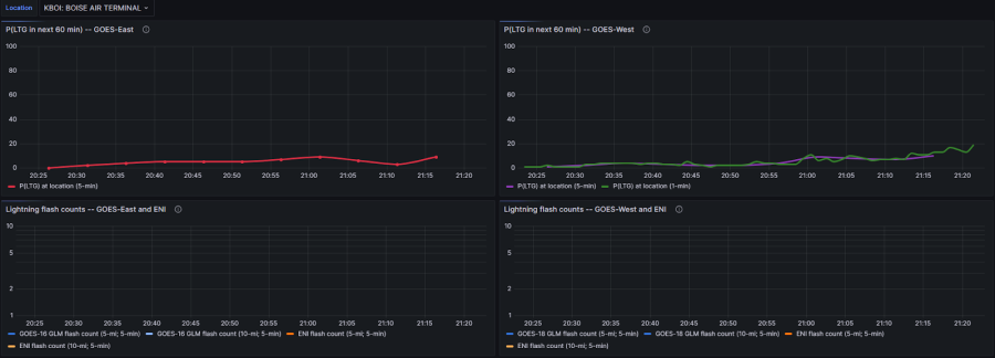
Above: 2123z: LightningCast indicating just above 50% probability of lightning within the next hour yet the Meteogram is well below 20% for the GOES East reading. It is suspected that this is because the AWIPS readout is Plax-Corrected, whereas the Grafana Meteogram may not be?
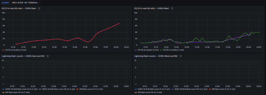
Just after 22z, Grafana Meteogram (above) shows GOES East ProbSevere Lightning to be 67%. This latency further aids in the belief that the Meteogram is not Plax-Corrected.
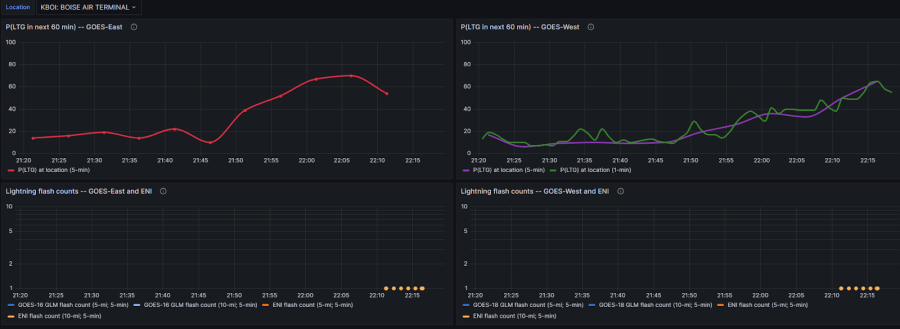
As of 2220z, downward trend displayed with regards to the Grafana Meteogram (topped at 70%, now showing 54%). This is indicative of the cells east of Boise (DSS area) initially showing signs of weakening…HOWEVER…
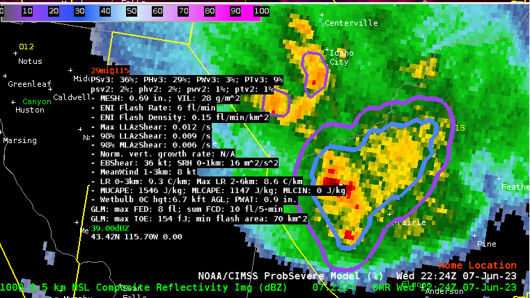
Things are starting to get juicy at 2224z with ProbSevere v3 showing the cell south of Idaho City has increased to 36% probability (below).
– Bolt and Harvey Specter

