
General Risk for Thunderstorms in Florida this Afternoon and Evening
The Tampa CWA is in a general risk for thunderstorms this afternoon and evening per the SPC.

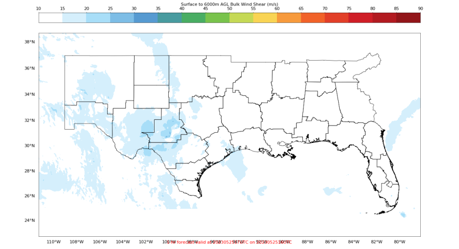
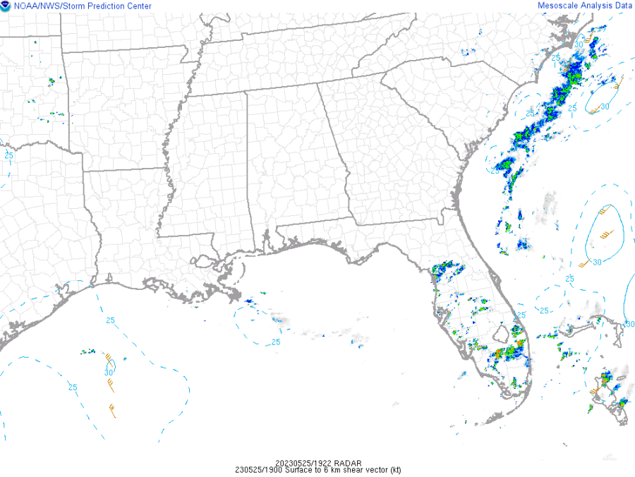
The main potential impacts are frequent lightning, heavy rainfall, and gusty winds thanks to decent amounts of SBCAPE. Localized flooding also remains possible, especially in urban areas, due to slow storm motion as PHS shows no 0-6 km Bulk Shear over Florida. This matches well with the latest SPC Mesoanalysis which also shows no 0-6 km Bulk Shear shear over the region.
NUCAPS showing SBCAPE values at 21Z. Values are highest across the central and southern portions of the Tampa CWA. Areas in green had values around 1600-1700 J/kg. Areas in teal show values ranging from 800-1400 J/kg. Areas in purple range from 200-300 J/kg. 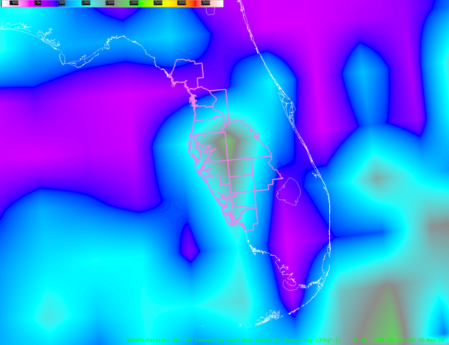 PHS shows a similar trend to NUCAPs with higher areas of SBCAPE across the central and southern CWA with lower values across the northern half of the CWA. However, the color scale on the online version of PHS is difficult to interpret as the gradient ramps up from light red to dark red. So, you cannot really pinpoint specific values of SBCAPE. However, you are able to see areas of lower SBCAPE and areas of higher SBCAPE at a glance.
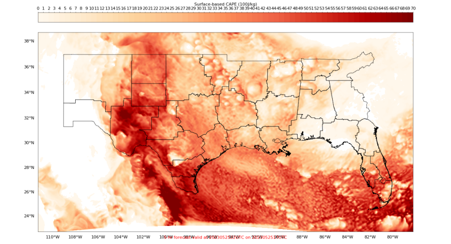
ProbSevere version 3 increases our confidence that storms will remain generally sub-severe as ProbSevere values are below 10% across the Tampa CWA as of 1930Z.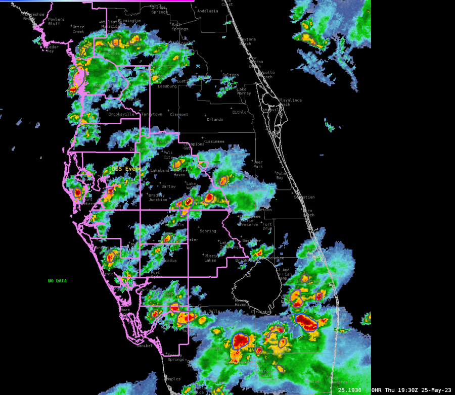 The Octane Speed Sandwich product further confirms that storms are remaining below severe limits as the strongest storms are noted over southeastern Florida this afternoon as of 1930Z. Not only do these products help us pinpoint areas of potential severe weather, but they also help us pinpoint areas of sub-severe weather.
  GLM shows lightning activity increasing across the Tampa CWA early this afternoon, and activity is expected to gradually increase in coverage as more thunderstorms develop through the late afternoon and early evening hours.
  Lightning Cast around 1930Z shows lightning probabilities increasing across the Tampa CWA over the next hour. Pink contours represent a 75% chance of lightning in the next hour. Green represents a 50% chance, teal a 20% chance, and dark blue a10% chance of lightning in the next hour.
 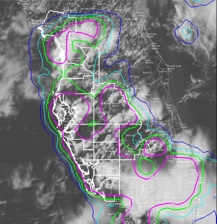 GLM showing lightning activity increasing across Florida from 1930Z through 2016Z across the Tampa CWA. Areas showing more oranges and yellows have shorter flashes and more lightning density. These areas help us know where stronger updrafts are located. The strongest updrafts at the time of this loop remain outside of the Tampa CWA.
  -Dwight Schrute