
The GLM can be used to help find where new convection is developing under a cirrus canopy. Here’s an example of this!
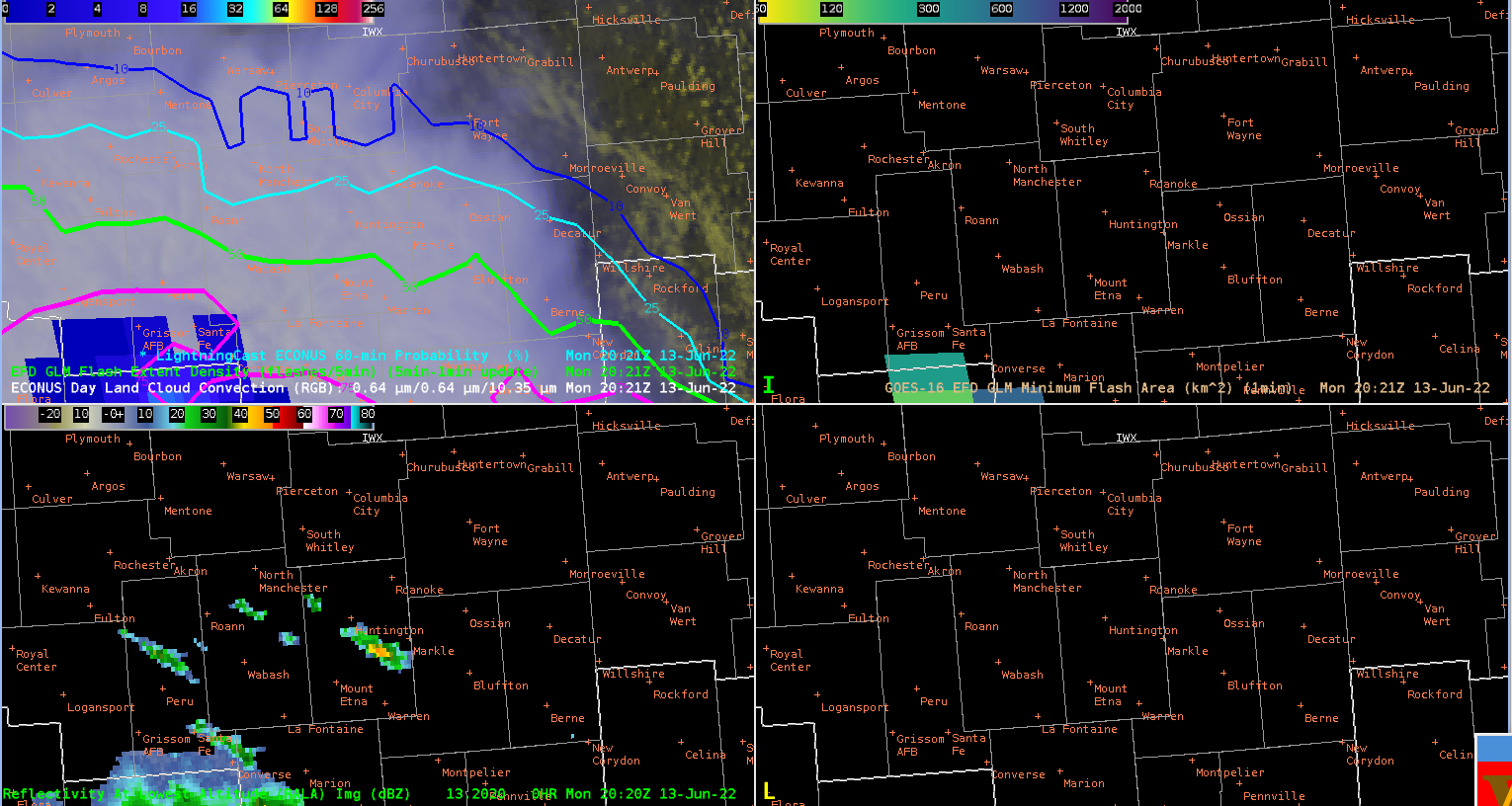
Top left – LightningCast with Day Land Cloud Convection and Flash Extent Density (FED). Top Right is Minimum Flash Area (MFA). Bottom left is MRMS 1km Reflectivity.
We can see that there are some returns developing in the center of the field of view on the MRMS reflectivity but it is hard to tell whether this is real or not. Five minutes later, we have this image:
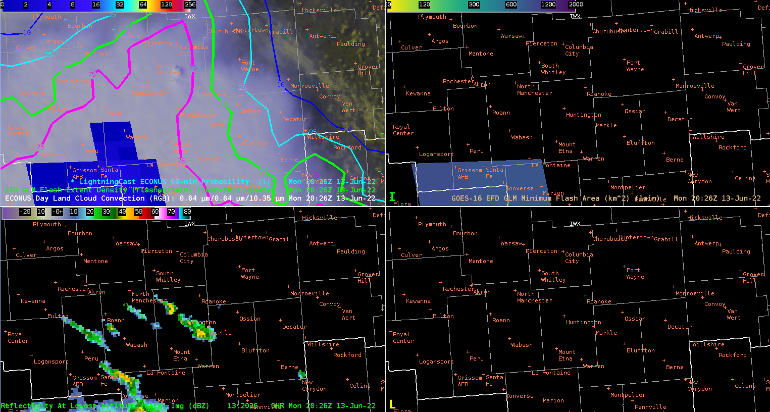
Hmm, that could be new convection developing on the Top Left panel because it looks like there is a tower coming through the cirrus shield.
And then the next frame we have:
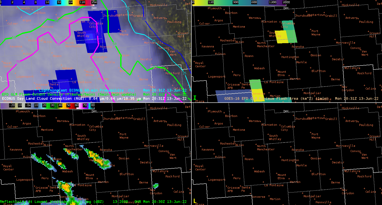
And there we go! Flashes starting to show up so it looks like this area of convection will need to be watched. (Should also note that it would also be helpful to time match to the GLM 1-minute FED instead of the 5-minute RGB!)
-Hank Pym