
With the Buffalo CWA being a long and narrow forecast area, there are areas where the Buffalo Radar doesn’t provide good coverage. On a day like today where their second radar (KTYX) isn’t providing any data, the entire eastern half of the CWA has the Buffalo radar hitting storms at 20 kft or higher. This meant that we had to more heavily rely on Satellite data for warning operations.
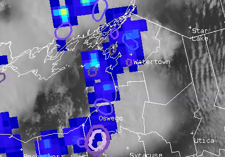
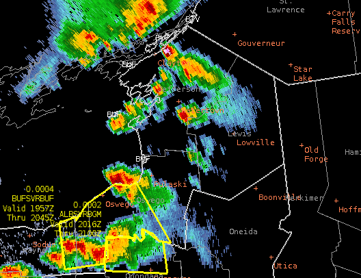
Looking at the northeast corner of the CWA we had convection popping for a few hours along a frontal boundary. Being able to look at spikes in the GLM over time and Prob Severe time scales and just instances in the Prob Severe were very helpful with determining what was going on in the lower levels that weren’t visible on radar. As one storm over the lake begins to move inland there is a jump in the GLM and Prob Severe.
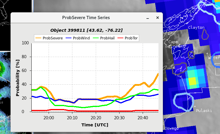
Being able to see the upward trends in time with the prob severe over time and then the increasing GLM was a big confidence boost to put out a warning.
-Cirrus Fields