
Our team, as WFO/JAN, chose the setup for the Mississippi Pickle Fest at 1150 Lakeland Drive Jackson, MS as our IDSS location today (Tue, 08 Jun). Per SPC Outlooks, the Jackson area was on the “edge” of the Marginal Risk Area for severe weather. As operations began for today, a thundershower was noted to the SW of Jackson, moving NE toward the IDSS location of interest:


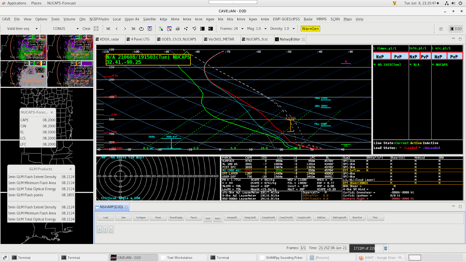
A modified NUCAPS sounding from near Jackson, MS (which became available later), indicated plenty of instability/CAPE (2000-3500 J kg-1), suggesting that the thundershower would be maintained as it advected toward the Pickle Fest location. This would be a good time for a “heads-up” to the event venue or EM. The unmodified NUCAPS sounding (not shown) still suggested sufficient instability aloft for the storm to maintain itself.
The ProbLightning product on the Web, somewhat surprisingly, still showed only ~25% chance of a GLM lightning flash within the next 60 minutes at 2001 UTC, but this had increased to 75% by 2026 UTC:


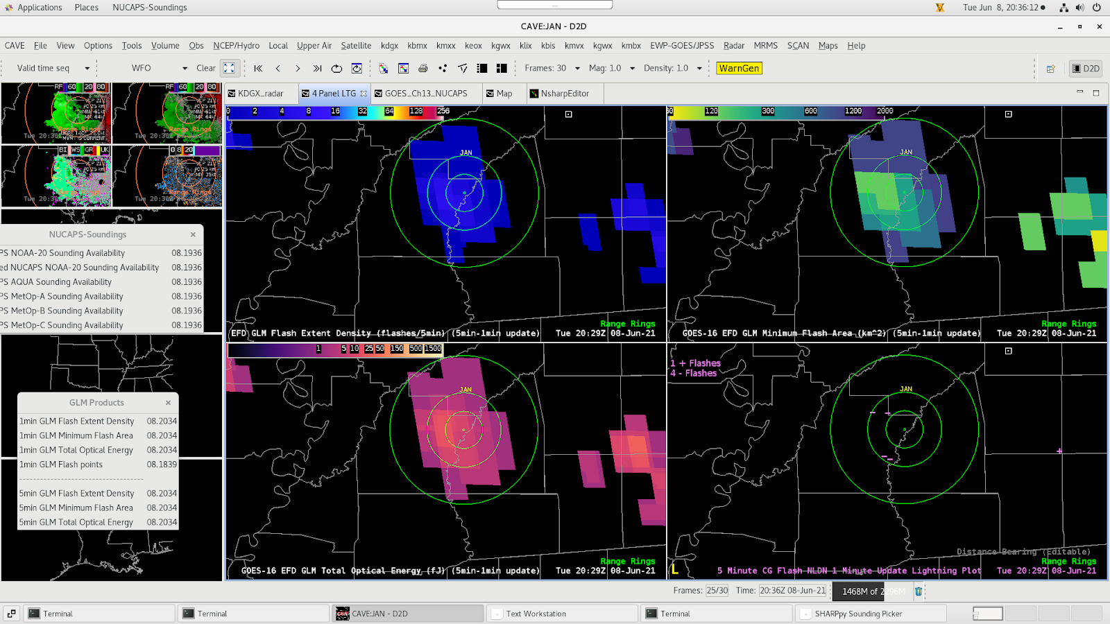
By 2029 UTC, the electrical activity was nearly overhead:
Interestingly, the NUCAPS forecast CIN was forecast to increase over the next couple of hours (valid 22UTC, below), after the storm passed, but ahead of another, stronger line further upstream (not shown).

Based on this, and the rapid collapse of electrical activity within the shower around 2110 UTC, a reasonably confident “all-clear” could have been given to the venue at that time…or at least until the upstream line approaches in a couple of hours, assuming it holds together.
– ProfessorFrink