
The air mass in the CTP CWA has been modified somewhat based on earlier convection. Here’s a NUCAPS sounding from central PA (note that it was yellow, meaning it IR retrieval failed due to clouds, but the microwave was successful).
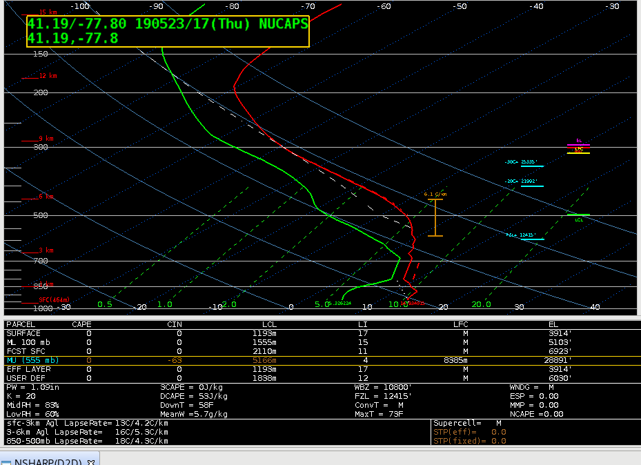
Notice the low level CAP, as well as the modest mid level lapse rates of 6.1 C/km. To get an idea of the air mass characteristics, I looked at a couple of NUCAPS soundings further to the west. The first was west of Pittsburgh along the PA/OH border.
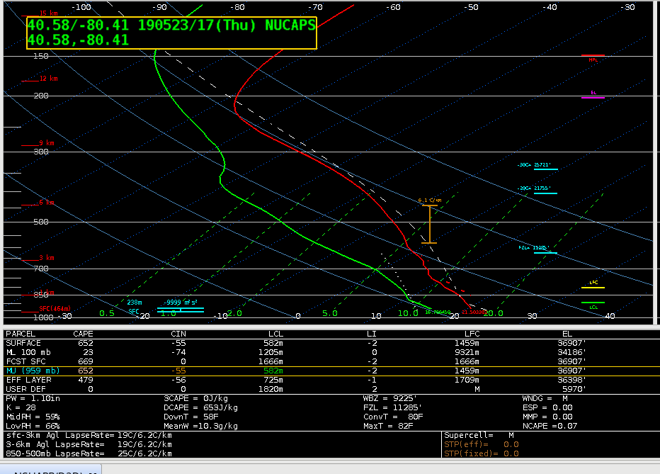
The mid level lapse rates were the same as further east, but the warmer temps and higher dew points were supporting non-zero SBCAPE values. There was still some CIN, however, and the MLCAPE was a paltry 23 J/kg.
Moving further west, I examined a NUCAPS soudning in central Ohio, potentially indicative of the air mass that would move into the CWA later in the day due to the mean westerly flow at mid and upper levels.
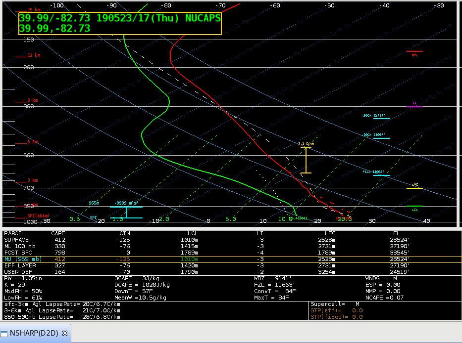 There was a noticeable difference in the mid level lapse rates, with a more significant value of 7.1 C/km. Also notice the DCAPE was in excess of 1000 J/kg, compared to values of 500-600 J/kg further east. This would indicate that there will be at least a threat of severe winds with convection that develops later in the day in the CTP CWA despite the early in the day convection that modified the air mass during.
Thorcaster