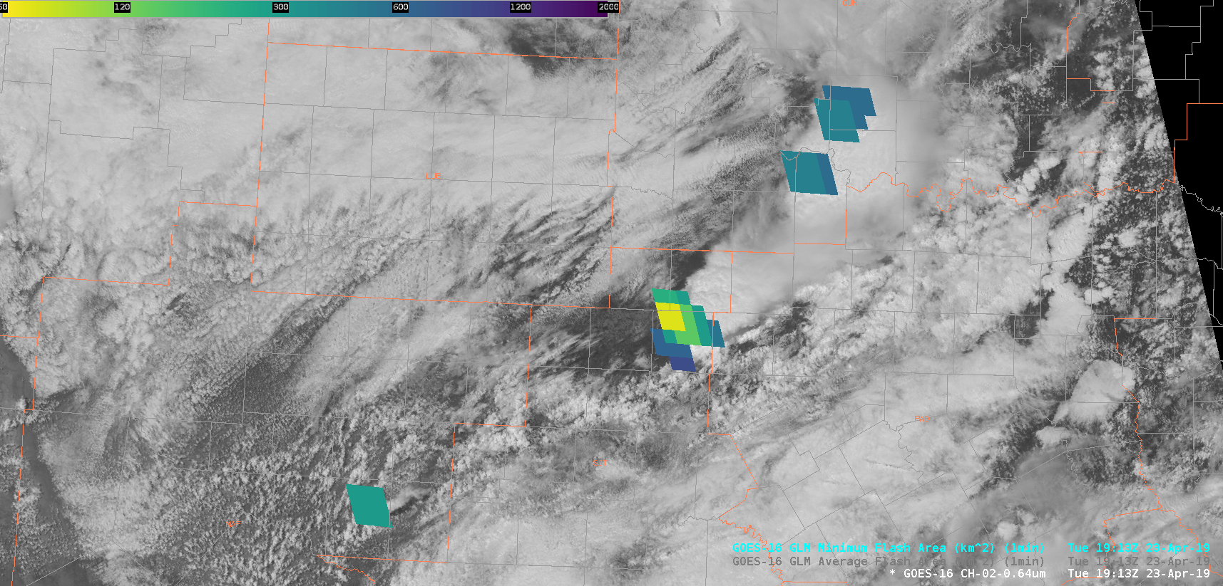
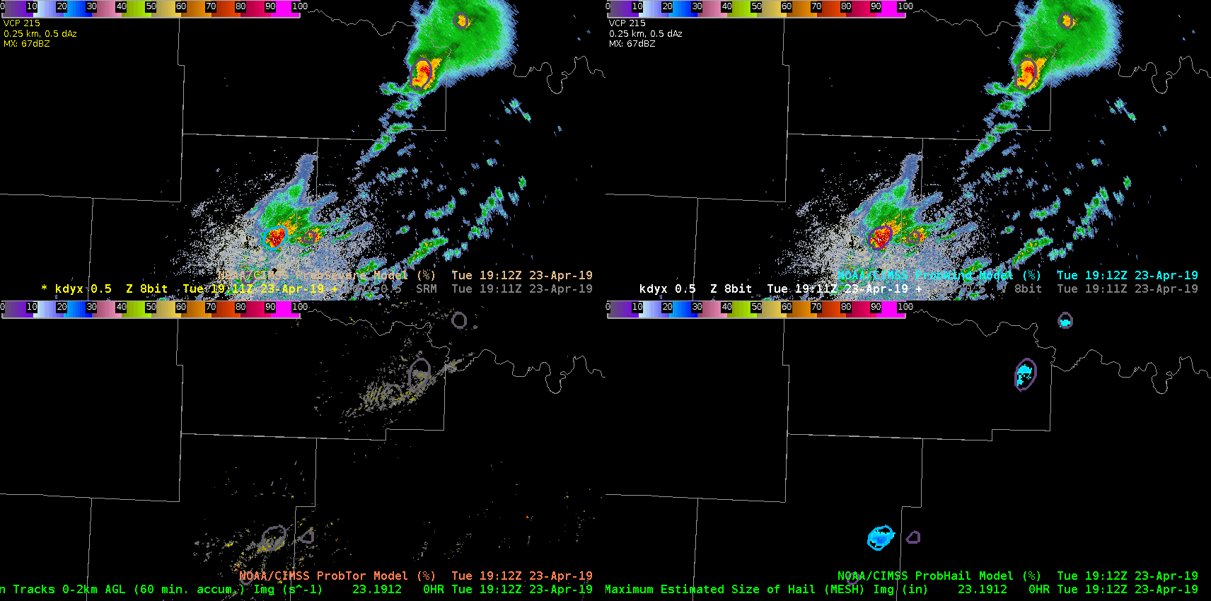
Taking a look at the Minimum Flash Area (MFA) product (part of the GLM suite) and comparing it to the Average Flash Area (AFA), my initial analysis leads me to think that there’s more value in the MFA as opposed to the AFA. The MFA, when watching the evolution of a storm in the far northeastern part of SJT’s CWA, shows the pulsiness rather well. The AFA, in comparison, had a washed-out look during the 19Z hour of analysis. I had a side-by-side of the meso-sector VIS satellite imagery with the MFA on top (1-min.) and the ProbSevere suite with radar products, including reflectivity (GIFs below). The MFA provided a few minute lead time over the ProbSevere and reflectivity products of the storm pulsing up. Thought: watching the trend of the MFA could provide some insight into the overall nature of the storm. In this particular case, the smaller flashes were consistent for several frames/minutes, and the ProbSevere/reflectivity core showed an uptick shortly thereafter. Because the smaller flashes remained confined to a smaller area/grid box (<72km^2), this indicated to me that this storm would remain pulsy and likely either sub-severe or low-end severe. Taking a look at what WFO SJT issued during this hour indicated to me that this thought process likely held true. From a mesoanalyst perspective, this could prove to be invaluable information to provide to a radar operator.
~Gritty