
GLM minimum flash area (bottom left) rapidly fell from ~1600 km^2 to 72 km^2 over a period of 5 minutes in the storm in the NE portions of these images. Maximum Total Optical Energy (TOE) topped out at 228 fJ shortly after the second image below. 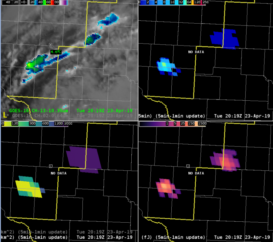
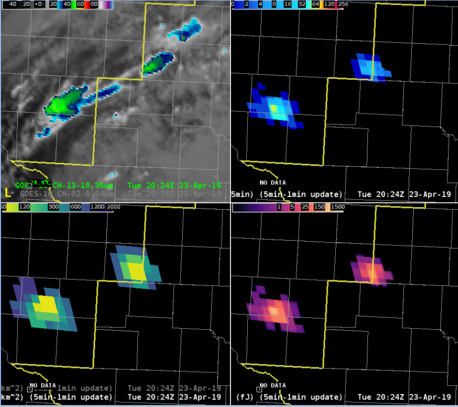 5 minutes later, this storm began displaying classic hail signatures in all-tilts base radar data, prompting a severe thunderstorm warning. I will note that several other storms displayed similar minimum flash area decreases without so quickly turning severe, but the rapid decrease was the first thing that brought attention to this storm.
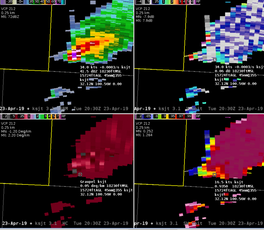
Severe hail very likely occurred shortly after the warning decision. Shortly thereafter, Max TOE fell off fairly dramatically, to around 50 fj by the end of this loop. However, the difference between the pre and post severe max TOE does not show up well with the default color curve.
Sandor Clegane