NUCAPS Sounding between RAOBs

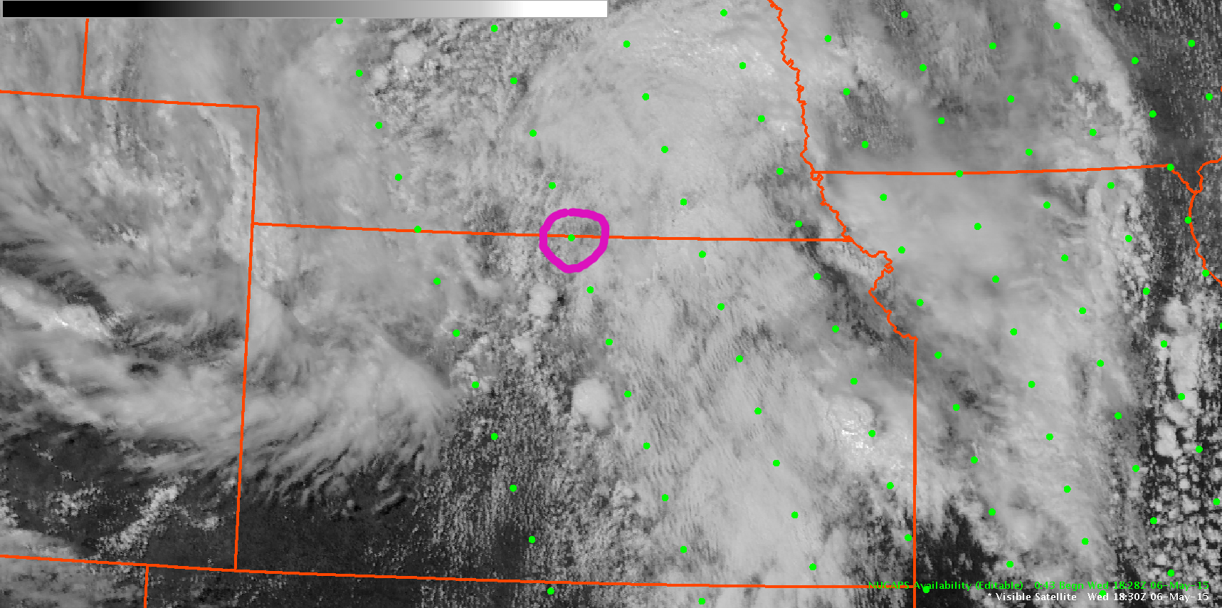
North Central Kansas was one of the prime areas for severe thunderstorm development this afternoon, but with the the nearest RAOB soundings being Topeka and Dodge City, it was difficult to assess the evolution of the thermodynamic environment. Neither of those sites launched an 18Z balloon today, so the area was lacking any observed thermodynamic profiles. The NUCAPS retrieval at 1828Z occurred when the storms were beginning to develop, and a retrieval point was available on the Kansas-Nebraska border (circled below).

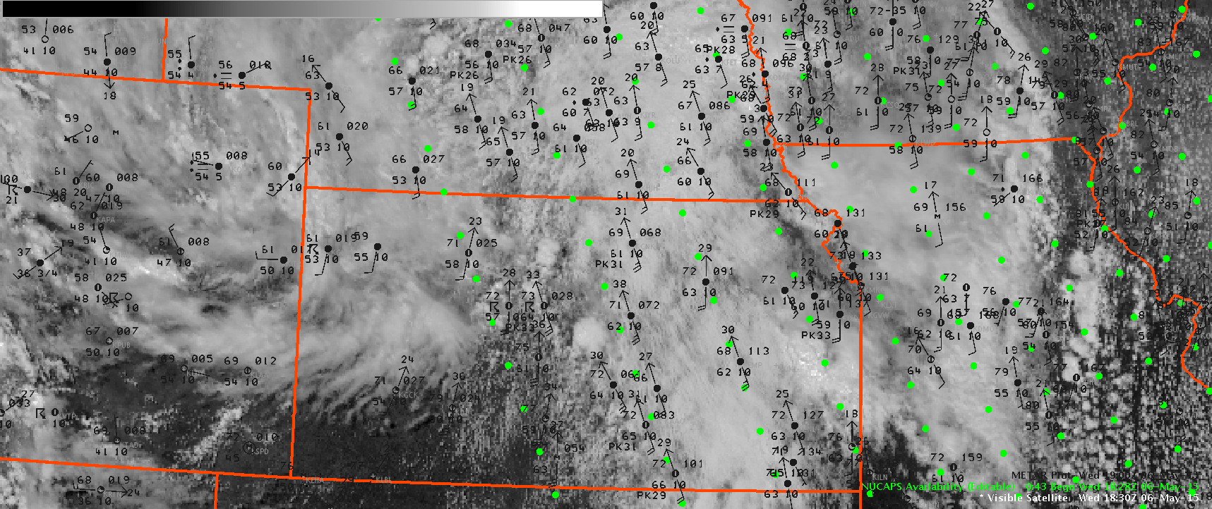
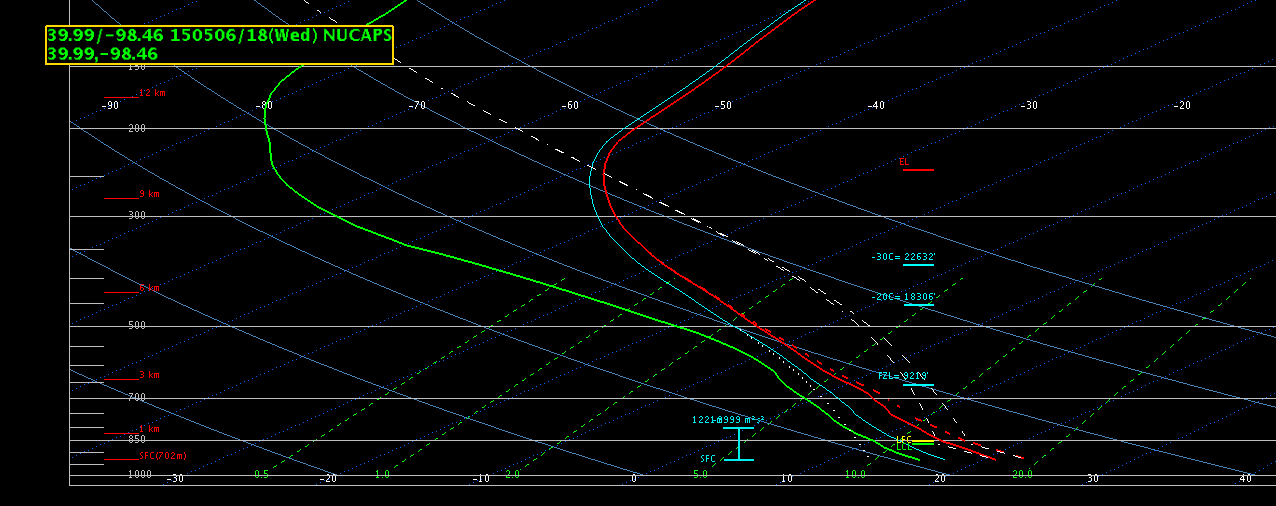
Surface METAR data was overlaid to determine a representative temperature and dewpoint for modifying the lowest levels of the sounding. The sounding was modified for a surface temperature of 69 and a dewpoint of 61 based on nearby METAR observations.  A broken cumulus field was evident on the visible GOES image at 1830Z. There was some concern for the data quality in the cloudy areas, but the quality appeared to look reasonable.  The retrieval indicated a CAPE of 1705 J/KG with no CINH… which supported the breaking of the cap and additional thunderstorm development.

-Daniel Nietfeld


NUCAPS-vis NUCAPS-vis-mtr NUCAPS-skewT

Tags: None

Severe Thunderstorm issued for Harper/Sumner

Severe thunderstorm warning issued based on base data in conjuction with ProbSevere increasing to 80% and shortly thereafter an ENI Dangerous Thunderstorm Alert was issued.

ProbSevere_ENI

ENI_DTA

I think the ENI time series showed well the lightning jump that occurred and helped provide confidence in the warning I was issuing.

ENI_timeseries

Jack Bauer

Tags: None

Another Update on the Northern OUN Storms

Still have a warning in place for the northern OUN storms. The storm farthest to the north has seen a weakening trend as it exited the warning, which matched a lowering in the ProbSevere data. Meanwhile, the other two storms still look severe on radar and match the higher ProbSevere data.

20150506_2115Z_Radar_NrnStorms

-SRF

Tags: None

Wall Cloud Reports in Saline/Lincoln counties KS

While monitoring the two storms moving northward in our area across Saline and Lincoln counties, which is in the most favorable area for shear with effective shear around 300 m2/s2, we received multiple wall cloud reports and one lowering wall cloud report.  However, the base data did not really indicate a severe thunderstorm regarding hail as the 50 dBz core was struggling to push through 20kft and no hail signature in the ZDR product and VIL values remaining below 50 kg/m2.  Unfortunately, both the ICT and TOP radars were showing range folded data in the SRM product for these storms but both radar bean heights were above 7000 ft anyway and would not be representative near the surface anyway.  The ProbSevere values never got higher than 17% on either storm and the ENI flash rates peaked at around 30 flashes with no DTA’s issued.

ProbSvr_ENI

So in this case, I did not see anything in the traditional base radar data that would lead me to issue a warning, and the ProbSevere and ENI data did not support a warning so in this case I might be inclined to consider this a positive null from the experimental data.

Jack Bauer/V. Darkbloom

Tags: None