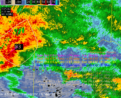
Using ENI cell polygons and cell flash rates to monitor for severe storms can be challenging if the cell definitions change to many times during a storms lifecycle. The loop below is a nice example of a supercell storm with a tornado confirmed where the cell definitions kept changing from one to two. Cell trend time v height plots would stop plotting and the user would have to reset the display. Possibly allowing a larger areal extent to a cell would allow isolated storms to remain as one defined cell, making the algorithm data easier to use. The loop below illustrates this well for the storm in question.
Further, I seem to be drawn to the cell flash rate plots for lightning interrogation.