

We are tasked with assessing the pGLM and GOES-R/UAH CI products. A very moist and unstable atmosphere is present over much of the LUB CWA with an ongoing MCS exiting the northeastern portions of the CWA. GOES-R/CIMSS layer CAPE values range 400-500 J/KG for the northwestern portions to 1200-1400 J/kg for southeastern portions. PWATs also possessed a sharp moisture gradient from NW to SE, with values near 0.60″ NW to 1.40″ SE, along with dewpoints in the mid 60s building across southern half of the CWA ahead of the eastward moving MCS.
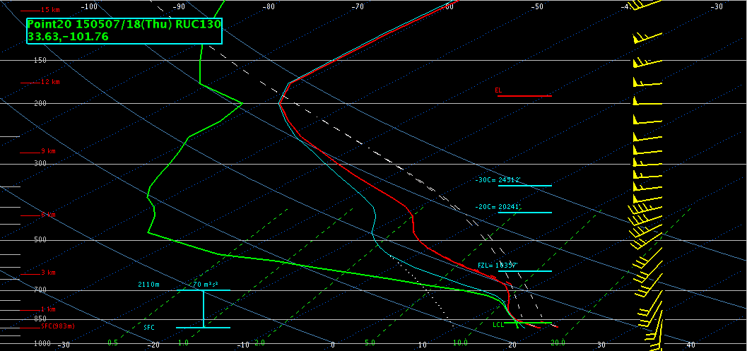 RAP13 forecast sounding centered just south of Lubbock around 18Z indicated MLCAPE around 1600 J/KG, fairly close to the GOES layer CAPE values. Freezing level and -20 C heights are around 20k ft with modest moisture in hail region, though very moist low levels will help overcome some drying aloft. Expect large hail and damaging wind gusts to be an issue with any discrete cells, as well as isolated tornadoes possible due to modest low level shear/helicity. Will monitor CI for possible development south of LUB/ongoing MCS in hopes of catching pGLM/lightning jump with storms as they develop.
Brick Tamland