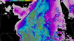
Around 1800 UTC, a MCS is going across the southeastern portion of our CWA. We expect this region to remain stable in the wake of this system as it progresses eastward along the Red River Valley. Central and western parts of the CWA have seen ample sunshine. A dry punch is visible moving in from the southwest, and dewpoints have dropped into the 40s through eastern New Mexico, with low to mid 50s through much of the Texas panhandle. We expect some additional moisture return, especially through southern parts of the CWA…along with a tightening of the dryline feature. There is some question to the amount of instability, although GOES LAP algorithm indicates 800-900 J/kg through central and southern parts of the CWA…although with heavy clouds in the region, it’s difficult to gage the accuracy of the values. A 500 mb low is centered over central California, with southwest flow over west Texas. Any subtle wave or ripple in this flow may be enough to trigger high based convection along the dryline feature. The 12 UTC AMA RAOB indicates mainly unidirectional flow through the column.
