

Discussed the OT apparent miss with forecasters here and after looking at the 4KM IR data it was clear that there was not enough difference to trigger it. It was borderline in the 1km vis but when the GOES R resolution is available this will become a very valuable tool, especially for nighttime use. DSatterfield WBOC Salisbury md.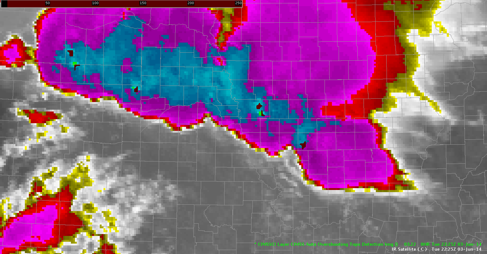
Month: June 2014
CI helpful again…
 Now that cirrus has pushed off to the NE…we are finally seeing increasing trends in the CI just on the SW edge of the large supercells in NE GID CWA. Values have gone from nothing to 61% in 12 min.
jca
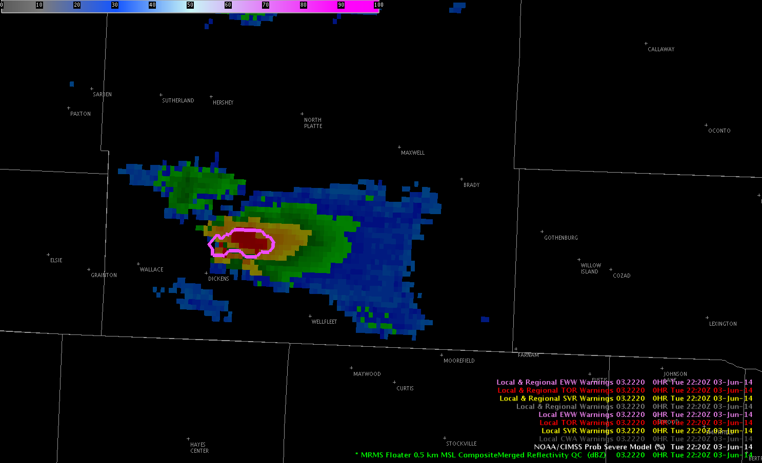
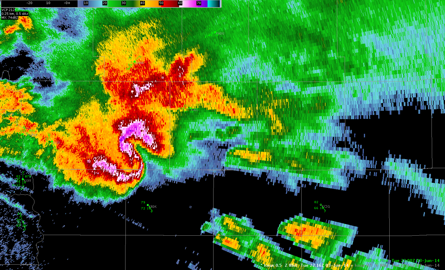
New Storm South of North Platte – Storm of the Day???
Many of the prognostic fields continued to show CI south of KLBF in that 21-22z timeframe – from the VLAPS and OUNWRF. These were both too early with the CI – with more vigorous development evident as of 2215Z. Prob severe quickly rose:
2214: 16%
2216: 53% (SVR issued here)
2218: 53%
2220: 78%
2222: 85%
 Mike Fowle
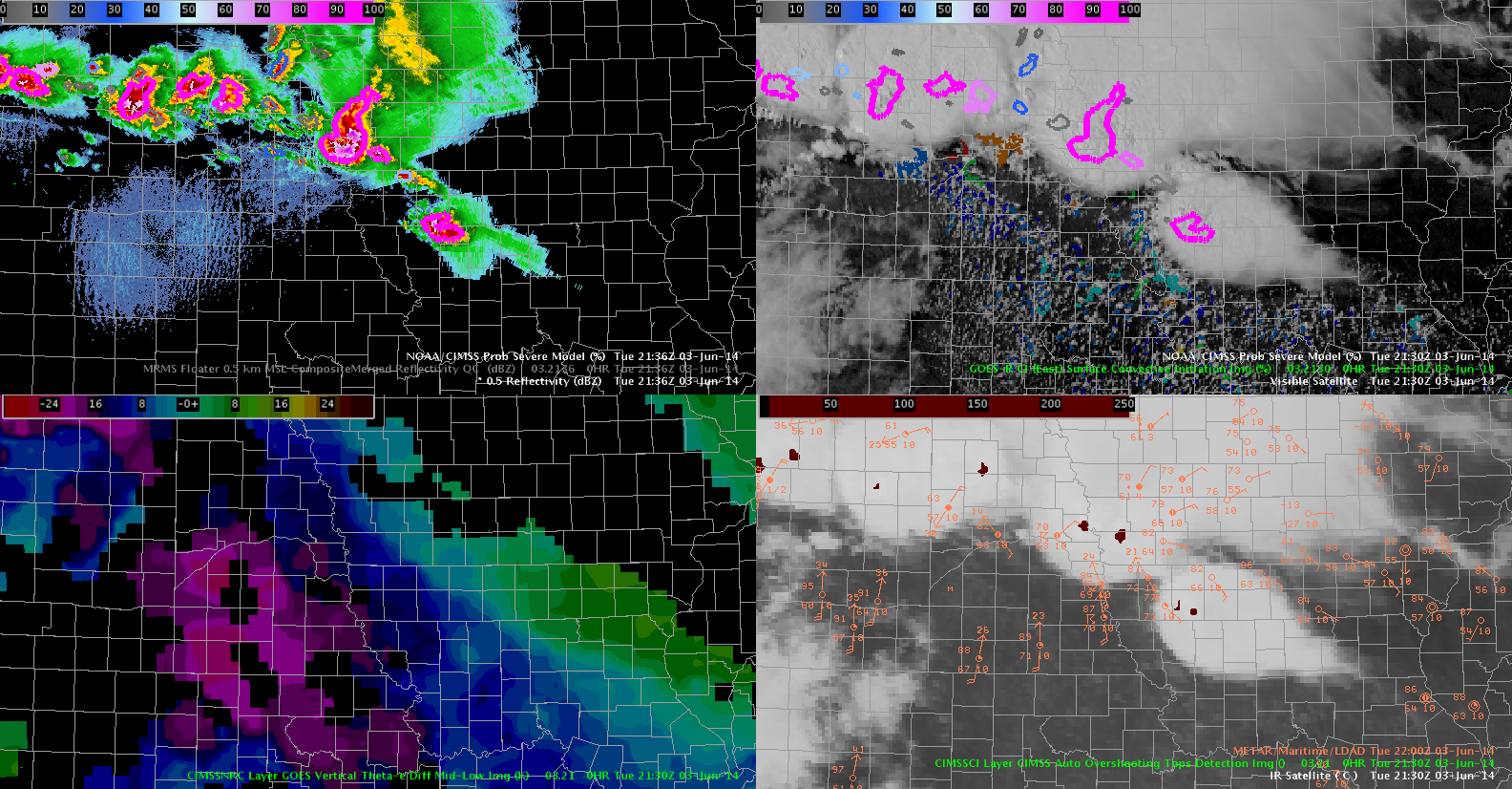
overshooting tops
 The hatched area shows pretty much continuous overshooting tops along with numerous reports of golf ball size hail and several tornadoes. This product is useful for this purpose because the radar is sampling these storms at or above 10kft.
jca
EWP Operations Update – Tuesday 6/3 – 5:27 pm
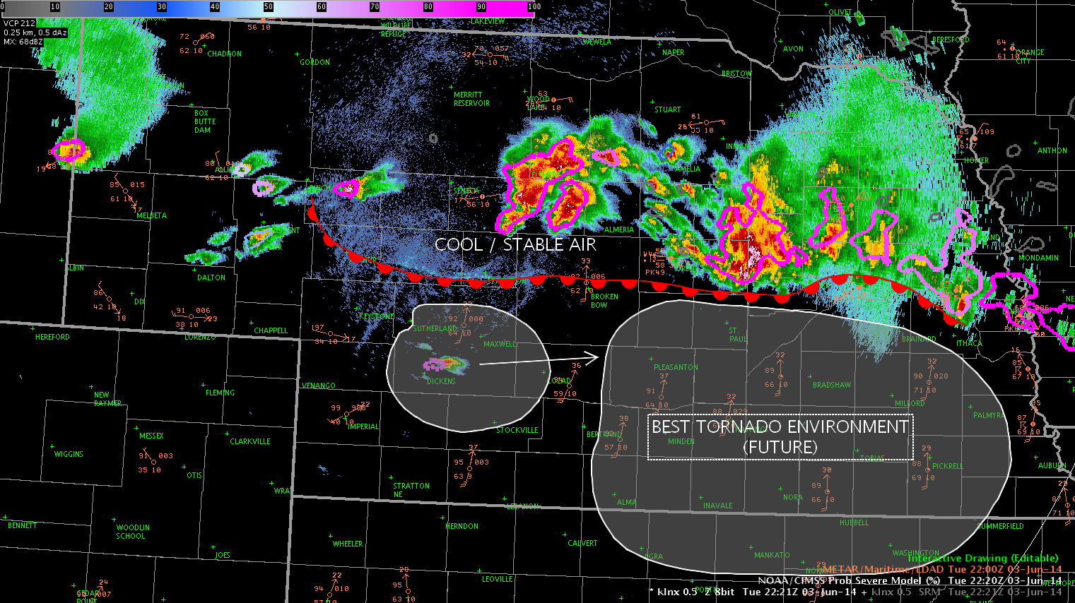
Operations continue in Hastings and North Platte. Currently, a line of severe thunderstorms – including a briefly tornadic supercell near Ord – extends through central Nebraska, just north of the warm front. At the moment, it appears that this activity will not pose a great tornado threat, owing to the cool / stable air just north of the boundary.
In the near term, storms are likely to develop west and south of North Platte. The storms to the south of North Platte will likely have the greatest chance of producing tornadoes, given the backed surface winds and extreme instability / low LCLs ahead of the development.
-G. Garfield
Z Imagery Near OMA – “S” means Severe
Very impressive LEWP pattern. S means severe in this case! A bit of humon on a busy day.
WarnGen inclusion area too small
The Inclusion Area/Percent in the warning templates must still be set to 0, because while issuing warnings for GID, even the smallest portion of a county in the polygon was included in the warning, many times not seen until the warning was created and the list of counties showed up. Just a suggestion, maybe set the inclusion area and percent to something a little higher so unnecessary counties are not included in warnings.
-KP
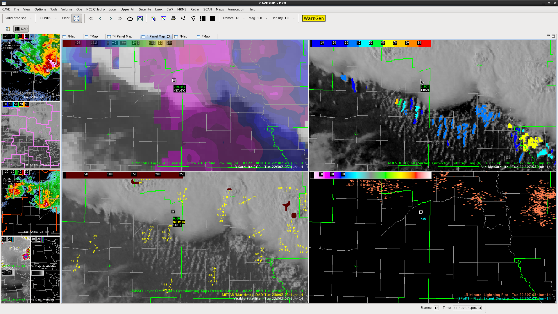
2152Z OT Tops 3 June
at 2130 the OT Top detection did pop up on the cell to the SE of our area today. Bottom right in the two right windows. Have seen what looked like an OT on this for at least 30 mins. but it was rather ill-defined… can see why the OT had trouble with it. Has 99% POS and has for at least 30 mins. The POS has been more valuable with this storm, while the OT has not been as helpful as I expected today. It is however very helpful in keeping track of the most severe storms, which is of course one reason it was designed for.
DSatterfield
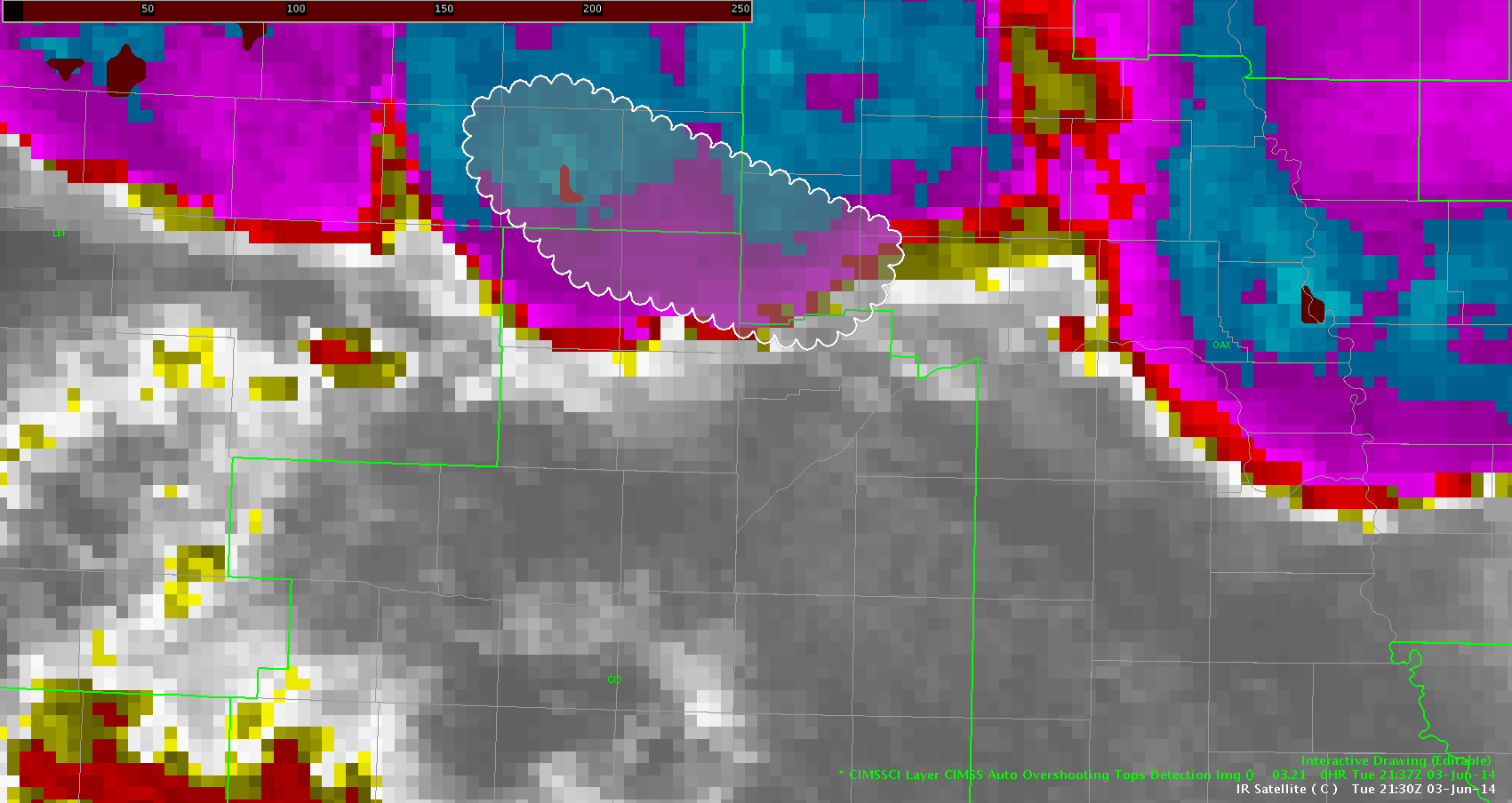
boundary interaction?
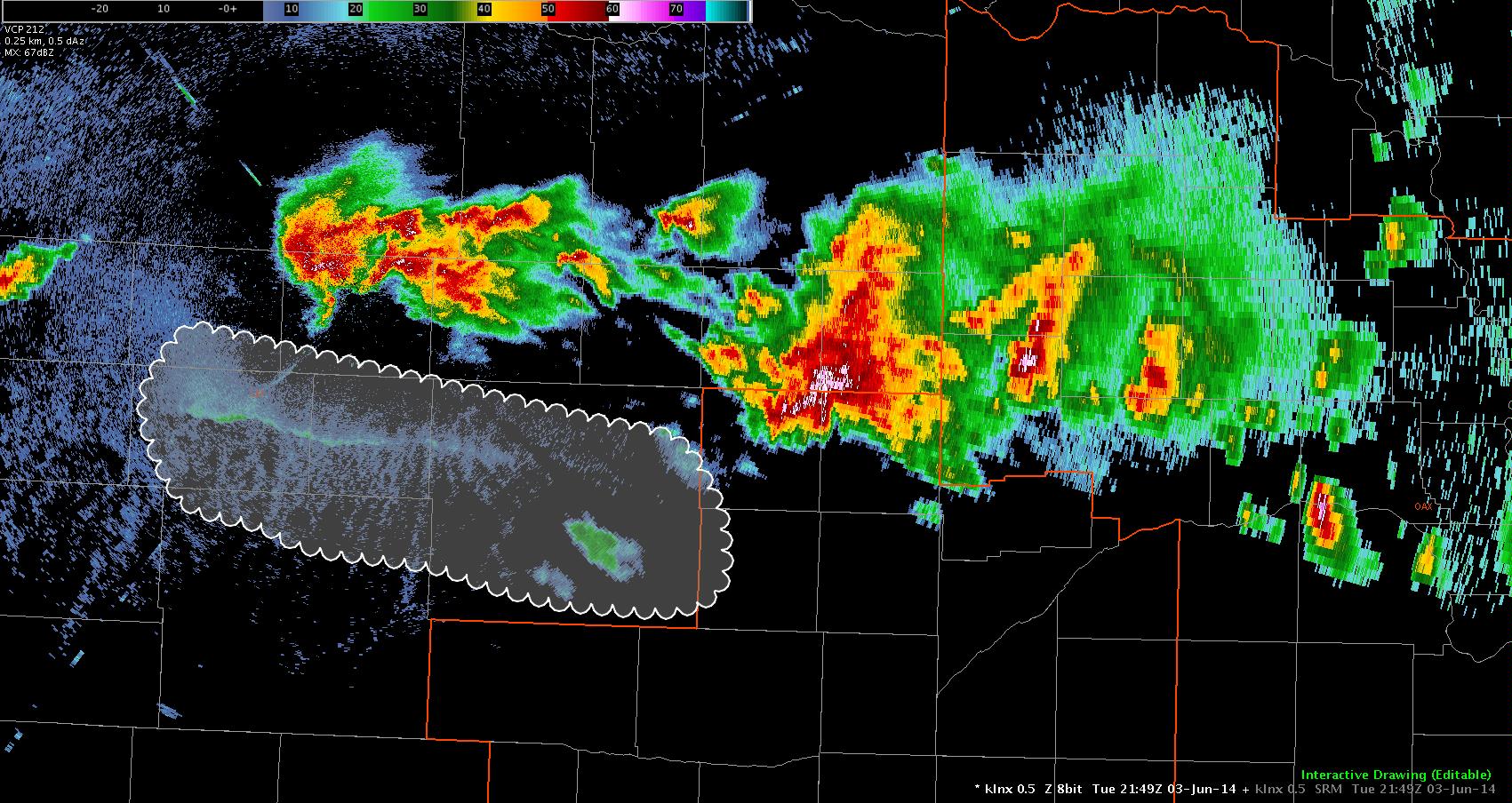 Taking a look at the boundary highlighted…it is moving south with showers developing further to the southwest. Will the interaction cause the convection to blow up? The CI product is not helpful as there is a thick cirrus shield overhead. This boundary is south of the main warm front where all the supercells are currently ongoing. Update to follow…
2209z…it looks like the outflow boundary is too far west to interact with echoes developing in Custer county. We will be looking for outflow boundaries from the supercells further north and see if we can get further development.
jca
2145Z Overshooting top notes 3 June high risk day
OT top detection is good but at 2115Z there is a cell that seems base don VIS 1km to have an OT. The OT Algorithm has not detected it. Might be something to go back and look at why. Prob SVR is 99% on this cell and it is warned.
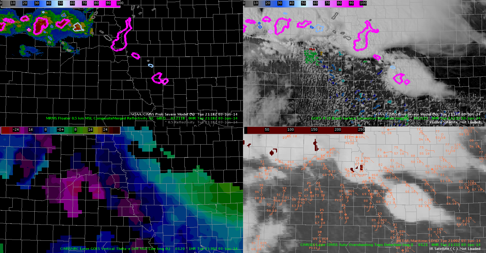 cell in question is bottom right on two left panels.
DSatterfield