
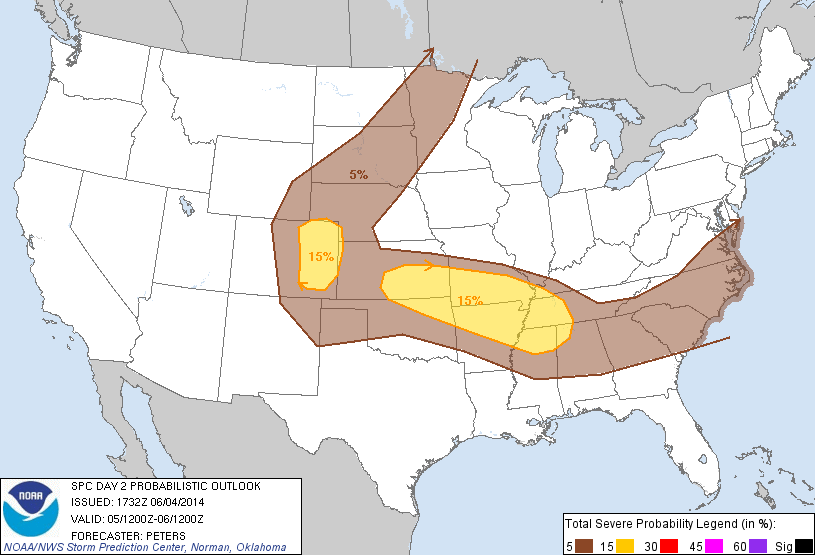
 On Thursday, rich moisture and strong instability will once again be present in the Plains. Additionally, a front / outflow boundary is forecast over southern Kansas / northern Oklahoma, which could locally enhance vertical wind shear. However, a stout cap / elevated mixed layer is forecast over the boundary, so convective initiation is questionable. Given a storm, though, a conditional risk will exist for supercells and a few tornadoes.
Further to the north and west, another day of upslope flow is expected in the lee of the Rockies. Instability may be higher tomorrow than it was today, so the severe threat may be slightly greater. Possible CWAs include Norman, Wichita, Dodge City, Pueblo, and Boulder. We will begin in the Development Lab at 12:30 pm.
-G. Garfield
Week 4 Coordinator