Convection Initiating Across N. IND

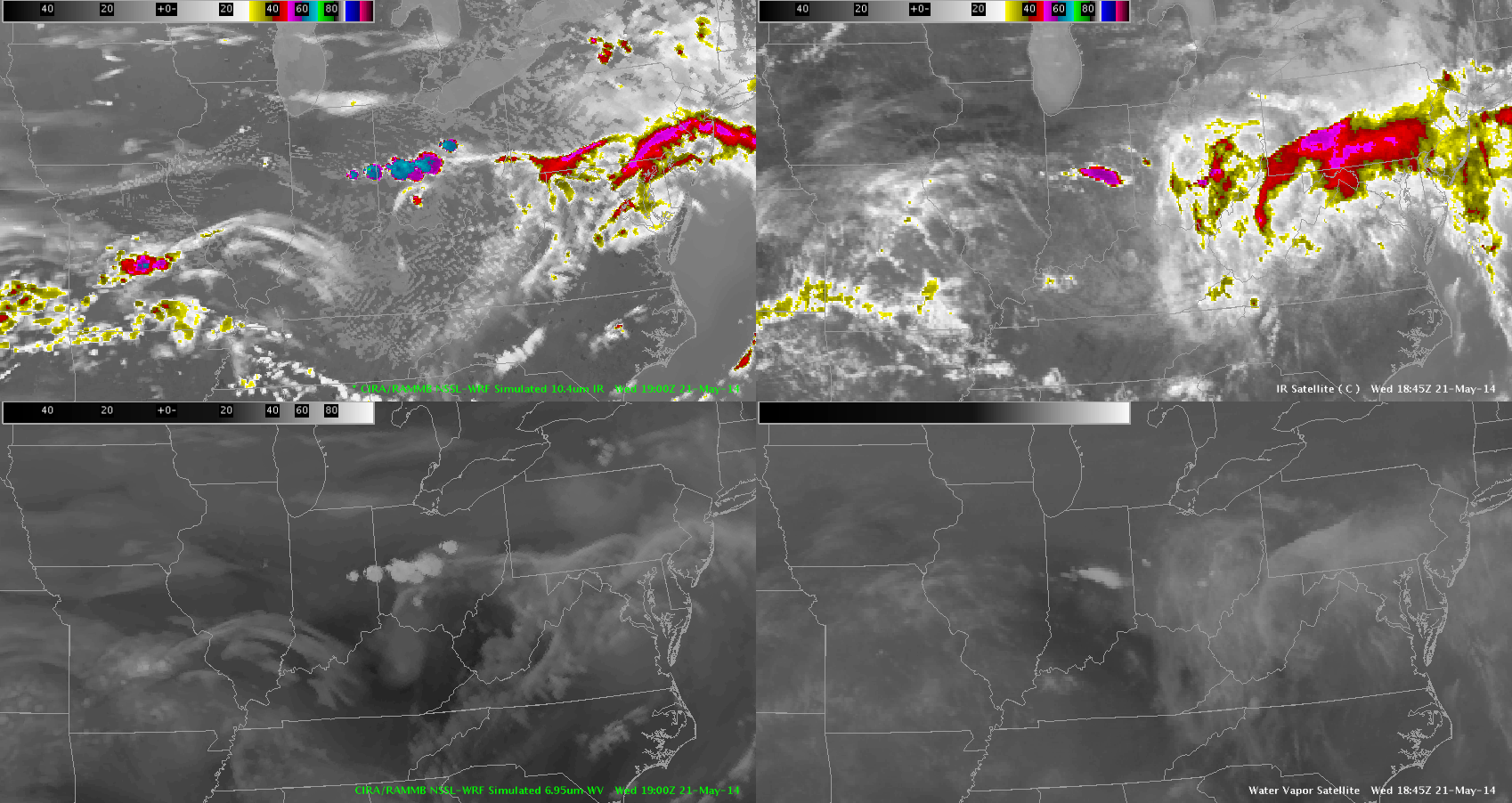
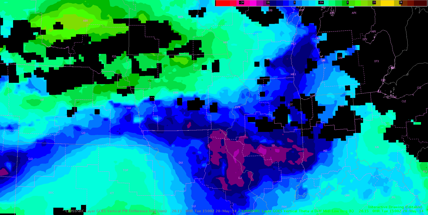
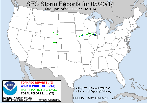
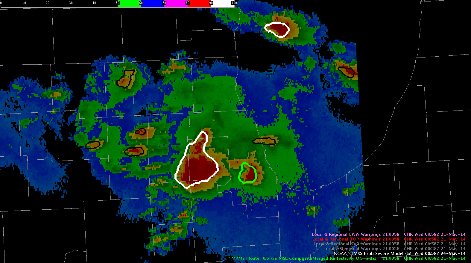
The convective initiation product is performing much better today as compared to what I was looking at yesterday. At 1815Z, 50% probs began to appear across the northern portions of IND’s CWA with a 60% area appearing at the intersection of the LOT/IWX/IND CWAs. At 1825Z & 1830Z, 70% CI probs had appeared just to the west of the supercell that was already underway and by 1837Z, the probabilities maxed out over 90%. Check out the loop below.

1715Z-1855Z_VisIn the next still image, I outlined the area that my partner and I are watching this afternoon, which matches exactly with where the CI product is highlighting (1837Z).

1835Z_Vis&CIBelow is a KIND radar loop between 1832Z and 1910Z, again outlining where convection is firing up across the northern CWA.

1832Z-1910Z_KIND0.5ref~Linda

Tags: None

LAPS Expected Convective Mode

LAPS products show widespread convection developing across the ILN CWA by 21Z this afternoon.

21May2014-2045Z-LapseReflectivity

In addition, some updraft helicity signals are noted.  Helicity signals are paired, which tend to suggest to me that stronger storms will be of a favored mode for splitting.  Large hail will be the initial threat.  The strongest signals are in the western portion of the CWA and the southeastern portion of the CWA, and convection has started in both locations, though both areas of convection appear to be sub-severe (at the time of writing this post, the Shelby County storm intensified quickly).

21May2014-2045Z-LapsHelicity


– JRM

Tags: None

Thought Expirament

While in Glasgow, our office about 4 to 5 years ago experienced a point where the lightning had taken out the main radar during severe weather…. about 5 minutes later another strike made all land line phones go dead.

What to do? Well at that time everything we had the backup office had. So, it was up to us.

At that time Satellite, lightning, and the one office emergency cell phone went into action.

It just so happens that a large portion of the products now being tested including nearcast, LAPs, rapid scan satellite with cradle to grave diagnostic algorithms for it, and total lightning and each have nothing to do with radar. I would like to see what happens when the radar goes down and how much difference there will be between me and the neighbouring forecaster for warning boxes. Finding things that work the best and seeing how much a box can be physically shrunk down as compared to an operator with radar is key in this scenario.

Grant H.

Tags: None

May 21 Simulated Satellite Vs. IR Sat


May 21 Simulated Sat 1845When comparing the NSSL-WRF simulated satellite to the IR satellite the timing of convection as you can see is right on.  However, the location of convection is farther west in central Indiana so it does make me hesitate for where convection will actually move too. ~Vollmar


Tags: None

EWP Status for Wednesday May 21th – 12:30pm to 8:30pm Shift

Another split decision day ahead with two areas of favourable convection.

1) NE Colorado area – Deepening low pressure center will push southward, bringing flow out of the south/southwest and pulling moisture into the region. Model soundings show destabilization occurring in NE Colorado between 18-21z with forecast PW values exceeding 1″ over the region by early afternoon. I don’t know how many people were chanting “UPSLOPE! UPSLOPE!” in the HWT today but there were quite a few.21z NAM12 forecast sounding over Adams County, Colorado.

21z NAM12 forecast sounding over Adams County, Colorado.

Ohio Valley/Lower Mid-Atlantic – Forecast surface dewpoints in this area in the upper 60’s/low 70’s with mid-level shear between 40-50 knots over the entire region. EFP forecast probabilities remain low over this region as there is quite a bit of uncertainty of what dominant storm mode will persist overnight. We will see in the morning!

EFP Day 2 Forecast of Hail for May 22, 2014.

We’ll meet in the Dev Lab tomorrow at 12:30pm and debrief our exciting adventures today before heading over to the HWT at 1pm.

-Darrel Kingfield
EWP Week 3 Coordinator

Tags: None

A NearCast Update for DVN

After a long afternoon/evening of analyzing convection over the northern half of DVN’s CWA, I took a few minutes to take a look back at the NearCast theta-e and PW difference products. Starting with the PW difference product, it was good to see the increased moisture advecting into the region and it lined up exactly with where storms initiated and persisted throughout the day. It did take some interpolating since there were some blacked out spots, similar to the theta-e difference product, but both are still helpful tools to see local storm environment as well as what’s coming upstream. The same trend could be seen in the theta-e product and combining these two, it raises my confidence level in being able to use these products when performing a mesoscale analysis.

15Z-02Z_pw_diff 15Z-02Z_theta-e_diff

~Linda

Tags: None

Daily Summary: Week 3, Day 2 (May 20th, 2014)

What some people (including me) called a marginal day last night were pleasantly surprised with the amount and extent of convection observed in all CWAs utilized today. For a majority of the day we operated in the Cheyenne, WY and Quad Cities, IA/IL CWAs (CYS and DVN). As a supercell fired east of Denver, CO (BOU) forecasters leveraged this opportunity to look at the lightning jump detection algorithm and track total lightning on the tornado warned storm. In the late afternoon as the storms in the CYS area weakened, we shifted our product evaluation to Chicago, IL (LOT) for a DVN/LOT side-by-side warning operations session.

By splitting our operations into West vs. East, we were able to take advantage of (and blog about) almost all products brought into the experiment…with the exception of OUNWRF (sorry Gabe 🙁 ). The tracking meteogram was put to the test again today with  forecasters wanting to track multiple product types simultaneously (radar + MR/MS, etc.) with mixed results. All forecasters issued their fair share of warnings (especially Danielle!) this afternoon. The training storms in the DVN region provided quite the challenge and convection is firing like crazy in LOT right now. I think it will be hard to pull the forecasters away from their computers tonight.

SPC Storm Reports as of 8:10pm on May 20th, 2014

-Darrel Kingfield
EWP Week 3 Coordinator

Tags: None

Changing Colors for Prob Severe

I found it nice to change the default color scheme on the prob severe procedure. The default colors sceme doens’t provide high contract between different levels of probability of severe. I changed the color scheme to highlight higher values of prob severe.

-JB
prob_svr_color

Tags: None

LAPs color bar change? Run to Run legend standardization issues.

May20th 2346Z

May 21st 0102Z

Just wanted to point out in the above two LAPs images. The color bar associated with number of CAPE is NOT fixed. This can cause some confusion when one model run is being actively overwritten with a new one. In this case the 22Z was overwritten with the 23Z model. The color for around 3000 j/kg dropped from Yellow/Orange to Green/Yellow. I believe this may be due to lower end of the CAPE spectrum being dynamic with runs (in this case -500 switched to -1000). It may be an idea to permanently fixed color bars to keep this from becoming a problem for the non-number oriented mets. Yes, they/we do exist!

Grant H.

Tags: None

NearCast, Prob of Severe, and MESH Verify

Severe Warning with Severe Prob MESH NearCast

I issued a severe t’storm warning for Linn County thanks to the Prob of Severe/MRMS data (bottom left) product and also looking at the NearCast (top right) which showed me that the environment was unstable to keep the storm severe.  Shortly after, I looked at the MESH (top left) and it shows hail around an 1″ or so and then a spotter reported 1″ hail in Alburnett which is right near the 1″ area.  All and all these products were good and my warning was verified. ~ Vollmar

Tags: None