GOES GeoColor.

May22nd 2207Z

Just wanted to stop and say this GOES true colors imagery is awesome.  Interested to see where the data is coming from that makes these false color composite. If indeed the background came out of GOES rather than polar orbiters which i suspect, it could probably be used to generate greenness maps for the fire weather community which is another partner.

Grant H.

Tags: None

LAPs wind fields will not transfer to Streamlines/Arrows in AWIPs.

May22nd 2158Z

Attempted to load CONUS LAPs for the second time today. CONUS data is now available. YAY!

While playing with wind fields, further attempted to load wind fields into streamlines and then arrows on the CONUS domain. Neither was possible while they both appeared on the load bar below. The in progress bar in the lower right “Contouring” continue to move but nothing has appeared on screen other than the load bar.

To check whether this was a size of data problem switched the domain size from CONUS to WFO level and clip the editing area/processing time. there was still no load of streamlines.  there may be something behind the scenes in the code that hasn’t been added.

Grant H.

Tags: None

Convection Moving Along Theta-E Gradient

Convection continues to develop and move southeast out of KY into TN. The strongest storms are moving southeast within the greatest convective instability indicated on the NearCast model. Although the model has holes across the OH and TN Valleys, extrapolation of the southern gradient of the instability axis indicates that the storms on the western side of the line may be in a less favorable environment for strong updrafts. Radar supports that storms are weaker in this area as well.

-JB

nearcast_theta_e_diff

Tags: None

First Experimental SVR for OHX

I issued the first OHX experimental severe thunderstorm warning for the day, based primarily on traditional radar analysis and utilizing the prob. severe model. When two cells merged at the Monroe/Barren/Allen county borders in LMK’s CWA, the prob. severe model indicated an 81% chance of severe and then one volume scan later, the probability jumped up to 97%.

2017-2140Z_KOHXref&ProbSvr

While I didn’t use these products as the basis for my warning, I went back to look at the SRSOR and OTD products. They clearly show the cell merger and significant updraft growth over the course of the last hour.

2034-2149Z_SRSOR&OTD

~Linda

**Update: Trees were reported down in Clay County, TN.

*** Just a note, the OTD’s appear shifted to the west (and only appear every several minutes) because these detections are from GOES-East, while the satellite imagery in this animation is 1-minute GOES-14. – BL

Tags: None

Lightning Jump Really Helps!

Another Severe Storm

I once again was watching a cluster of storms and the lightning jump turned to red.  I immediately started to monitor that storm and started to see flash extent density increased.  Then Prob Severe started to jump and I actually issued it before it turned hot pink.  I will have to see if this verifies but I think I got a jump by at least 15 minutes or so about issuing a warning! ~ Vollmar

Update it did produce wind damage! WICKED AWESOME!

Tags: None

NearCast Verifies with Radar

nearcast_w_radar

I already blogged about NearCast earlier today, but I wanted to show how it actually verified.  Storms initiated on the boundary and as they moved into the unstable air, they became stronger as the followed the unstable air.  Also, the storms that formed in the lighter blue actually began to weaken as more stable air moved in.  The storms moved like this model showed from NW to SE.  I would use this for storm motion for sure! ~Vollmar


Tags: None

Tracking Tool, Lightning Jumps and Storm Evolution

dc_jump_ex4

souuthern_jump

Above are two examples using the Tracking Meteogram tool and Flash Initiation Density to build flash rates of two individual storms near Washington D.C.    Rapid increases in total lightning signalled the onset of storm intensification in both cases, and multiple lightning jumps were observed as each storm developed and moved across the DC and Baltimore Metro areas. Hail to the size of golfballs was observed in the top storm with the first 1 inch hail reports falling at 1939 UTC.  At the time of this post, the southern storm produced hail to the size of quarters at 2035 UTC.

Chris S.


Tags: None

An OTD Appears!

At 2030Z, an OTD appears in PAH’s southwestern portion of the CWA. Unfortunately, a jump in the data occurs between 2011Z and 2030Z in the SRSOR imagery. Around the same time as the detection, some hail reports were disseminated from the PAH WFO but nothing over severe criteria.

20-21Z_IR&OTD

~Linda

Tags: None

Some times you just have to sit back and laugh.

May22nd 2038Z

So some of this may have been AWIPs 2 some of this may have been alternate issues.

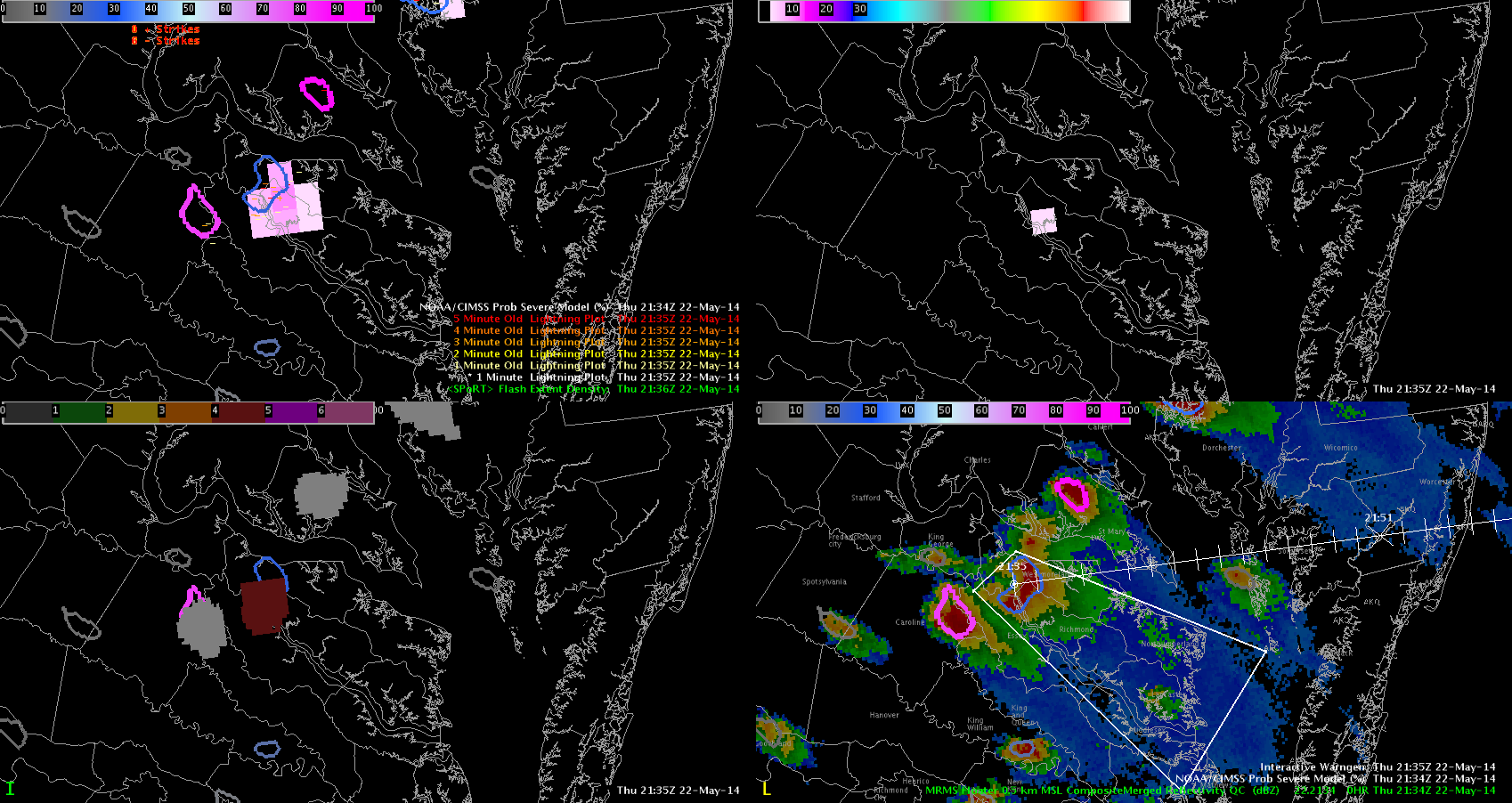
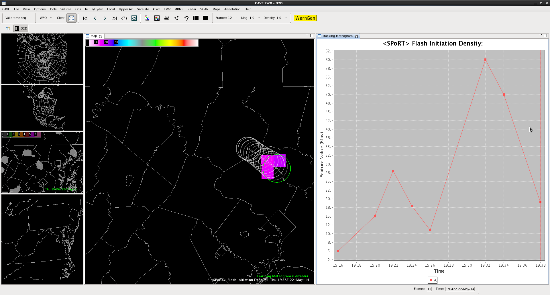
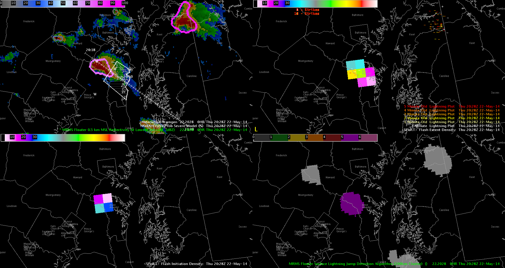
Chris was behind me as we were researching the LJDA components to things. When we noticed the one minute CG data disappeared…. then the 5 minute CG data disappeared. However the LJDA maps/shape files continued to work.  Whalla! a 5 and 6 sigma jump occurred successively over 2 minutes. It was time to warn.

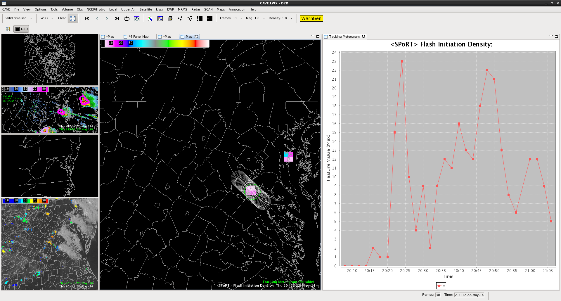
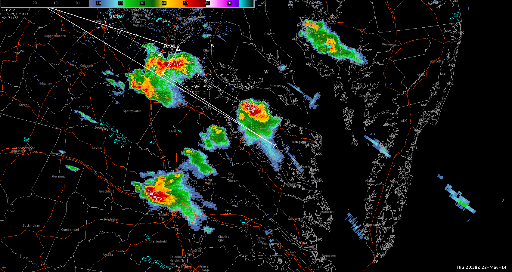
So, I went over to radar base products on another CAVE windows to issue the warning over the base all tilts reflectivity.  Loaded Warngen to find that the old radar display controls from yesterday were still controlling the flow of the storms today 240 when I wanted roughly 320. I immediately attempted to to change the flow and redraw the box. Except now the box refused ro redraw in the southwest direction and immedately insisted on the northwest direction…. fine I’ll attempt to track the ball backward and force a redraw of the box in that direction…. Done. Who Hoo… that wasn’t  hard.

then i went to redraw the verticies….. after clicking on the first vertex the whole screen proceeds to move on me. … “Maybe I missed it” goes through my mind…. and click again…. “nope missed again”… click again…. “okay this is not cool”.  So, I permanently right click down to find a window to edit the vertices. “YAY alternative.”  Next I discover that the one vertex I’m moving is now permanently attached to the mouse icon….. “GAAAHAHHAHAHAHA!!!!!!!”

As i step back and look at it, someone out there of importance could be dead right now. But in this case I’d like to think it was Barney… Because personally I want that fat purple dinosaur to die. Thankfully this is an experiment and i’m happy nobody died… except for that awful singing dinosaur.

Grant H.


Tags: None

When I decided to issue a warning

Prob and Lightning

As the storms to began to break out, I used the prob severe tool in combination with the total lightning initiation and total lightning extent and lightning jump and based on how they all came together, I felt comfortable issuing the warning.  About 15 minutes later, golf ball size hail was reported so with this particular t’storm these products did well together. ~Vollmar

Tags: None