
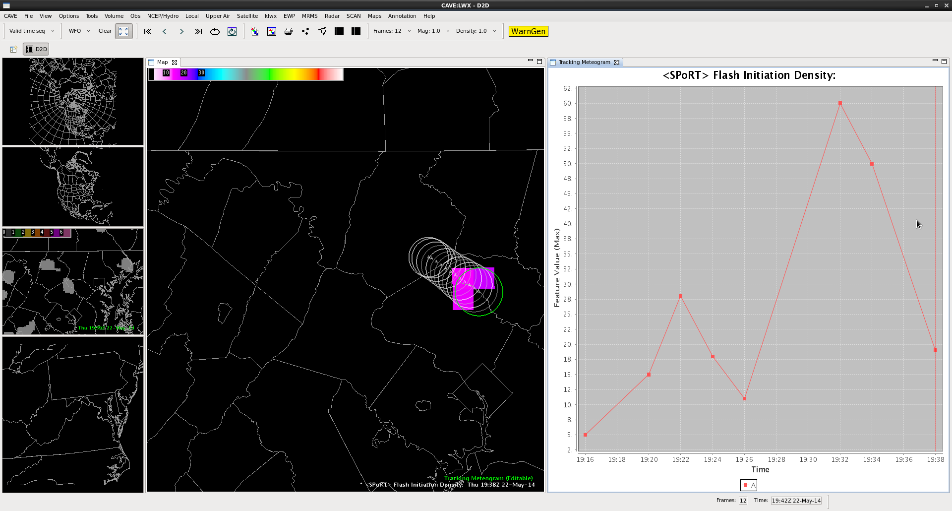
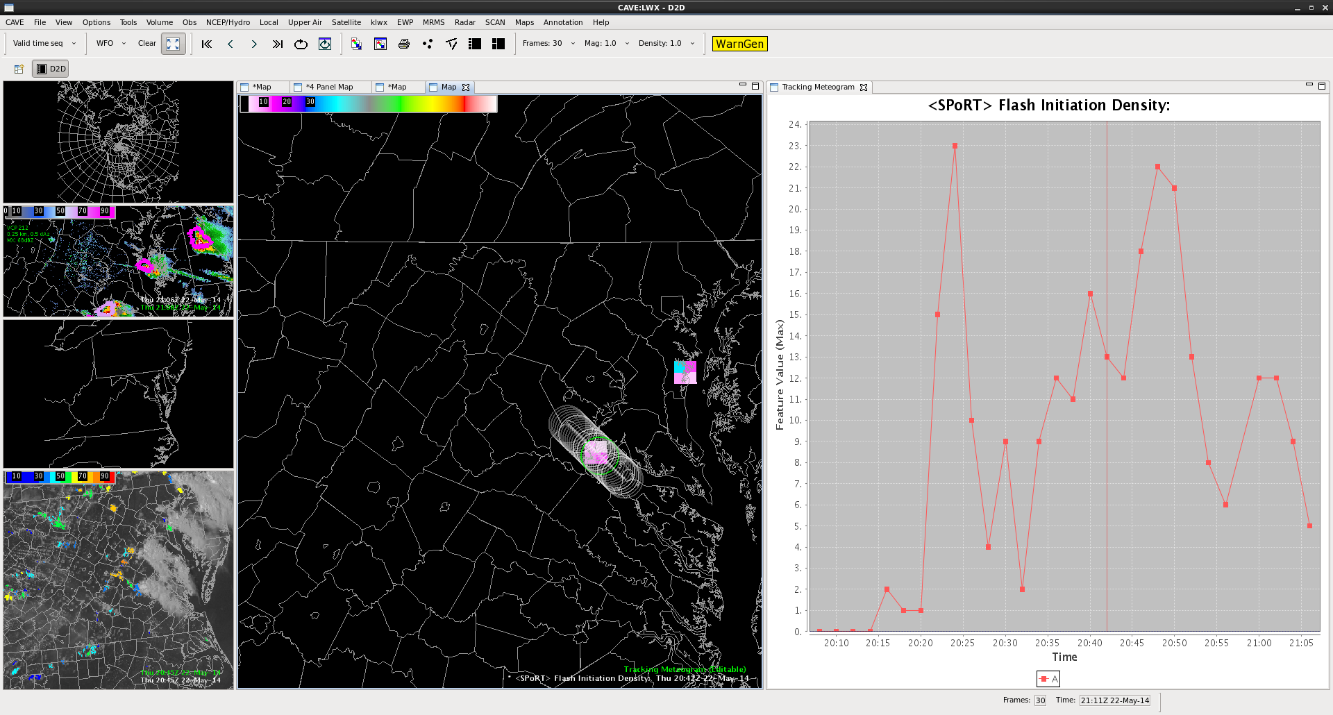
Above are two examples using the Tracking Meteogram tool and Flash Initiation Density to build flash rates of two individual storms near Washington D.C. Rapid increases in total lightning signalled the onset of storm intensification in both cases, and multiple lightning jumps were observed as each storm developed and moved across the DC and Baltimore Metro areas. Hail to the size of golfballs was observed in the top storm with the first 1 inch hail reports falling at 1939 UTC. At the time of this post, the southern storm produced hail to the size of quarters at 2035 UTC.
Chris S.