
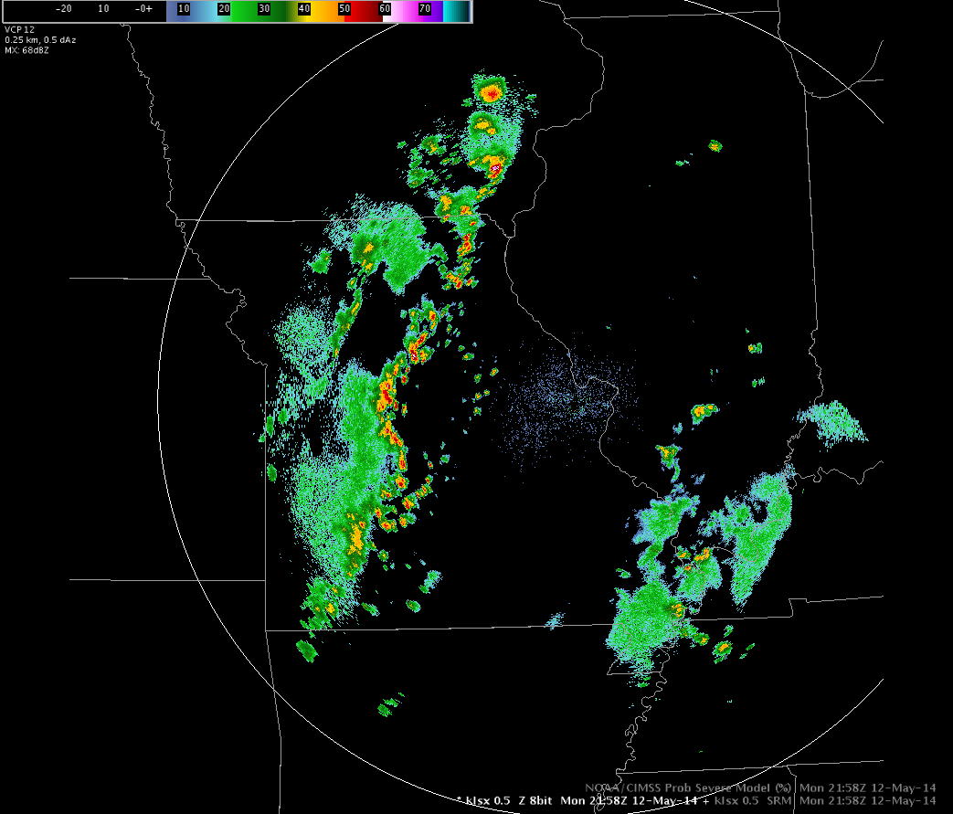
On Monday afternoon, a line of storms developed and propagated eastward, essentially bisecting Missouri by late afternoon. Here’s a look at the base reflectivity for the radar at KLSX (St. Louis) at 22Z (about 4pm):
 In the same timeframe, the CIMSS NearCast model was projecting a fairly high Theta-e lapse rate.
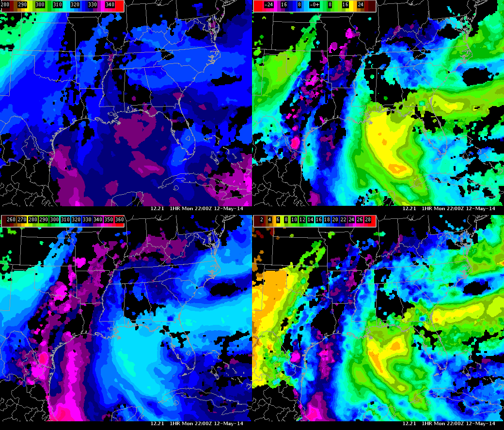 The box in the top right corner shows this GOES- derived Theta-e difference of around 20-21K in an area west of St. Louis. Interestingly enough, this ΔTheta-e maximum is aligned with the area of convection, seen in the radar imagery above. Will the storm cells continue to propagate eastward and will they actually strengthen as they enter this area of higher instability?
By 23Z, We’re starting to see some individual storm cells develop out ahead of the bow echo.
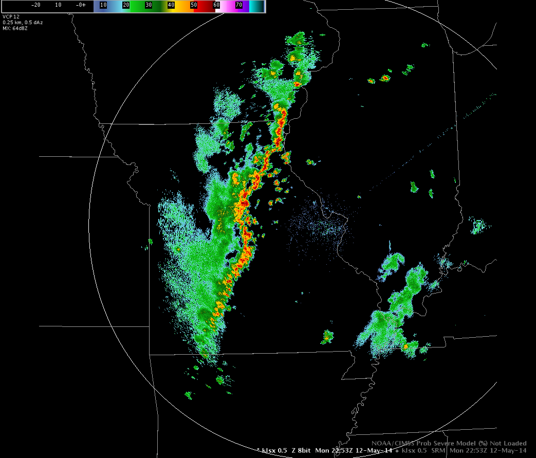 This would indicate that the area of high instability on the NearCast model is starting to produce some convectively-driven storms. The highest value I found in this image in the newly-formed cells was 56dBZ. So in the near term, it appears the NearCast is correctly predicting convective initiation through the ΔTheta-e product. How about at 0Z itself?
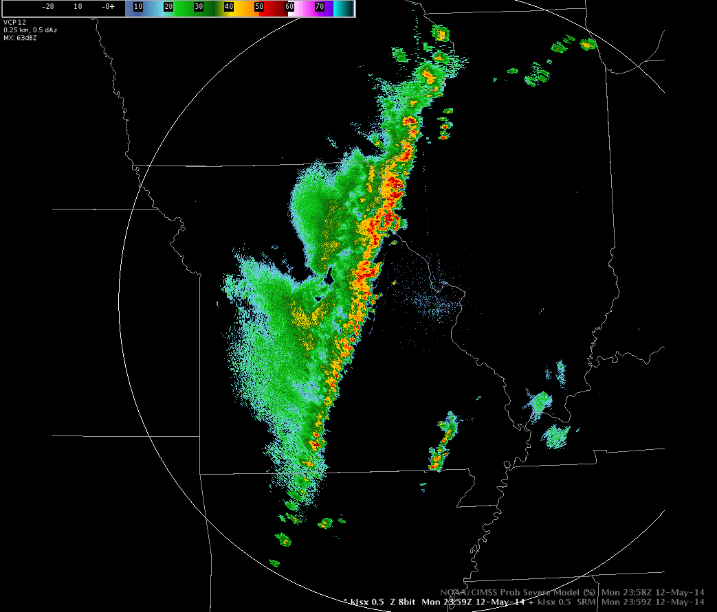 The stronger line behind the pop-up cells has accelerated and swallowed up the smaller individual cells! That is a straight line of storms if I’ve ever seen one. I suppose the ΔTheta-e could be used in this situation to predict that this storm line would evolve in this way. More cases will have to be examined in order to see if this parameter is consistently usable for this purpose!