
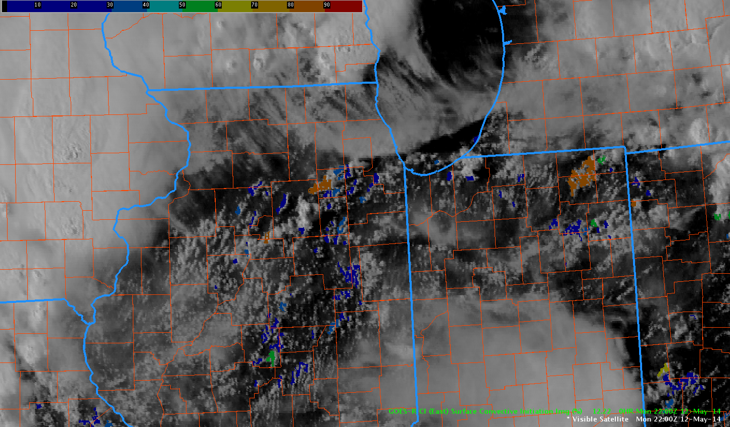
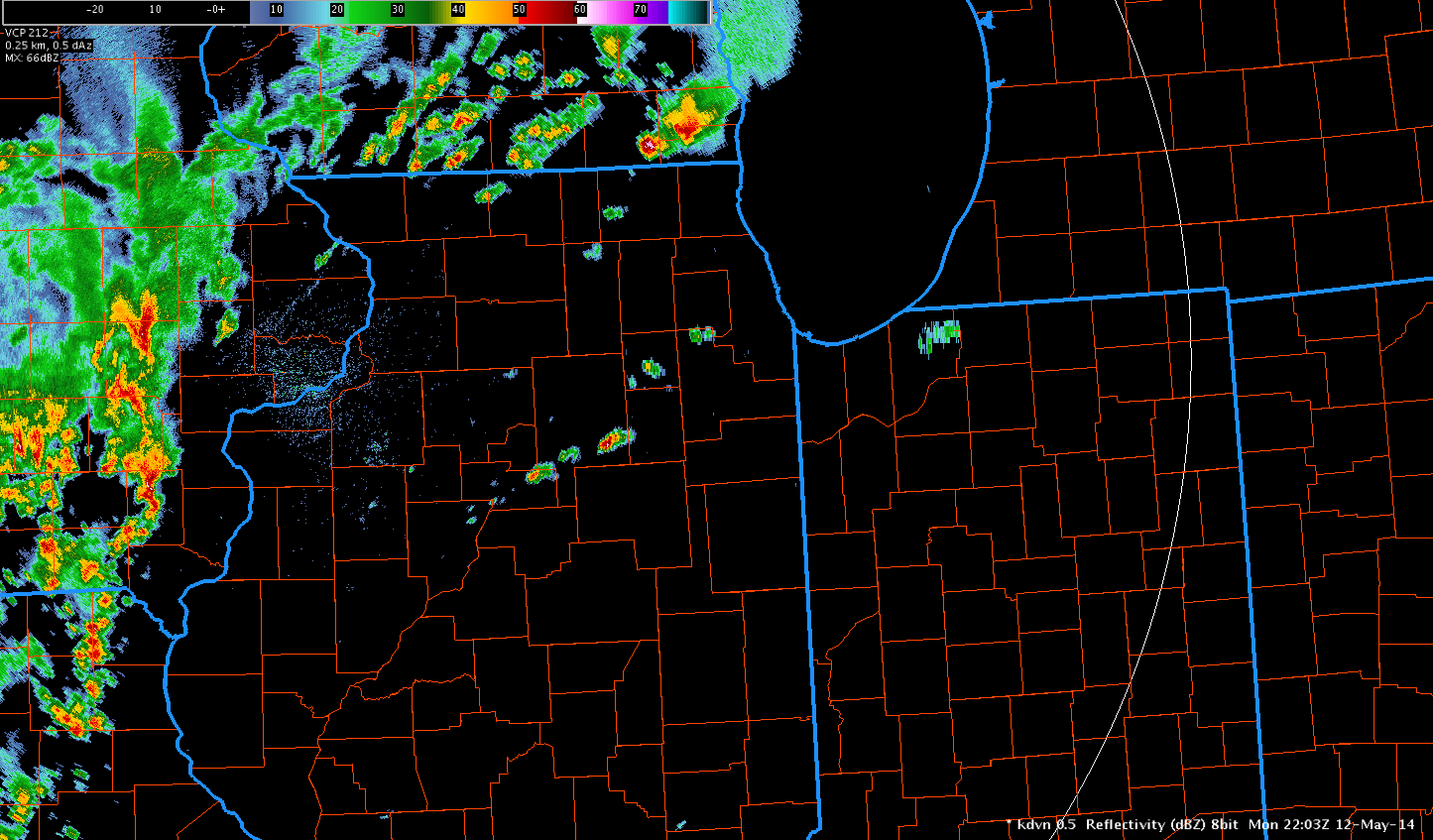
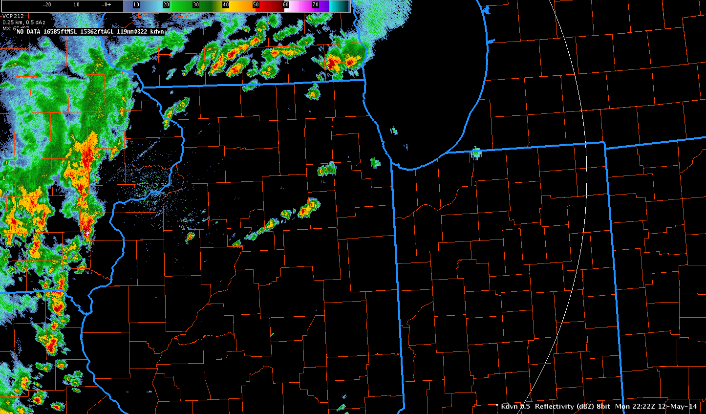
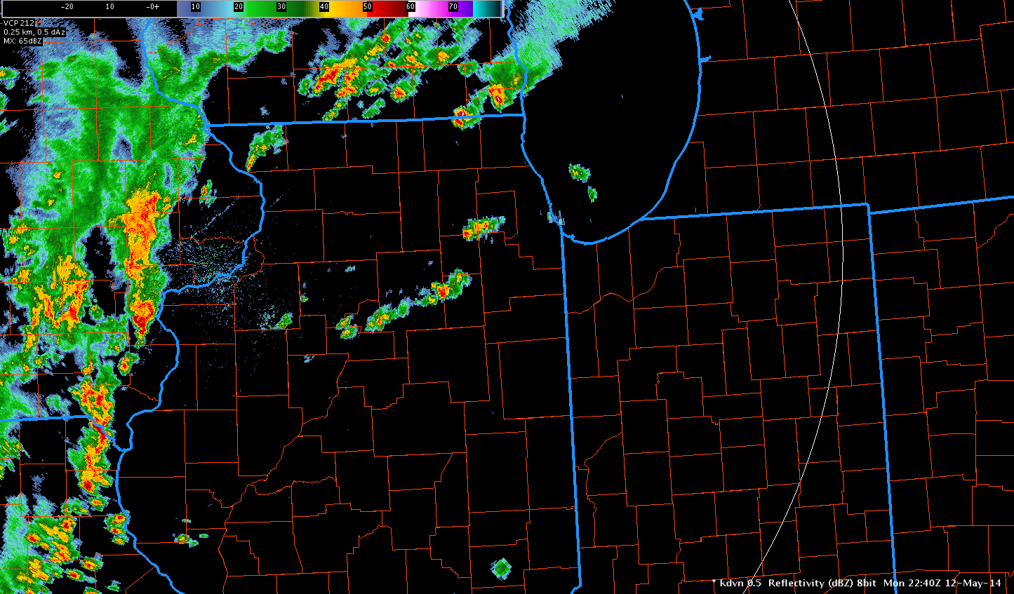
The GOES-R CI product did a fine job depicting convection growing in northern Illinois. The top image at 2145 UTC depicting values around 74% and the second image at 2200 UTC depicting 89%. The radar images below at 2203, 2222, and 2240 UTC depicted a few developing showers and storms near the CI values below. The product gave 15-45 minutes of storm lead time. These storms did not become severe.
 Michael Scotten