

The western sections of the San Angelo TX CWA have become quite favorable for thunderstorm development. First, here is a look at the sounding from nearby Midland TX at 12Z.

The values seen here are confirmed by RAP13 (pictured) and OUNWRF soundings just ahead of the developing convection near San Antonio.
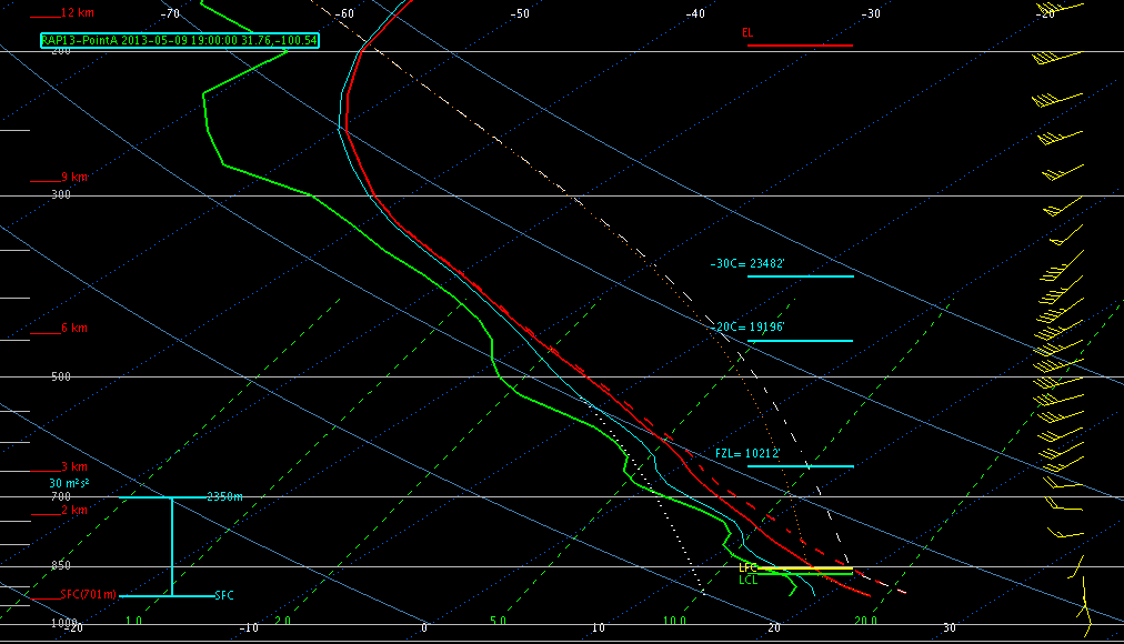
Lapse rates are extremely steep, and the moisture quality is quite good as well. Deep layer shear is favorable for supercells.
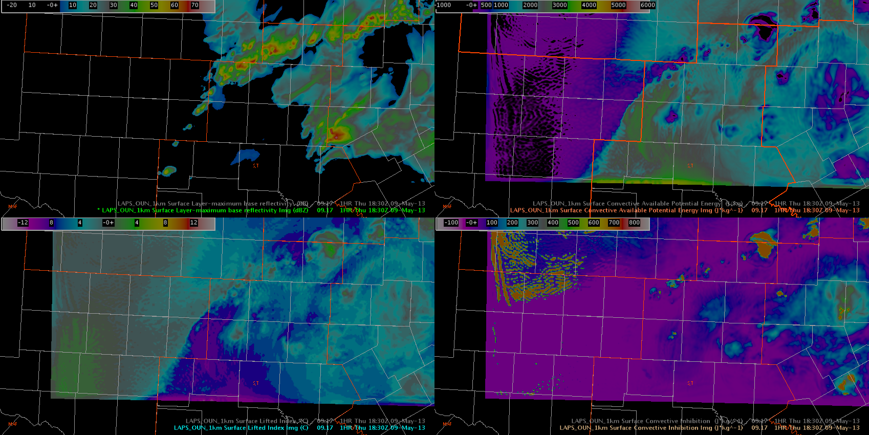
The LAPS 1km (OUN domain) data showed that the dryline in this area would activate explosively, in an area with 3000 J/KG CAPE (first image, top right corner) and LI values near -10 C (first image, bottom left corner). The second image is after the storms are mature, so these values diminish with time due to the convection (perhaps too aggressively ahead of the convection).

Because this is an area of clearing behind the large cirrus shield associated with the central Texas MCS, the GOES products are providing information about development in this region.

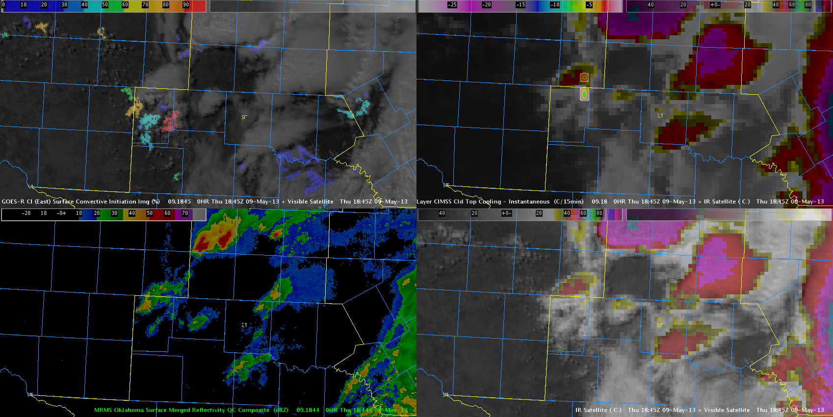
A warning was issued based on this data. The polygon was massaged to incorporate both aggressive CI signal to the south and CTC signal to the north. The UAH CI product was persistent in depicting 90 plus percent probabilities of CI while the CTC product indicated 10 to 15 degrees of cooling over a 15 minute interval. No reports were received to verify the warning, but MESH did end up indicating values of 0.87 inches, which has correlated to severe hail in past events and similar environments this week.
–Hatzos/Guseman