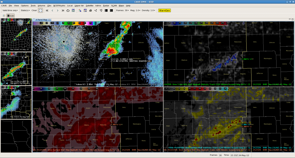
A few interesting storms across WFO DMX this afternoon. Several were severe, with one storm producing hail and quite a bit of damage in and just S-SE of Waterloo. In this post, however, we will focus on a storm that was a little closer to the radar that did not as of yet produce any severe reports. Let’s look at a 4-panel of 3DVAR data:

We are interested in the storm that moved from southern Marion County into and through Mahaska County. Notice the Max Updraft and Vorticity Tracks (lower panels). These fields stay fairly constant over time along the path of the storm. This storm did develop some weak low to mid level rotation. Not the updraft helicity values in the top right that peaked near 100m2/s2 indicative of this.–Gordon Strassberg for WFO DMX.

