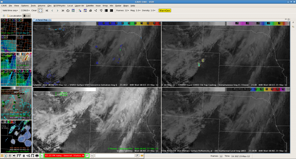
Conditions gradually improve for thunderstorm development over NE Colorado although initiation may be delayed until the 23-00 Z time frame. Surface boundary pushed through as lee depression slowly consolidated over W-Kansas. 12Z Denver soundings showed steep lapse rates with a deepening and well mixed boundary layer. Numerous weak caps present (roughly at 700, 600 and 500 hPa). CIMMS Cld top cooling product revealed numerous spots with moderately cooling tops in the order of -10 to -15 K/15 min with UAHCI CI product showing low to non existent probabilities. This may be the reason for growing updrafts before reaching one of those aforementioned caps, which suppressed further development. For the forecaster however this is already helpful to pinpoint the area, where enhanced cumulus growth occurs and where initiation may be the most likely.
Question now arises if moisture recovered since 12 Z. Surface dewpoints struggle to exceed mid to upper 30s with lower 40s now entering far NE Colorado as winds backs more to NE-erly directions in response to the consolidating lee cyclogenesis. However, products like the 780mb equiv pot temp and the theta-e diff show robust signals for available potential instability over far NE Colorado with an increasing trend during the following hours. In fact, latest HRRR forecast and the tongue of pot. instability seem to overlap nicely. Hence initiation seems possible around and south of a line Steamboat Springs-Denver-Deer Trail during aforementioned time frame. Incoming mid-level speed max pushes DLS aoa 80 kt, which is more than adequate for well organized storms.
Helge
