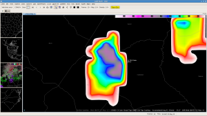
The CIMMS cloud top cooling algorithm first detected cooling rates of approximately -10 C/15 min with a thunderstorm developing across eastern Hoke and western Cumberland counties on the 1815z image. The algorithm continued to show strong cooling rates on the next two images with accumulated CTC values of approximately -30 to -35 C/15 min before the cell was dropped from the display after 1845z. A report of quarter sized hail was received in far southwestern Harnett county with this thunderstorm at 1937z, almost an hour and a half after the algorithm first detected stronger cooling with this storm.

