The Thank You Post

After we wrapped up daily operations in the HWT on 6 June 2008, I took a 2 week holiday to chase storms and then entertain visiting family members. I’ve spent the last few days back in the office catching up on 9+ weeks of accumulated emails and other assorted and sundry items that have piled up.

I’ve been meaning to make a post expressing my gratitude to the many participants of the Experimental Warning Program’s 2008 spring experiment. This year’s experiment was an order of magnitude larger in terms of effort by these folks than last year’s experiment, and they all deserve many kudos.

The biggest expression of thanks goes to our IT Coordinator, Kevin Manross, who put in more hours than anyone else to pull off the experiment.

Next, I’d like to thank our Weekly Coordinators for keeping operations on track each week: Jim LaDue, Kevin Manross (again!), Travis Smith, Patrick Burke, and Liz Quoetone. There were a few times when we relied on our backup coordinators to fill in when needed: Kevin Scharfenberg and Kiel Ortega.

The cognizant scientists brought their expertise to the experiment to help guide live operations and playback of archive cases for each of the three experiments.

For the Gridded Warning Experiment, they included Kiel Ortega (his software!), Kristin Kuhlman (she shed that rookie hat quickly!), Mike Magsig (lots of these ideas were his), Travis Smith (SWAT’s fearless leader), Angelyn Kolodziej (up and coming star), Les Lemon (the veteran), Kevin Scharfenberg (the “bureaucrat”), and Kevin Manross (once again!).

For the Phased Array Radar (PAR) experiment, Dr. Pamela Heinselman captained the ship, along with Ric Adams, Dr. Rodger Brown, Les Lemon, Kristin Kuhlman, Arthur Witt, Dave Preignitz, Rick Hlucan, and that seemingly available Kevin Manross.

For the Collaborative Adaptive Sensing of the Atmosphere (CASA) experiment, the leadership of Brenda Phillips and Jerry Brotzge got us through the storm, or lack there of! Maybe next time we’ll get decent storms in the CASA network during the forecaster shifts, and not the last hour of the last day of the experiment! In addition, we had help from Ellen Bass, Don Rude, David Pepyne, Kurt Hondl, and Patrick Marsh.

We had IT help from Charles Kerr, Vicki Farmer, Karen Cooper, Paul Griffin, Brad Sagowitz, Brian Schmidt, Doug Kennedy, Joe Young, and Darrel Kingfield.

There were a number of guest evaluators from the NWC that provided expertise: Brad Grant, Cynthia Whittier, Paul Schlatter, John Ferree, Patrick Marsh, and Jami Boettcher.

Undergraduate students who supported our SHAVE efforts were: Steve Irwin (coordinator), Jennifer Bowen, Jessica Erlingis, Margaret Frey, Tiffany Meyer, and Kelsey Mulder.

I can’t forget our extra special guest star from the Weather And Society Integrated Studies (WAS*IS) program, Dr. Eve Gruntfest, who spent an exciting week with us in mid-May.

The EWP leadership team of Travis Smith and David Andra, along with the other HWT management committee members (Steve Weiss, Jack Kain, Mike Foster, Joe Schaefer, and Jeff Kimpel), and my MDL boss Dr. Stephan Smith, were instrumental in providing the necessary resources to make the EWP (and EFP) spring experiment happen.

Finally, I express a multitude of thanks to our National Weather Service and international operational meteorologists who traveled to Norman to participate as evaluators in this experiment (and I also thank their local and regional management for providing the personnel). They are:

David Blanchard (WFO Flagstaff, AZ)

Mike Cammarata (WFO Columbia, SC)

Ken Cook (WFO Wichita, KS)

Andy Edman (NWS Western Region HQ)

Bill Rasch (WFO Billings, MT)

Craig Shoemaker (WFO Tucson, AZ)

Bryan Tugwood (Environment Canada, Toronto, ON)

David Schmidt (Environment Canada, Edmonton, AB)

Ria Alsen (Environment Canada, Toronto, ON)

Dave Hotz (WFO Morristown, TN)

Daniel Porter (WFO Albuquerque, NM)

Ron Przybylinski (WFO St. Louis, MO)

Dan Miller (WFO Duluth, MN)

Jonathon Howell (WFO Memphis, TN)

Steve Rogowski (WFO Sterling, VA)

Steve Hodanish (WFO Pueblo, CO)

Ryan Knutsvig (WFO Elko, NV)

Dave Patrick (Environment Canada, Winnipeg, MB)

Eric Stevens (WFO Fairbanks, AK)

Kevin Brown (WFO Norman, OK)

Mark Melsness (Environment Canada, Winnipeg, MB)

Brad Colman (WFO Seattle, WA)

Jon Hitchcock (WFO Buffalo, NY)

George Phillips (WFO Topeka, KS)

Chris Sohl (WFO Norman, OK)

Milovan Radmanovac (Hydrometeorological Service of Serbia)

Many thanks to everyone, including those I may have inadvertently left off this list. Please let me know if I missed anyone. I can certainly edit this post and include their names later.

Greg Stumpf (EWP Operations Coordinator)

Tags: None

Blog Entries Cleaned Up

I just spent most of the day cleaning up all the entries on the EWP Blog. This included fixing “ownership” of posts and post categories, standardizing the post titles, and re-ordering posts in their correct chronological order. It should make the blog entries easier to read now.

Greg Stumpf (EWP Operations Coordinator)

Tags: None

Feedback from our participants; planning for 2009

I am beginning to post feedback from some of our visiting forecaster/evaluator participants. I have pre-dated these posts to match up with the end of the week that each forecaster participate. A quick link to these posts is on the side of this blog, “Forecaster Thoughts”, or you can just click here.

The 2008 EWP scientists will be meeting soon to have a post-mortem “retreat” of sorts to start planning for 2009. Some information may be posted here in the coming days. Also, as we begin to analyze the data, you may see more posts in the future.

Greg Stumpf (2008 EWP Operations Coordinator)

Tags: None

Forecaster Thoughts – Bryan Tugwood (2008 Week 2), Dave Patrick (2008 Week 4), Mark Melsness (2008 Week 5)

In May 2008, we were given the opportunity to participate in NSSL’s Experimental Warning Program (EWP), which is part of the Hazardous Weather Testbed. It was held at the National Weather Center in Norman, Oklahoma for 6 weeks this year, running from April 28th to June 6th. This is the 2nd year of the EWP, and was born out of the Spring Program. The other component of the Hazardous Weather Testbed is the Experimental Forecast Program.

The purpose of the EWP is to evaluate new research and technology, and brings the researchers and developers into the same working environment as the forecasters. The goals of this year’s program were threefold:

  1. Evaluate the Phased Array Radar (PAR), located in Norman.
  2. Evaluate the 3 cm CASA radars in central Oklahoma.
  3. Evaluate gridded probabilistic warnings.

Before delving into any of the above 3 evaluations, we were given some training as well as time to practice with the software. During the evaluations, there was always help available as the learning curve was rather steep – especially for us Canadians who were unfamiliar with the Warning Decision Support System II (WDSSII) software. Above all, they wanted our feedback, as we were being “run” through the various implementations. Feedback was given to them both ongoing, and after the evaluation in a written survey. We will attempt to give a quick overview of each of our evaluations that we participated in.

Phased Array Radar: The PAR is being considered as a possible replacement for the WSR-88D, which is now 20 years old. The array consists of 4352 transmit/receive elements which form the array, as opposed to a large rotating antenna with one feedhorn. The radar beam is vertically polarized, as opposed to the horizontal polarization of the WSR-88D, the power is slightly reduced, thus features such as outflows and horizontal convective rolls are almost impossible to detect. Scans are available at one minute updates though, making storm evolution appear much more fluid. More information is available online at http://www.nssl.noaa.gov/projects/pardemo/ .

CASA Radar Network: There are four low power CASA (Collaborative Adaptive Sensing of the Atmosphere) radars to the southwest of Norman, filling the “gap” between two WSR-88D radars, namely Frederick, OK and Norman. The CASA radars are 3 cm wavelength, so although they suffer greatly from attenuation, having four of them in close proximity negates this problem in way of a composite image. The big advantage of the CASA radars is its high resolution, both spatially and temporally, with an added bonus of being able to collect data from as low as 200 metres above the ground. Additional information is available at these websites: http://www.casa.umass.edu/research/springexperiment.html and http://www.casa.umass.edu/

Experimental Gridded Probabilistic Warnings: Currently, the decision to warn a particular storm is subjective, and takes place when a forecaster has a certain degree of confidence (decision threshold crossed) that severe weather is occurring, or is likely to occur. There is no avenue available to explain how likely it is that severe weather is expected, other than in the discussion.

Recently the National Weather Service changed their warning areas from counties to polygons. You will notice while you are watching a radar animation that as a particular storm is tracking along, warning polygons will “jump” every 30 minutes or so to take into account new storm positions and expected motions. While storms appear to track along fairly smoothly, warning polygons do not. As a result, lead times for an approaching storm will differ from one locality to another, based on the warning issue time and the shape of the warning polygon.

Gridded probabilistic warnings (prob-warns) give forecasters the option to warn a storm before their mentally pre-defined threshold is crossed. Storms can be warned on as low as a 10% probability, all the way up to 100%. Storms are warned based on 3 categories: tornado, large hail, or damaging wind. In some supercells, there could be probability “cones” for all 3 simultaneously, each covering different areas depending on the specific threat.

Prob-warns are also given a velocity, thus they track along as smoothly as the storms being observed on a radar animation. Prob-warns can be assigned a changing threat level for storms that are expected to soon change in their intensity. Future versions will allow the warning “cones” to also depict curved probability paths.

The only drawback to prob-warns in the way they are currently set up (all experimentally of course), is they still don’t give you the option of tiered warnings. Even with prob-warn, we would still to a certain degree face the challenge of having more threats than bulletins (graphics) to express them. For example, a cold core tornado threat of 10% is considerably less threatening than an F5 tornado threat of 10%. Is it possible to design a “Tiered Gridded Probabilistic Warning System”?

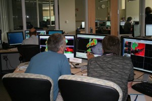
Mark Melsness, Environment Canada, Winnipeg and Kevin Brown, NWS, Norman discussing a severe Nebraska storm during a live probabilistic warning exercise.

Overall Impressions: The National Weather Center is an impressive facility located at the University of Oklahoma in Norman. It was completed in 2006 as a collaboration between NOAA and the University of Oklahoma. It is home to research scientists, operational meteorologists, faculty, students, engineers, and technicians. It is also the home of the SPC, NSSL and the Norman NWS.

We worked mainly in the Hazardous Weather Testbed (HWT), physically located between the SPC and the Norman NWS. The program ran for six consecutive weeks, with 3 or 4 operational forecasters present each week, coming from such diverse localities as Winnipeg, Toronto, Serbia, Fairbanks, Seattle and Norman to name a few. It was our input as operational forecasters that the researchers and developers wanted to tap into. We filled out several surveys, participated in daily debriefings, and also gave ongoing input to the HWT staff, who were most accommodating and professional.

The sheer scope of the forecasting challenge is much different in the United States than in Canada, especially in the Prairie and Arctic region where two to four severe weather meteorologists (two during the night and early morning hours) are responsible for issuing all warnings, watches, and special weather statements for half the land mass of Canada. These same two to four meteorologists monitor the nine radars which cover the populated portion of the Canadian Prairies – an area of comparable size, population density, and climate as 8 to 10 northern US NWS offices.

Having the ability to view minute by minute updates on both the CASA and Phased Array Radars was fascinating. Watching storms evolve in such a fluid motion was like the difference between watching a High Definition TV vs. an old black and white set. The main drawback for both radars was their inability to detect outflow boundaries and horizontal convective rolls. The amount of data to assimilate was huge, impossibly so when mentally translated into an Environment Canada office. The only way to incorporate this technology in a Canadian office would be to use an approach analogous to SCRIBE – quasi-automated warnings with the forecaster having the final say.

The scientists at the Hazardous Weather Testbed envision a time in the future, perhaps 10 to 15 years from now when warnings evolve from our current, “Warn on Detection” to “Warn on Forecast.” In other words, increased atmospheric monitoring coupled with an increased understanding of severe storms should allow us to issue warnings before a severe thunderstorm has even formed.

The Hazardous Weather Testbed is an excellent example of what could be accomplished here in Canada with a new National Laboratory dedicated to testing technology which could be used in Operations… with the goal of improving the forecasting and dissemination of severe weather.

We wish to thank our managers for allowing us to participate in this program, and the scientists at the National Weather Center for making our time there enjoyable and rewarding.

Bryan Tugwood (Environment Canada – Week 2 Participant)
Dave Patrick (Environment Canada – Week 4 Participant)
Mark Melsness (Environment Canada – Week 5 Participant)

Tags: None

Week 6 Summary: 2-6 June 2008

Visiting forecasters this week were George Phillips (SOO, WFO Topeka), Jon Hitchcock (Forecaster, WFO Buffalo), and Chris Sohl (Lead Forecaster, WFO Norman). In addition, Milovan Radmanovac from the Weather Service in Serbia also participated. John Ferree (OCWWS) was an observer. Other participants who supported testing included Angelyn Kolodziej, Kevin Scharfenberg, Travis Smith, Greg Stumpf, Jerry Brotzge, Dave Priegnitz, Kevin Manross, Pam Heinselman, Rick Hluchan, David Pepyne. Liz Quoetone and Kiel Ortega were Weekly Coordinators.

Weather during the week was predominately outside the Oklahoma Testbed. Forecasters spent the first half of each shift on training or simulations for Phased Array and CASA. Monday through Wednesday evening IOPs were Probabilistic Warning events generally associated with weather in the central and southern Plains. Thursday both teams did the Prob Warn exercise from Grand Forks. This was followed by the only live event to make it into the testbed. Storms reached the PAR network and were viewable (albeit at longer ranges) for a couple hours. Storms ultimately reached the CASA network with less than an hour remaining in the shift.

General observations:

Prob Warn

Participants got very comfortable with the technological end of this process such that by the end of the week, they were putting out multiple threat areas for the same storm and keeping track of things. Both groups used AWIPS to interrogate storms and WDSS II for assigning the actual threat area. This seemed like a good way to keep the technology from getting overwhelming, as well as involving both members of the team. Some discussion involved how the users would interpret these probabilities. The idea was that most would have a trigger point for various actions based on the probabilities. However, once the forecaster becomes aware of those trigger points, does this factor into the assigned probabilities (even though we are technically not suppose to consider any societal aspects of this).

Forecasters experimented with probabilities with one team issuing a 100% hail threat for 60minutes with no degradation. This was associated on a long-lived HP supercell and obviously confidence was high. The group did some wind threats but speculated that this could be much more complicated in squall line situations (which nature did not afford us during the live events).

CASA and PAR

Scientists captured more thorough findings from the group but in general, everyone found the temporal improvements to be beneficial. While the improved resolution was also a plus, it was felt that this was somewhat offset by the release of the Super Res products in the 88D. Some mentioned the sector scanning for CASA as not very useful. Participants talked about the small scale (time and space) features that you could see with each radar and the benefits of perhaps getting a warning out earlier, but also weighing this against the inclination to overwarn on features which are transient and not associated with severe weather. A definite learning curve.

The Friday wrap-up session was followed by two talks:

“December 19, 2004 Southern Lake Michigan Single Band” Jon Hitchcock, Buffalo NY

“Radar Network and Hail Suppression System in Serbia” Milovan Radmanovac, Serbia


Liz Quoetone (EWP Weekly Coordinator, 2-6 June)

Tags: None

Forecaster Thoughts – Chris Sohl (2008 Week 6)

While the weather in the local area started out rather quiet, it ultimately picked later in the week allowing us to view PAR and CASA radar data in real time. In the early part of the week we also had the opportunity to view archived data and issue real-time probabilistic forecasts for thunderstorms in the central plains.

For both the real-time and archived cases where we made probabilistic forecasts for thunderstorms, the process seemed to work reasonably well. The fact that many of the storms were discrete probably made the task relatively manageable. It would be interesting to experiment with cases of widespread strong/severe thunderstorm development including a few high-end storms such as supercells. Managing the boxology and frequency of updates could be a challenge.

I can envision the additional value that the probabilistic forecasts could provide to some customers especially for values below some “threshold” that might trigger a warning. For example, tornado probability trends for a supercell could give an EM or TV weather person some insight on the likelihood that a storm may subsequently have a tornado warning issued on it.

The strength of the PAR data was clearly its capability to perform rapid volume scans. Storm evolutions seemed to be easier to follow and also allowed the detection of features a little sooner than you might with the 88-D. The archive data of a developing microburst nicely demonstrated the advantage of having more frequent volume scans available.

While the range of the CASA radars was limited, they did provide additional information about the near surface wind speeds in storms than could be detected using the 88-D which was located farther away from the storms.

Although only available for a few volume scans, live radar data from a SMART radar was available for display on a workstation. To be able to view a remotely transmitted dataset in real time was impressive.

In the back of my mind, as I explored many of these datasets, I was trying to visualize how a warning forecaster could incorporate all of this information during warning operations. The long term solution may be short-term storm-scale forecast models that incorporate all available datasets. However, in the interim, it might be worthwhile to also explore the development of tools that would allow all available radar data sources to be combined into a seamless dataset for interrogation by the forecaster. This would also include developing robust 3D and 4D visualization tools.

Chris Sohl (NWS Norman OK – Week 6 Participant)

Tags: None

Forecaster Thoughts – George Phillips (2008 Week 6)

While PAR, CASA and probabilistic warnings are quite away down the road, I appreciated the fact that they are obtaining considerable input so far in advance.  This is, of course, the way every significant change in technology/operations should be tested and input from operational people received.

PAR – We only had one day where real storms impacted the PAR coverage area.  On the other days we played back archived cases.  While working the real weather day, it didn’t seem to help a great deal while I was the one investigating the storms early in the event.  Very strong wind fields on that day (June 5th) led to multiple dealiasing failures, making especially the early part of the real-time case, difficult.  As the event progressed and storms moved closer to the radar, rotation could sometimes be seen earlier on the PAR than on the 88D.

On the playback cases, the high temporal resolution would have helped greatly with the issuance of warnings for pulse storms, and would have led to more lead time in a tornado case.  If the high frequency updates from the PAR were coupled with a display like GR2AE, the ability to see updraft/core development and downdraft/core descent, would greatly help in visualizing what was going on with storms, and could easily help with understanding when warnings are or aren’t warranted based on their evolution.

Another advantage of the PAR was obtaining time continuity for questionable quality data.  Let’s say on the 88D you see an interesting velocity signature in an interesting area of the storm, but it doesn’t quite look right.  You may have to wait for another volume scan (4-5 minutes) before making a decision based on this signature to see if it is a dealiasing failure.  With the PAR, you have time continuity in very short order and can usually evaluate data quality much quicker.

On the challenging side was the fact that we are not used to such high frequency updates.  Transient features, that may or may not mean anything from a warning perspective, are seen much more frequently.  It will take awhile to adjust to mentally calibrate the WDM process with such high temporal resolution updates.  Concern was expressed about possible data overload as the volume scan could come in at 30 second or 1 minute periodicity.  While this is a valid concern, good visualization software would certainly help with this situation

CASA -  These radars are southwest of Norman, and are only about 30 km from each other.  Once again, only one day had real weather that impacted the radars, and that was late in the shift on the last day, so real-time evaluation was not extremely useful during that week.

We played back a few cases using the CASA radars and they showed some of the strengths.  In particular, with wind storms, the actual winds are often at some large angle to the 88D radar beam.  Or, the 88D is showing strong winds with a storm, but 0.5 degrees is intercepting the storms at 8000 ft.  Are those strong winds making it to the surface?  With CASA radars spaced relatively close together, sampling the lower atmosphere is easy, and the likelihood of being able to obtain a good estimate of the winds as they approach (or move away from) one or more of the radars, is also good.

Also, being able to sample the lower atmosphere in high resolution means that velocity and reflectivity signatures of small scale features should show up much better/more frequently.  We saw this in an example case with a mini-supercell associated with a tropical system, which had a nice little hook, and decent velocity couplet on the CASA display, while the 88D showed it as a blob with no real velocity signature until after the tornado had touched down.

Of course at 3 cm wavelength, attenuation occurs frequently, so any future CASA network would seem to need to be a supplement to a network of 10 cm radars.

Probabilistic “Warnings” -  Ever issued a deterministic warning and wish 10 minutes later you could cancel it, or reorient it, but are concerned about the verification implications, or possible consequences if you are wrong?  In the era of probabilstic warnings, one simply decreases/increase the probabilities, or reorients the track to produce a different area of probabilities.

We did this each day, in real time for various CWAs across the Plains.  We also did this on the last day with a canned case that all the participants in the EWP went through.

This actually worked better than I had expected.  But one could see that following more than two storms around with probabilities for tornadoes, winds and hail, quickly became a workload.  Of course there are also challenges with reasonably assigning probabilities, since that is not something we are used to.

On the last day we worked an archived case that all the participants in this EWP went through.  We had VERY limited environmental information for this event.  Assigning tornado probabilities without good environmental information was very frustrating, and really emphasized the importance of having this data.

There are a number of problems with the current warning system.  How we would transition from what we do now, to this method is not entirely clear, and how some of our users would react to this change is also unclear.  However, one can see that sophisticated users could obtain useful information that they currently don’t have.  Frequent updates to threat areas has the potential to give earlier heads up to people downstream of the ongoing severe storms, than issuing periodic warnings does.

George Phillips (NWS Topeka KS – Week 6 Participant)

Tags: None

Forecaster Thoughts – Milovan Radmanovac (2008 Week 6)

Coming from Serbia, my intention was to get familiar with the new technologies and new endeavors in meteorology, especially in radar meteorology, because that is the field where I’ve worked in for more than 15 years. The 2008 Experimental Warning Program spring experiment was a great opportunity to see the possibilities and practical implementation of some ongoing projects like the Phased Array Radar, CASA radars, probabilistic warnings…At the same time, through the EWP, I learned a lot about some other projects and systems (Mesonet, verification of severe weather, collaboration with TV and radio stations) and got a lot of ideas which can be applied or implemented within the meteorological services in Serbia. The Experimental Warning Project is especially important because there is the intention for improvement and modernization of the Serbian warning system, so the experience I got here will have a great practical value in my country.

Personally and on behalf of Hydrometeorological Service of Serbia, I’d like to thank you for being kind and making it possible for me to be a part of this program.

Milovan Radmanovac (Hydrometeorological Service of Serbia – Week 6 Participant)

Tags: None

Summary – 5 June 2008

End of IOP. Sent forecasters home. CASA now sampling data but we will look at this first thing tomorrow. Most feedback today will be on long range PAR which is not the best especially since this was (so far) mainly a wind event.

Liz Quoetone (EWP Weekly Coordinator, 2-6 June)

Tags: None