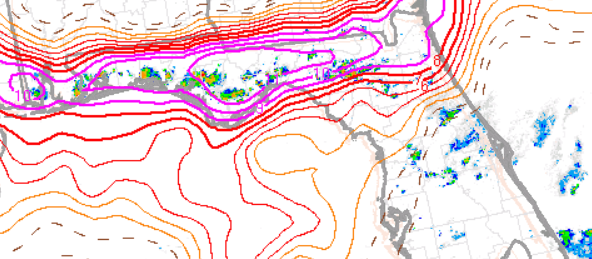
GLM:
On the afternoon of June 15, 2 different convective regimes were noted across Florida, with different GLM lightning characteristics. A cold front was sinking southward towards the Florida panhandle, with convection developing along the Gulf sea breeze along the FL panhandle. Convection of more uncertain forcing developed in Central Florida.
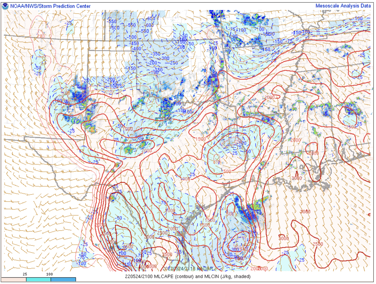
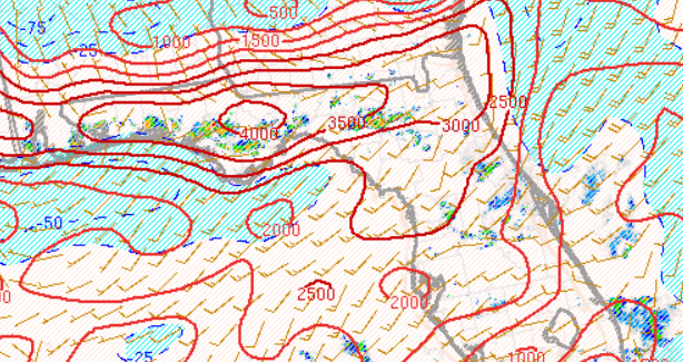
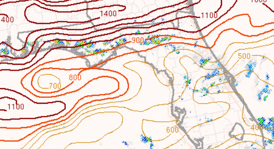
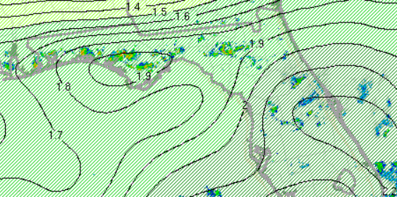
Convection along the FL panhandle had higher MLCAPE and DCAPE due to mid-level drier air and steeper lapse rates, with somewhat lower PWATs. SBCAPE in excess of 5000 J/kg and MLCAPE in excess of 3000 J/kg was unusually high for this region. Convection in central FL was in a more tropical air mass, with PWATs at or above 2 inches and more saturated profiles. Convection in the FL panhandle developed in an area with very high microburst composite parameter values, indicating conditions very favorable for microbursts and localized damaging wind gusts.
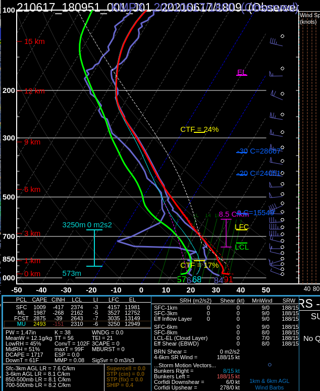
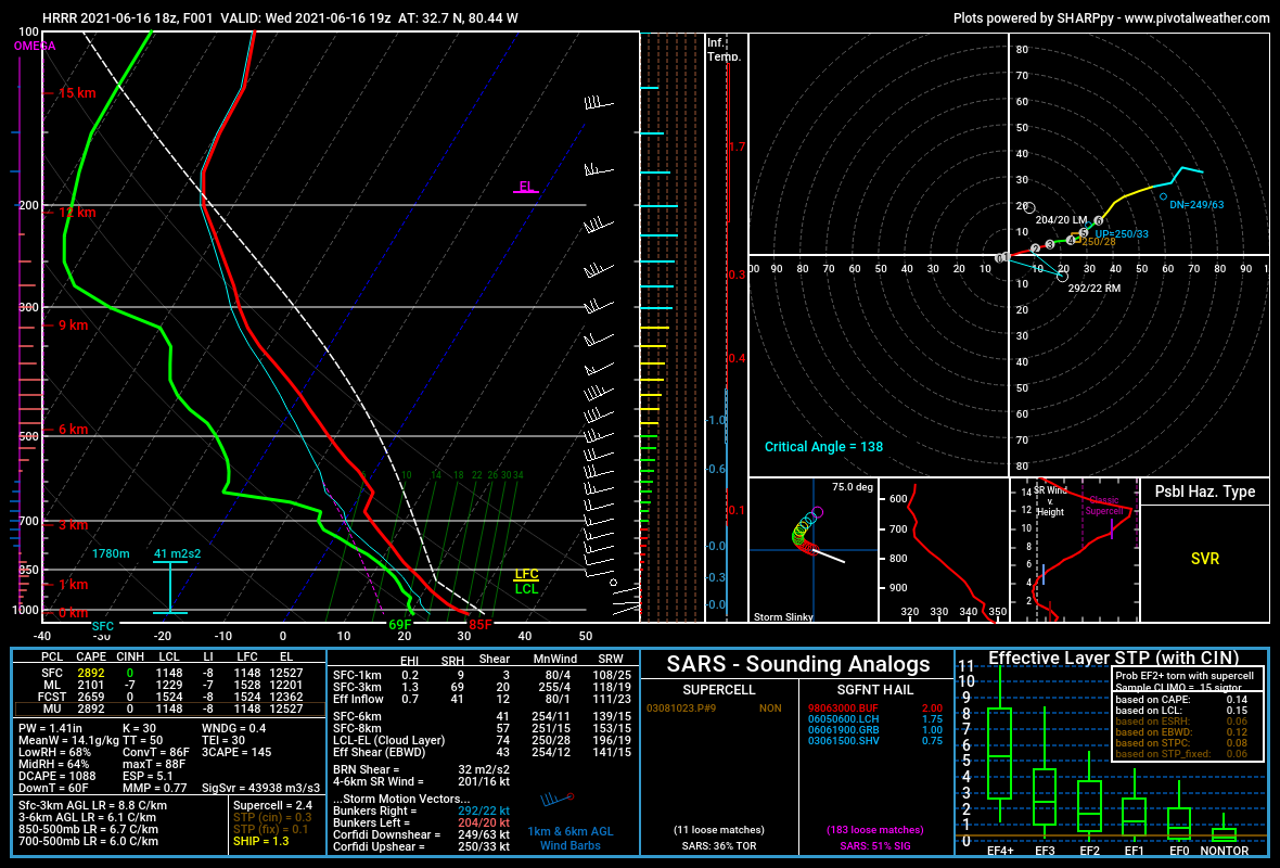
12z TAE sounding:
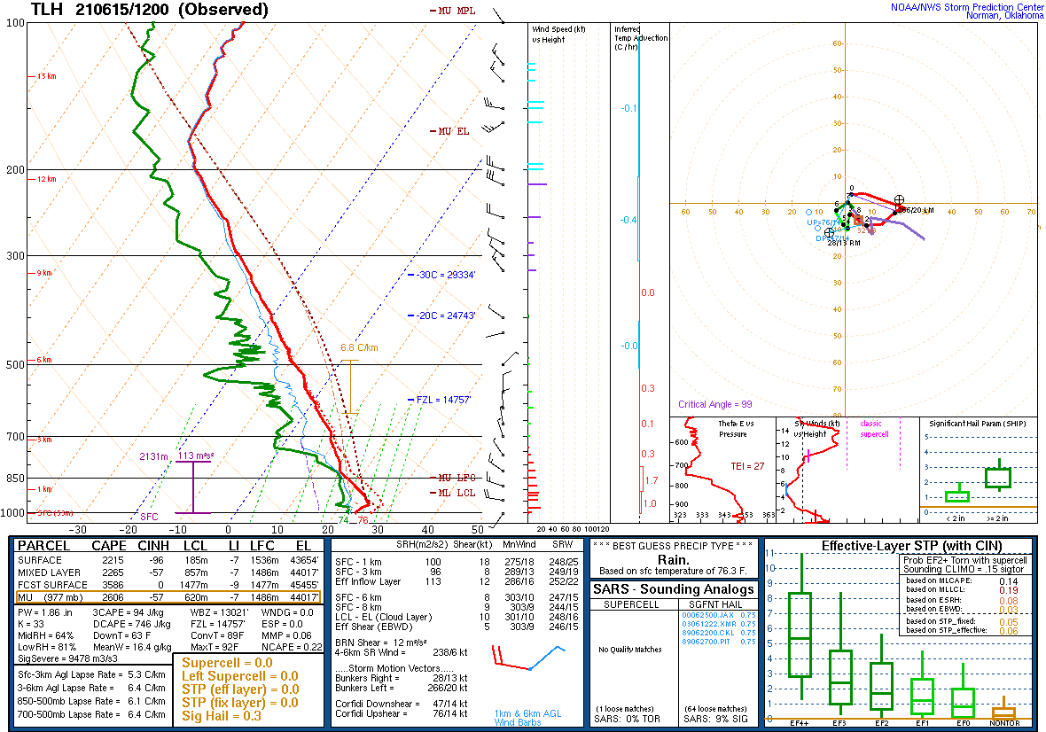
15z XMR sounding:

MLCAPE 19z:
19z DCAPE:
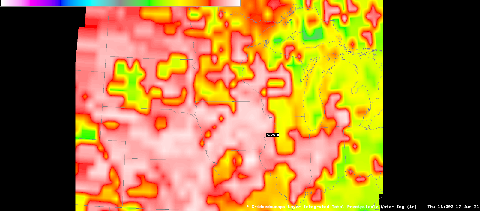
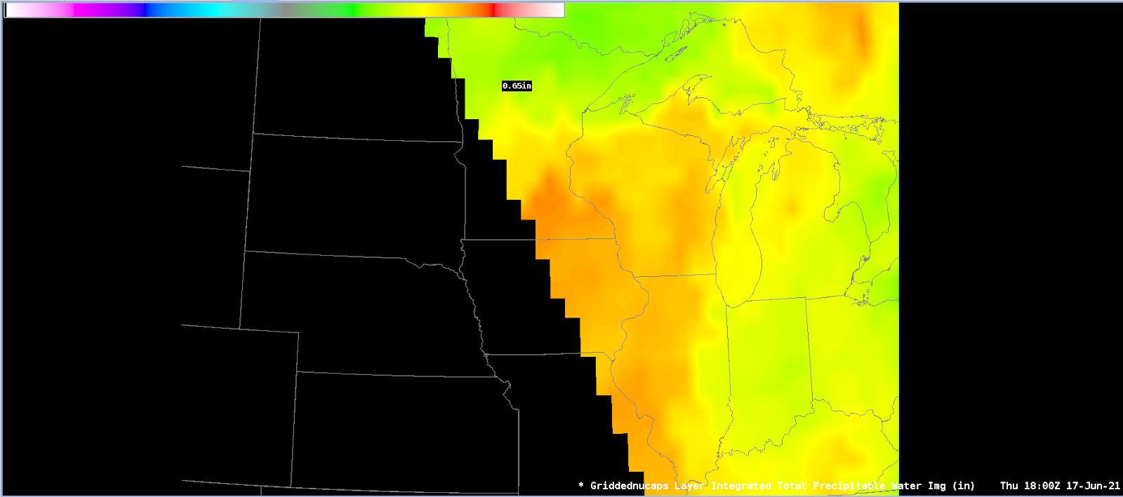
19z PWATs:
Microburst composite parameter 19z:
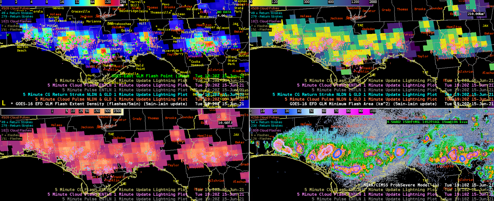
The FL panhandle convection was more intense on radar and also had higher flash extent densities. It also tended to have lower minimum flash areas, centered on locally strong updrafts. Notable hail cores were observed aloft, and melting of these hailstones caused strong downdrafts and damaging wind reports, and in a few instances quarter size hail made it to the ground, with one instance of golf ball size hail..
1920z:
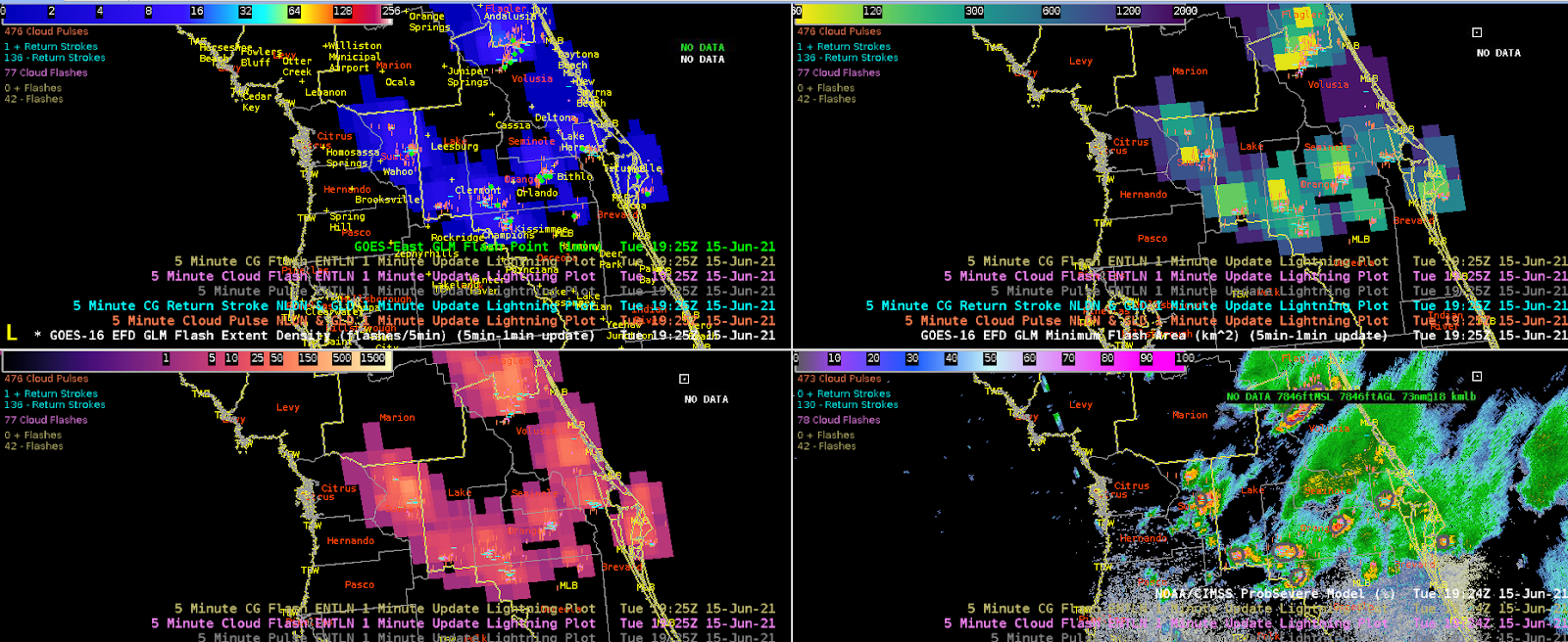
The central FL convection was weaker and had also been going on for longer, so there was some convective debris stratiform precipitation with larger minimum flash areas. Flash extent densities were lower than in the FL panhandle. There were still areas of lower minimum flash area centered on the updrafts.
The GLM flash points were very useful and lined up with the NLDN and ENTLN strikes and flashes. The parallax correction was especially useful for DSS purposes as partners often request notification on lightning strikes within a particular radius on the order of 8 to 20 miles, so an accurate location is important. At first glance there were much less flash points but this appeared to be due to the data only being 1 minute data without having the 5 minute accumulation that the NLDN and ENTLN offers. Having this similar 5 minute accumulation would be imperative for using the GLM flash points in operations. The sampled metadata for the flash points appeared less useful operationally. The flash area would be more of interest than the duration, but with a large number of flash points some sort of graphical depiction would be needed, and flash extent density seems to serve this purpose.
ProbSevere:
One interesting thing that was noted was v3 had much lower ProbHail than v2, while still having decent ProbSevere (mainly wind-driven values). We speculated that this was due to some of the machine learning based on environment and climatology, since severe hail would be less likely this time of the year with higher freezing levels/hot surface temperatures causing melting. However, in this case a golf ball size hail LSR was issued at 19:59z (report time appeared to be incorrect) for 2 ENE Saunders in Bay County, FL. This was comparable to MRMS MESH which maxed out at 1.89”.

On the technical side, I did want to note that typically I have sampling turned off in AWIPS, but then double-click on something that I want to sample. Since the ProbSevere timeseries plugin is also opened by double-clicking on the object, sometimes when I meant to double-click to sample the ProbSevere values I accidentally ended up opening a time series. And then I would double-click outside the ProbSevere area to sample something else or turn off sampling and I would get a black banner. Perhaps the timeseries doubleclick function could be turned on and off by making the ProbSevere product editable or not editable in the legend.
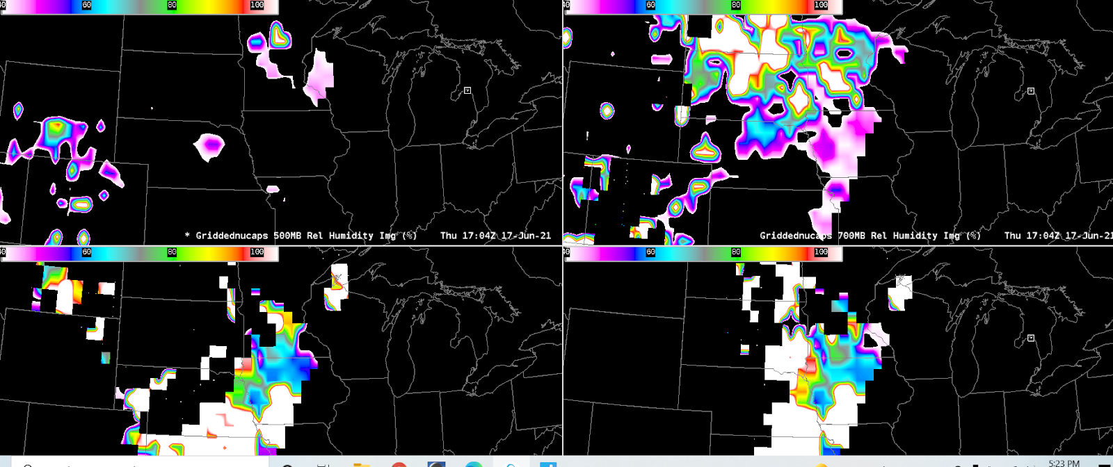
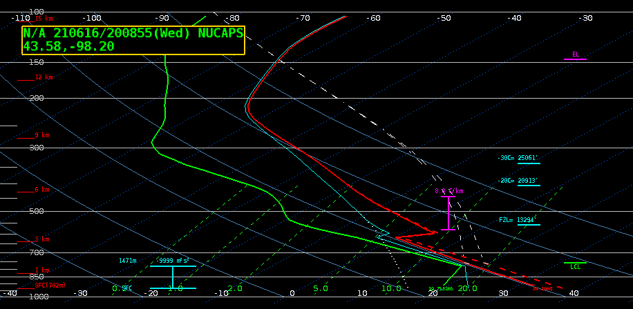
NUCAPS:
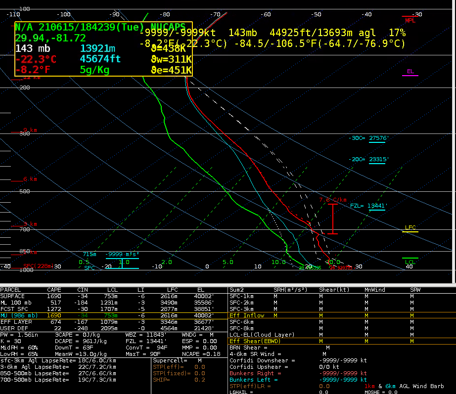
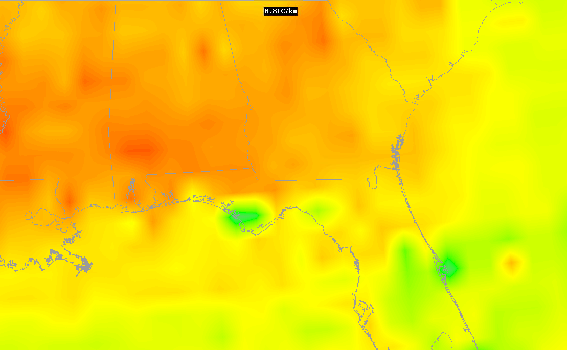
Gridded NUCAPS and individual NUCAPS soundings at 1840z showed steeper 700-500mb lapse rates than what was shown on the SPC mesoanalysis and some of the morning soundings, in areas away from convection. It’s hard to say which one was right, but the hail cores observed do seem more consistent with 700-500 mb lapse rates of near 7 C/km or greater. (Note that it would be useful to have contours to go with the images on the gridded NUCAPS plots.)
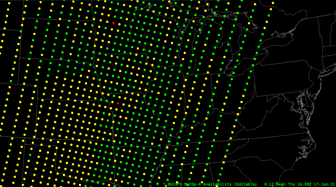
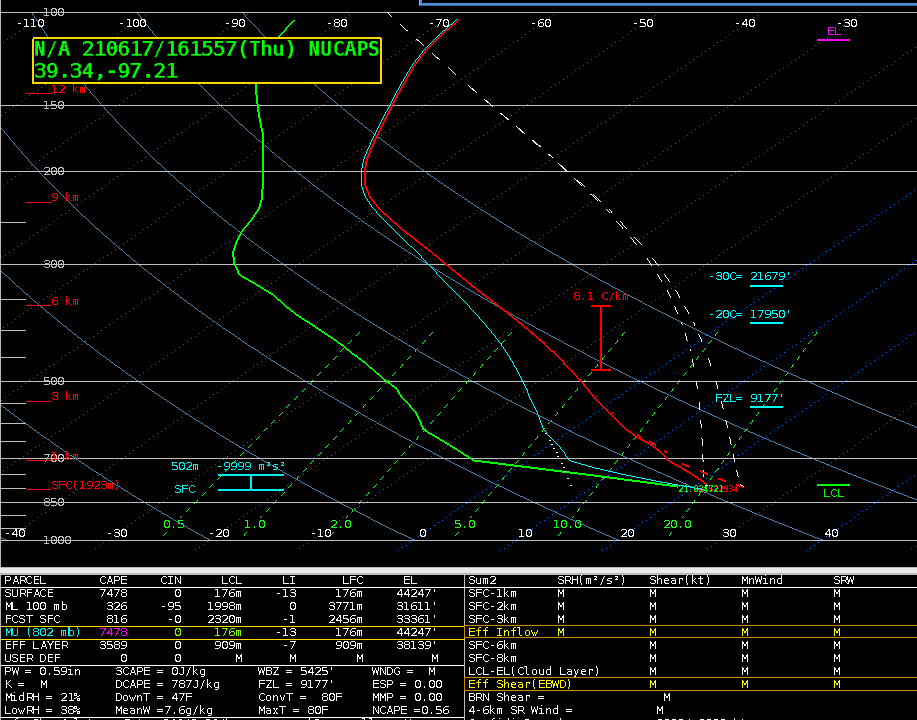
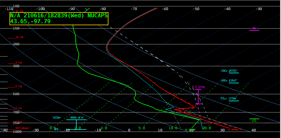
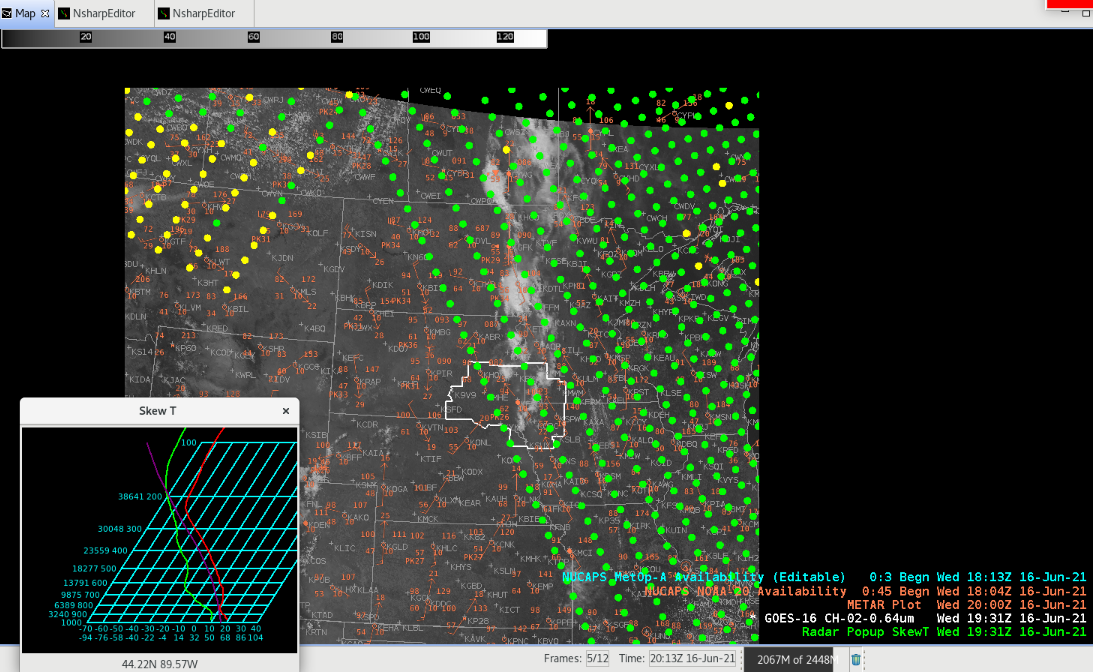
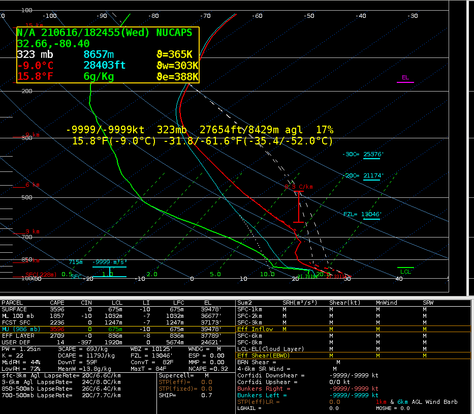
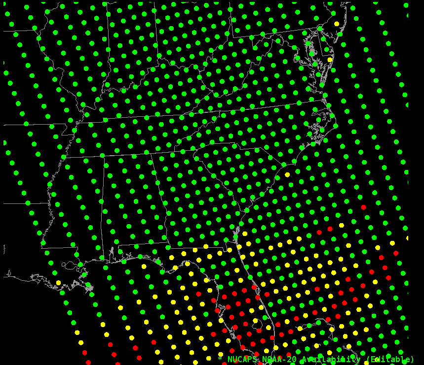
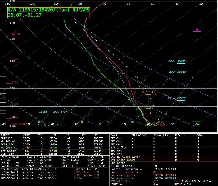
NOAA-20 sounding availability and example sounding (1823z)

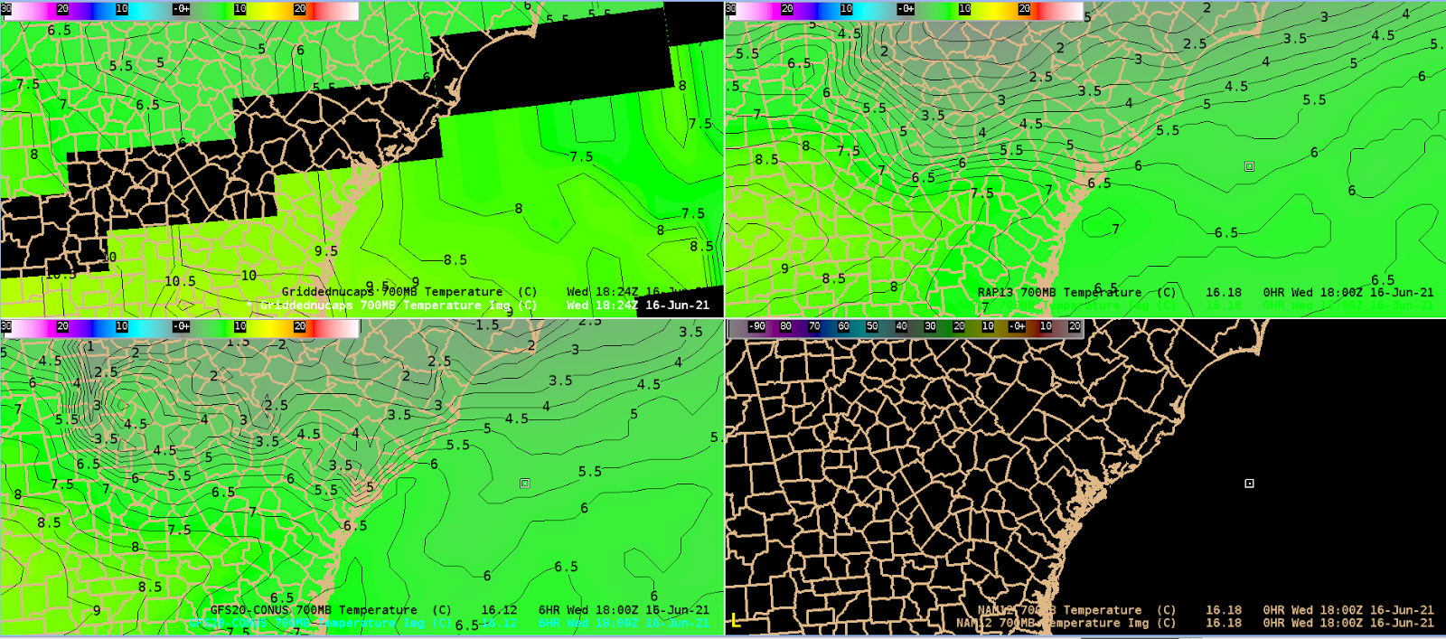
1840z gridded NUCAPS 700-500mb lapse rate:
18z SPC mesoanalysis 700-500mb lapse rate:

NUCAPS also indicated the more saturated profiles/weaker lapse rates in the central FL convective regime.
NUCAPS did indicate some of the higher CAPE values, but with missing data in much of the area of interest as convection had already initiated when the pass occurred.

– Barry Allen