Live Blog – 20 May 2009 (5:59 pm) – Verification Calls

Matthew has worked diligently to track down phone numbers of people who live beneath the storm near Harrison, NE, where MESH indicated golf ball size hail earlier.  His calls were mainly unsuccessful in reaching people, but one person reported 0.25 inch diameter hail, the same as a recent LSR from the Cheyenne WFO.

Patrick Burke (EWP Weekly Coordinator, 18-22 May 2009)

Tags: None

Live Blog – 20 May 2009 (5:47 pm) – IOP – issuing warnings for hail

Both teams have been issuing warnings for hail in far northwest Nebraska.  These storms appeared to be in the best environment, taking advantage of moderate mid level flow seen on the Medicine Bow profiler, and somewhat backed northeasterly surface flow just north of the slow moving cold front.  Forecasters have been using the Max Estimated Hail Size (MESH) product, which reached near 1.75 inch.  They have also been very interested in reflectivity at the 0 and -20 degree C level.  They have looked at echo tops products, but mostly for completeness.  The echo tops have not influenced warning decisions.

Patrick Burke (EWP Weekly Coordinator, 18-22 May 2009)

Tags: None

Live Blog – 20 May 2009 (4:53 pm) – Easing Into MRMS Warning Operations

Since about 4:15 PM CDT, forecasters have been analyzing data in the Cheyenne CWA, while NSSL scientists provide more in-depth explanation of the various MRMS products.  One team has already issued a severe thunderstorm warning for hail.  We suspect the event will peak later this evening, however, once the forecasters are fully familiar with the MRMS tools available to them, and when storms move into the North Platte, NE, area.

Patrick Burke (EWP Weekly Coordinator, 18-22 May 2009)

Tags: None

Live Blog – 20 May 2009 (3:14 pm) – Wyoming/Nebraska Target Heating Up

Forecasters have finished with an LMA archive case.  Timing couldn’t be better, as the SPC has issued a mesoscale discussion citing a severe weather watch possible in the central High Plains.  Forecasters are listening to an end-of-day discussion from the Experimental Forecast Program.  This will serve as at least the beginning of a “shift change” type briefing, while we bring the machines up into the Cheyenne, Wyoming, CWA.

mcd0853.gif

Patrick Burke (EWP Weekly Coordinator, 18-22 May 2009)

Tags: None

Live Blog – 20 May 2009 (2:42 pm) – LMA Archive Event

Forecasters are currently working an archived LMA event, viewing lightning data associated with a number of supercells.  Starting at 4 pm CDT, we will initialize the machines to our central High Plains target region for the MRMS IOP.  This should give forecasters plenty of time to become familiar with navigating and interpreting the MRMS products as storms develop in Wyoming, before we begin intensive warning operations from 5-9 pm.

Patrick Burke (EWP Weekly Coordinator, 18-22 May 2009)

Tags: None

Live Blog – 19 May 2009 (8:54 pm) – PAR/CASA Update

The CASA group is intently analyzing data, and will run up to 9 pm.  The PAR group is providing feedback verbally to the facilitators, and filling out a case study survey.  There will not be time for an end of day debrief, but we plan to hold more discussion at the beginning of the 1 pm briefing on Wednesday.  For now, some of the comments I’m overhearing from PAR include: for storms at long range, please experiment with elevation angles lower than 0.5 degrees; forecasters like the beam overlapping in the horizontal and vertical; forecasters would like to see the reflectivity color curves in WDSS-II display more noticeable breaks at 50 and 60 dbZ for hail threat.

Patrick Burke (EWP Weekly Coordinator, 18-22 May 2009)

Tags: None

Live Blog – 19 May 2009 (8:20 pm) – CASA Group

In viewing the archived CASA data, Rob is bothered by the sector scans from the individual radars at certain elevation angles.  He finds it difficult to trust the data near the sector edges because we are taught to look for dealiasing failures, etc., when traditional radar shows sharp cutoffs.  Additionally, Rob and Mike would prefer to see the entire 360 deg scan at all elevation angles.  They would be willing to accept slightly slower updates in favor of 360 deg scans.

Patrick Burke (EWP Weekly Coordinator, 18-22 May 2009)

Tags: None

Live Blog – 19 May 2009 (7:26 pm) – Nevermind

The strong storm in the Glasgow area weakened when it became elevated north of the warm front.  Other cells tried to initiate along an arcing outflow boundary southeast of the original storm.  These new cells were never a threat to produce severe weather.  Rather than chasing new mediocre cells in western and central Montana, we made the decision to end the IOP, and return to the more fruitful archive cases.

Patrick Burke (EWP Weekly Coordinator, 18-22 May 2009)

Tags: None

Live Blog – 19 May 2009 (6:09 pm) – MRMS IOP – Take II

We’ve reinitialized in the Glasgow, MT, area, as of 6 PM CDT.  A strong thunderstorm coming out of the higher terrain to the west… is now interacting with a warm front oreinted NW-SE across Montana.  The initial cell has shown a weakening trend, but there are other cells coming up along the flanking line…and in the vicinity of the front.  If these cells become potentially severe, we will stick with this IOP.  Otherwise, we may choose to switch to PAR and CASA archive if the Montana activity hasn’t shown us anything by 7 PM.

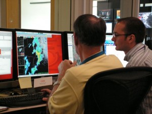
Les Lemon (Left) and Rob Handel (Right) analyze data from the Glasgow, MT, WSR-88D

Patrick Burke (EWP Weekly Coordinator, 18-22 May 2009)

Tags: None

Live Blog – 19 May 2009 (5:20 pm) – MRMS – IOP moving to Montana

Technical difficulties have slowed our progress this afternoon.  One team, Matthew and Mike, were able to view data from Salt Lake City in both D2D and Google Earth.  The Warngen functionality was compromised, though, and the group did not feel the convection warranted warnings.  They would have issued special weather statements, if possible.  The second group, Rob and Les, did not have a functioning data feed, so instead carried on a fruitful conversation with a group conducting satellite-based research.  We are now taking a dinner break while Kevin works to correct the technical problems.  Hopefully when we return there will be a window of opportunity in which to issue warnings over the Glasgow or Billings, MT, area.  If not, we will return to archive cases of PAR and CASA data.

Patrick Burke (EWP Weekly Coordinator, 18-22 May 2009)

Tags: None