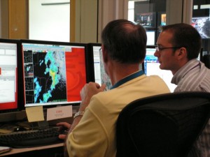
We’ve reinitialized in the Glasgow, MT, area, as of 6 PM CDT. A strong thunderstorm coming out of the higher terrain to the west… is now interacting with a warm front oreinted NW-SE across Montana. The initial cell has shown a weakening trend, but there are other cells coming up along the flanking line…and in the vicinity of the front. If these cells become potentially severe, we will stick with this IOP. Otherwise, we may choose to switch to PAR and CASA archive if the Montana activity hasn’t shown us anything by 7 PM.

Patrick Burke (EWP Weekly Coordinator, 18-22 May 2009)
