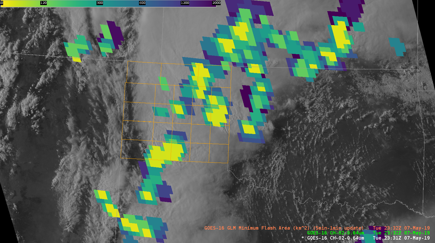
Product is performing as I’d expect it would from training and has been helpful to me as the storms have gone upscale. Compared to GLM MFA I was able to observe yesterday, this has been more helpful in understanding the product today.
Official websites use .gov
A
.gov website belongs to an official government
organization in the United States.
Secure .gov websites use HTTPS
A
lock (
) or https:// means you’ve safely connected to
the .gov website. Share sensitive information only on official,
secure websites.

Real-time posts made during testbed nowcast and warning operations.
Product is performing as I’d expect it would from training and has been helpful to me as the storms have gone upscale. Compared to GLM MFA I was able to observe yesterday, this has been more helpful in understanding the product today.
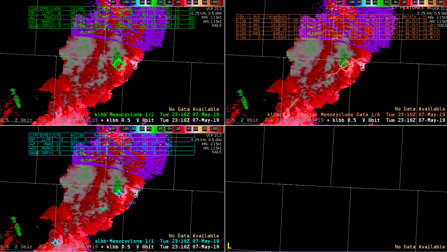
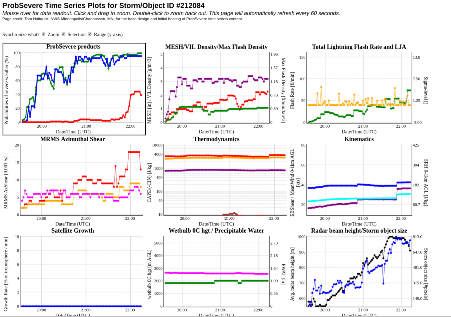
A measured 69mph wind gust by the West TX Mesonet occurred in an area where high AZ Shear and a mesocyclone was indicated by all three MDAs.

I’m pretty confident that a few of these cells given core heights and storm environment probably have real world warnings on them at the moment, but I’m holding off due to the performance of prob severe hail and tor through the day today. We’ll see….Particularly the northern storm in the CWA as it is more discreet than the storms near Lake Meredith.
-icafunnel
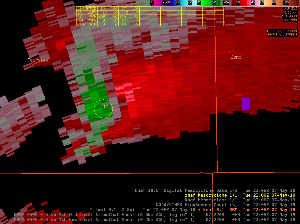
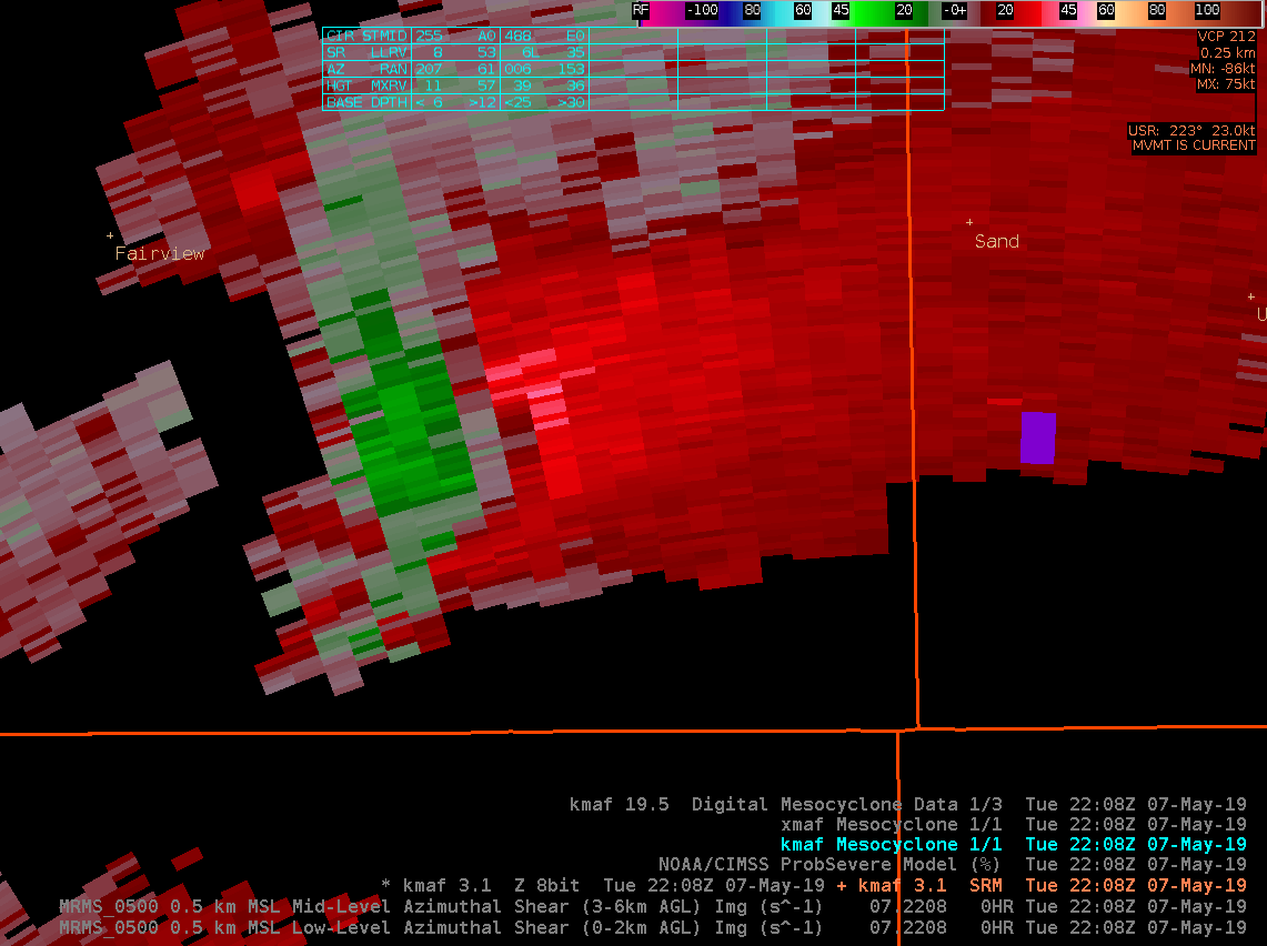
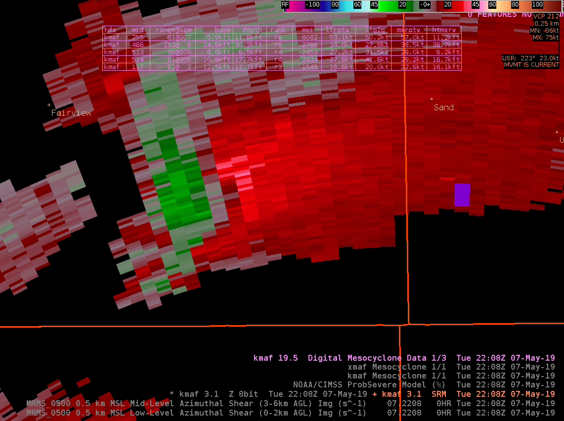
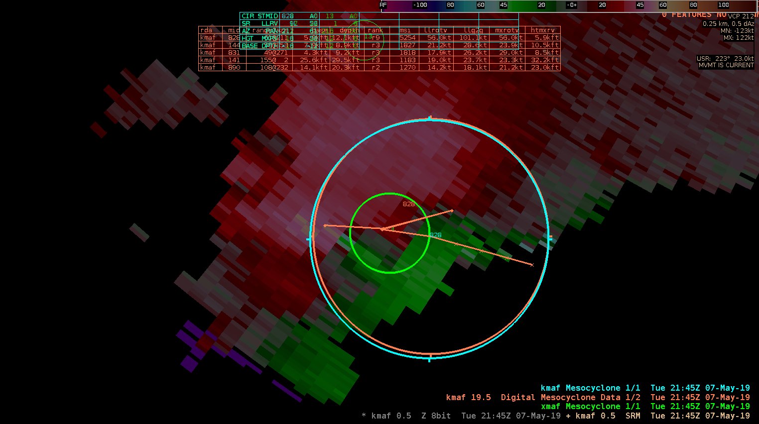
Not gonna lie, it took a while to digest what was being displayed by the various meso detection algorithms since we don’t get a lot of meso in the Pac NW. However, here is an example when NMDA picked up on broad mid-level rotation while the MDA and DMD didn’t for a storm in the northern portions of MAF’s CWA. (Also displayed is SRM around 17,000 ft from KMAF)
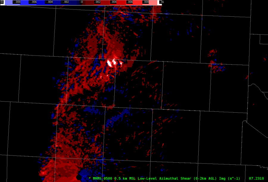
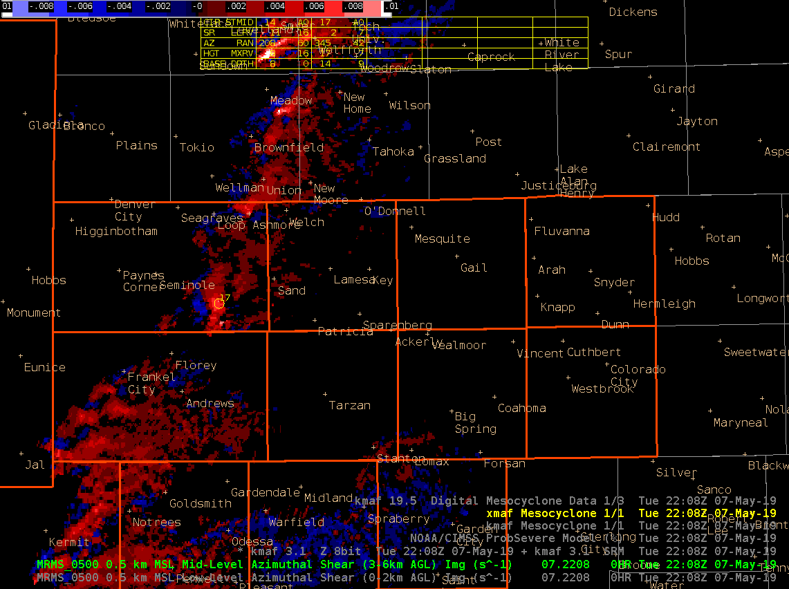
For good measure, here is a look of the 3-6km Merged AzShear.
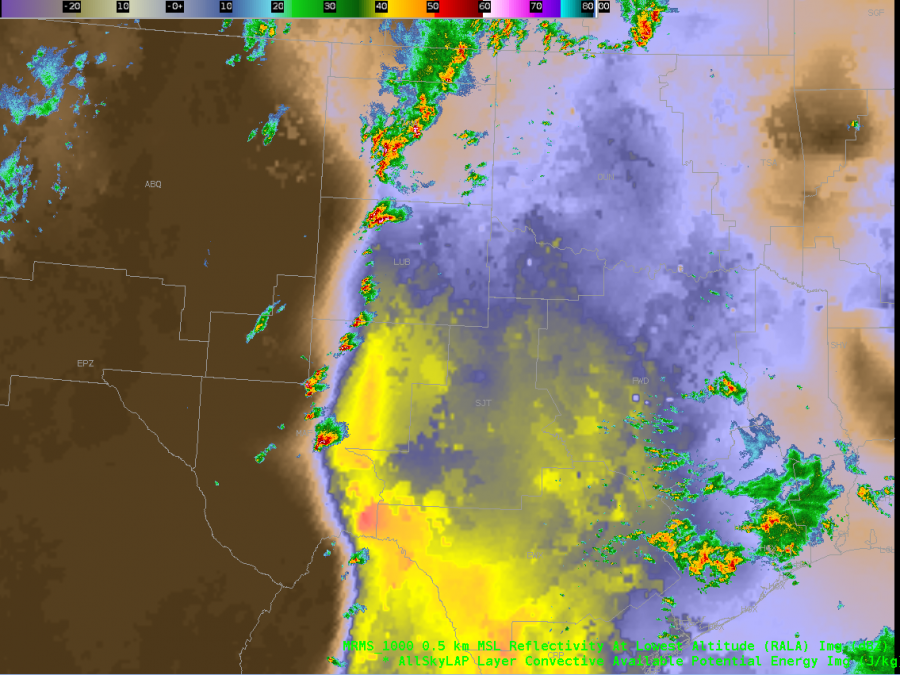
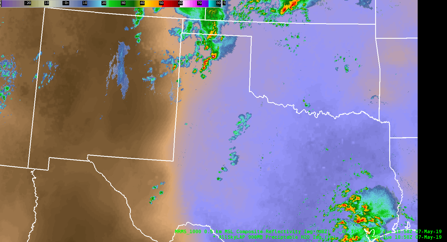
Supercells developing along the western edge of the AllSky CAPE depiction.
A few minutes prior to tornado touchdown, the NMDA comes through as superior to DMD and MDA. NMDA focuses in on a tighter circulation, although just above the lowest slice, as opposed to MDA and DMD.
ZDR_Arcophile
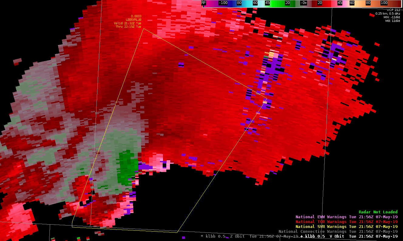
When the reported tornado developed in Swisher County in the northern portion of the LUB CWA at 5:12 PM, it was preceded by increases to the ProbTor and AZShear products by several minutes. Initially, I believed these algorithms to be picking up on sidelobes in the lowest levels of the radar scans, as noisy velocity data was being recorded in areas where reflectivity values were small. You can see these artifacts in and around areas of purple haze in the animation below. However, these products verified their jumps with a brief tornado touching down. It was reported to look relatively strong while on the ground with multiple vorticies visible at the time. It was short-lived, however, seeming to dissipate relatively quickly after touchdown.
The NMDA also did well picking up on this circulation before tornadogenesis, but I had some questions regarding the data quality in the low-level detection prior to the tornado.
#ProtectAndDissipate
NMDA (in green) had problems picking up on the 1.3 slice circulation compared to DMD (in orange) and MDA (in cyan). This is a mid-level rotation at about 11K ft above sea level. This is about half an hour before tornado touchdown.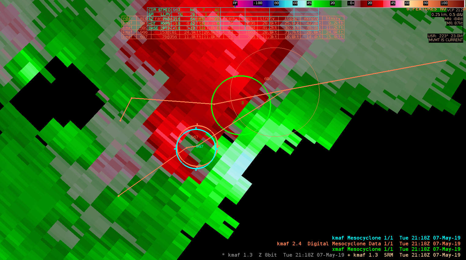
ZDR_Arcophile
Another loop of supercells developing along the advancing dryline as depicted by the AllSky H9 PW imagery.
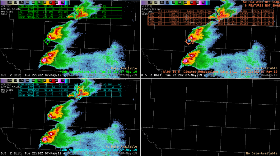
In this image from LBB, the legacy MDA (top left) and DMDA (top right) were indicating a meso in an area where a hail spike was resulting in false velocity data. The NMDA was the most trustworthy during this time frame.