Live Blog – 29 May 2008 (4:56pm)

The forecasters have begun warning operations in two different sectors. Team 1 (Eric and Patrick on Higgins) are currently focusing on two storms in N. Kansas, issuing a hail swath on the northern storm and hail and tornado for the storm in Sheridan Co, KS. Team 2 (Kevin and Mark on Moore) are covering 3 storms in the Hastings Nebraska CWA, including an HP supercell near Lexington, NE that seems to be outflow dominant. Travis and Greg are keeping track of storm reports and spotter locations and cameras on the SAD.

Monitoring storms in Goodland, KS CWA

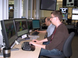
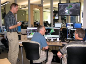
Team 1 (above) is updating storm motions for multiple threats on the Sheridan Co storm and have already noted that it would be nice to update all threats at one time. They are also using a different naming convention for the storms, referring to them instead by county names–perhaps due to Patrick’s familiarity with the Goodland’s CWA.

Discussing storm structure in NE

Team 2 (above) have issued a low prob tornado warning on the Lexington, NE storm as the velocity signature has gotten a bit better… storm spotters have just recently reported a brief touchdown with this storm.

Kristin Kuhlman (Gridded Warning Cognizant Scientist)

Tags: None

Live Blog – 29 May 2008 (3:54pm)

Prob Warn Ops in High/Moderate Risk Area

Forecasters have completed the archived PW case. They will take a short break, and then begin the PW IOP. One team will track cells across south central Nebraska. The second team will begin operating in north central or west central Kansas, but this team will likely jump up to the Sioux Falls/Omaha Area when storms initiate there later this afternoon.

Patrick Burke (EWP Weekly Coordinator, 27-30 May)

Tags: None

Live Blog – 28 May 2008 (8:46pm)

ProbWarn Discussion:

Slider bars give too much control, increments of 5 or 10 should be used (forecasters don’t think in terms of 66 vs 68 %). Group uncertainty together in widget following sliders for motion and speed… peak probability should be labeled ‘trend prob’ or ‘mid prob’–has lead to some confusion. Preview of product is necessary before saving…

Product for low probabilities, allows for communication of threats that forecaster may just wait on otherwise.

pulsing probabilities can lead to confusion to end user… How often do you update grids? and how does the updates get translated to outside user? how can we issue the right product to get the desired reaction?

need to more clearly tie original threat polygon to storm, either clarify naming convention (e.g., alpha, beta, etc–something more obvious than the utc convention currently used) or move polygons along automatically with time using set motion from warning.

Kristin Kuhlman (Gridded Warning Cognizant Scientist)

Tags: None

Live Blog – 28 May 2008 (7:57pm)

Both teams continue to follow the same storms mentioned in the previous post. A glitch has prevented auto-updates in AWIPS D2D, but WDSSII is operating well. Team 2 notes their lead storm is taking on HP character as it approaches the north side of Tucumcari. They are toning the tornado probability down while maintaining a high probability of severe hail. They will also initiate a damaging wind threat area.

Kevin of Team 2 examining side-by-side supercells:

Tucumcari Storm

Team 1 has threats for hail on both the Chaves and Alamagordo storms. They have a low probability tornado threat area for the Chaves storm, which has just begun to interact with the aforementioned boundary.

Brad with Team 1 monitors the Alamagordo storm from his workstation and using the SADS:

NM and SADS

Patrick Burke (EWP Weekly Coordinator, 27-30 May)

Tags: None

Live Blog – 28 May 2008 (7:48pm)

Operations continue with two teams alternating positions every hr… forecasters seem to appreciate the ease of updating the warnings with this method, though the start-up in its current format is a bit tedious. Can also get confused with multiple warnings on the same storm by highlighting the wrong threat polygon, though hasn’t been a huge issue tonight… Forecasters again would like to see a preview of ProbHail (or other threat) swath before saving it…

Team 1 issuing a lower prob tor warning on storm in northern Chaves Co.; storm in SW Chaves Co has moved out of threat area with lack of attn to storm. New cell has developed to west and the team is debating covering both cells with one warning or beginning new warning on western cell. (Team has joked it would like a “maybe” button on choosing whether a deterministic warning would be issued for this cell, probabilistic warning covers this uncertainty much better).

Team 2 plans on tackling wind threat on storm with HP nature nw of Tucumcari and bringing down probs on tor threat.

Kristin Kuhlman (Gridded Warning Cognizant Scientist)
Tags: None

Live Blog – 28 May 2008 (7:15pm)

Both teams appear comfortable with handling multiple threats, even on multiple storms. Team 1 is warning for hail with the storm east of Chaves. They are curious to see how this storm evolves upon interacting with a NNW-SSE oriented boundary located in the path of the storm. They also issued a high confidence hail warning for a storm southeast of Alamagordo…which has a 3-body scatter spike, and for which MESH indicates 3 inch hail.

Team 2 has been following a long-lived supercell which has occasionally produced a TVS, and at one time a fairly strong TVS…tracking just north of I-40 toward Tucumcari. They are maintaining high probabilities for hail and tornado with this cell…and have just added a low probability for tornado with a second supercell following in the path of the first. These cells are moving along an east-west oriented boundary of unknown origin…which may have bee produced by differential heating.

Patrick Burke (EWP Weekly Coordinator, 27-30 May)

Tags: None

Live Blog – 28 May 2008 (6:47pm)

Possible software guidance for future: Encircle large area and grid points exceeding some threshold value (e.g., MESH > 1.25 in) gives an initial first guess polygon for threat area.

Team 1 is expecting their storm to decrease in intensity as it moves off the terrain and are going to begin issuing warnings on the storm NW of Roswell (Chaves Co). Velocities from KFDX are not good on WDSSII, so will begin with hail threat and then possibly tackle tor next (funnel cloud reported with storm). They have also tackled the hail threat on a separate storm in far SW Chaves Co.

Team 2 is discussing possibilities of probabilities of hail > 2 in or 3 in (sig hail?). Move to allowing others (the public) to decide what is important for themselves (e.g, different thresholds for action)–the NWS issues probabilities of events occurring (not warnings)…

Kristin Kuhlman (Gridded Warning Cognizant Scientist)
Tags: None

Live Blog – 28 May 2008 (6:06pm)

We finished a first training exercise using live data in southern NM around 5:30 pm and have moved to issuing warnings on two separate storms in NM. Team 1, Mark and Brad (on Moore), concentrating on the hail threat near Los Alamos. Team 2, Kevin and Eric (on Higgins), are looking at both the hail and tornado threat in southeastern Santa Fe.

Team 2 have noticed that threat areas can be a bit ahead of radar / mesh output as update times 1min for the former, 5 min for the latter. Both teams have discussed how often should update product, see it as a continuous product that you don’t have to wait until the end of the “warning” to update/reissue.

Kristin Kuhlman (Gridded Warning Cognizant Scientist)

Tags: None

Live Blog – 28 May 2008 (4:30pm)

PROB-WARN Ramping Up

Forecasters will head back to the Hazardous Weather Testbed to practice drawing probabilistic warnings…then an intensive operations period is planned beginning sometime after 2200 UTC…most likely in the area just east and southeast of Albuquerque, NM. Northeast parts of the state may be too stable to support a long-lived storm.

Patrick Burke (EWP Weekly Coordinator, 27-30 May)

Tags: None

Live Blog – 28 May 2008 (3:37pm)

Eastern New Mexico Heating Up

The SPC has outlined a mesoscale discussion for eastern New Mexico, where a weather watch may be needed soon. Satellite and surface observations suggest the original target of northeast NM has been slow to warm up beneath widespread stratocumulus clouds north of the frontal boundary. Greater destabilization has taken place along the I-25 corridor and into east-central/southeast NM. This zone of greater instability should develop northward this afternoon. Thunderstorms are initiating in a widely scattered fashion between Albuquerque, Pecos, and Clovis. One cell near ABQ briefly exhibited supercell character with a small appendage and sharp reflectivity gradient.

Patrick Burke (EWP Weekly Coordinator, 27-30 May)

Tags: None