MAF CI and Cirrus

Watch southern Brewster County (south of mature storms in center of image) as cirrus spreads over CI objects.  Appears to be an example of the dropout.
Expecting that more, thicker cirrus spreading in from Mexico will limit utility of CI elsewhere in the CWA in the hours to come.
Click to animate0520 MAF CI

-Holaday

Tags: None

Utility of GOES Superscan to visualize vertical wind shear and individual cell development

The 1 minute temporal resolution allows for visual tracking of individual small convective cell development. (first image) This details in not as easily detected in the 15 min typical visible satellite imagery…because the vertical development gets disconnected from the low-level feature kin that time span.

It is also easier to visualize the shear. In the example below…you can see the se low-level flow advecting the 2500-3500 ft cu Nw…as depicted in the 18z ruc sounding. This flow then veers to the west as you go up to 600 mb (15000ft)…which is seen in the blow off of the towering cu to the east.

GOES R EWX 2045


18z ruc ewx

Pickles

Tags: None

SVR at 2006UTC and 2032UTC in MAF

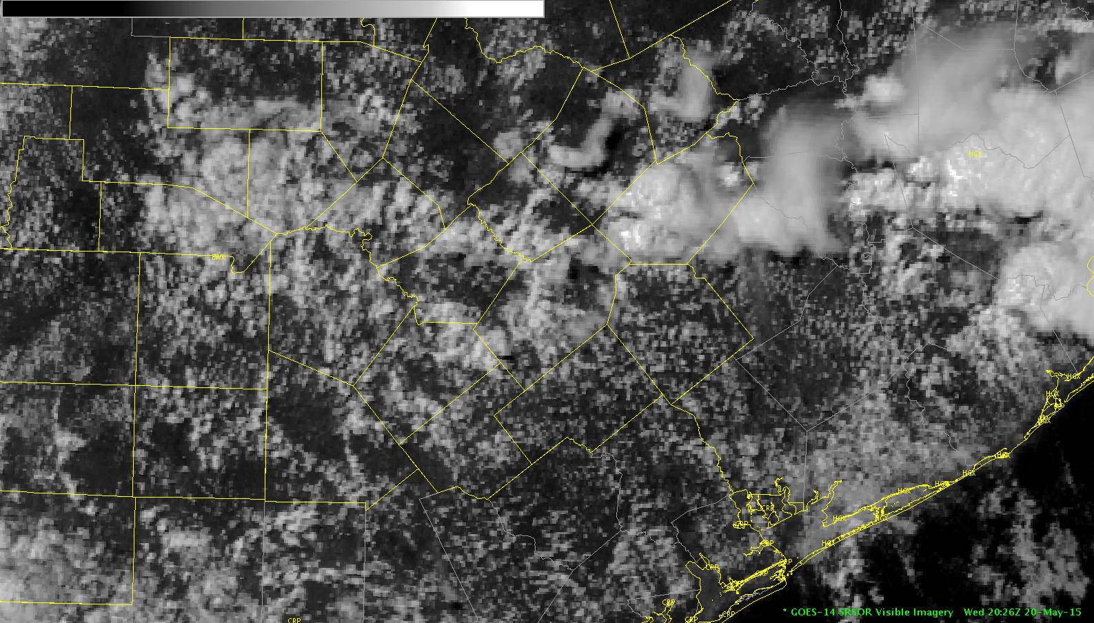
In this case the ProbSevere (99%, 1.51 MESH, Strong vertical growth rate), ENI Dangerous Storm Alert, and ENI Lightning Time Series (with  jump from aprroximately 55 to 104 in 5 minutes) all pointed toward issuing a Warning. In retrospect, data in the 10 minutes leading up to this time all pointed toward cell becoming severe, so could have issued the warning earlier.

-snowstrm

Screenshot-CAVE:MAF - D2D -5  LightningJ

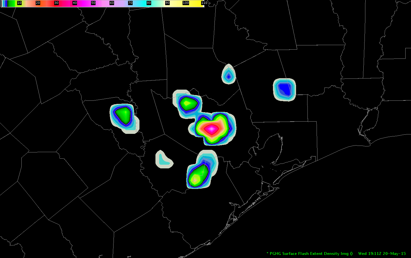
Lightning continued to increase (overall) as indicated in the latest chart below. ProbSevere at 2030UTC MESH was up to 2.93 inches. Storm took a right turn and ENI Motion Projection looked pretty good, so was helpful in constructing my warning polygon. Issued a new warning with larger hail and stronger winds.TimeSeries

Screenshot-CAVE:MAF - D2D

Verification: 1.75″ hail reported by a trained spotter at 2040UTC 6NE of Stiles in Reagan County.

Tags: None

CI utility in congested cu fields


CI utility in an environment with abundant Cu development appears to be more in deciphering general timing of convective intiation across the entire area. The algorithm has trouble latching onto individual cloud elements and therefore groups together many individual cu features together…washing out the signal on development of individual pulse convective cells. This overall result in a very pulsey and blotchy CI pattern from scan to scan…which is hard to utilize for targetting individual cell development. Once the cu begins to tower and glaciation takes place the algorithm drops tracking the feature all together…adding to the pulsey nature of the CI algorithm imagery.CI EWX 1945z

Pickles

Tags: None

Trackable Boundaries Better Seen in GOES 1min Imagery

Two boundaries were evident over southern TX that had direct effects on the cumulus field, suppressing it, as it passed through. No evidence of a wind shift occurred with these boundaries.

The north-south boundary began in west TX earlier in the day and continued to move east. The W-E boundary is believed to be an old outflow boundary shifting south.

Rocky

1minGoesVis 1minGoesVis

Tags: None

Storm Develops in Nearcast Model Vertical dThetaE Max

The good: The initial storms of the day in the Midland, TX forecast area formed in the Nearcast model most unstable differential thetaE depicted in the 0-1hr forecast (see the Nearcast+Radar+Visible image below).

The bad: Because my forecast area (San Angelo, TX) further east had prolonged morning clouds (see 14Z Visible image), the retrievals could not be accomplished and the instability trends in the Nearcast model through 9 hr were not available.

Rocky

Nearcast_MAF_Vis1830_StormInit

Vis_1400Z

Tags: None

LAPS Gradients Focus for Convection in MAF CWA

LAPS PW and Stability all did a good job depicting the moist unstable air in the sou6thern and eastern portion of MAF CWA. The area enclosed in the white line represents initial convective initiation. As has been the case the past two days the north-south oriented line is along a zone of tight gradient of PW (and CAPE and other stability parameters).

In this case the PW field also shows more discreet areas of higher PW where convection is initiating in an east-west band in an area of clearing skies ahead of the surface cold front.

Overall, I think LAPS has done a very good job in providing an initial view of environmental conditions (and gradients) during initial severe weather analysis and spin-up. It helps focus in on areas most likely to see initial convective development, which can be verified against numerical guidance.

-snowstrm

VISPW

Tags: None

MAF first storm timeline

Brewster Co TX cell was first of the shift in the MAF CWA.  Creating this to compare to the evolution of other cells in this environment as the afternoon goes on.

1730Z – CI  value at 73%, clearly the only object of immediate interest in the region at that time

1812Z – Prob Severe first passes 50% (jumped to 63%) with strong growth and moderate glaciation
1818Z – STA
1815-1822Z – first significant jump in ENI TFR (image below)
1822Z – Prob Severe reaches 90%

1838-1845Z – another significant jump in ENI TFR
1838Z – MRMS MESH first indicates sustained 1″ hail potential
1840Z – DTA
1842Z – MRMS MESH first indicates 2″ hail
1844Z – cell split becomes evident0520 Brewster ENI


-Holaday

Tags: None