PGLM 1 min vs 6 min summation

Both the 1 min and 6 min summation PGLM data was useful in diagnosing the storm over HUN. For the CAVE displays, I preferred having both datasets displayed (side by side). Overall, I found the 1 minute data more useful though I wasn’t necessarily loading it with radar data at the same time.

pglm_1min

pglm_6min


George

Tags: None

Utility of Prob Severe and DTA in Situational Awareness

A high cape/low shear environment has resulted in pulse convection along a seabreeze and outflow boundary across eastern EWX.  The convection has been weak for the most part…until a stronger cell developed in Lee county at 22z. CIMSS prob severe provided good situational awareness of this…jumping to 57% severe prob at 2204z…and DTA producing a significant thunderstorm threat (Fig 1). After closer detection…the reflectivity with the storm did briefly increase to 55 dbz at 40 kft…about 20 kft above the -20c at around this time.  (Fig2) Prob severe increased to 74% at 2215z.

I would normally have warned on this storm in operations…and the prob severe would have alerted me to this storm. Reflectivity/Vil did fall off after 2215z…but ENI lightning trace indicated that the updraft could have loaded precip until around 2225z. (fig3) So perhaps a 20 minute lead time could have been gained after first awareness of this storm. No confirmed reports yet.

Fig 1

2205 eni


Fig 2


kewx 2205 5.3 deg

Fig 3

ENI kewx 2205z

Pickles

Tags: None

SVR 2247UTC in MAF

I was considering issuing a warning for a storm in Pecos County when an unconfirmed  report of 1″ hail came in at 2232UTC. The ProbSevere was climbing with a value of 80% at the time and 1.02″ MESH. ENI Alert indicated a Significant Thunderstorm. A look at the ENI total flash rate time series the report came in during the lightning jump. This was borderline  at the time based on totality of data, so may have decided to wait. The storm did continue to intensify after I issues the warning.

-snowstrm

ProbSevere2236

ENI2251

Tags: None

Pulse Storms: The Wheat from the Chaff w/ProbSevere and ENI Ltg Data

Dear Diary,

Today we had many showers and storms across the area for hours. The storms never reached severe criteria and were pulse in mode.  However, one cluster did quickly grow and was the strongest of the afternoon thus far at ~2215Z.

Prob Severe Model ramped up from 14-57-91% over 8 minutes, while lightning jumped from 16 to 50/min in that same time frame. It drew my attention for further evaluation (see the loop and the storm to the northeast of the RDA). Radar evaluation said WARN for the first scan, but quickly the reflectivity values lowered in the next, owing to the pulse mode we had seen all afternoon.No warning was issued.

SA: Both the ENI ltg flash rates plan view data and time series, and the Prob Severe led to great SA to evaluate that storm further.

Rocky.

2225Z_PulseStorms 2231Z_ENI

Tags: None

MAF NUCAPS example

0520 MAF NUCAPS

Indicates near-surface conditions 32/10, the most exaggerated instance seen so far of being too warm at that level.
This NUCAPS sounding is very near KE38 observation of 26/14, which is fairly representative for the southern part of the CWA at that time

When sounding adjusted to KE38 current conditions, it looks very reasonable and yields CAPE of 2800.

-Holaday

Tags: None

4-Panel ENI Time Series

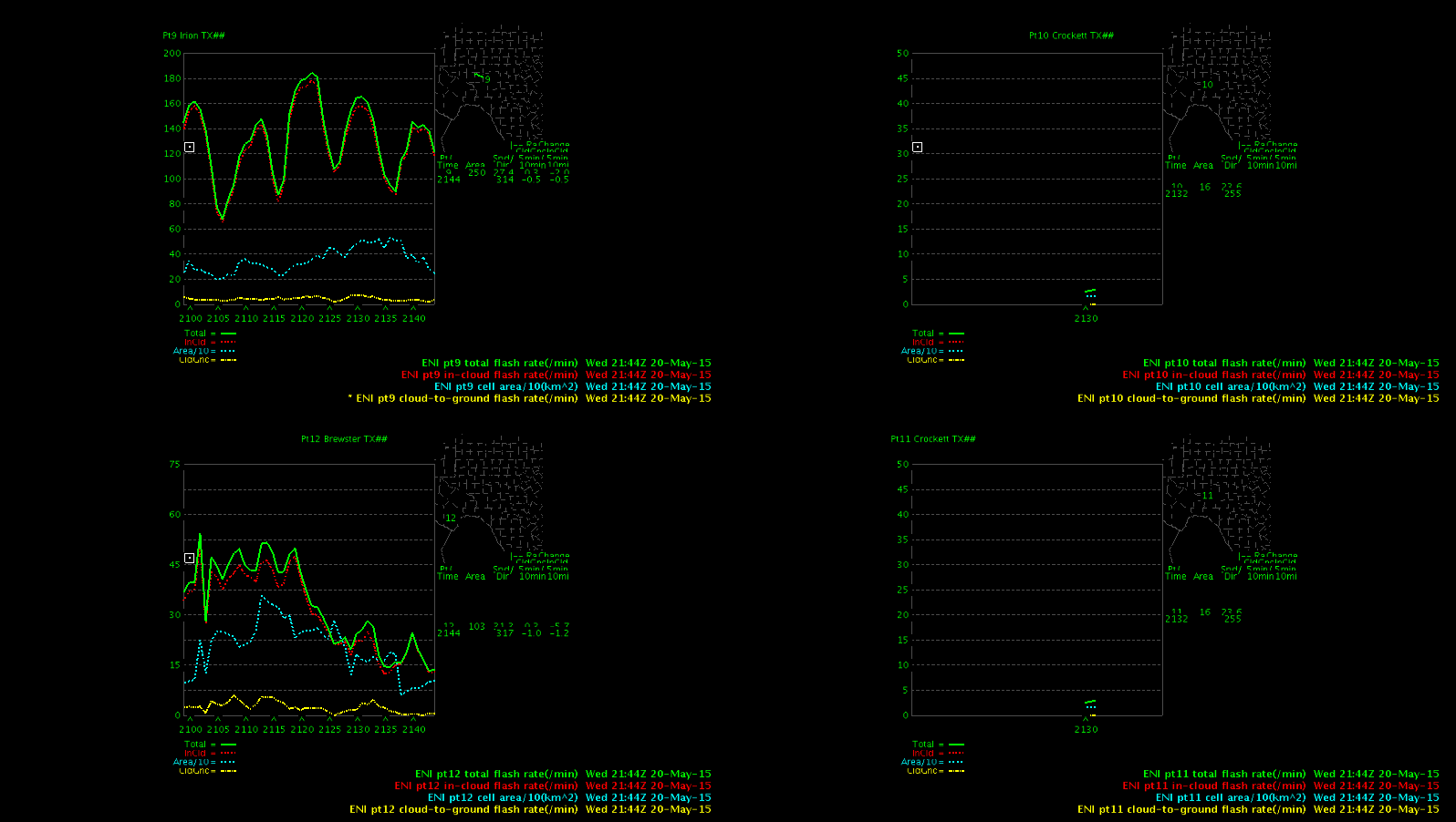
I appreciate the option to track four different cells in the ENI Time Series. If you ware watching multiple cells you don’t need to call each one up separately. In busier situations where you may be switching the cells being monitored it seems like it would be confusing to keep track of which cell is in which window. The cell tracking is plotted on a map in each of the four windows, but it is not easy to see.

-snowstrm

4PanelTimeSeries

Tags: None

A2 Lightning Training Ideas

Because lightning data in A2 has taken a larger step forward in recent builds, a more thorough training is needed for NWS forecasters. Some ideas on what that package could contain (~2 hours):

1) Foundation: Networks, Pulse v Flash v Strike, Gridded
2) Scientific Research Review: Data Signals and Sensible Storm Outcomes
– Severe Storms (e.g., jump)
– Winter Season Uses?
3) A2 Data: Menus and Products, Definitions (ENI Polys & Tracks, Density), Latency, Display Tips
4) The future: GOES-R mapper, Future A2 data

Rocky

Tags: None