
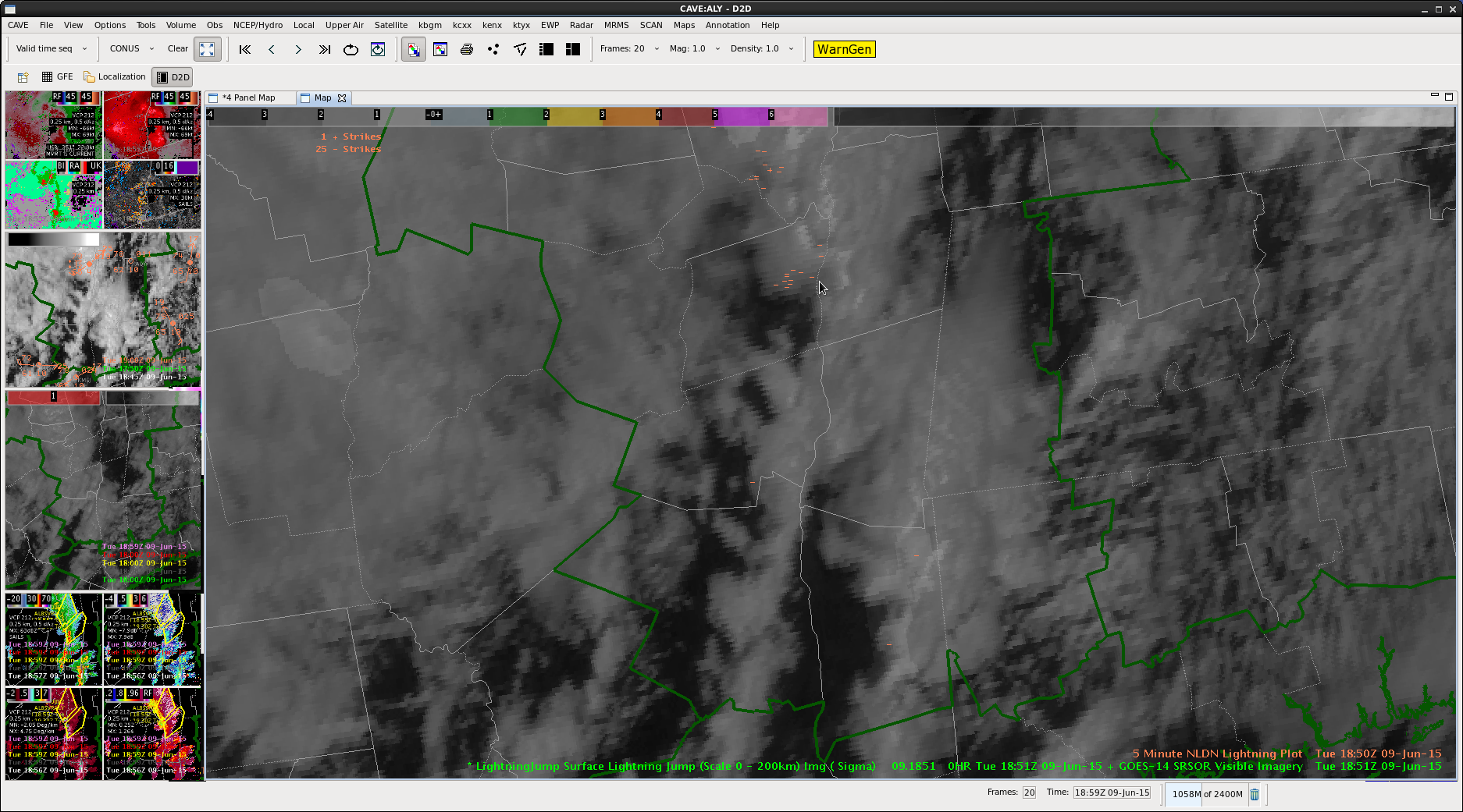
CI accurately depicted increasing chances for showers and storms across western MN this afternoon, with around 30 minutes of lead time with regard to the developing convection.
-Wacha
Official websites use .gov
A
.gov website belongs to an official government
organization in the United States.
Secure .gov websites use HTTPS
A
lock (
) or https:// means you’ve safely connected to
the .gov website. Share sensitive information only on official,
secure websites.

General Information and News
CI accurately depicted increasing chances for showers and storms across western MN this afternoon, with around 30 minutes of lead time with regard to the developing convection.
-Wacha
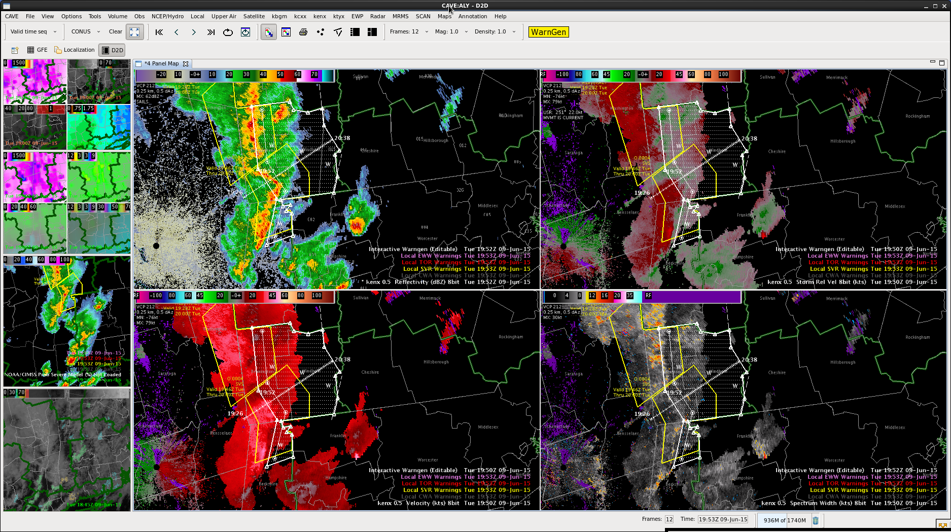
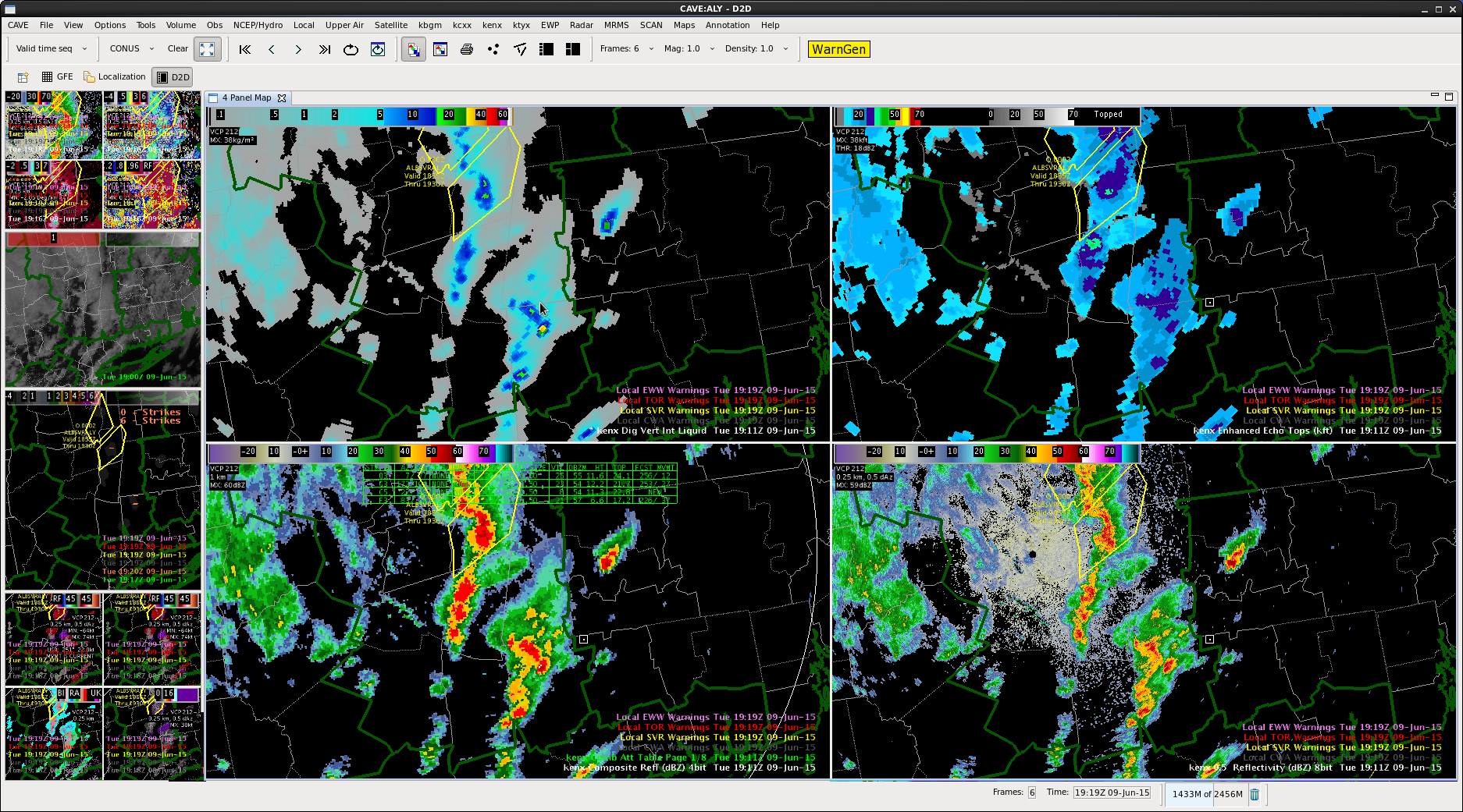
Line has merged and weakened, with no new reports east of Albany. Decided to go with a SPS instead of a SVR, keeping winds of 40 mph. Lightning data still not impressive. Passed on information via chat to our neighbors to the east in Boston about the products we were issuing.
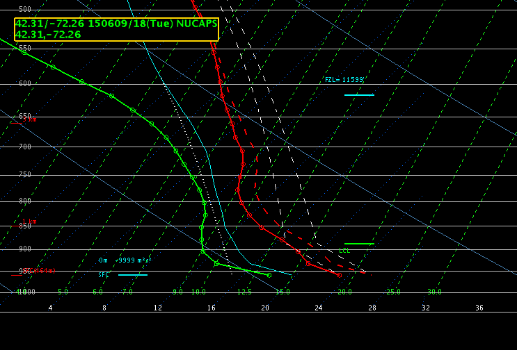
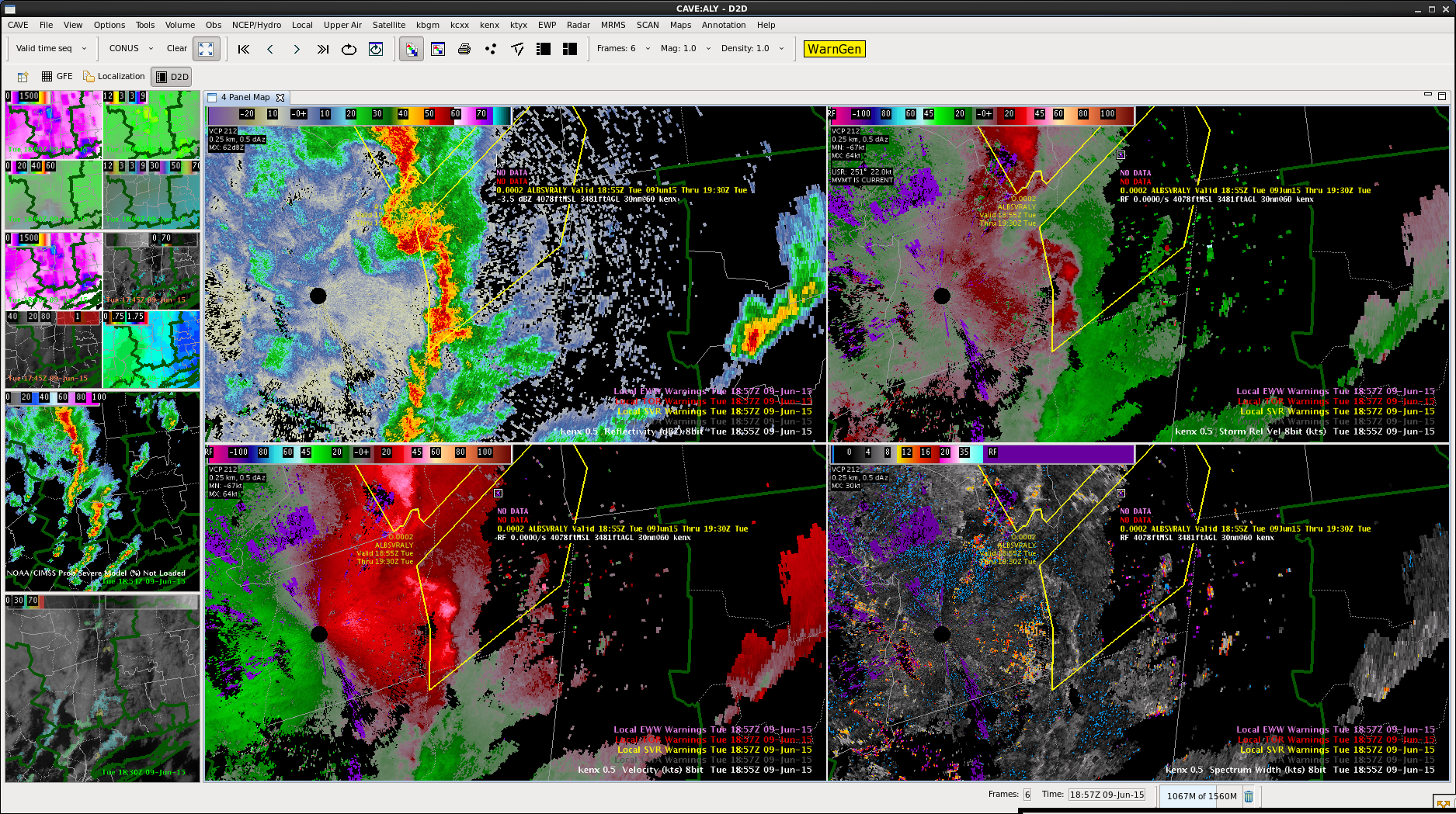
We were able to retrieve a NUCAPS sounding in a relatively clear area…at least looked the most free of high clouds in the area. I manipulated the surface conditions to closer match those at the surface and came up with somewhat similar values of CAPE to what we where seeing on the SPC mesoscale analysis…a little higher than what was on the GOES-R LAP Algorithm cape.
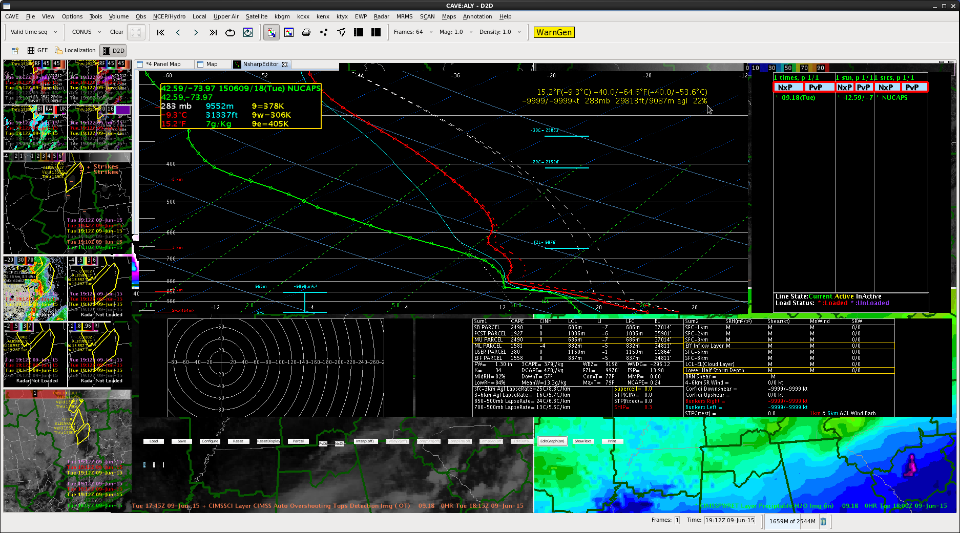
Had a NUCAPS sounding in a clear spot over the area. CAPE was higher than LAP data indicated, with a surface adjustment to 77 degrees over 66 dewpoint. Freezing level is fairly low at ~10 kft, so will be watching for hail growth. DCAPEs around 500, similar to SPC mesoanalysis.
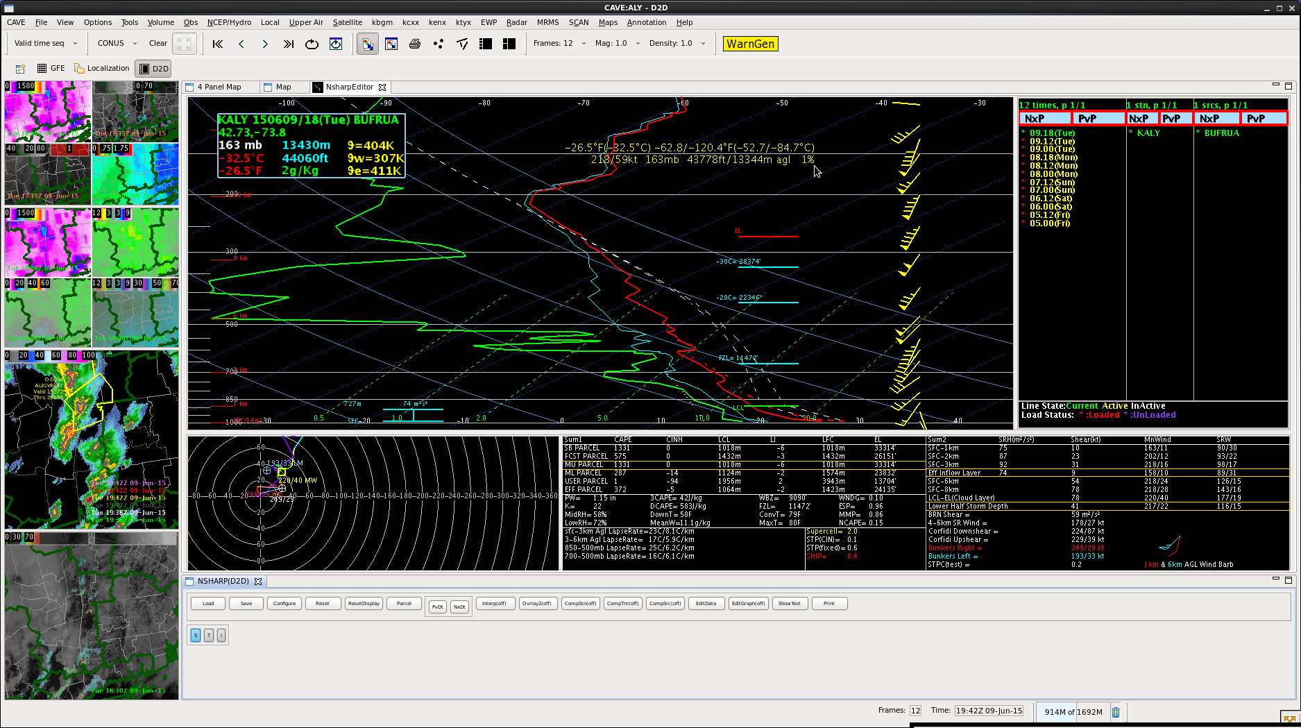
In addition, ALB did an 18Z sounding. Shows CAPE not as high as my estimate, and freezing level a little higher as well.
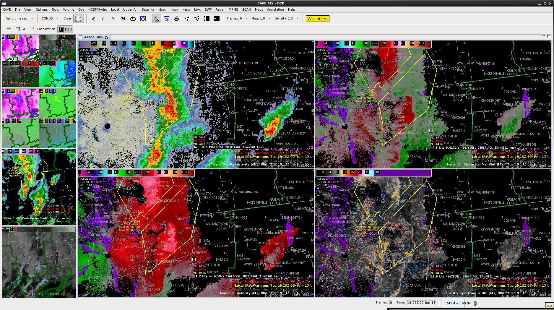
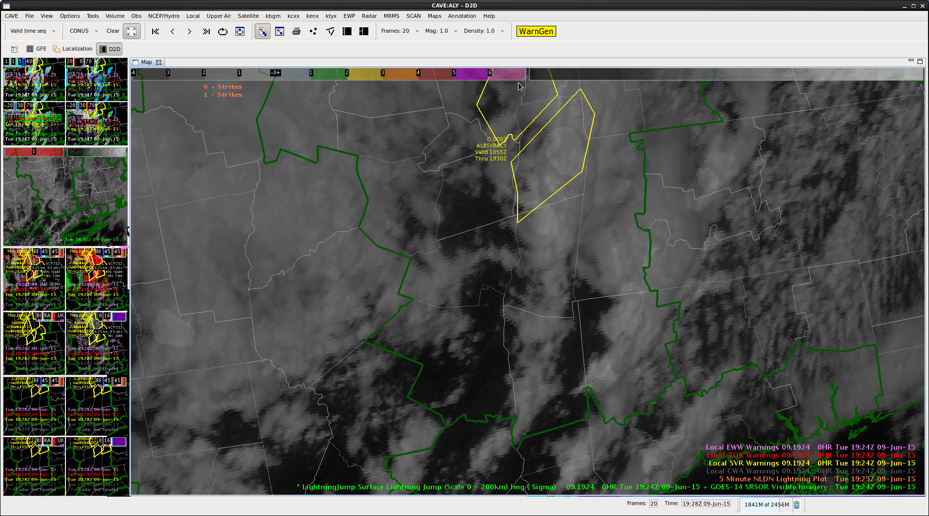
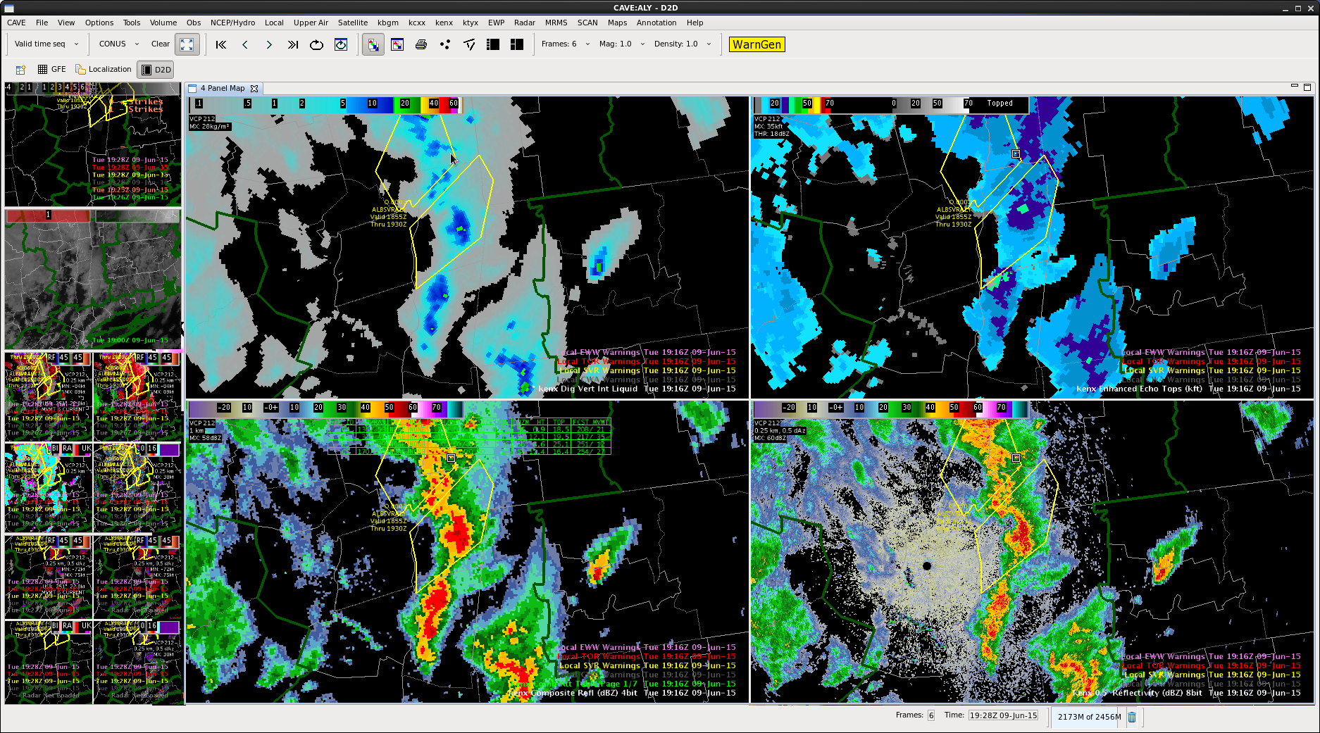
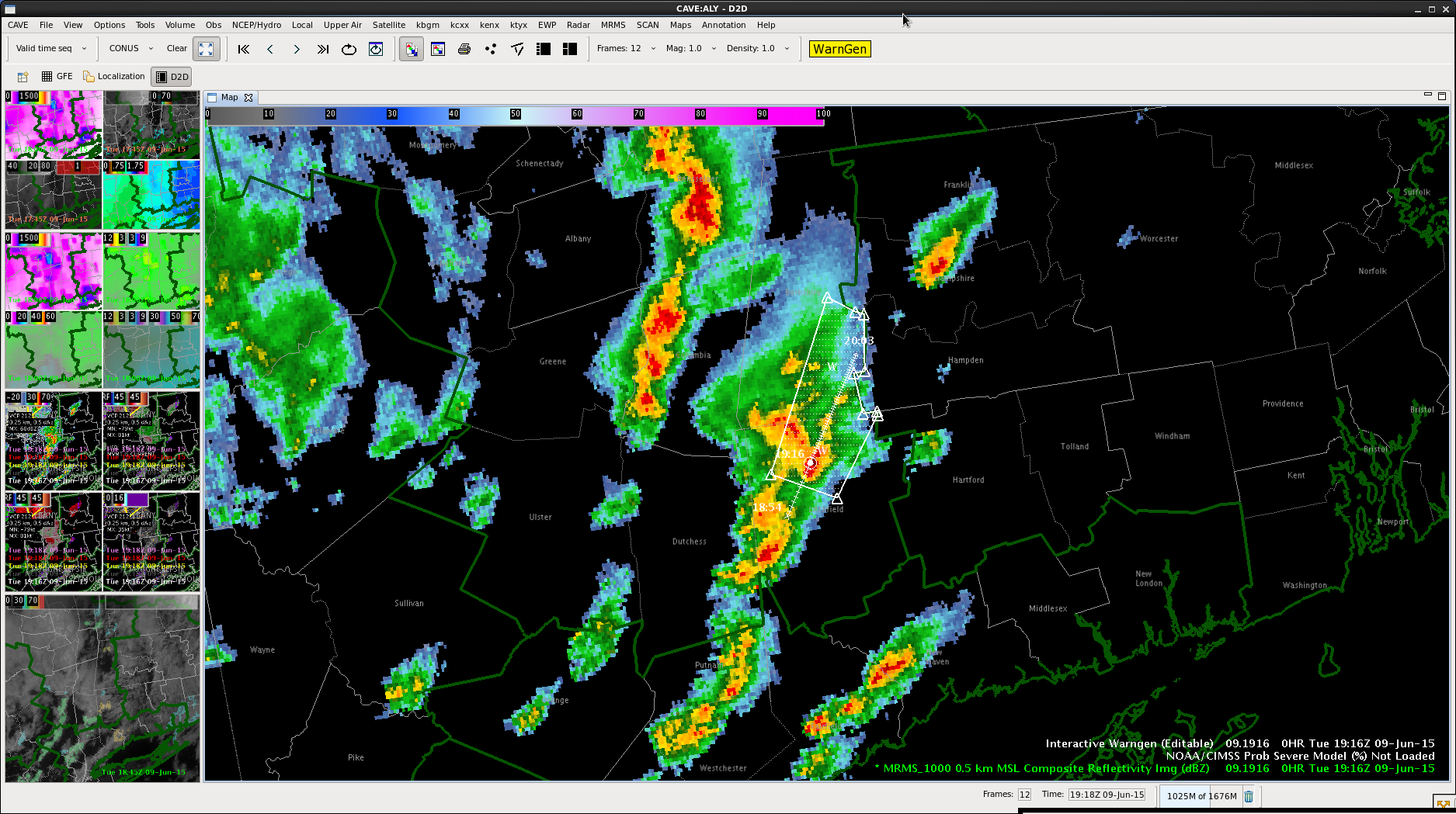
Continued my first warning downstream. Had a report called in for tree damage caused by this cell, and the wind signature on velocity is still warranting a warning. Good signal on spectrum width of a wind shift colocated with the reflectivity gradient. Lightning jump showed no changes in the data, as well as little in the way of CG strikes.
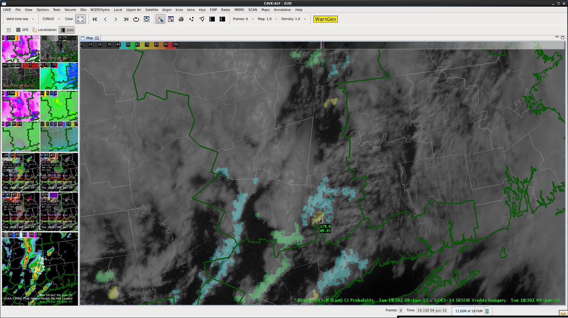
SPS for Litchfield county. Saw this cell earlier get a CI blip of 60-70%. Cell moving to the left of the mean flow. Not overly tall yet, but growing faster than other parts as it merges into the line to its west. Will have to watch to see if this one gets more organized.
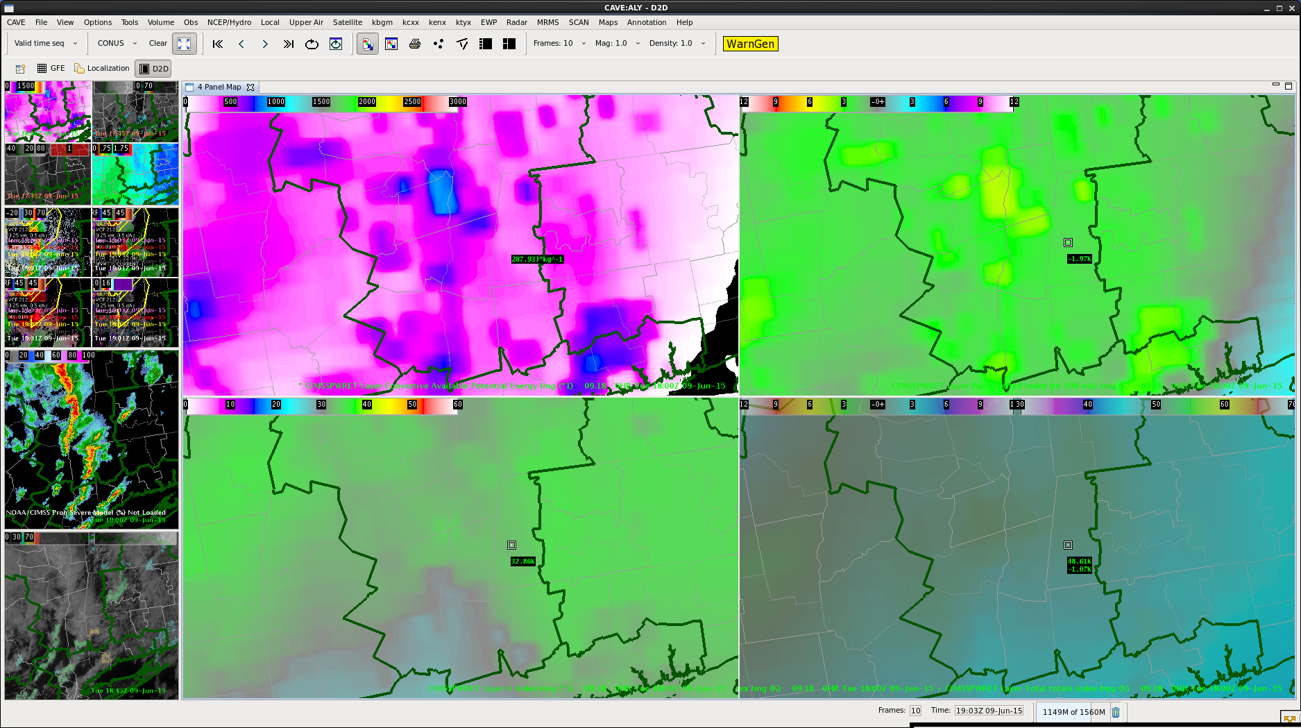
Weak disturbance moving through the forecast area currently resulting in little more than cloud cover at this time. Behind that shortwave, skies are relatively cloudless across the western boundary waters in northwest Minnesota. This clearing has allowed temperatures to quickly jump into at least the upper 70s, lower 80s in some locations. A corridor of higher dewpoints were noted along eastern North Dakota with values commonly in the low 60s. The result is that SB CAPE values are >1500 J/KG, but a weak mid-level cap exists. Hi-res near term models indicate that this corridor of higher dewpoints will remain ahead of the front and push eastward into the CWA by 23Z. This will help fuel whatever convection does develop. To balance the moderate CAPE values, 50kts of deep 0-6km shear were noted. Freezing levels are about 12kft, so hail does seem plausible with stronger cells, but the inverted v shape to the soundings indicate that this may be more of a wind threat. SPC has a slight risk issued for the area including a 2% tornado area.
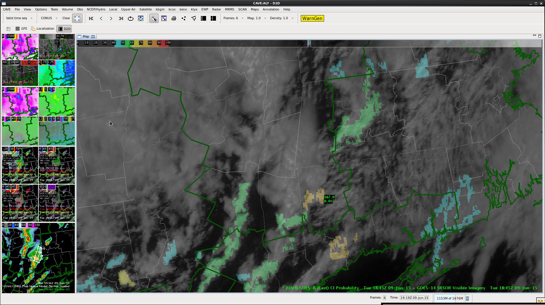
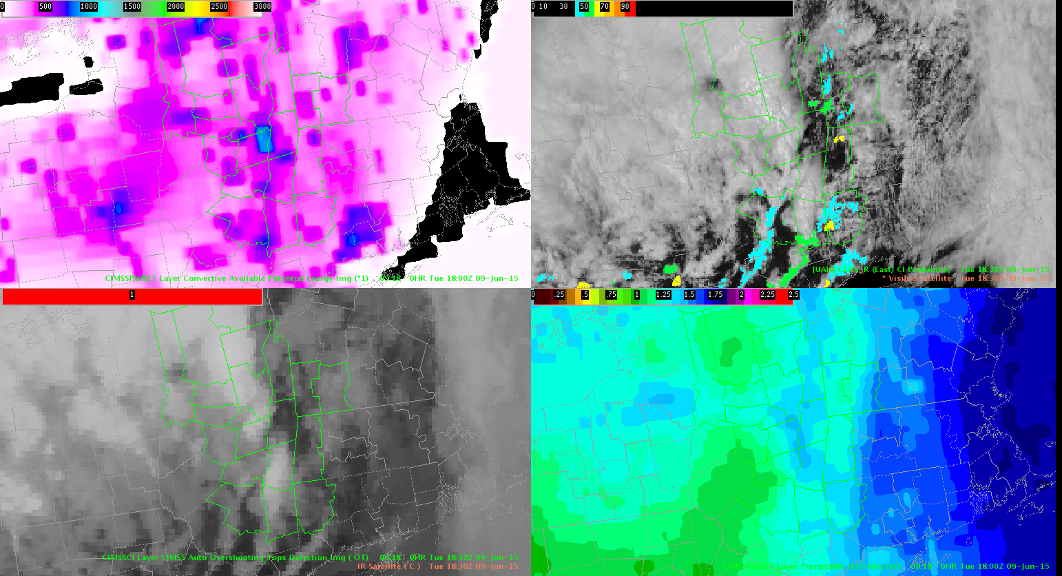
Agitated cu field beginning to develop along and ahead of the cold front nearing the Canadian/ND/MN border. While we don’t have access to the 1min super rapid scan, we have noted some expansion of the cu field over the last 45mins. The Convective Initiation Product returning a modest 10-27%, but even those numbers have started to increase over the last few scans. Looking at the total PW values sampled by the GOES-R LAP algorithm, values do seem consistent with the numbers from the SPC Mesoanalysis Webpage. However, the 18Z Total PW has shown a few bullseyes of values >1.4″ coincident with the aforementioned cu field.
Shasta/Wacha
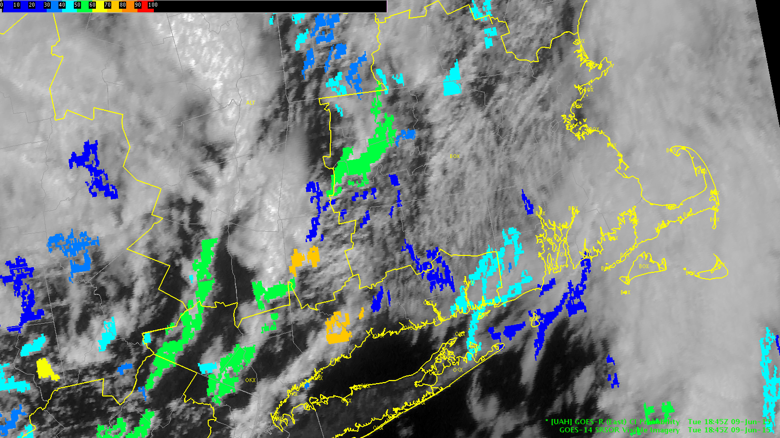
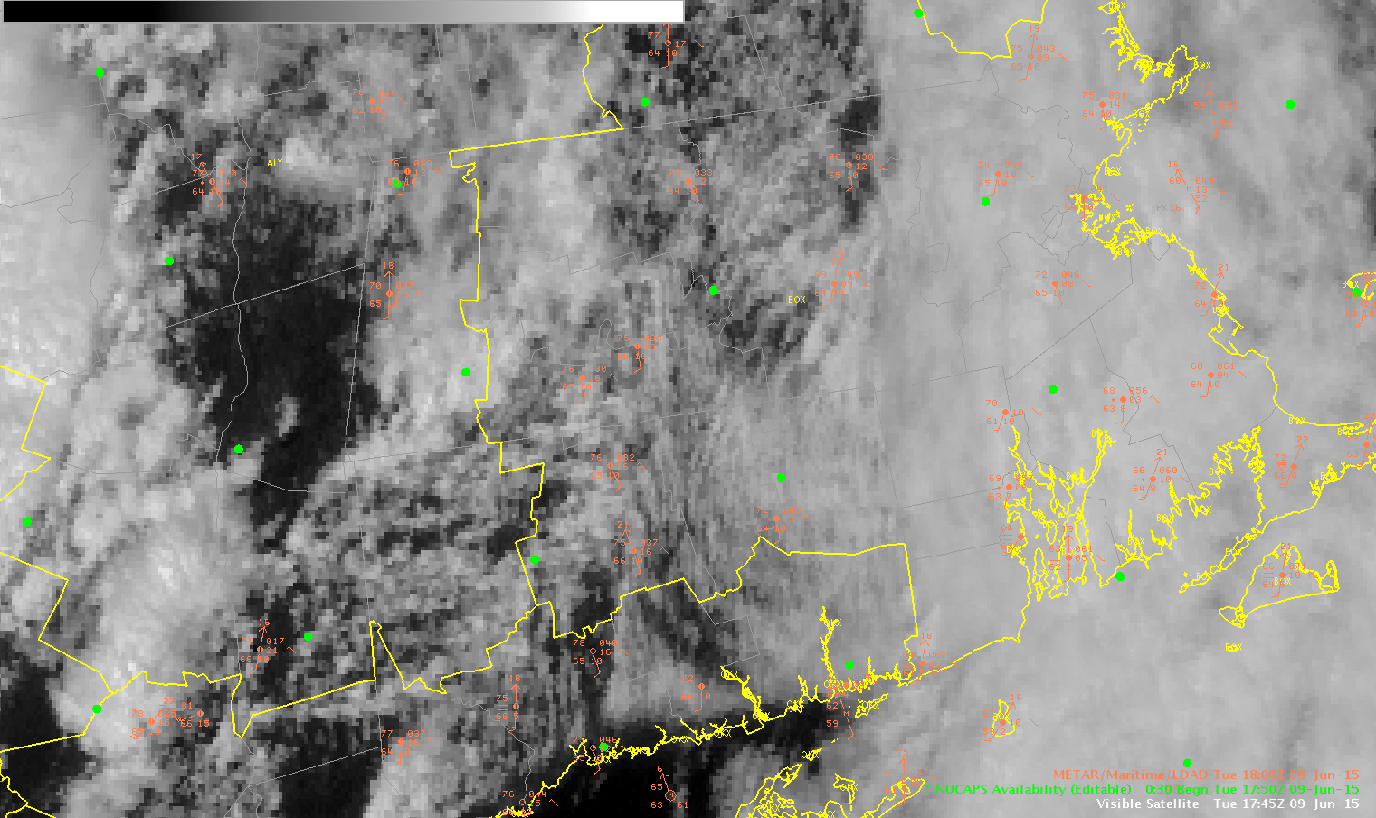
CI product showing 58% chance of development at 1845Z in the western portion of our CWA
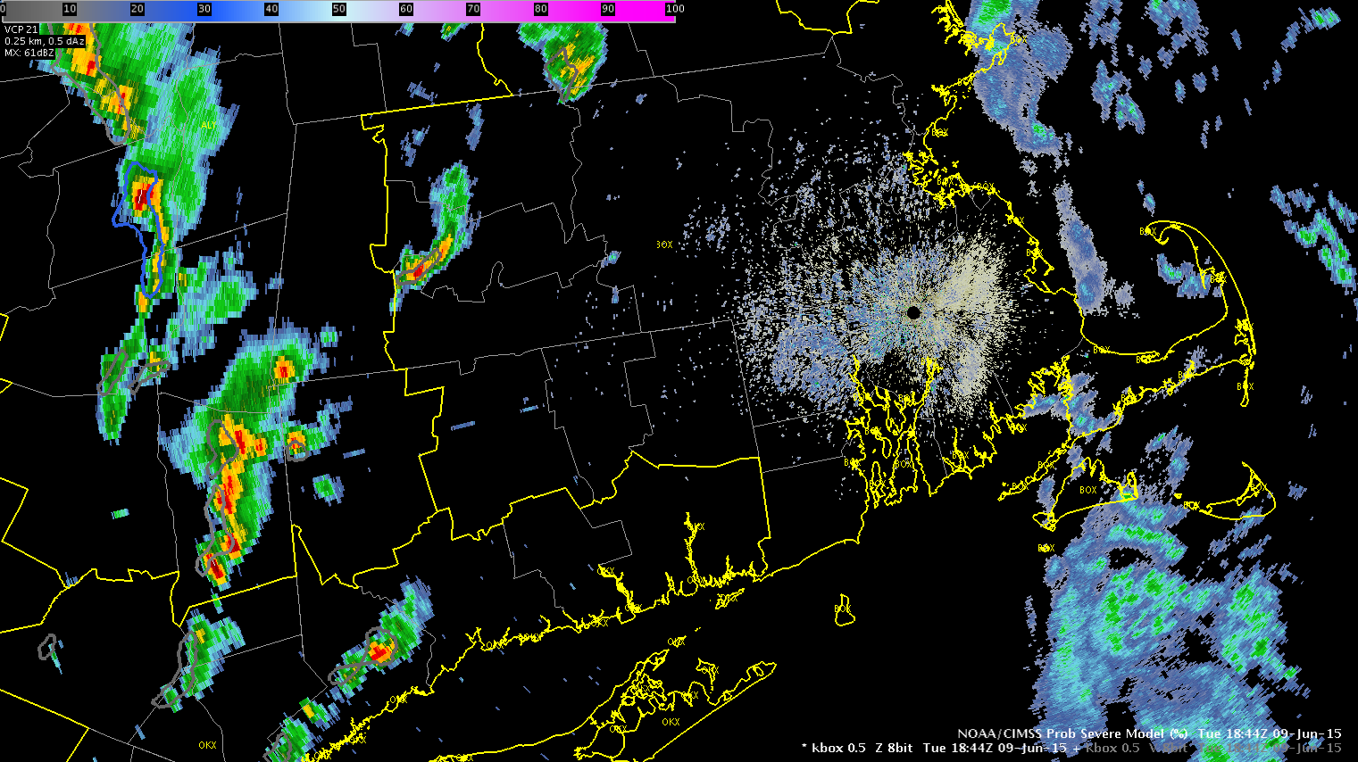
By the 1908 frame here on the box radar you can see that development has continued to occur in both areas that it showed the 50% and the over 70% to the SW of BOS CWA, here a new storm cell developed in front of the area. Here is the loop.

Not much lightning with this cell, and jump was not there. Wind signature on radar above as well as refl. is bowing out indicated a need for a quick warning here. ProbSevere not useful here, as line has been ongoing for awhile. Line was over an area of higher CAPE as well as lowering LI, around -5.
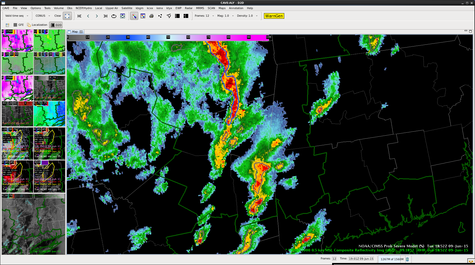
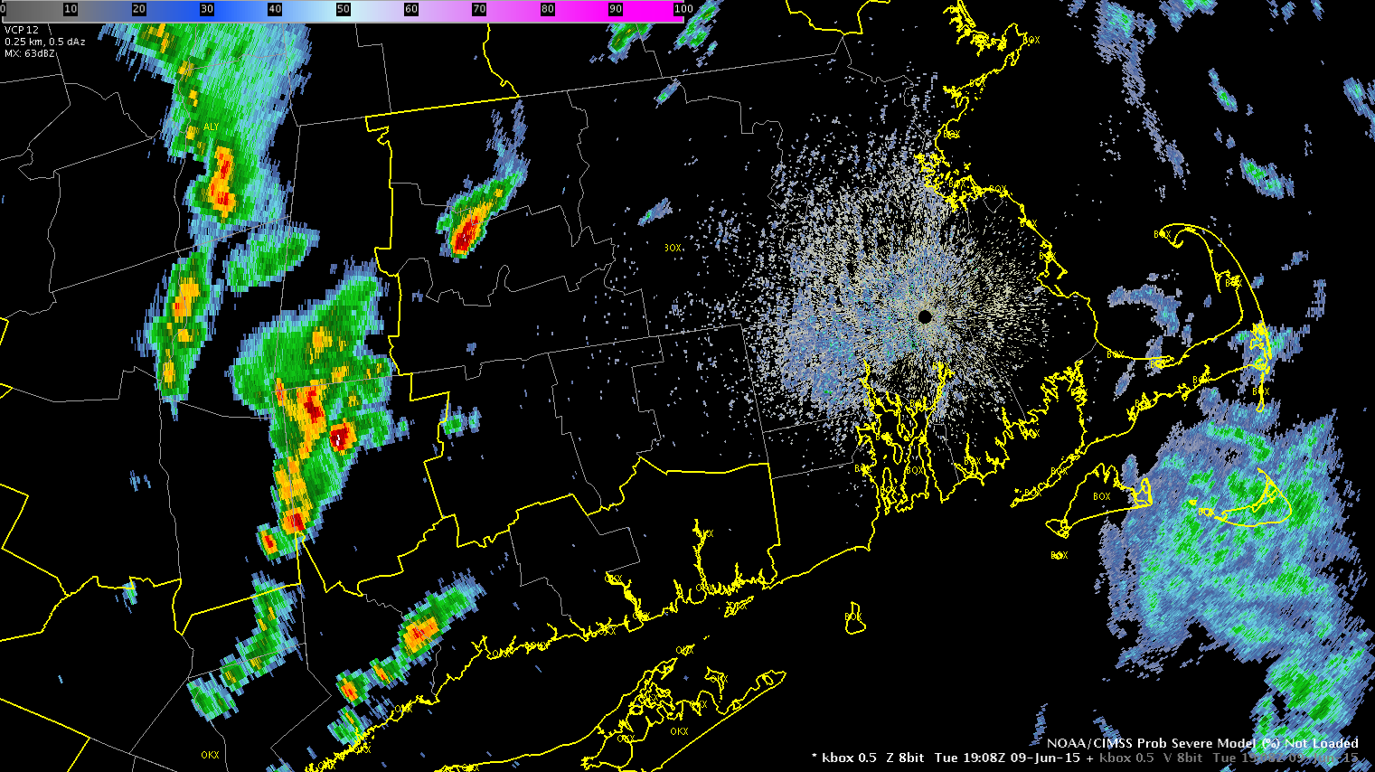
A quick look at the environment shows a limited amount of instability based on LAP CAPE (up to 900 J/kg). LAP LI continues to drop (as low as -6) There is some clearing across our eastern counties which the CI product is expecting some development (50-60%). A line of storms is working into that area of clearing and wind velocities are starting to strengthen. Warnings will likely be issued soon.
-BT