Cirrus obscuring LAP Algorithm CAPE

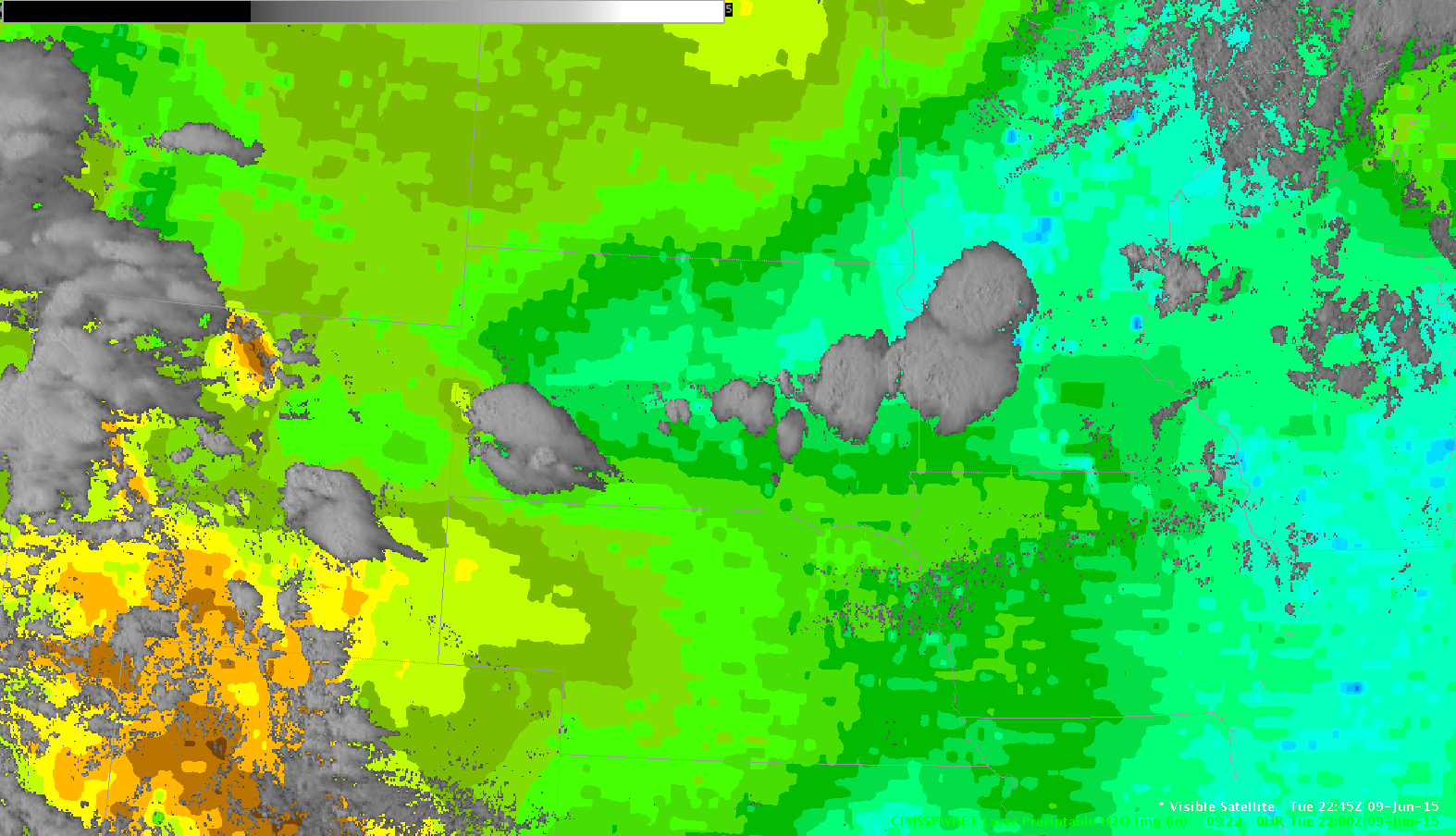
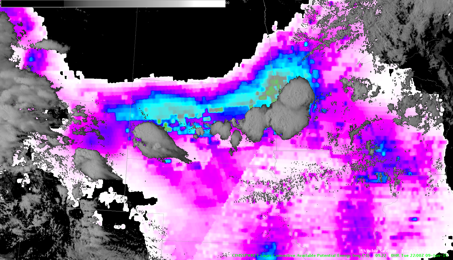
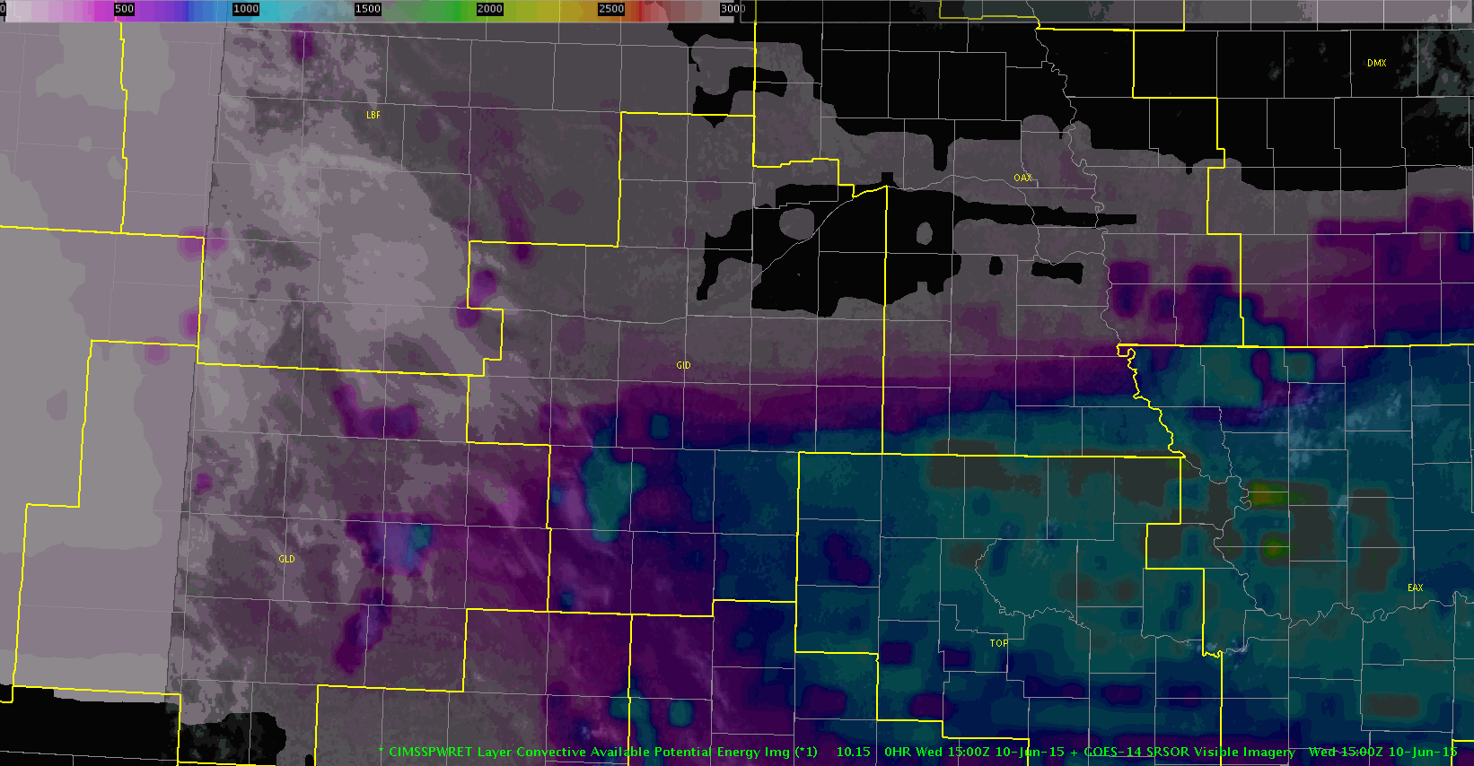
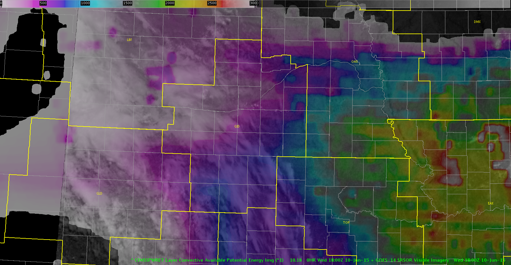
One thing we quickly noticed was that the CAPE values from the LAP algorithm were nowhere near the values represented on the mesoanalysis page. Part of the problem seemed to be due to the obscuring cirrus over 2/3rds of the forecast area. Attached is the latest image and a loop of the CAPE retreating east as the high clouds move in.

CAPEVIS2CAPEVIS

-Shasta

Tags: None

TBSS and Golf Balls

Very pronounced TBSS on a cell just north of KMSP.  Storm has produced golf ball size hail at 713 CST.  NOAA/CIMMS Severe Prob near 90%.  Not crazy about the color bar right over the top of the base data color bar.  Maybe it could go just below? MrSnow.

TBSS


TBSS

Tags: None

CI Day vs Night

Perfect example across SD how the CI model has a tough time when switching from day (1st image) to night mode (2nd image). The outer edges of the storms are assigned a low percentage (~20%).

CIday

CInight

Tags: None

Renville Co Storm MPX

mn2_reflec

An increase in the CIMSS prob severe gave us higher confidence to issue this warning for this storm over you can see a jump in the lightning also near the time the prob severe increased it’s prob.


Renville_ts

Tags: None

10 Sig Jump!

We spotted a 10 sigma lightning jump with the cell heading into Lyman Co, SD! This is probably the highest value we’ve spotted so far. There were only 2 CG strikes though. Still looks nice on reflectivity.

 -BT

10sig jumpradar0016 10sig jump0016

Tags: None

Storms Finally Form in Northeastern MN

Scattered showers and storms finally formed in Northeastern MN late this afternoon. However, with just marginal instability storms have remained below severe limits despite excellent deep layer shear in the 40-50 kt range. As mentioned in a previous post CI indicated a line/cluster of showers and storms was likely to develop. As storms develop the CIMSS Prob severe model showed most storms having only a small chance of being severe, which has worked out great today (see images below for radar/prob svr at around 2330Z and CI near 22Z).

SVR.Prob.not.enough.today

CI.possible.convection

-Wacha

Tags: None

Swift Co Warnings

cimss-swift

Switched to MPX CWA  and had high confidence to issue based on 95% probability of severe.

eni_ts_swiftmn


Interesting look at the time series for lightning…after I issued the second warning the cell showed a significant decrease in intensity…perhaps this the downtrend in lightning should have told me that the storm cell was already beginning to weaken. The storm was a good ways from the mpx radar.


mn_reflec

Tags: None

Severe Left Moving split and Lightning goes to zero

Curious left mover from a second storm split produced 64 mph winds at 610 pm. Warning was based on 50+ dBZ to 36Kft.   Lightning has waned to near zero, but reflectivity remains 65 to 70 dBZ.  The right moving cells seem to be dying out.  The initial warning was based on a 90% prob severe according to the NOAA/CIMSS model. This was extremely useful since we had little situational awareness since we just started but had enough trust in it and a quick glance at the radar confirmed it was probably on to something.  Helped give us a nearly 20 minute lead time.  MrSnow/itsinthecards

SevereLeftMover

Tags: None

Interesting Observation

While looking at the CAPE and PWAT trends, we notices the storm development in SD matches almost exactly with the leading edge of the gradient ahead of the approaching cold front.

The exact CAPE values were about twice as much as the LAP analysis, but the overall pattern matched well. The NUCAPS altered sounding (adding low level moisture) brought the CAPE closer to expected values.

PWAT-vis22:45 CAPE-vis22:45

-BT

Tags: None