CPTI and Azshear

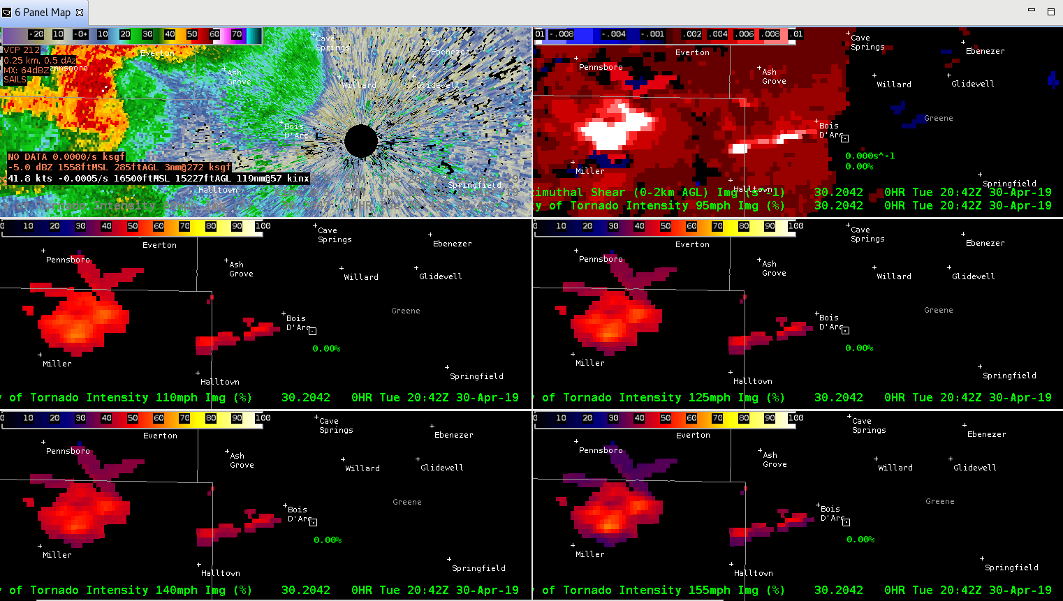
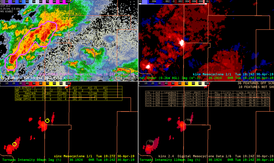
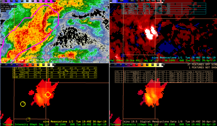
Tracking this northern most SC @ 1926 UTC prior to tornadogenesis.  Azshear 0-2 km product did a nice job highlighting shear with developing storm very early on in storm evolution and was very persistent in highlighting area of shear throughout.  Temporal continuity was very good.  Lower two panels are 80 and 110 mph intensity probabilities.  Used this 4-panel to monitor evolution.  Also displayed is legacy mesocyclone (upper-right), DMD (lower right) and XDMD l(lower left).  This SC also exhibited well-organized ZDR arc and KDP foot (not shown) that whose centroids were normal to storm motion suggesting MC intensification was likely.
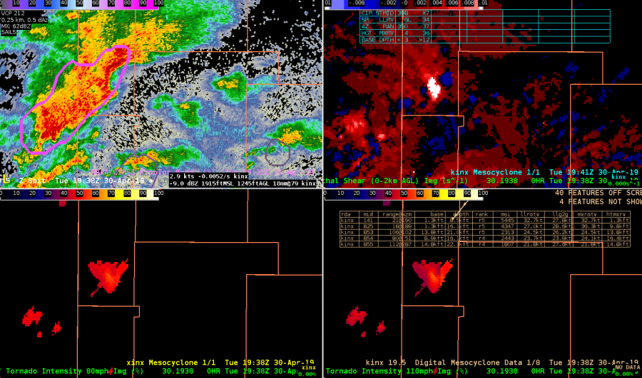
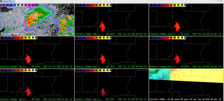
1938 utc Azshear still showing strong signal with CPTI gradually increasing to near 60%.  ProbTor increased to 78% as well.  DMD, XDMD and MD not showing much and did not seem to be very helpful.
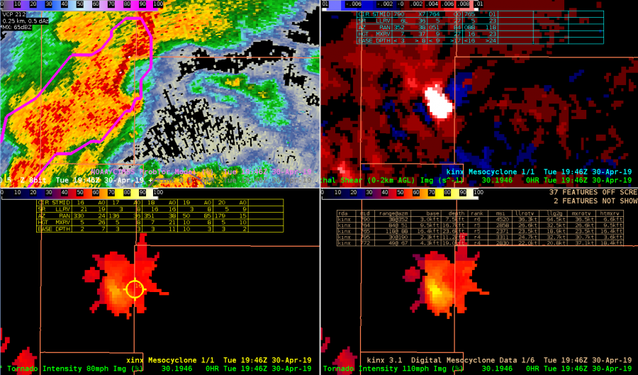
 

CPTI was insightful with increasing probabilities of tornado intensity probabilities at higher speeds (110 mph lower right).   Note that XDMD was also indicating MXRV of 26.
 

1448 UTC – would occasionally see dual maxes in AZShear and CPTI products that was a bit of an issue at times.

CPTI 110 probablities up to ~ 75 % at this time (lower right)

Overall…0-2 km Azshear was quite helpful in quickly grabbing attention to areas of concern.  0-2 km product was temporally very consistent.  Its location relative to developing Mesocyclone was typically off…but still very useful.    XDMD, did seem to perform better than legacy DMD products but not much at least with this storm.   Early in storm evolution, examining ZDR/KDP centroids relative to storm motion was also helpful as a reality check on MC intensification and increasing SRH with this particular storm.  Bottom line was generally pleased wiith  AzShear and CPTI performance for this storm. – Quik TWIP

CPTI/AzShear anomaly

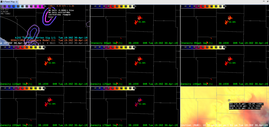
AzShear increased ahead of an approaching tornadic storm. At the same time the CPTI product also indicated an enhanced probability in the same area. Velocity data in the lowest few tilts became suspicious along the radials ahead of the storm as PRFs struggled to improve range folding.

— SCoulomb

CPTI Usefulness

Here’s a look at some attempts to use the CPTI for storm carrying a theoretical tornado warning. I have a fair number of thoughts on the product. In terms of a primary application. I think it would be best suited to the first update/continuation on a tornado warning. Basically allowing you to chose what types of language to use…if the CPTI is picking up on a very high intensity circulation than you are going to want to ramp up the intensity of the wording within a warning. This could be used to communicate how dangerous a storm is. Especially since the damage associated with a 80mph circulation will be drastically different from a 170+ mph circulation.

Now for areas that I would improve/and or change. The CPTI might be better off using a category scale/range of values. Intuitively, I would expect probabilities to increase if the storm is more intense. I.E. if the circulation is 155mph then I might expect the 80mph CPTI to be close to say 80% while the 155 mph CPTI is something like 50%. If the tornado intensifies maybe the 80mph CPTI would increase to something like 95% while the 155 mph CPTI increases to a value such as 75%. Currently, there are a lot of very similar values as the image below shows 80, 95, 110, and 125 mph all have pretty much the same value within 3% of one another. I would want there to be a much larger variance in these values, so that I  could easily gauge , how intense the tornado is. I think CPTI has a  great potential, but I would change it so that it was more of an probability of exceedence  scale and could be used as a quick product to determine intensity wording in products.

South Beach


SC Entering Washington County

This storm has had consistent Azhear max for past several volume scans, but again does not seem to match low-level SRM scans very well. Prob Tor has increased and remained steady at about 75 to 77 % CPTI has remained slightly over 50%. Upgraded SVR to Tor possible. Reflectivity structure suggests increasing organization with well organized ZDR arc arc suggesting increasing SRH. May upgrade to tor shortly given better storm structure in base data. Quick Twip

AZShear and CPTI Product for TUL SC

Watching storm northeast of Hominy @ 1854 utc. 0-2 km AzShear has been showing persistent max with the cell but seemed to displaced to far west of broad circulation. 0-2 kn Azshear not very helpful with this storm given displacement. CPTI has been showing consistent 50-55% 80 mph intensity probs for past several scans.  – quik twip

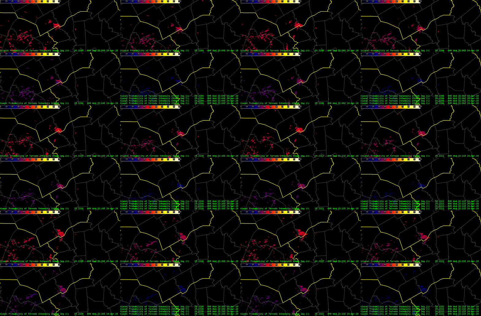
CPTI Trend with Storm in WFO FWD – 24 April

Watched the trend in CPTI on the storm in the far southern section of WFO FWD.  This was associated with a cell that straddled the FWD and HGX CWA.  Velocity data showed broad cyclonic rotation that tightened up periodically – including decent GTG.

In terms of CPTI – the probability of the lowest range (80 mph) ranged from 40 to 50% between 2015Z and 2230Z.  As wind speed thresholds increased, the values at 95 and 110mph did not differ much from 80 mph – generally around 40 to 45%.  The highest values of CPTI also remained higher than I might have thought in this case with even the 170mph+ as high as 25%.  This seemed a bit high to me (did not like like an EF4 event) – but maybe statistically this is true???

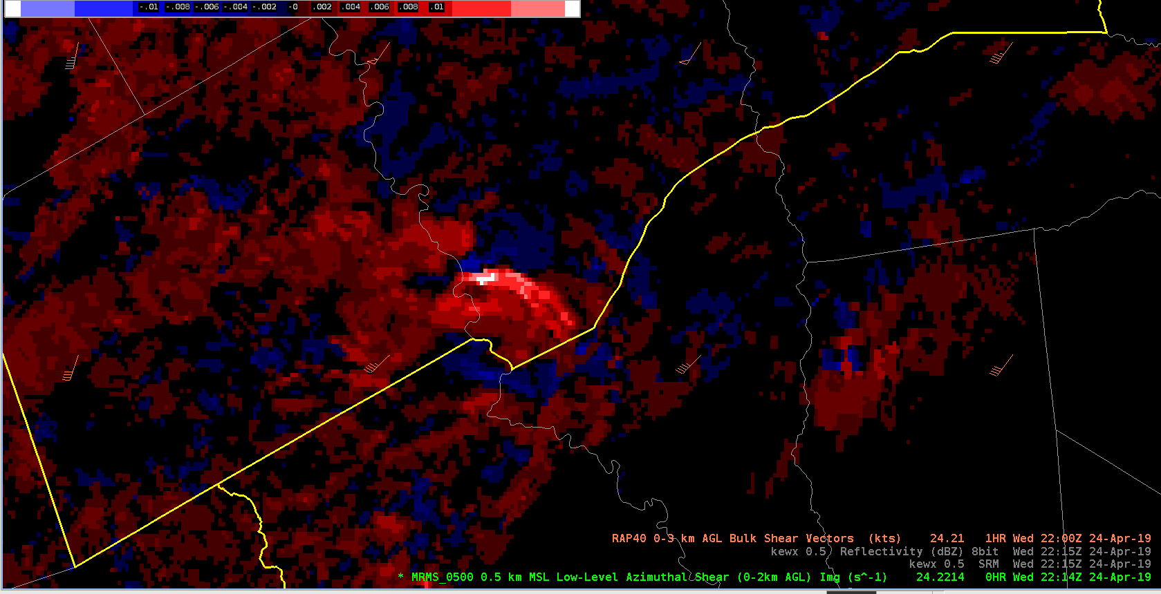
The merged 0-2km AzShear highlighted this area nicely.  Note, I adjusted the default color table – to cooler colors – e.g. bright white is > 0.015 s-1.  I wouldve loved to view the single radar AzShear product as well!

See AzShear plot at the trends in CPTI below.