An official website of the United States government
Here’s how you know
Official websites use .gov A
.gov website belongs to an official government
organization in the United States.
Secure .gov websites use HTTPS A
lock (
) or https:// means you’ve safely connected to
the .gov website. Share sensitive information only on official,
secure websites.
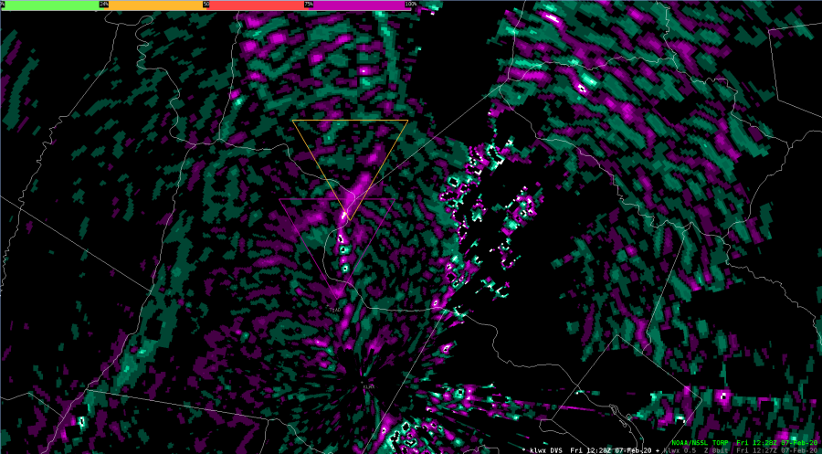
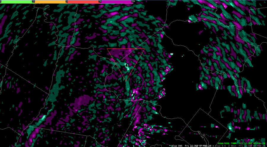
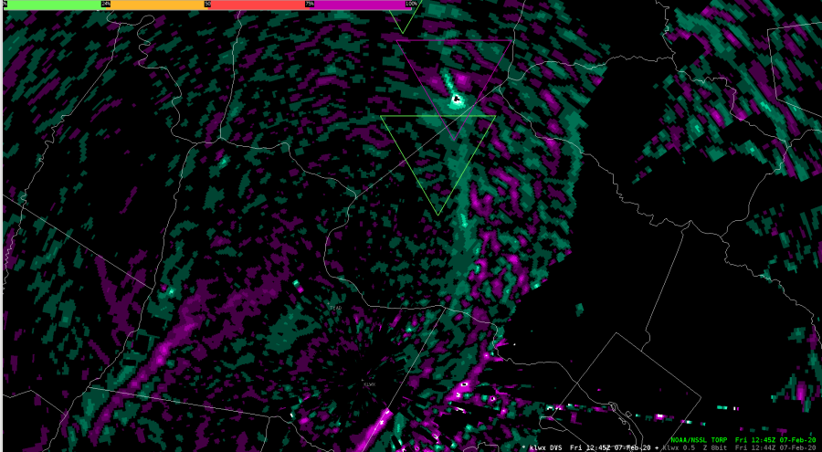
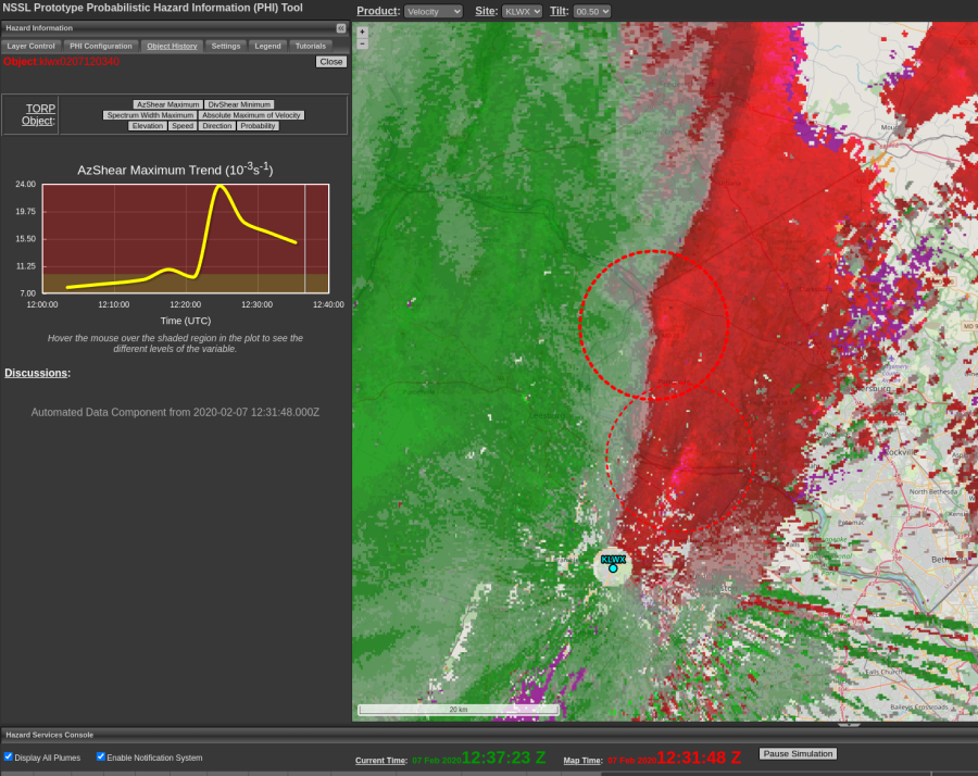
In retrospect, if a forecaster relied solely on the Torp product, there could have been good lead time for the tornado in Monrovia. Displayed below is the progression of Torp while overlaid with DivShear. Note, there is a magenta Torp outline in third image.
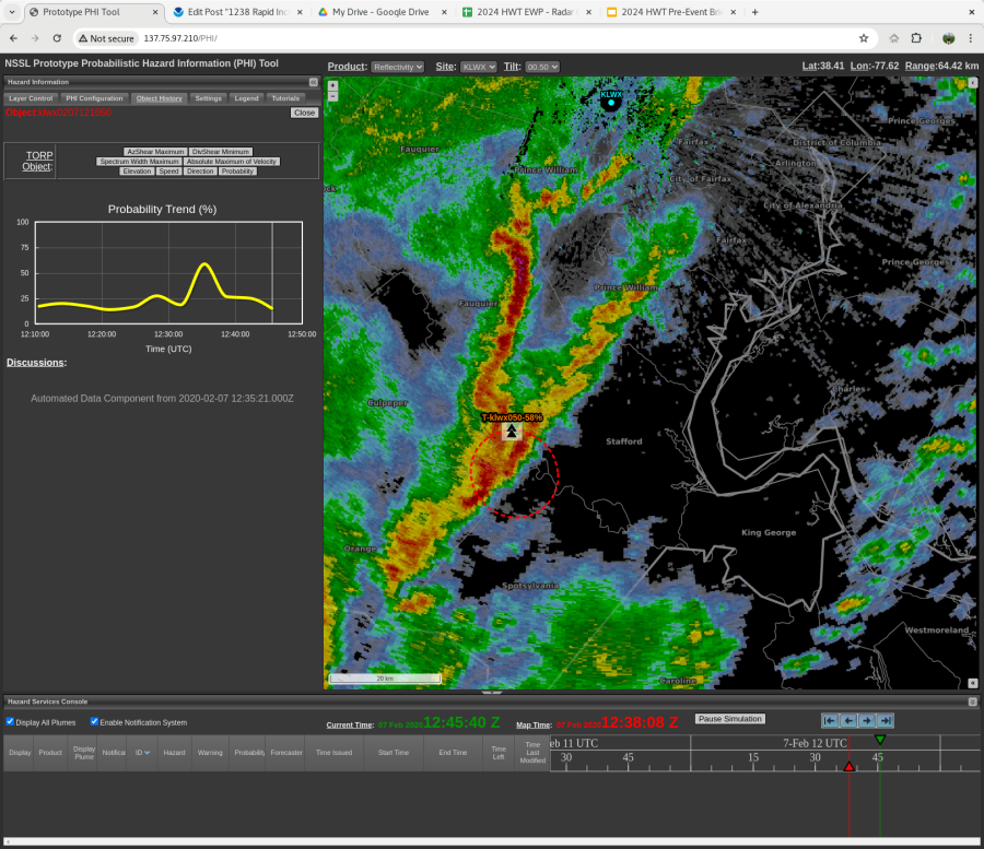
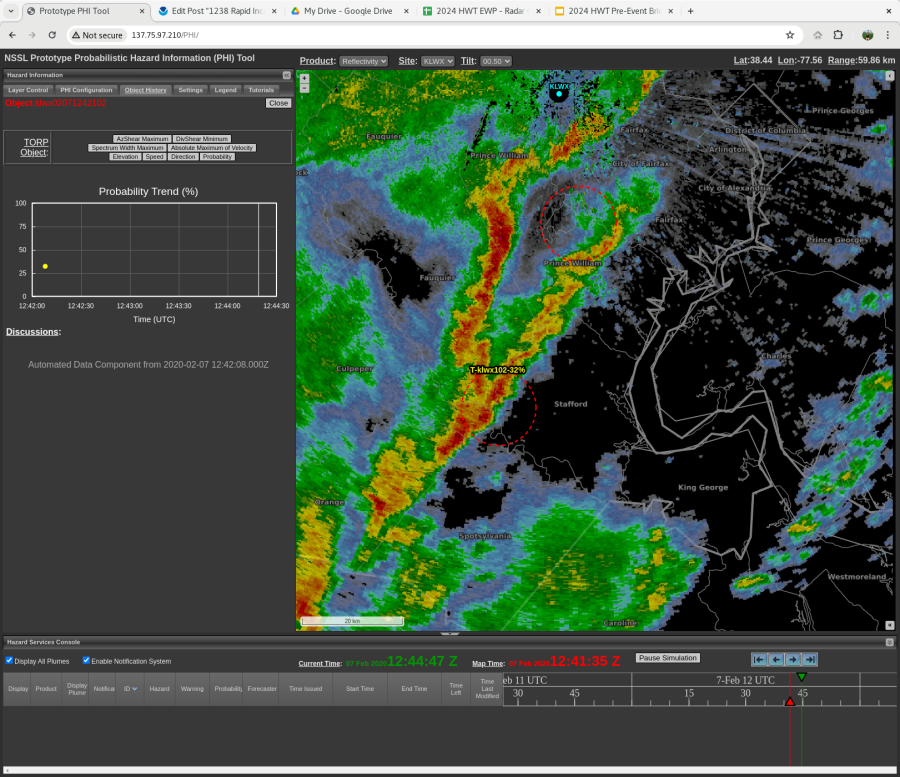
The TORP object in Orange/Stafford counties that showed rapid increase in probabilities also showed a quick decrease. As it did this, a second TORP object was created in a similar spot. -Sidney Crosby
Just wanted to note that it was impressive to see the DivShear show the cloverleaf product associated with the strong circulation around 1221 UTC in this QLCS event.
New TORP object showed rapidly increasing probabilities as it exits Orange County, which caught my attention to sparked further investigation. -Sidney Crosby
Doing a comparison of Torp to ProbSevere, I found Torp to be superior on the tornado that occurred northwest of LWX as ProbSevere Tor probability never reached about 35% while Torp had values well above 50% for this identified object. It is nice to see a new tool like this that can improve on the older ProbSvr model.
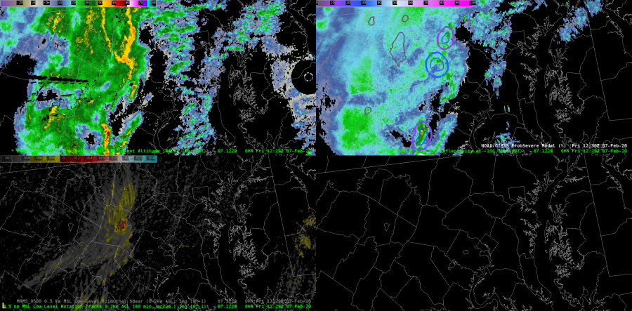
Flash
MRMS RALA upper left, MRMS Refl at -10C upper right, 0-2km AGL low level rotation tracks lower left
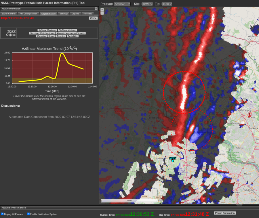
Both AzShear and DiVshear highlighting tornadic area quite well, and coincides great with Z and V data. Good example of high warning confidence “nudgers”.
This line of thunderstorms split into 3 main line segments by 1150-1200Z. These line breaks are one of the nudgers/confidence builders in the QLCS tornado warning process. You can see convergence along the UDCZ and a few areas of weak rotation beginning to form along the southern flanks of each of those line segments.
KLWX 4 Panel of Z/V/SRM/CC at 1157Z
As things started to look interesting in the reflectivity/velocity images, increasing values of DivShear and AzShear led to a couple TORP 30-40% objects being created on the southern end of a couple of those line segments (a sign that we need to keep a close eye on the radar for possible tornadogenesis).
KLWX AzShear Product shown at 1157Z.KLWX DivShear product shown at 1154Z.
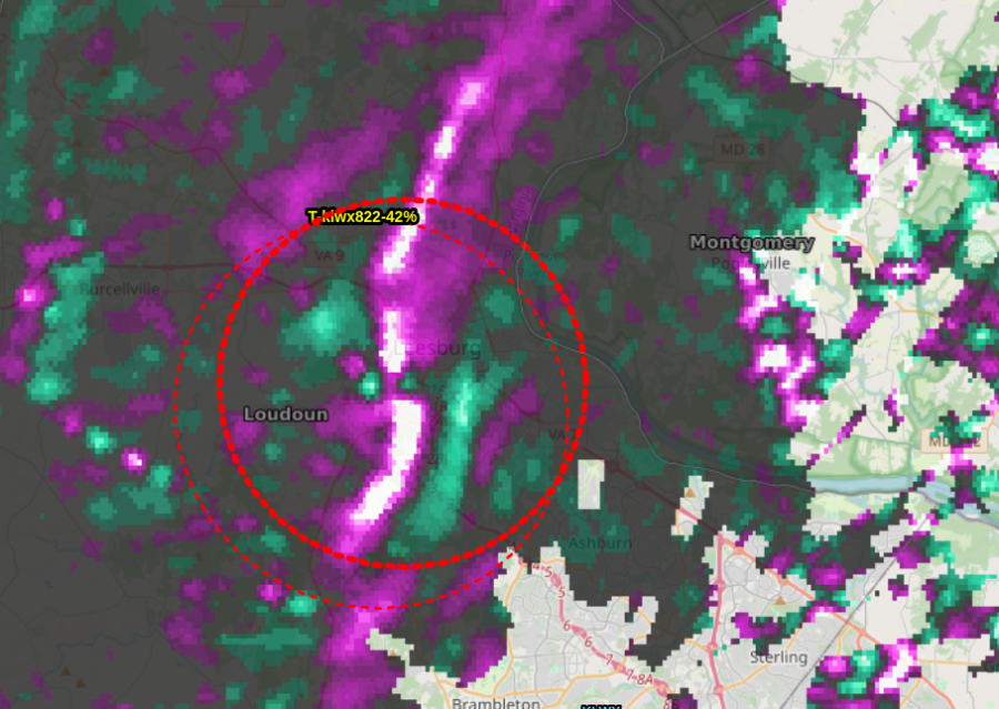
And ultimately, TORP tornado probabilities increased to ~95% right around the time wind/tornado damage started to be reported all across the city of Leesburg, Virginia (~1220Z). You can also see somewhat of that clover-type shape/look in the DivShear product ususally indicative of tornadic circulations.
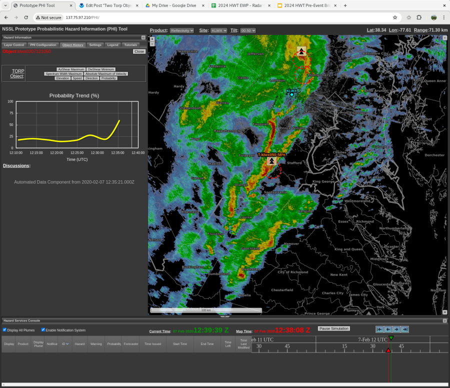
TORP created a second object (95%) on the same circulation from the same radar (LWX). The original object maintained a 75%. This caused confusion, and led to a lack of trend on the new, 95% object.
TORP with two objects on the same circulation, from the same radar.
Two TORP objects were created for this tornado-warned storm. Interestingly, the higher percentage object was new and did not have a trackable history, but the (slightly) lower percent object showed a rapid increase. -Sidney Crosby