


 TOR issued based on radar @ 2130Z. WFO Hastings issued a TOR on the same storm @ 2110Z.
Update…a tornado was confirmed on the ground within our CWA right along the county border @ 2125Z.
jca
Official websites use .gov
A
.gov website belongs to an official government
organization in the United States.
Secure .gov websites use HTTPS
A
lock (
) or https:// means you’ve safely connected to
the .gov website. Share sensitive information only on official,
secure websites.

TOR issued based on radar @ 2130Z. WFO Hastings issued a TOR on the same storm @ 2110Z.
Update…a tornado was confirmed on the ground within our CWA right along the county border @ 2125Z.
jca
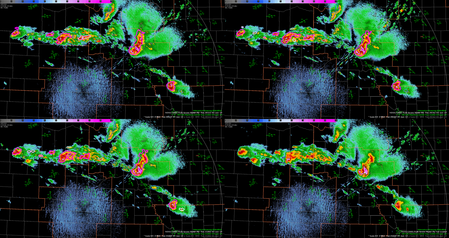 This loop shows over 3 volume scans the prob severe going from 66 to 94% at 21z, but as of 2115z there is still no warning issued, even though several storms around this one with similar characteristics are warned. And as of 2115z…the prob severe is 97%!
The WFO issued a severe thunderstorm warning at 2119z with a prob severe of 96%.
jca
NSSL WRF has some 2-3 hour temporal errors over WEST NB this afternoon. The reason seems to be slow heating due to a model forecast showing a thick cirrus shield over the area. There was a minor shield of cirrus but it moved east and vis satellite showed strong heating by late morning in the area. Convection developed well ahead of the NSSL WRF forecast due this cirrus impacting the heating and thus the forecast going forward. A great example of using a close analysis of synthetic satellite imagery to adjust and evaluate model output.
images below from 14 Z and 23Z 23Z on top.
 D. Satterfield from WBOC Salisbury,MD

 The first image shows a CI of 58% prior to high cloud intrusion. The second image highlights the higher clouds moving over the developing CU in question with no CI.
jca
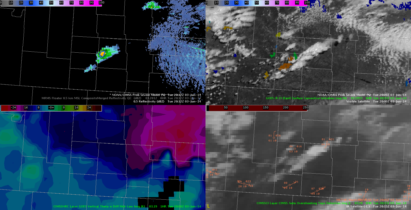
Looks like vigorous CI is just starting to take place in the southern portion of LBF. Recent VIS imagery shows a deepening CU field with GOES-R CI rate of 72% as of 2030Z (see image).
This is the same area that the OUNWRF and and VLAPS show very vigorous storms – especially UH.

Watching rapidly dev cell (center of image) it is on extreme theta e boundary (warm front i suspect) and prob severe is jumping rapidly from 27% at 2028Z and at 2030 jumped to 59%. The satellite signals both went strong (prob SVR) in the second update both vert growth rate and glaciation. MUCAPE around 4600 on this cell from prob severe algorithm.
CI at 2014 was up to 46% on this cell. now at 2038Z prob svr is 78%
 dsatterfield
Issued a test warning – based on VERY early indications from ProbSevere. Admittedly, it was unrealistic – but the parameter space in this event is amazing. Utilized the ProbSevere readout and got the following:
MUCAPE: 4600
Effective Shear: 68 kts
MESH: 0.34″
Satellite Growth Rates: Moderate/Strong

 Although this storm is on the northern edge of the GID CWA and moving out to the north, it is the first to develop in our CWA with a Prob Severe potential. If convection continues to develop to the southwest will monitor closely as that appears to be a favorable area.
-KP
 This cell has a 73% prob severe with a MESH of 0.11 inch(es). Vertical growth is strong and the environmental parameters are very favorable…but it seems weird that the prob would be so high with such a low MESH…
jca
Update to make note of how valuable I believe it will be to have 1 min GOES imagery with CI overlayed. The GOES R era cannot come soon enough. With this as part of a total situational awareness of the environment (using v laps NSSL WRF etc), I cannot but think it will lead to improved nowcasts/warning lead times
 dsatterfield wboc