PGLM Utility

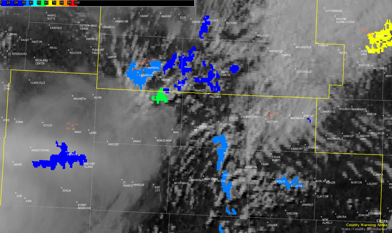
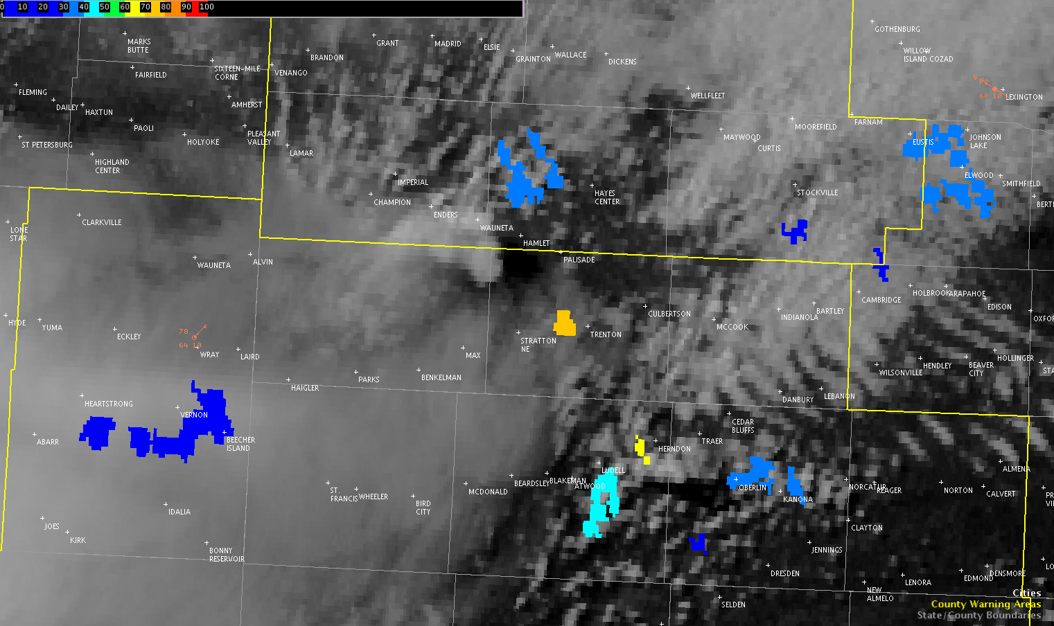
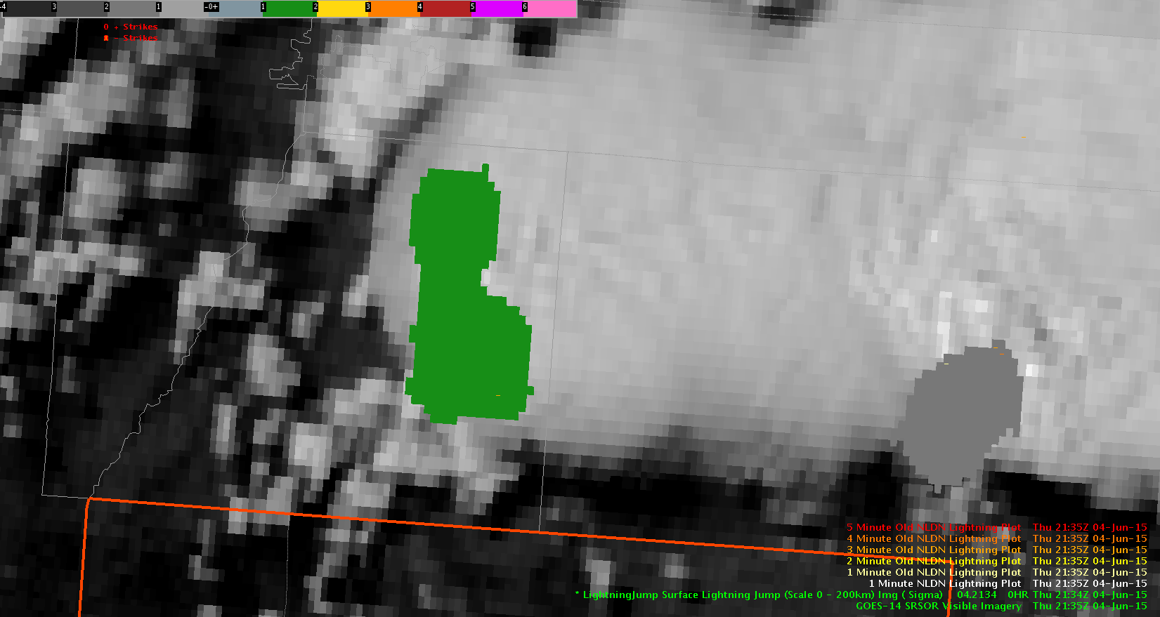
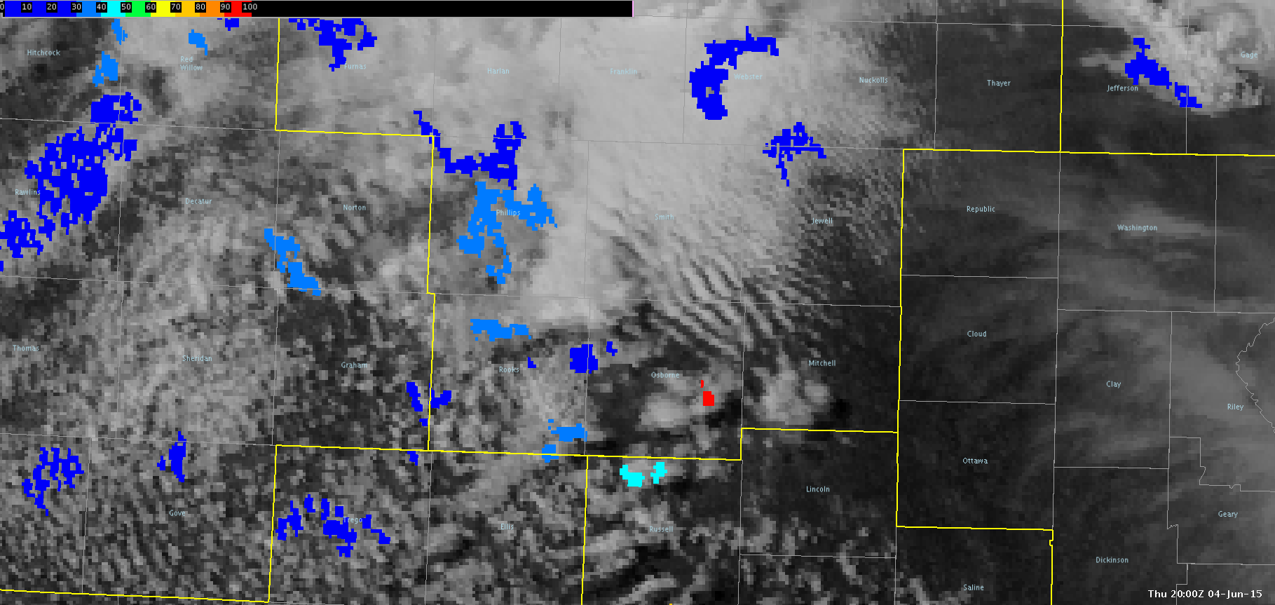
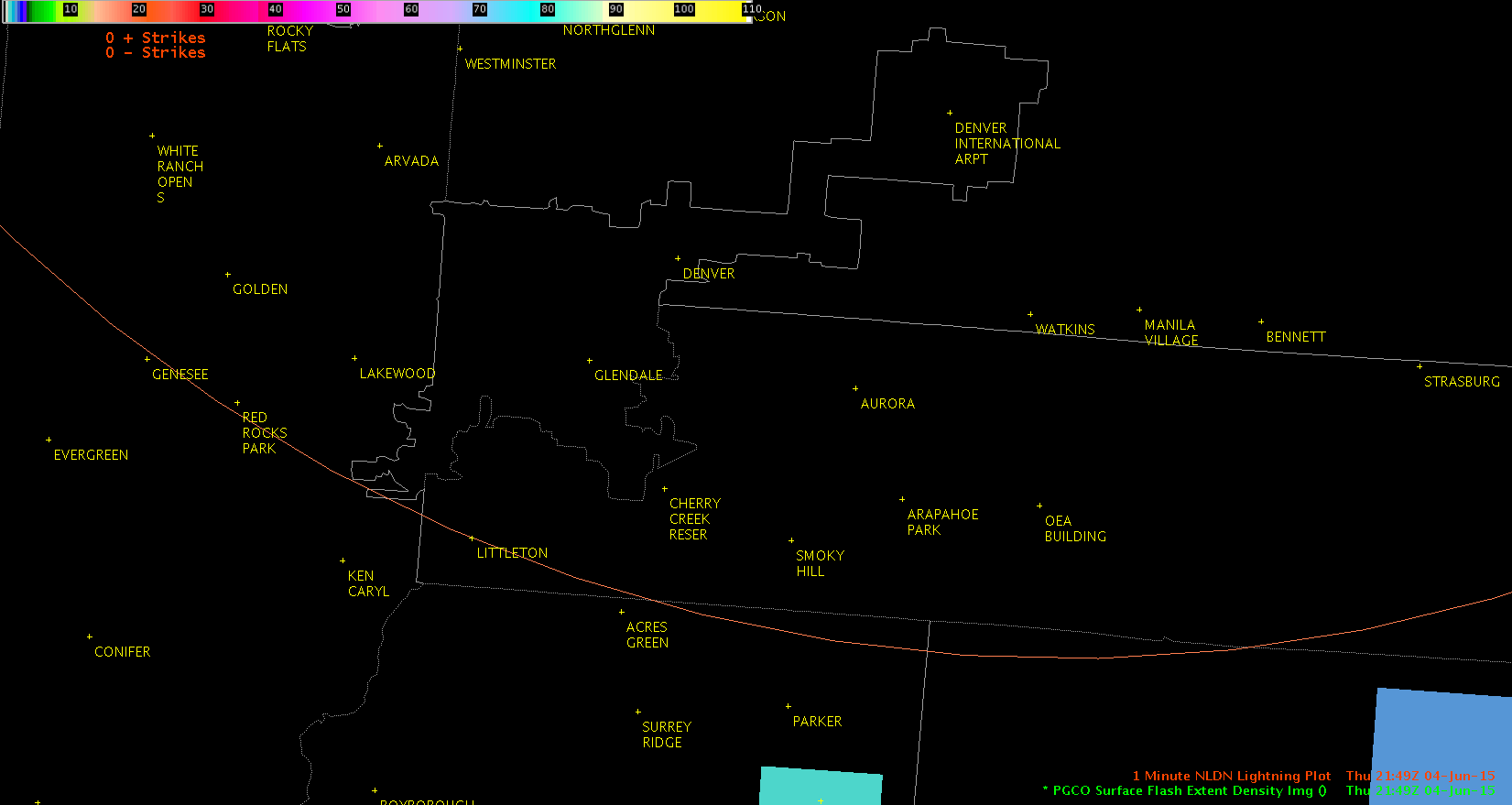
I am finding the PGLM lightning data to be very helpful in detecting lightning before there are any cloud to ground flashes. This data would be helpful in the Columbia, SC FA when storms are approaching outdoor events. It would allow us to give people a heads up sooner than CG data can. The animation below shows the PGLM Surface Flash Extent image overlaid with the 1-min NLDN lightning plot. Near Denver, CO, you can see how the PGLM data picks up on lightning much earlier than the NLDN first CG strike appears (16 minutes earlier!). 16 minutes is critical when it comes to trying to move a large number of people out of an event.

PGLM(Click image to see animation)

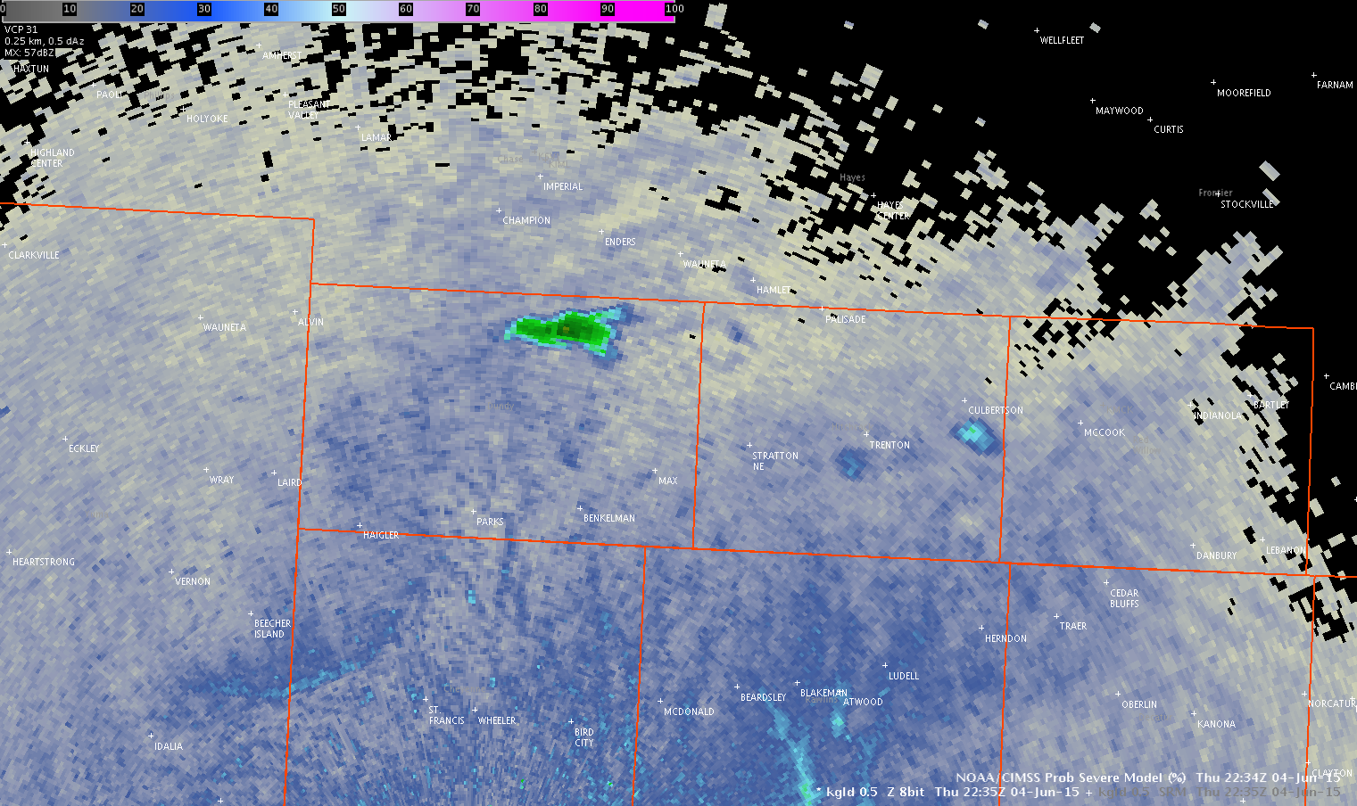
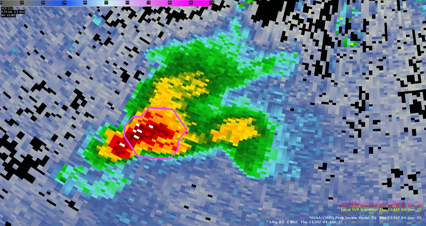
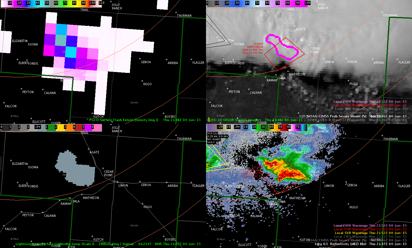
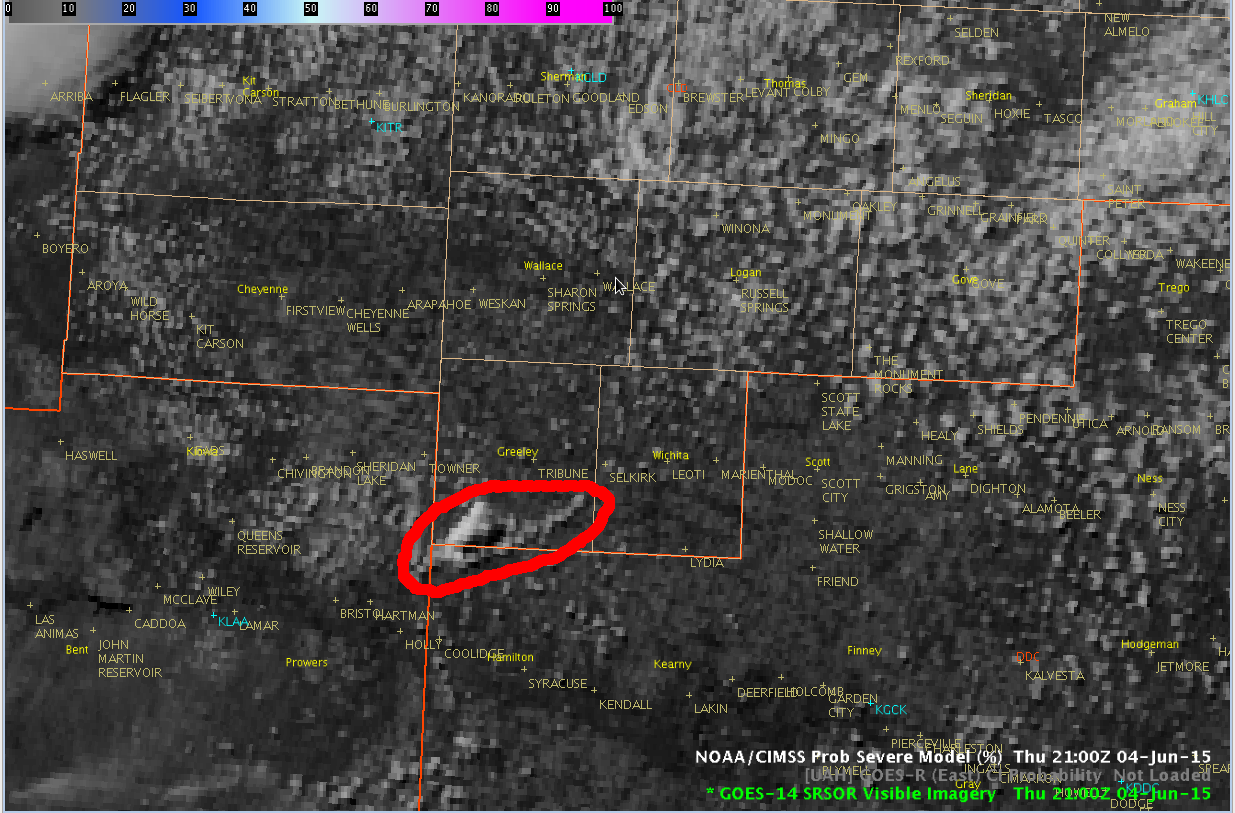
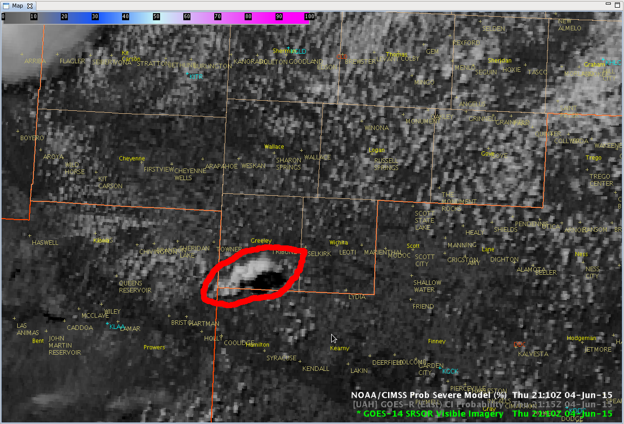
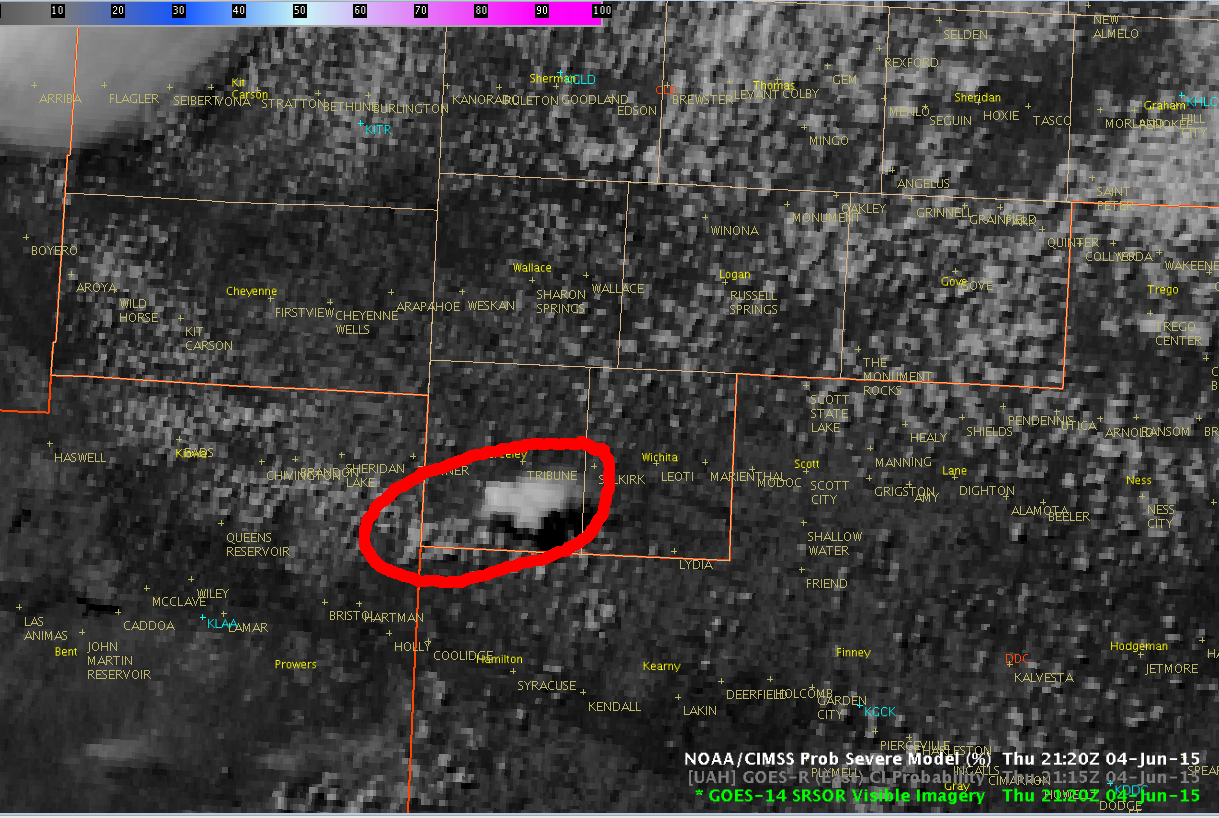
As far as other uses for the PGLM data, I’m not sure that it’s something that I would actually use after CG lightning appears and when I’m trying to decide whether or not to issue a severe thunderstorm warning. At that point, I think it would be useful to have the PGLM data incorporated into the ProbSevere data rather than looking at it on it’s own.

-Helen Hunt

Tags: None

CI and a storm’s anvil

cirrusCI1cirrusCI2 radar2234z 50% CI at 2208z; however, that particular cloud element ended up fading away. There was one just to its west that ended up initiating; however, it was underneath the cirrus shield from storms to the west and thus wasn’t caught by the CI product.

Jason Williams & CoonieCatEye

Tags: None

Thoughts on 1-min vis imagery

Even though we haven’t had anything manage to sustain itself in the GLD CWA, there has been a lot of utility in the 1 minute visible imagery. Using imagery with coarser time resolution would almost certainly have us missing much of the (albeit brief) life cycle of those little pulses that tried to get an updraft going before getting sheared off.

Having such fine time resolution really helps to pick out which clouds might have the most promise of going up, and being able to see them begin to get sheared almost as it’s happening is valuable in assessing not just the individual cell’s situation, but the environmental conditions as a whole. Clearly, even though CAPE values were being shown as quite high, updrafts were not able to be sustained. Having real-time information on actual conditions was very helpful in having an idea of how the short-term would likely evolve, rather than simply relying on short-term model data and/or satellite imagery that only would come in every 15+ minutes.

Jason Williams

Tags: None

CI false alarm, yet another sheared-off cloud

visloopthu

Click for animation. CI was 75% on another cloud, which began to show signs of getting sheared off not too long into vertical growth. The 1 min imagery showed that it was still trying to have growth going below that level, but it never managed to get its act together.

Jason Williams & CoonieCatEye

Tags: None

Lightning Jump and ProbSvr Used in Warning Decision

I had been noticing a gradual increase in ProbSvr and at 2134Z, it reached 79%. At the exact same time, I got a 2 sigma lightning jump. This increased my confidence that the storm was intensifying and that a severe thunderstorm warning was needed. I went ahead and issued the warning based on ProbSvr and Lightning Jump alone. After the warning was out, the prob severe continued to increase to 94%. The WFO has not issued a warning on the storm. It will be interesting to see whether or not it verifies.

ProbSvr2

LJJJJ

-Helen Hunt

Tags: None

Low CI verifies in GLD

2135z_vis2135z_CI2154z_vis

First two images are from 2135z showing a little cellular blob (middle of the image) trying to go up. CI was fairly low at 38%, and given how things have gone thus far, we figured the chances of it going up were pretty small. The third image is from 2154z, showing that indeed that cloud had pretty much completely dissipated.

Jason Williams & CoonieCatEye

Tags: None

Supercell west of Limon, CO matures

tor_inflow

Sustained total lightning as indicated by surface flash density and CIMSS prob severe model 99% indication on the cell west of Limon, CO. MESH is topping out around 1.25 inches.  Due to the sustained high lightning activity lightning jump sigma levels remain  around 1 or less.  I min visible imagery shows a developed inflow region marked by low level cu field streaming into the southeast flank of the cell.

John Pendergrast


Tags: None

Thunderstorm tried to get going…but sheared (GLD)

GOES-14 1-minute visible satellite data showed a towering cumulus that tried to grow across southern portions of Greenley county at 2050 UTC…

GOES-14_1min_Vsbl_4Jun15_2050Z

which started to build nicely over the next 10 minutes…

GOES-14_1min_4Jun15_2100Z

and grew further, showing what looked like a nice anvil top at 2110 UTC.

GOES-14_1min_4Jun15_2110Z

However, the low level southeast winds clashed with the stronger mid level southwest winds, which tore the top of the thunderstorm away from the low level convection just 10 minutes later.

GOES-14_1min_4Jun15_2120Z

A light shower was noted on KGLD radar at 2118 UTC near the southern Greenley county border that quickly dissipated.

CoonieCatEye/Jason Williams

Tags: None

False Hopes, CI 90% (Hastings, NE)

Just an FYI, probably saw the highest CI I’ve seen since I’ve been here (90% eastern Osborne CO).  Went on to just be run of the mill cu with no radar reflectivity seen. I continue to monitor CI but it has not instilled much confidence this week. –Cattywampus

CI90

Fig 1: 90% CI in eastern Osborne Co.


Tags: None