CI performing very well today in CO

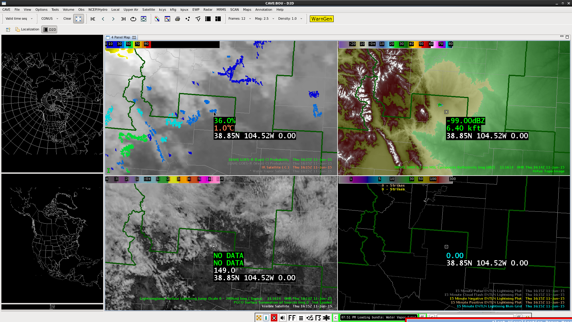
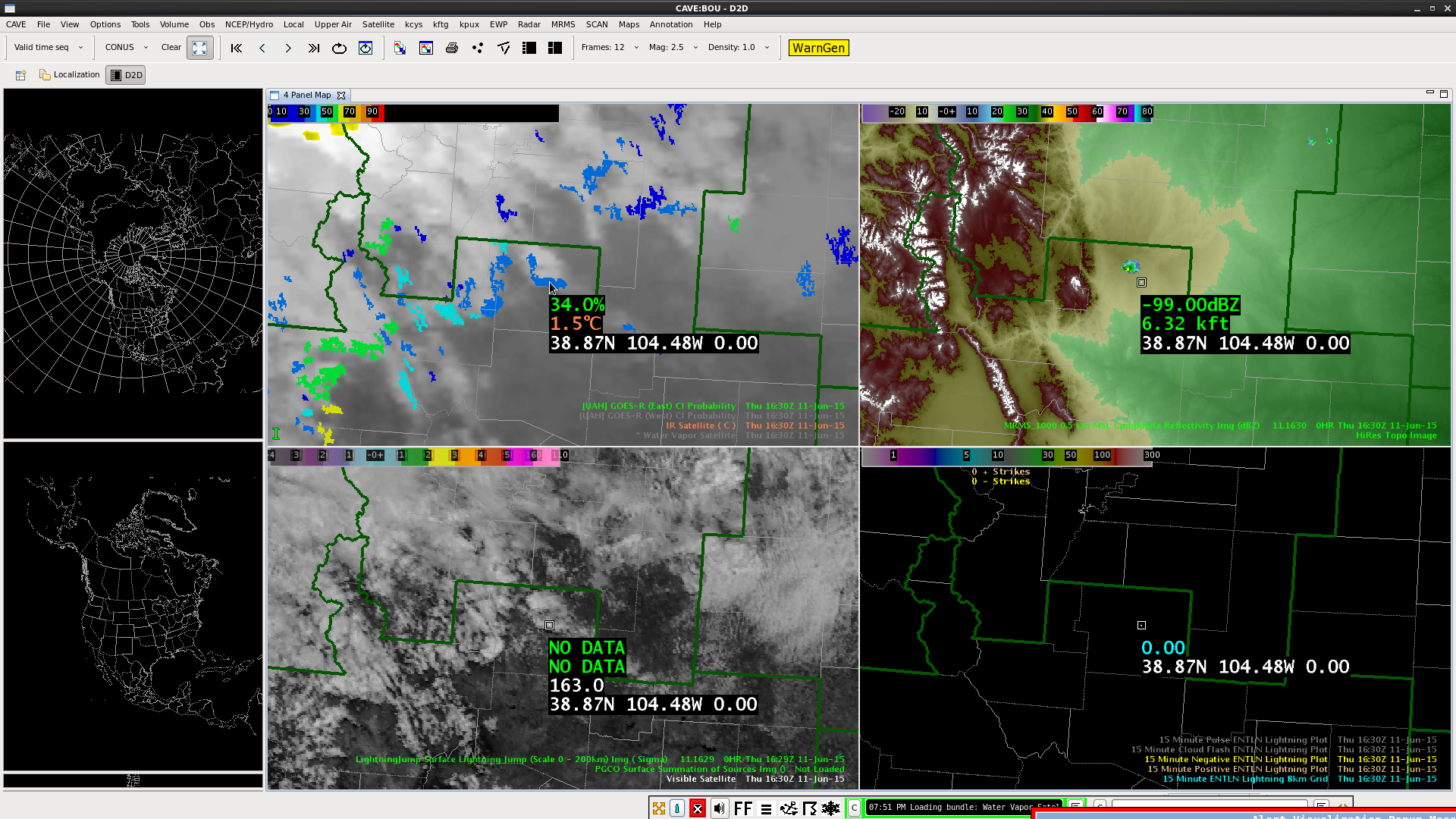
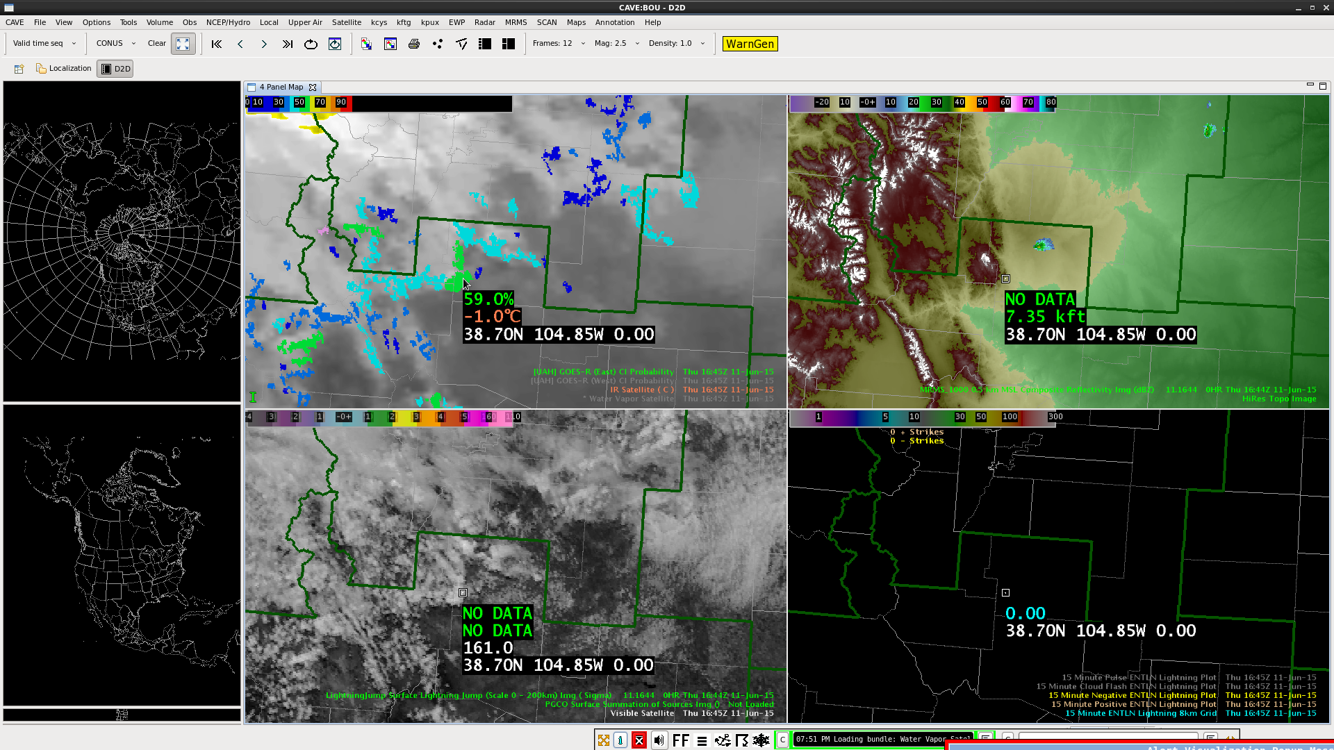
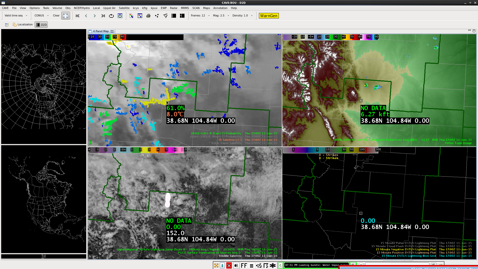
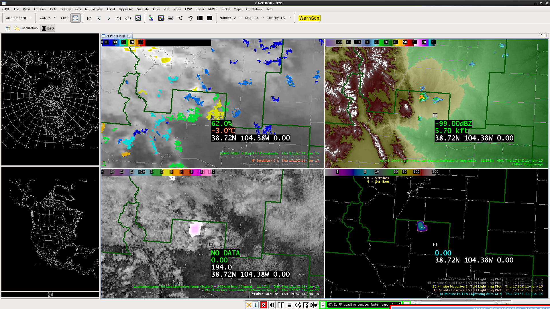
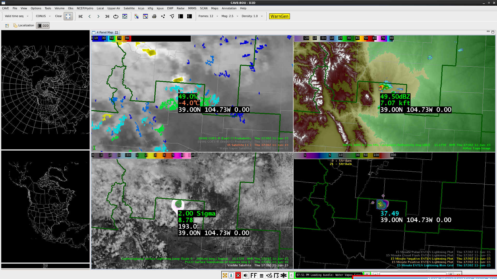
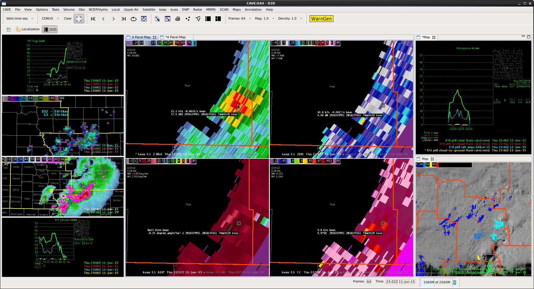
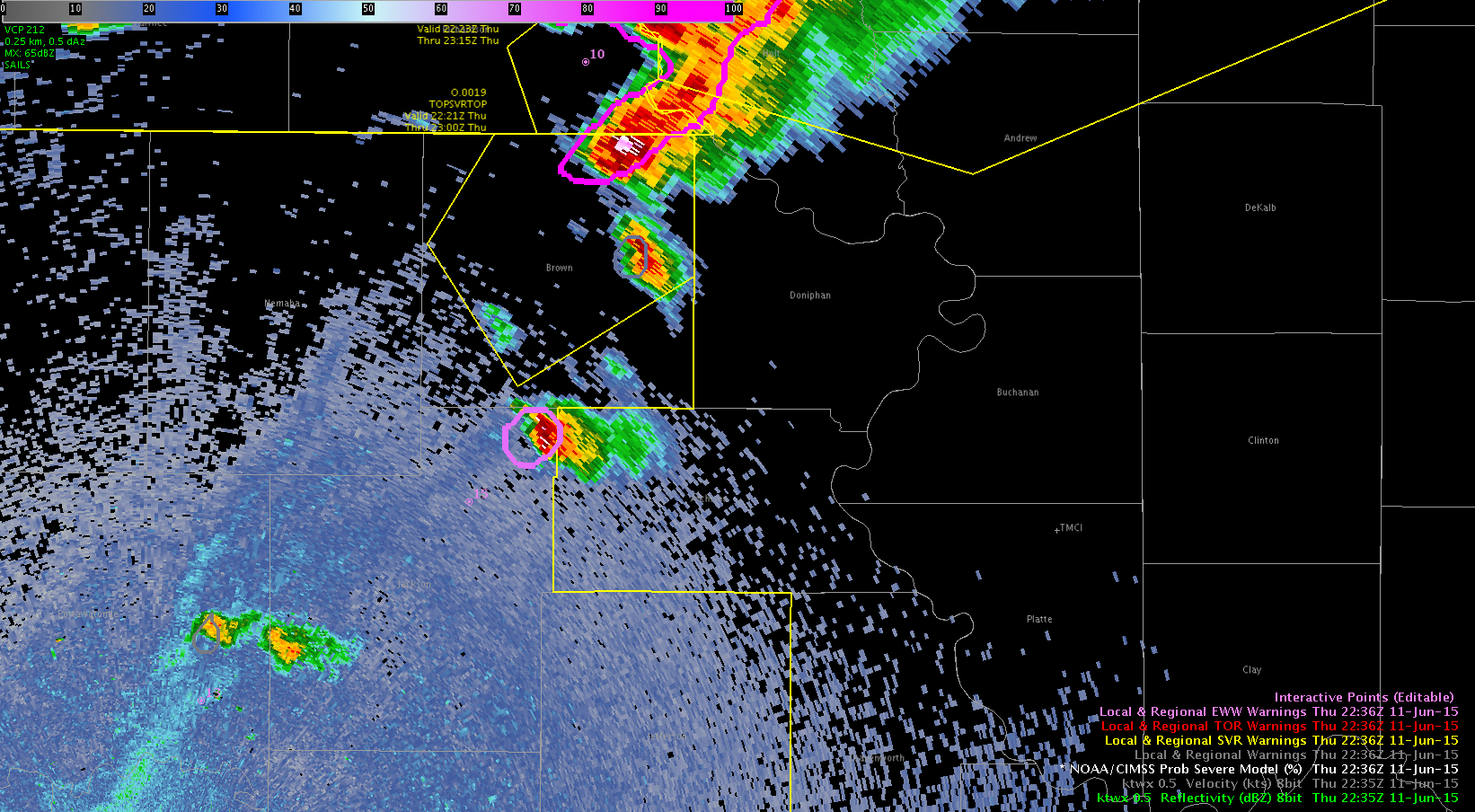
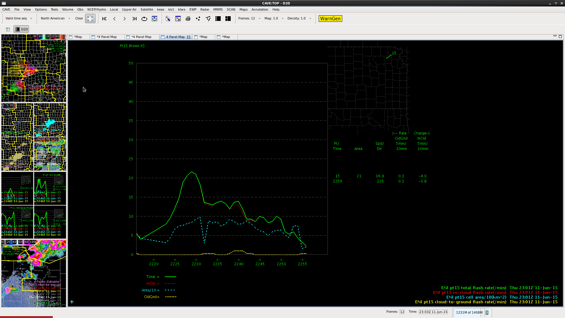
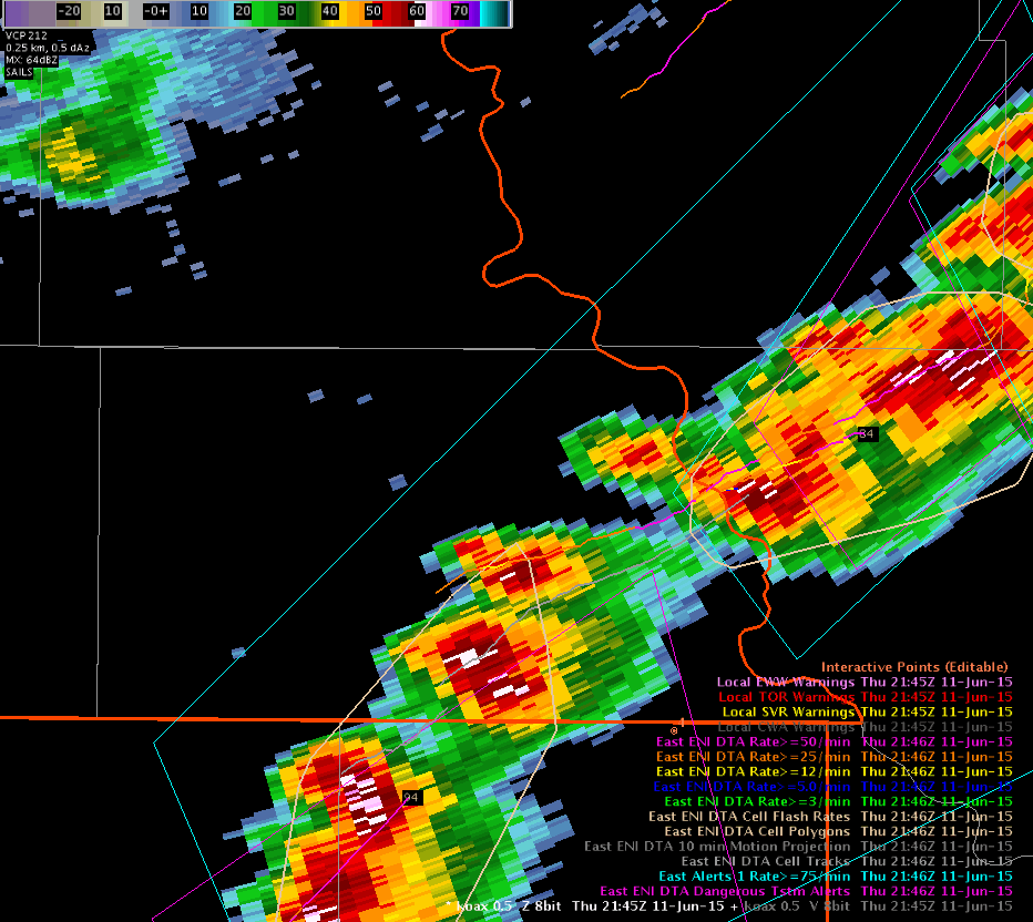
Convective Initiation product (CI) correctly showed increasing values just south of the Denver Boulder area from 1600 to 1800 UTC 11 June 2015.  Values increase from 36 to near 60% in the general vicinity of the storms that developed  in the Pueblo, CO area.  This gave about 30 minutes of lead time to the first lightning strikes around 1715Z.  It would be nice to get CI output at 1-5 minute temporal resolution to match RSO/SRSO.  We had outflow boundaries evident in the SRSO imagery but had to wait 15 minutes for CI updates.  Below are a series of images as the storms were developing showing the CI, the MRMS Composite Reflectivity, Visible satellite, PGLM 6min summary, 0-200km Lighting Jump, 15minute ENI 8km interpolated lighting grid and cloud to ground strikes.  The lightning jump showed up to 2 sigma jumps at 1729 UTC.  MrSnow/Shasta.

– CI is/was available with RSO! – BL

CI1CI2CI3CI4

CI5CI6CI7


Tags: None

New SVR for Page County

SVR6_OAX_2 SVR6_OAX_1

Had a lightning jump on this cell with higher reflectivity aloft as well.  Issued a short warning for southeast Page county.  ProbSevere was up as well as CG strikes and DVIL.

Tags: None

To Warn or Not To Warn…

…we didn’t warn. Despite ProbSevere jumping to 75% and decent looking reflectivities, we decided not to warn on the cell in Jackson Co, KS. The MESH estimates were only up to .7″.  probsevere2236


But the bigger deciding factor was unimpressive lightning data (seen below). lightningnojump

-BT


Tags: None

No SVR in Pawnee County

ProbSevere had a 69% chance, but highest dbZ still in the low 20 kft range.  DVILs from neighboring radars all low, lightning data coming down.

NoSVRPawnee_2 No_SVR_Pawnee

This cell continues to move into an area that had a window of clear skies, and SRS imagery still shows a fairly good updraft, but not overshooting.  Thus we still have not issued a SVR.

Tags: None

Decided against TOR in OAX Charley

Had an earlier signal on a rotating cell that lasted only one frame in our southeast and did not receive reports from it.  Had another signal in Gage county, also did not last too long.  Area already under a SVR warning.

NoTOR_OAX_2 NoTOR_OAX_1


Here’s an earlier snapshot when rotation was stronger, but not in an area where reflectivity was high, especially given how high up we were in the storm.

NoTOR_OAX_4

Also, we have some local office research using RAP parameters for when we issued TOR warnings.  They looked at warnings that verified and those that didn’t and what the parameters were.  In this case, the 0-1 km shear was low, 10-15 knots, where the storm was, so it likely was just a rotating cell.

0_1km_Shear


Tags: None