An official website of the United States government
Here’s how you know
Official websites use .gov A
.gov website belongs to an official government
organization in the United States.
Secure .gov websites use HTTPS A
lock (
) or https:// means you’ve safely connected to
the .gov website. Share sensitive information only on official,
secure websites.
Starting to see multiple mesovorts fire along the line, prompting a severe with the tor possible tag and would issue individual tornado warnings as they’re warranted. DivShear is also lighting up along the line as these mesovorts developed. -Sidney Crosby
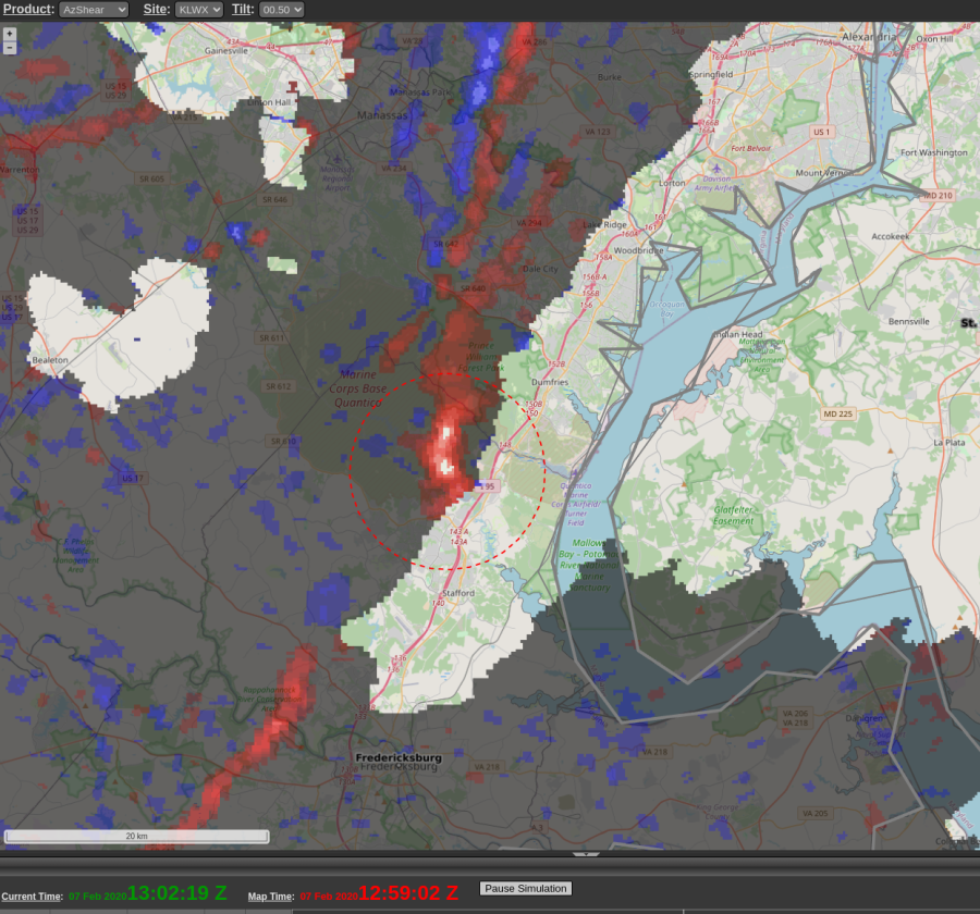
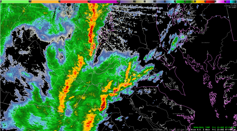
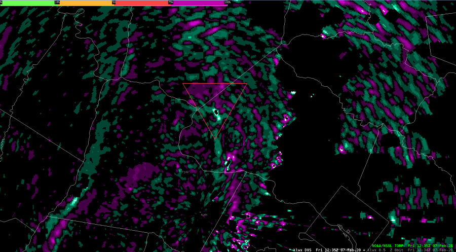
A line of convection southeast of LWX around 1302 UTC had a segment bowing out ahead of the main line and despite an unimpressive reflectivity display and some weak rotation in the velocity, the AzShear and DivShear products really showed enhanced values which caught my attention and prompted me to be proactive in issuing a tornado warning. Torp values (not shown also peaked up to around 50 percent).
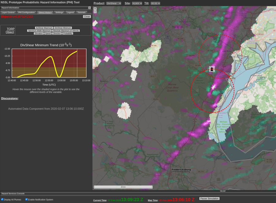
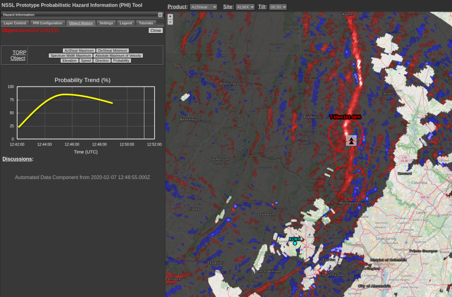
TORP object showing increasing probabilities. DivShear showing four-leaf clover signature. Both correspond with surging bow and mesovortex that would warrant a warning. -Sidney Crosby
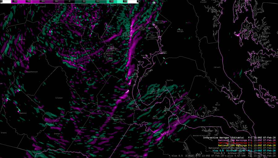
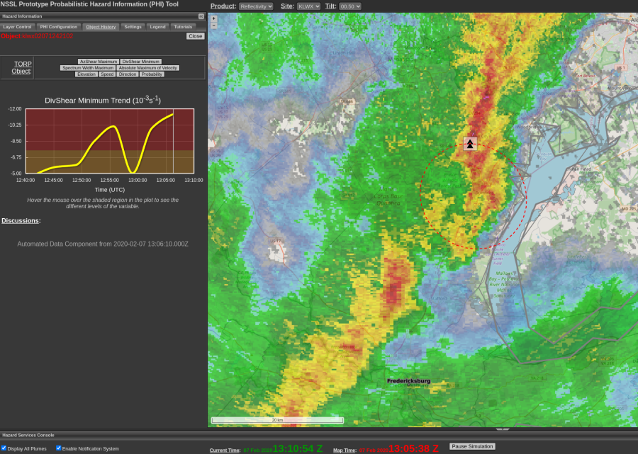
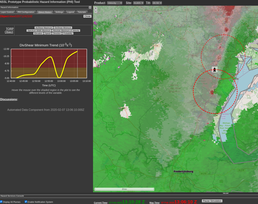
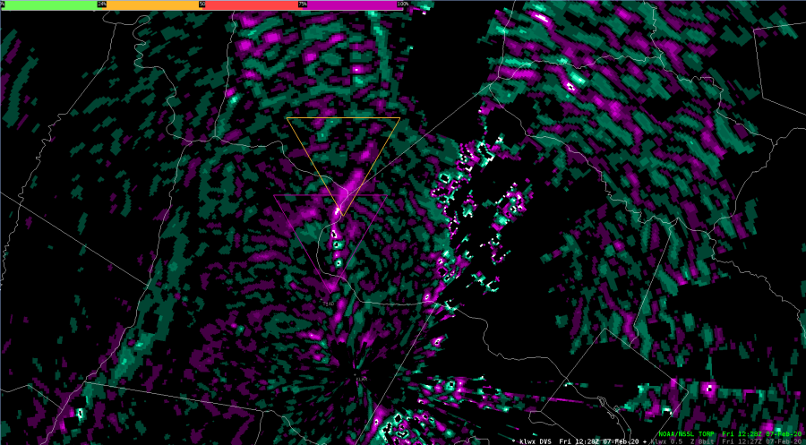
DivShear does appear to do a slightly better job at highlighting the mesovortex in this line. AzShear is too broad and highlights the entire UDCZ, while DivShear pinpoints the circulation. Both are a bit noisy close to the radar.
AZ/Div Shear with a QLCS tornado.
A second mesovortex south of the radar shows the “clover leaf” in DivShear
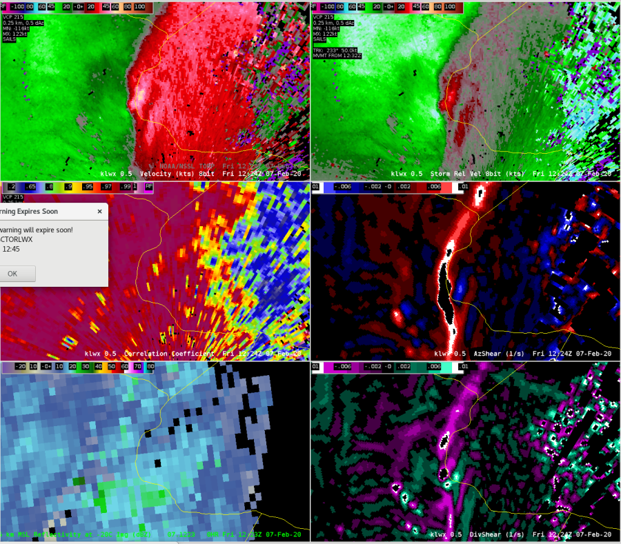
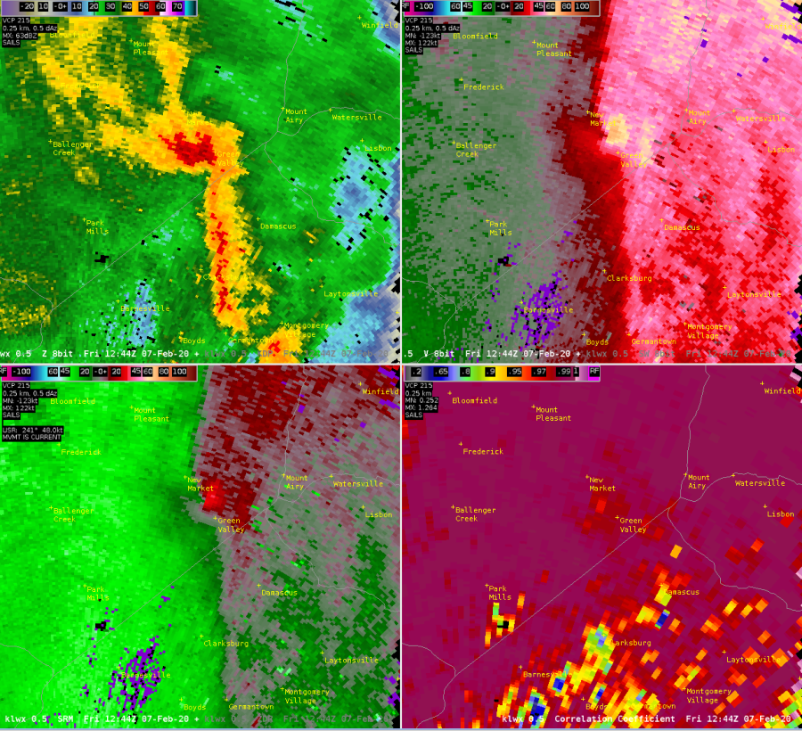
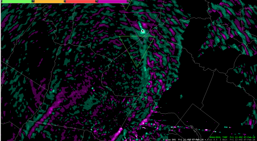
Another example of rapid tornadogenesis on the northern flank of this QLCS. Tight rotation formed rather quickly in between 1240-1245Z just northwest of Green Valley, Maryland. Tornado damage would be reported at 1244Z.
KLWX 4-Panel Z/V/SRM/CC at 1244Z.
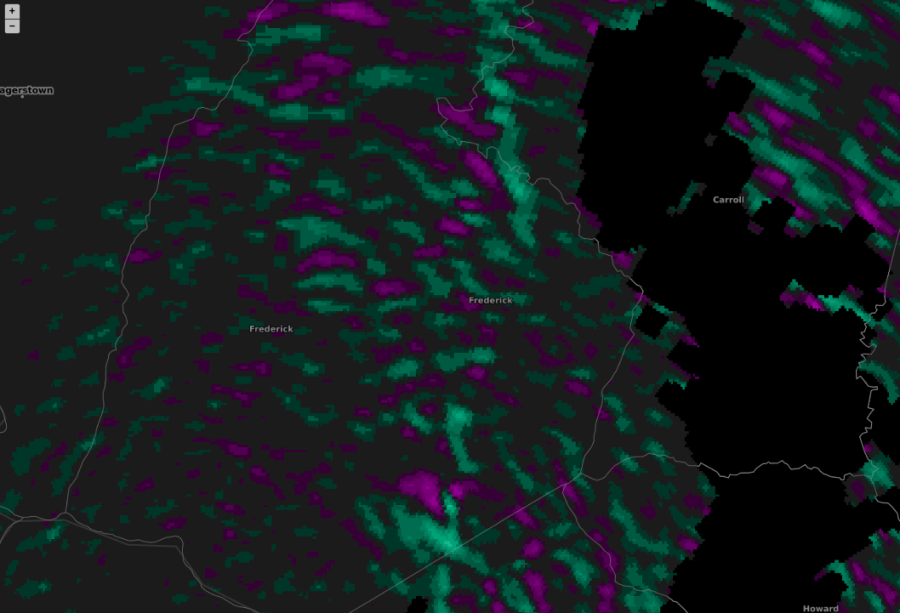
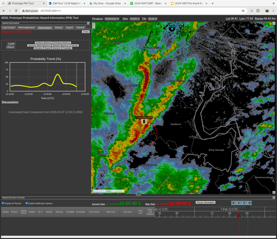
At 1242Z, the DivShear image showed mostly noise with maybe an increased signature in the southeastern portion of Frederick County, Maryland where the tornado circulation would be located. Imporant to note that a TORP object had not been created quite yet, even though we are within a couple minutes of tornadogenesis.
KLWX DivShear at 1242Z.
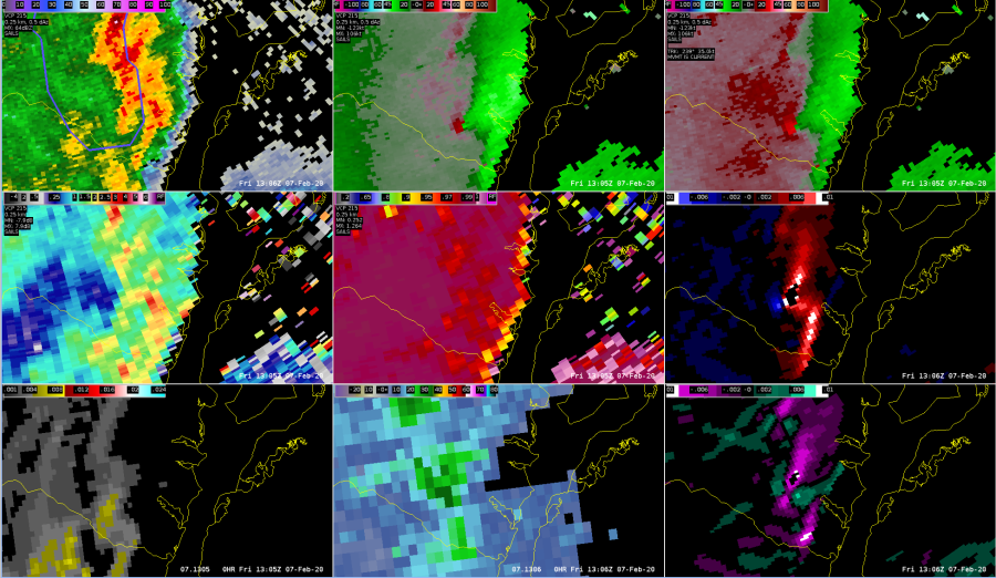
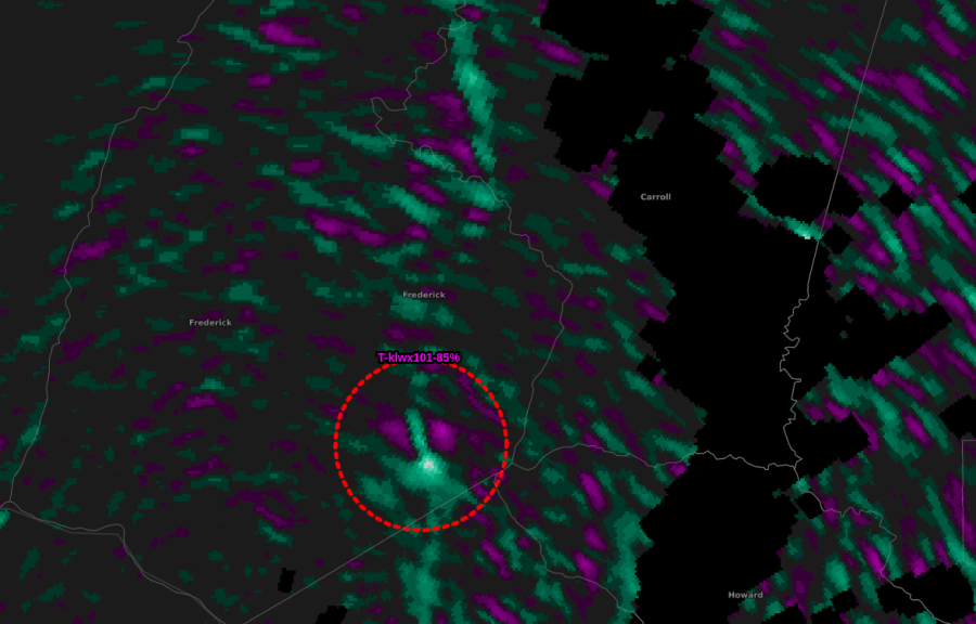
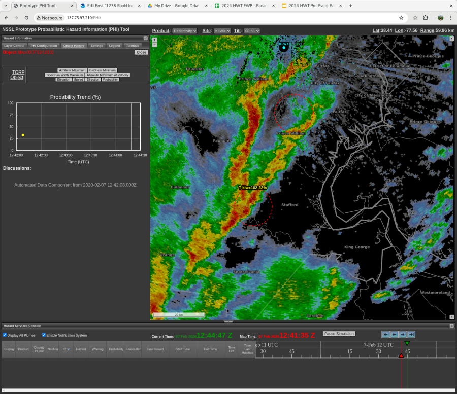
Very soon after the last image, a TORP object with an 85% probability was created at 1245Z (roughly a minute after the first tornado damage report). Also started to show signs of that clover-type look/signature in the DivShear image. It seems that TORP may sometimes struggle predicting these really quick QLCS-type circulations.
Potentially a situation where AzShear is picking up on something where Vel data is not all that usable given angle of beam. If confidence was a little greater, I’d issue a warning based on the AzShear data. (UPDATE FARTHER DOWN BELOW).
UPDATE: The following volume-scan resulted in significant confidence increase in warning necessity. Trends indicated rapidly strengthening/increasing values.
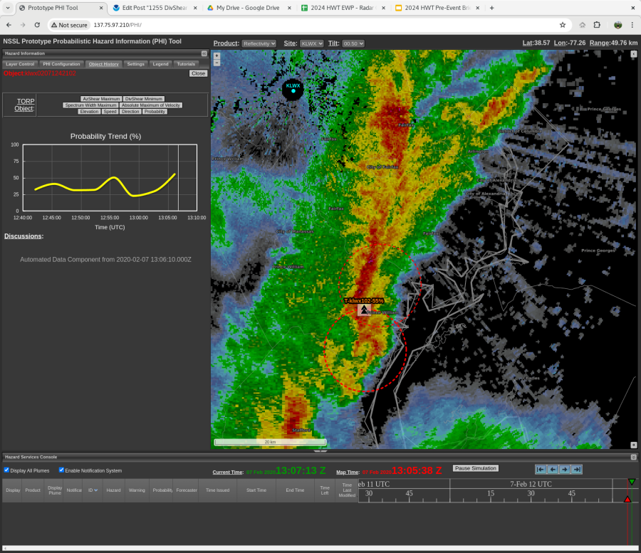
I am finding the trend graphs of the Torp and AzShear to be very helpful for situational awareness during the tracking of a storm/object. Seeing the trend helps warning decisions to extend or end a warning. I think it would be fantastic to be able to view the trend graphs in AWIPS and be able to view multiple object trend graphs at the same time. I also think a nice enhancement would be to have the probability value displayed inside the display icon would be really helpful for the warning forecaster to be able to quickly glance and see probabilities overlaid on radar data without the need to sample (and the icon could and should still be color coded).
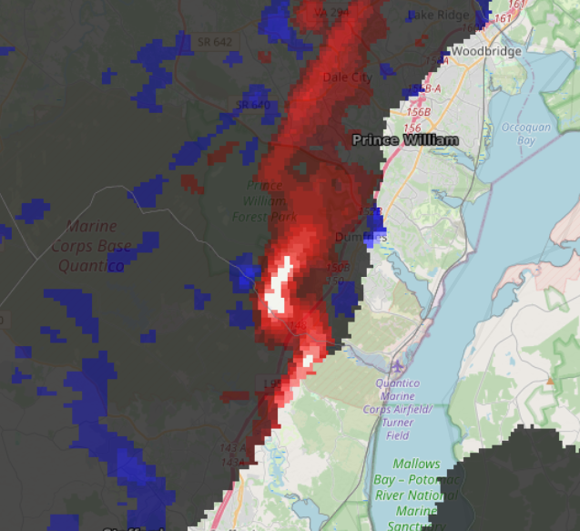
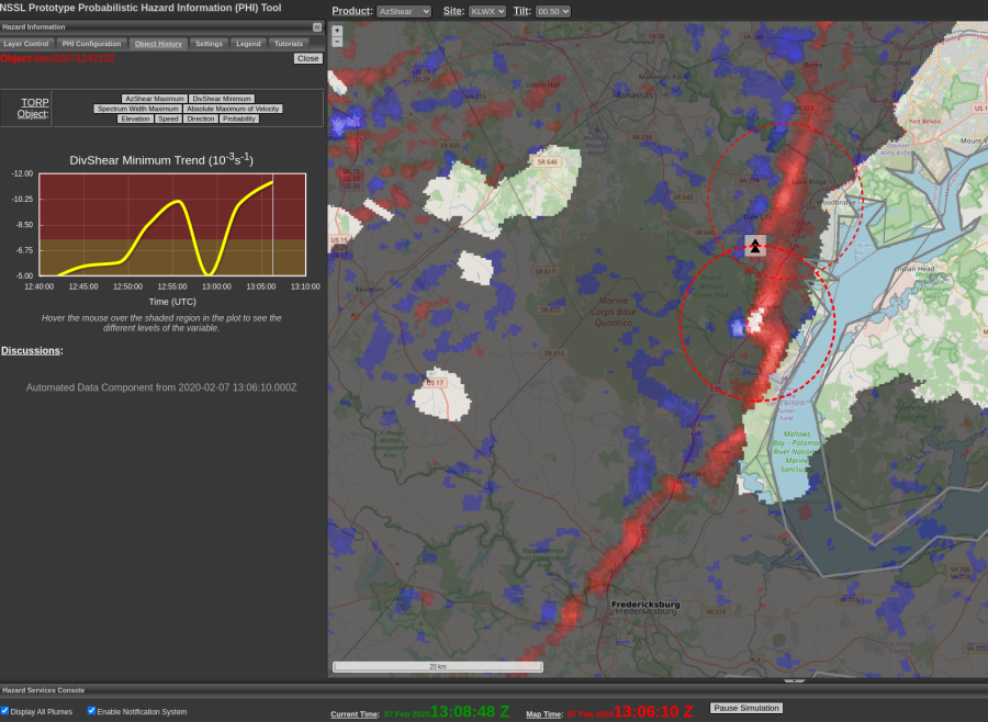
A quick analysis of DivShear shows a local maximum has been tracking with the circulation for the past 3-4 scans, though weakening with time. -Sidney Crosby
In retrospect, if a forecaster relied solely on the Torp product, there could have been good lead time for the tornado in Monrovia. Displayed below is the progression of Torp while overlaid with DivShear. Note, there is a magenta Torp outline in third image.
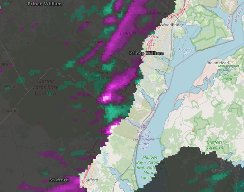
The TORP object in Orange/Stafford counties that showed rapid increase in probabilities also showed a quick decrease. As it did this, a second TORP object was created in a similar spot. -Sidney Crosby