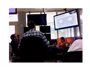
In week 5, the Experimental Warning Program reached out to Canada and the Pacific Northwest, bringing in meteorologists with quite unique perspectives on thunderstorms and warning operations. Our forecaster/evaluators included Brad Colman, Meteorologist in Charge at the Seattle Washington NWSFO, Eric Stevens, Science and Operations Officer at the Fairbanks, Alaska NWSFO, and Mark Melsness of Environment Canada in Winnipeg. Adding some local experience to the group, we had Kevin Brown, Senior Forecaster at the Norman, Oklahoma NWSFO. And I am Patrick Burke, General Forecaster at the Norman NWSFO; I served as Weekly Coordinator, but also as an evaluator for Thursday’s operations.
Although the Memorial Day Holiday shortened Week 5 to three and a half days, the group was able to work on all three experimental data platforms, including plenty of live data – particularly for probabilistic warnings.
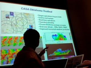
Tuesday initially showed some promise for a Central OK intensive operations period (IOP), so we ran with a game plan to complete PAR and CASA training. The group sat down for the first time in front of WDSSII to practice data interrogation using a live supercell near Altus, OK. Kevin and Eric then viewed PAR data for about an hour, with this storm just near the edge of the domain. Unfortunately, stable air overspread central OK, and all the thunderstorms propagated away from the PAR and CASA domain. Participants then turned to archive cases to round out the evening.
Wednesday brought an opportunity for the groups to trade places on the PAR and CASA archives before moving smoothly into Probabilistic Warnings for the remainder of the day. Upslope flow pushed mid and upper 50s dewpoints onto the parched high plains of eastern New Mexico, while mid and upper level winds showed a gradual increase downstream from a trough over southern California. The situation proved favorable for severe storms. Coordinating with the SHAVE project to find relatively dense verification swaths, Brad and Mark issued probabilistic warnings for hail on multiple storms, and eventually one low-probability warning for tornadoes. Meanwhile, Kevin and Eric inherited a long-lived eastward moving supercell which paralleled Interstate 40 from near Albuquerque to Tucumcari. The team issued probabilities for hail and tornadoes for this and a second cell which followed in the same path. Both cells received traditional tornado warnings from the Albuquerque NWSFO. Kevin and Eric eventually added a probabilistic swath for severe hail when the lead supercell took on high-precipitation character with an extensive rear flank downdraft. It was very impressive to see how comfortable the teams became with issuing multiple threats for multiple storms within hours of first being introduced to the experiment.
Thursday presented the best opportunity yet this spring for participants to test probabilistic warnings during an outbreak of long-lived tornadic supercells. After our map discussion which included a categorical High Risk for severe weather in Nebraska, we chose to put Kevin, Eric, and Mark stright to work on the Prob-Warn archive case; it is important to have as many forecasters as possible provide feedback on this one particular case so that meaningful statistics may be derived. We said goodbye to Brad who left as planned so he could attend to other obligations. Thus, when we jumped on the live Prob-Warn operations at 2130 UTC, Kevin was paired with Mark, and Eric with myself.
Both teams inherited severe storms already in progress, and though it was not the original intent, storms aligned such that it was beneficial for Team 1 to work within the Goodland NWSFO CWA, and Team 2 within the Hastings CWA. At one point this resulted in a unique opportunity to coordinate the passing of a probabilistic swath across CWA borders. Another storyline developed as teams tested the workload by issuing probabilities for hail, tornado, and straight line winds for each of 3 different storms, resulting in 9 threat areas. Threats from one storm often overlapped those of another storm, and the teams took to giving their warnings meaningful names based on the location of the initial warning.
Operations were also enhanced by the Situation Display which showed live video streaming from storm chasers in both CWAs. The Hastings team worked a storm that appeared to be producing a significant tornado at Kearney, NE, while the Goodland team received occasional tornado reports from Sheridan to Rooks Counties. The Goodland storms found deeper moisture and began producing more significant tornadoes near Jewell and Beloit, KS, just after the IOP ended. We allowed enough time to hold a short debriefing late that evening while replaying the event through WDSSII on the Situation Display.
Friday allowed us to hold a more thorough round table discussion of the Thursday event, and also reflect on previous days’ events. Despite the holiday-shortened week, forecasters gained experience with PAR, CASA, and Probabilistic Warnings, and worked one of the most data-productive events of the season on Thursday. Before concluding for the week, we were treated to a brown bag lunch at which our participants presented the following:
Mark Melsness: “Precipitable Water Veriication of a Ground-Based Sounder using RAOBS at Winnipeg.â€
Eric Stevens: “Impact of Snow Cover on October Surface Temperatures in Fairbanks†(a.k.a. “Falling off the Cliffâ€)
Kevin Brown: “Influence of Radar Beam Ducting on Warning Decisionsâ€
PAR Discussion:
· DISPLAY
o Multi-panel (even greater than 4) would be useful
o For Looping, would like to select from a range of time resolutions since 1-min updated is not as important 60 minutes in the past. Perhaps a hybrid loop that has 5-min resolution transition to 1-min upon nearing the present.
o Interlaced 0.5 deg data is good
· DATA
o Would like improved azimuthal resolution (beam width) at long range
o Like opportunity to scan even faster in 45 deg sectors
· ANALYSIS
o Tuesday’s Elk City supercell split was recognizable in PAR earlier than 88D
o For other features, KFDR was best simply because of location
o Very useful for intensity trends
o Numerous features that might prompt warnings from 88D perspective, but many are transient. Felt it was a luxury to watch them evolve and warn only on those that showed consistent upward trend in intensity. Will need much training on this concept to avoid dramatic increase in false alarm rate
o Could combine PAR with Prob-Warn thinking, and a good approach could be broad area of lower prob warning with pinpointed short-duration higher prob warning for these transient features.
CASA Discussion:
· DISPLAY
o Please add contours of wind speed to 3DVAR product
o 3D isosurface of wind speed, looped in time, would be useful
o Four-Dimensional Storm Investigator could be used in lieu of RHI
· DATA
o Adaptive scanning was too hard to follow. Forecasters preferred the 2.0° scan which is 360°. Greg Stumpf mentioned that WDSSII has a merger that can put all the data into a 3D grid, update only those portions (sectors) of the grid with live data, and then time-to-space displace the older data. 3DVAR product can also do the same
o Dual-pol could be useful for non-precipitation returns, like smoke, volcanic ash, during “big bubble no trouble†conditions (i.e., “severe clearâ€)
o Some were overwhelmed at the resolution, especially spatial. Need 88D-like data working side by side to maintain awareness of the big picture.
· ANALYSIS
o In Alaska, CASA would be more useful as a gap filler under 88D beam over population centers, rather than as an overlapping adaptive network. He gave the example of Delta Junction, AK, where there are “competing†mountain-valley circulations (Chinook v. Bora) which the CASA radar could help diagnose.
o Could be useful for Olympic venues (although for Vancouver, will be using mobile radars).
PROBABILISTIC WARNING Discussion:
· DISPLAY
o Need an alert system for warnings nearing expiration, or perhaps for storms bleeding outside the warning swath. Something akin to the AVNFPS could be ideal.
· DATA
o Would like options for applying a more advanced approach to swath creation, such as different motion uncertainty and buffer to the left versus right
o Would be nice to be able to multi-select several warnings and group-adjust variables like the motion vector.
· ANALYSIS/OPERATIONS
o Need to add information about intensity (e.g. Hail Size, Wind Magnitude)
o Workload is an issue. Varying degrees of comfort handling multiple threats on multiple storms. Could let algorithms assist, especially with hail which tends to be easiest to detect. Forecasters want ability to QC any warning the algorithm suggests before sending to public
o Like the ability to issue low-prob threats as this more continuously conveys trends in forecaster thinking compared to legacy warnings
o Gridded probabilities offer ability to derive output with many grades of sophistication for various users
· Related Discussion
o Greg Stumpf: What if a storm begins to turn right after issuing a storm-based polygon? Do you issue a new polygon? Does it overlap the old? Do you cancel the old polygon?
o Patrick: The gridded warning concept is preferred, as it allows you to nudge the motion vector when needed.
o Patrick Related his experience taking over warnings on the 5/24/08 Oklahoma supercell. With two tornado warnings in effect for the same county, each labeled directionally (e.g. Eastern Noble County) he cancelled the western warning (essentially the threat was advecting east out of the first warning and into the second. A television station only picked up on the Cancellation headline, and not the continuation of the eastern warning mentioned in the text. Thus, he had to issue another SVS 1 minute later to reiterate this. This was a good example of a non-meteorological condition affecting warning judgment. Feels that the PW system would have dealt with this a lot better.
TRAVEL & EXPERIMENT LOGISTICS:
· Organizers made experience very easy.
· Enjoyable.
· Nice mix of lecture and hands-on experience.
Patrick Burke (EWP Weekly Coordinator, 27-30 May)


