18 May 2011 AFD

Morning surface analysis shows surface low pressure over the northern TX panhandle, with a warm front extending ESE across northern OK and multiple drylines…one over western TX with dewpoints in the 20s behind it, another over western OK separating air with dewpoints in the 40s to the west and lower 60s to the east.  Aloft, the 12Z NAM indicates mid level energy ejecting from the western closed low, with a mid level shortwave moving into southeast CO and southwest KS late in the day, with a weaker southern extension moving into western OK…while the northern TX low intensifes and retrogrades into northeast NM.  NAM forecast soundings also show an 800 hPa capping inversion eroding late this afternoon over western OK.

With the eastern dryline already into western OK and a little farther east than the NAM forecast, think best chance for convective initiation will be over a narrow corridor in west central OK, beginning about 21Z-22Z, especially where low level convergence will be maximized near the intersection of the dryline and warm front just northwest of OKC.  This plus strong veering wind profiles and SBCAPE values up to 2500 J/kg support idea of isolated surface-rooted supercells capable of producing large hail and tornadoes during this time, becoming elevated later this evening as they move east of OKC where the cap should hold.  The 14Z HRRR and 12Z SPC WRF also lend  support to this idea.

A much more conditional severe threat exists farther northwest into southeast CO and southwest KS north of the warm front, where lift will be better but instability more elevated in nature as the cap holds.  Farther east across eastern OK, models (especially the OUN/SPC WRF) generate waa-induced showers along and north of the warm front, but instability is meager and do not expect CI algorithms to perform as well in this area.

Taking a look at high resolution simulated reflectivity, the RUC HRRR has been consistent in its past few runs of a lone supercell initiating and then propagating east. The NSSL WRF is similiar in this idea, though generates several training supercells.  Both are in agreement for an area North and west of Norman. The 15Z OUN WRF was consistent with the 0z SPC 4 km WRF in not generating convective activity…and keeping things confined to weak echoes east of OKC. Now, a look at the 16z OUN WRF is now suggesting supercellular convective initiation similiar to the NSSL WRF. It indicates, Max column hail values in excess of 40 kg/m2, Updraft helicity in the 2-5 km layer indicates in excess of 300 m2/s2, and we are now seeing convective initiation from OUN WRF reflectivity. Timing of convective initation looks to be in the 21-23z time frame. The image below is the 16z OUN WRF model simulated reflectivity forecast at 23z, the first run to initiate convection over NW Oklahoma. Note also the model places updraft helicity in the correct conceptual model location, with the max hail slightly removed. Max column hail (integrated graupel) values greater than 40 kg/m2 and Updraft helicity in the 2-5 km layer in excess of 200 m2/s2 are indicative of strong mesocyclones, with is consistent with the high CAPE and strong low and mid level shear environment.
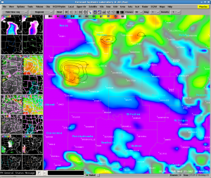
OUN WRF 7 hr forecast of Simulated Reflectivity (img), Max Column Hail (black), and Updraft Helicity (red)

Therefore, it looks at this time with the plethora of data around OUN that this will be our area of focus this after to test the convective initiation products and to monitor the progresssion of the OUN WRF and other hi-res models, despite additional convective activity possible in SE Colorado.

Ongoing thunderstorms in the Mid Atlantic may serve as a possible alternative location in addition to SE Colorado, should convective activity fail to materialize in the southern plains.  MUCAPE 500-1000 J/kg, effective bulk shear 30-40 kt there, and cold pool aloft with 500 hPa temperatures -18C to -20C are supportive of locally severe storms from the Delmarva northwest into southwest PA and WV…with the main threat large hail.  Low LCL’s and localized/marginal 0-1km SREH of 100 m^2/s^2 also suggest brief tornado potential in new storms via stretching of rotating updrafts.

Goodman/Donofrio/Schultz

Tags: None

Update on Week 2 :: Day 2 Activities

Around 2330z we switched from the LWX area to BOU where storms have developed and become severe.  There have been reports of a ‘landspout’ tornado near 00z.

Bill and Jessica have mentioned the utility of the updraft field (Merged W Composite) as being an interesting tool for landspout-type environments.

It should be noted that compared to the updraft field looked quite “off” (incorrect) with the storms in the DC domain, but look much better in the Floater (BOU) domain.  Perhaps the 3DVAR we are using is better “tuned” for a supercell environment and the sub-severe storms in the DC area provided a bit more of a challenge.

We will operate for another hour or so and then begin surveys.

-K. Manross

Tags: None

17 May 2011 AFD

Convection ongoing across Carolinas into Virginia this morning, and convection is expected to continue and intensify this afternoon given some clearing in warm sector and minimal cap. Nearly saturated environment, low-cape/moderate shear environment will result in strong and possibly severe storms. Although damaging wind gusts will be primary concern, low-lcl environment will keep threat of brief/weak tornadoes with initial development of convection primarily over eastern Virginia into eastern North Carolina where low-level cape/stretching potential will exist. Warm front extending sw-ne across northern portions of Virginia will need to be monitored as well with conentrated low-level shear. CI satellite detection possible early in the event before cirrus canopy becomes an issue. Hi-res models forecast banded convection near cold core and initiation of bands with CI detection may prove useful where higher impact areas will evolve. Already some more obvious clusters of CI detection using UAH product are highlighting areas in srn VA/nrn NC where new 12Z SPC 4km WRF is fcstg clusters of convection near short wave to develop early afternoon. CI products may continue to be useful to help identify where these potential severe clusters/bands may develop within the wider scattered shallower convection expected to develop. Value of 3dvar may prove useful as well where low-level vort and updraft fields can help warning forecasters concentrate on regions where low-level cape/shear are maximized. Good opportunity to experiment with utility of many 3DVAR products with shallower convection.  Same with MRMS products. In addition, some  of the nearcast differential theta-e/PW products indicating severe potential through mid to late afternoon over central VA shifting NW into northwestern VA…consistent with local WRFs and SPC WRF ideas.

High plains convection will be possible near developing dryline across eastern Colorado/western Kansas. CI detection will be useful late this afternoon and early this evening as it may take a while for CI once cu develops. Although shear will be increasing through the day, moisture availability will be a concern for more than LP type supercells, especially as storm move off of higher terrain.

Warning ops – our feeling is that initial warning ops, perhaps through at least 21z, should be centered on mid-atlantic region with the option of shifting west to Colorado eastern plains and western Kansas after 21z for possible initiation of isolated/scattered supercells. Greatest value of satellite CI detection and 3dvar fields may be most useful over eastern ops area, although CI detection along with OUN WRF output could be utilized out west. Expecting mainly a hail threat with the LP-type storms in the Plains, and evaluation of some of the MRMS products would be helpful as well.

Tags: None

Wrapping Up

Forecasters are finishing their surveys on the DRT case.  When they are done, we will spend some time discussing their first look at the products and have some Q&A.  Comments folow…

Thoughts on training vs DRT case:

Steve – Would like to have more background but also have the chance for an in-depth look, but given the time time constraints this worked.  Essentially,  would like more time for background AND data analysis.

Kevin D – will now look back at the handbook after having some idea of the usable values.

Kevin B. – procedures preset would have been very helpful to jump into the analysis more quickly.

Bill – more of a chance to see relationship between base data and experimental.

Jessica – would like to have seen something other than a slam dunk case.

Initial thoughts on using experimental data for the first time:

Kevin B – “misplaced” downdraft max to SE of storm E of Henessey (2216 Z).  Illustrates confusion of the max/min composite W can have to operational forecaster.  If we were able to browse levels, this might be a bit easier to use/grasp.  We may try using WDSSII a bit more to illustrate this.

-K.Manross Week 2 EWP Weekly Coordinator

Tags: None

DRT Ongoing

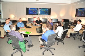
We have completed the orientation briefings for the day and each of the participants is working through the DRT Case (19 May 2010).  This is the first taste that the forecasters are getting with the data.  We have encouraged the forecasters to explore ways to blend the data that they have available to them.

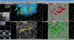
Jessica has captured a screenshot of using a 4-panel display which several forecasters have migrated to:

4 Panel Image showing Z (TL), 3DVAR Composite Updraft (TR), 3DVAR Composite Vorticity (BL), 3DVAR Composite Downdraft (BR)

-K Manross :: Week 2 EWP Weekly Coordinator

Tags: None

Week 2 Under Way!

We have begun EWP 2011 Week 2.  With us this week are:

Kevin Brown (OUN), Kevin Donofrio (PQR), Bill Goodman (OKX), Steve Keighton (RNK), Jessica Schultz (ROC)

We will be going through training fore most of the day ending with the 19 May 2010 DRT case.

-K Manross: Week 2 EWP Weekly Coordinator

Tags: None

Daily Summary – 10 June 2010

We are starting to wrap up operations.  Storms are either leaving the CYS domain or are diminishing in severity, so Dan N and Frank are starting their surveys.  The BOU crew is still operating a bit longer, but we’ll end their activities soon.

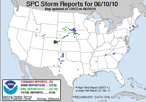
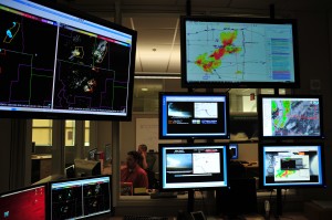
There was a tornado visible via streaming chaser cams on the SAD.  Also, we had on the large monitor in the corner a WDSSII display with two panels: one with warnings and MESH and the other with warnings and 30 min RotationTracks.  Pat really liked this as a SA tool.

We tried some GOES-R operations for a good part of the day.  The cap kept a lid on things in the GLD domain pretty much all day.  There were a few reports of overshooting tops to add to the CI detections.

Technical Issues of the Day:

  • Tupelo was slow to load when we switched Dan D to that machine.  He was trying to load his procedure.  We tried a reboot and it was still pretty slow so we just patiently waited for it to load.
  • Otherwise things worked quite smoothly.

Kevin Manross (EWP Weekly Coordinator, 7-11 June 2010)

Tags: None

Live Blog – 10 June 2010 (7:22pm)

Well, we’ve pulled the old switcheroo again.  We now have Frank and Dan N focusing on CYS and moved Dan D over to BOU where Pat and Andy are stationed.

Storms are actice with plenty of hail and what appeared to be a tornado via streaming webcam near the CO/WY border.

We will consider going a bit over the 02z ending time that we normally have since initiation was a bit late and the storms are interesting.  We will try to remember to give enough time to do surveys without holding everyone too terribly late.

Kevin Manross (EWP Weekly Coordinator, 7-11 June 2010)

Tags: None