2011-06-08: Area Forecast Discussion Update

NW OK/SW KS

SOUTHERLY FLOW WILL CONTINUE TO ALLOW FOR MODEST IMPROVEMENT IN BL MOISTURE ACROSS THE SOUTHERN HIGH PLAINS THIS AFTERNOON…WITH SURFACE DEWPOINTS LIKELY REACHING THE LOWER 50S ACROSS THE REGION BY LATE IN THE DAY. THIS WILL COMBINE WITH VERY HOT TEMPERATURES…AROUND 100…TO RESULT IN MODERATE INSTABILITY. DESPITE VERY WARM H7 TEMPS…AROUND 15 C…FORECAST SOUNDINGS ARE LARGELY UNCAPPED AND FEATURE A CLASSIC INVERTED-V STRUCTURE. BL CONVERGENCE…ESPECIALLY IN THE VICINITY OF THE DRYLINE/SYNOPTIC FRONT INTERSECTION SHOULD BE SUFFICIENT TO ALLOW FOR ISOLATED/WIDELY SCT CONVECTION BY LATE AFTERNOON. VERTICAL SHEAR SHOULD REMAIN QUITE WEAK…GENERALLY PRECLUDING ORGANIZED STORM STRUCTURES. HOWEVER…IN LIGHT OF THE THERMODYNAMIC STRUCTURE…THERE SHOULD BE AN ENHANCED RISK OF HIGH-BASED CONVECTION PRODUCING OCCASIONAL HYBRID WET/DRY MICROBURSTS ACROSS THE REGION BY THE END OF THE DAY.

Tags: None

2011-06-08: Area Forecast Discussion

SYNOPSIS

THE LARGE SCALE PATTERN OVER THE CONUS CONTINUES TO BE CHARACTERIZED BY AN EASTERN RIDGE/WESTERN TROUGH…WITH A SURFACE QUASI-STATIONARY FRONT EXTENDING FROM THE NORTHERN GREAT LAKES INTO THE CENTRAL PLAINS. AS OF WEDNESDAY MORNING…A SW TROUGH WAS RAPIDLY SHEARING OUT OVER ONTARIO…AS IT ENCOUNTERED THE STRONGLY CONFLUENT FLOW OVER EASTERN NORTH AMERICA.

GREAT LAKES/UPPER MISS VALLEY

THE AFTERNOON CONVECTIVE FORECAST IS SOMEWHAT COMPLICATED BY THE PRESENCE OF ONGOING WARM SECTOR CONVECTION FROM EXTREME EASTERN IA INTO EASTERN WI AND MI. OVERALL…THIS ACTIVITY HAS BEEN GRADUALLY TRENDING DOWNWARD IN TERMS OF COVERAGE/INTENSITY DURING THE PAST TWO HOURS. MEANWHILE…THERE IS A NARROW CORRIDOR BETWEEN THE FRONT AND THE BACK EDGE OF THIS CONVECTION THAT IS DESTABILIZING QUITE NICELY FROM SOUTH CENTRAL IA INTO NORTHERN WI (MLCAPE VALUES WERE ALREADY IN THE 2500-3000 J/KG RANGE IN THIS AREA AS OF 1600 UTC). lOW LEVEL SOUTHWEST FLOW IN THIS REGION SHOULD MAINTAIN SURFACE DEWPOINTS IN THE MID/UPPER 60S…WHILE AFTERNOON TEMPS SHOULD SOAR WELL INTO THE 90S. A CONSENSUS OF MODEL GUIDANCE SUGGESTS MLCAPE SHOULD EASILY EXCEED 3500 J/KG JUST AHEAD OF THE FRONT BY LATE AFTERNOON. THIS REGION IS ALONG THE SOUTHERN EDGE OF THE WESTERLIES…SO SHEAR PARAMETERS RANGE FROM FAIRLY STRONG ACROSS NORTHERN WI…TO RELATIVELY WEAK ACROSS SOUTHERN IA. THIS IS UNLIKELY TO CHANGE SIGNIFICANTLY THROUGHOUT THE DAY.

AS THE FRONT SLOWLY SAGS SOUTHEAST ACROSS THE REGION… SCATTERED THUNDERSTORMS ARE EXPECTED TO DEVELOP THIS AFTERNOON. LACK OF SIGNIFICANT LARGE-SCALE FORCING SHOULD LIMIT THE OVERALL COVERAGE. HOWEVER…CLUSTERING OF CONVECTION ALONG COLD POOLS COULD OCCUR…PARTICULARLY IN THE MORE WEAKLY SHEARED AIRMASS ACROSS EASTERN IA. ACROSS WI…STORMS MAY TEND TO BE MORE DISCRETE/SUPERCELLULAR IN NATURE. HOWEVER…WITH THE VEERED LOW-LEVEL FLOW…THE THREAT OF TORNADOES SEEMS TO BE LOW…UNLESS WINDS BACK LOCALLY IN THE VCNY OF LINGERING OUTFLOW/DIFF HEATING BOUNDARIES. OTHERWISE…THE MAIN THREATS WILL BE IN THE FORM OF LARGE HAIL…SOME OF WHICH COLD BE VERY LARGE…AND DAMAGING DOWNBURSTS IN ASSOCIATION WITH THE MORE ACTIVE MULTICELLULAR COLD POOLS.

NORTHEAST/NRN NEW ENGLAND

ALTHOUGH THE AIRMASS OVER THE NORTHEAST WILL BECOME QUITE UNSTABLE THIS AFTERNOON…THE PRESENCE OF THE UPPER RIDGE OVER THE EASTERN CONUS SUGGESTS THE LARGE SCALE PATTERN IS GENERALLY UNFAVORABLE FOR SIGNIFICANT CONVECTIVE DEVELOPMENT. THE SURFACE FRONT WILL ALSO REMAIN TOO FAR TO THE WEST OF THE REGION TO PROVIDE A FOCUS FOR CONVECTION THIS AFTERNOON. ALTHOUGH DIFF HEATING SHOULD RESULT IN INITIATION ACROSS THE HIGHER TERRAIN OF NORTHERN NY/NORTHERN NE THIS AFTERNOON…IT APPEARS COVERAGE IS LIKELY TO BE TOO ISOLATED TO WARRANT EWP OPERATIONS IN THIS REGION. (A HIGHER THREAT MAY EXIST IN THIS AREA AFTER 00Z…ESPECIALLY IF CONVECTION ORGANIZES ALONG THE FRONT ACROSS SOUTHEAST ONTARIO/SRN QUEBEC THIS AFTERNOON).

CENTRAL HIGH PLAINS

VERTICAL WIND SHEAR WILL LIKELY BE SUPPORTIVE OF A ROTATING STORM OR TWO BY EARLY EVENING…IF SUFFICIENT DESTABILATION CAN OCCUR IN THE WAKE OF DEPARTING SURFACE RIDGE OVER CENTRAL AND NORTHERN PLAINS.  AT THIS TIME…RETURN FLOW OF INCREASINGLY MOIST UPSLOPE FLOW SUGGESTS ONLY MODEST DESTABILIZATION TODAY AND EXPECT VERY ISOLATED STORM COVERAGE THROUGH 03Z. THUS…BELIEVE EWP OPERATIONS SHOULD BE FOCUSED FARTHER EAST OVER GREAT LAKES/UPPER MISSISSIPPI VALLEY REGION.

Tags: None

Update – 2011-06-08 0105 UTC

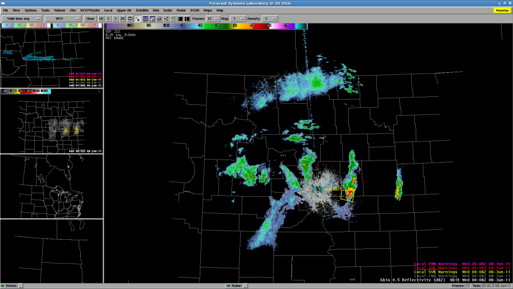
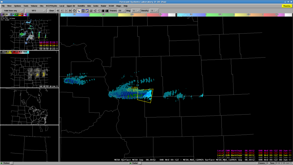
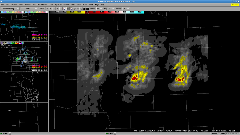
Bill and Justin worked three isolated storms in the BIS area, issuing a SVR warning on one of them.  The basis for the SVR ground relative velocities, mainly a wind threat, perhaps 60-65 mph and 1″ hail.  The actual WFO issued a Tornado Warning on the storm, but the EWP team felt that the circulation was too shallow to warrant a TOR.  Our 3DVAR data feed was out until about 0040 UTC, and wasn’t used much for the warning.  By then, the storms were below severe limits.  While watching the 3DVAR on Jidong’s website prior to restoring the AWIPS feed, there was decent vorticity at 3km, perhaps at the time of the official NWS TOR warning.  Here are some images:

Fig. 1.  KBIS reflectivity and EWP SVR warning.

Fig 2.  MESH and 120-min MESH Swath, and EWP SVR warning.

Fig 3.  30-min 3DVAR Vorticity Track.

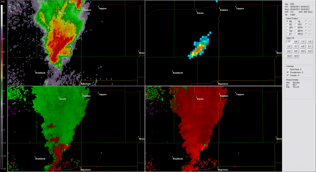
Here’s an image at 0004 UTC at the time of the NWS TOR issuance.  I’ve placed a marker where the supposed strong rotation couplet is observed.  Note on the reflectivity image that this position is well out ahead of the “hook” in the clear air ahead of the storm core.  Looks like side lobe contamination rather than a vortex couplet.  There is no continuity upstairs either.

Fig 4.  KBIS images from 0004 UTC 8 June 2011 from GR2AE.

We’ve wrapped up fpr the night, and the forecasters are filling out their surveys.

Greg Stumpf, EWP2011 Week4 Coordinator

Tags: None

Update – 2011-06-07 2305 UTC

Enough waiting!  We’ve decided to slide the MRMS and 3DVAR domains to the west to pick up the ongoing convection in BIS CWA.  Re-locaizing the machines now.  Will add BIS localization and either split Bill and Justin to BIS and FGF or put them both on BIS for now.  They are taking a dinner break while AWIPS does its thing.

Tags: None

Update – 2011-06-07 2215 UTC

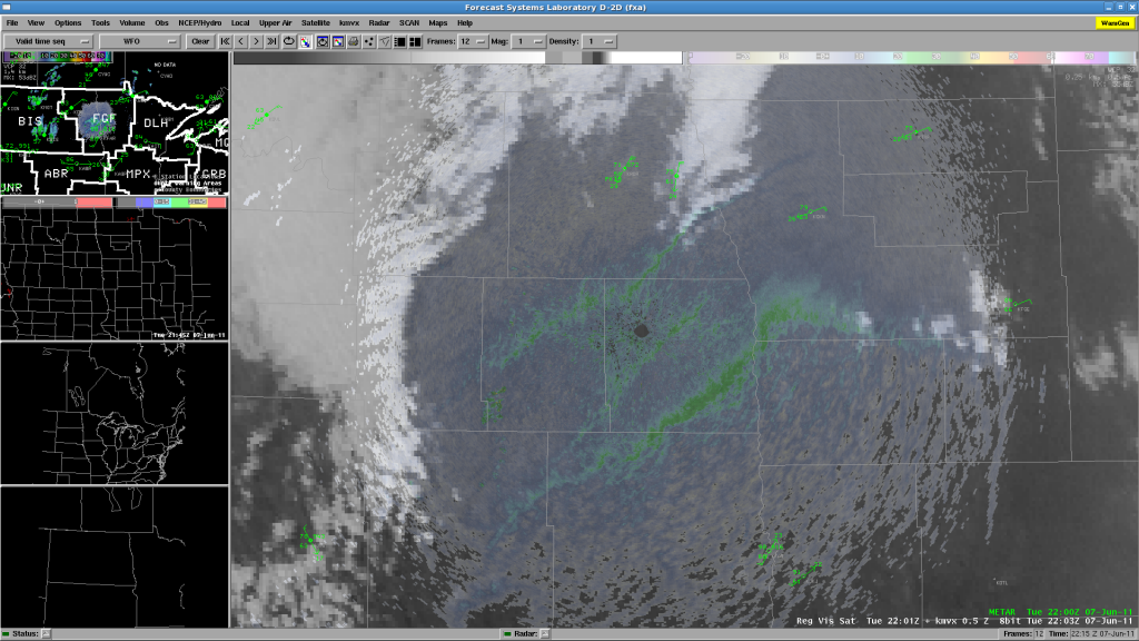
Well, we’ve been waiting, and there has been no CI in either DLH or FGF CWAs.  There has been a hint of some towers on the bulging dryline near FGF, just east of the Red River in Minnesota:

but so far, most of the thunderstorms are remaining west in BIS’s CWA.  Chris and Chris are ending their real-time shift and beginning their surveys.  Meanwhile, Justin is being moved from the DLH WFO to join Bill on the FGF CWA, hoping for CI there, or even the storms in BIS area to move into the west edge of the CWA.

Greg Stumpf, EWP2011 Week 4 Coordinator

Tags: None

Update – 2011-06-07 2040 UTC

We are currently working two CWAs:  Duluth MN and Grand Forks ND, in anticipation of convective initiation in our risk area.  Nothing so far!  The forecasters are monitoring the various CI products and the nearcast product, and we are in “wait mode”.

Greg Stumpf, EWP2011 Week 4 Coordinator

Tags: None

EWP2011 Week #4 Begins

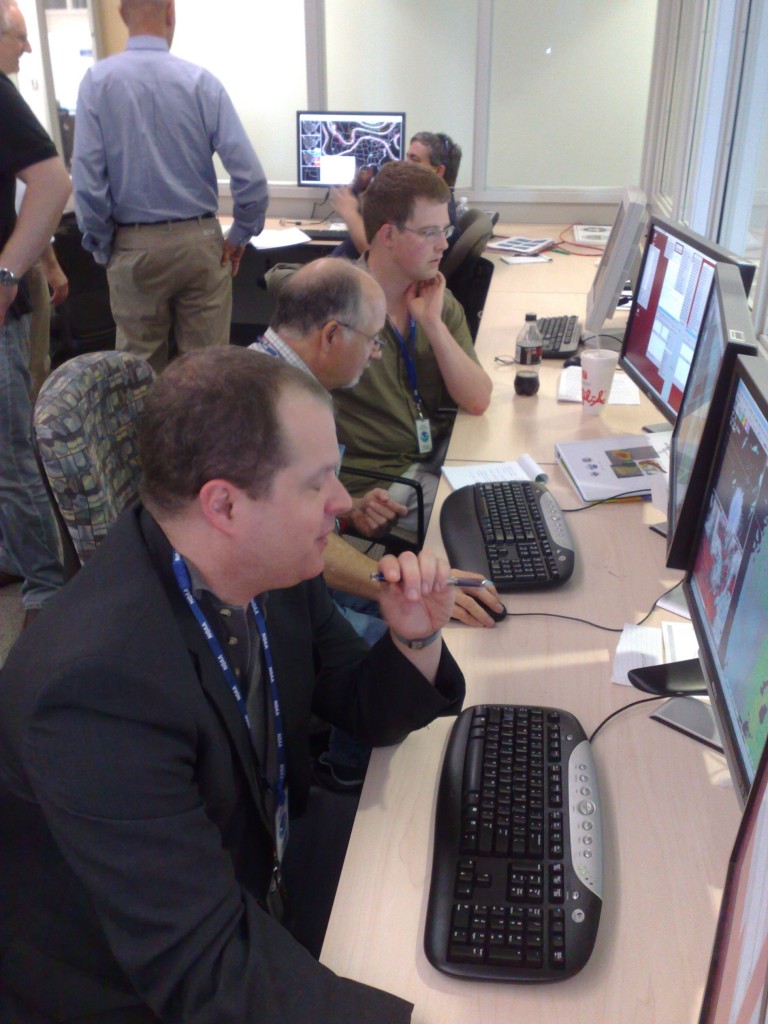
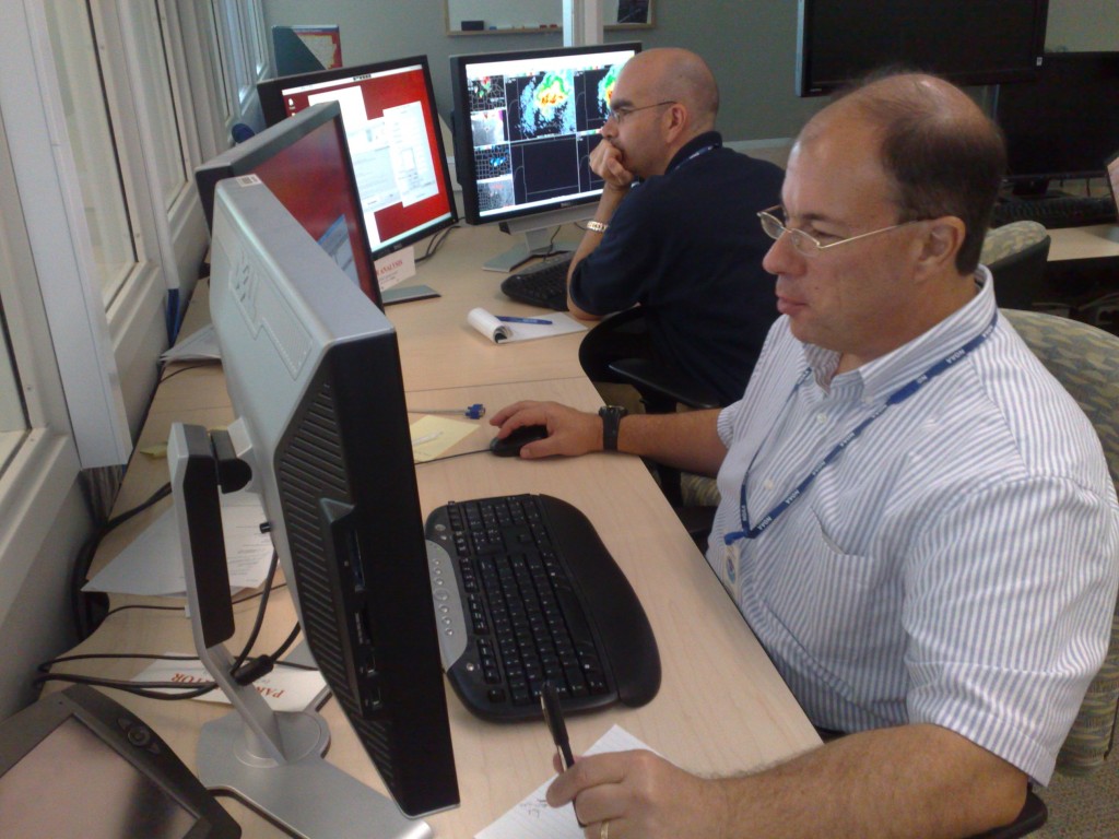
Monday 6 June begins the fourth and final week of our four-week spring experiment of the 2011 NSSL-NWS Experimental Warning Program (EWP2011) in the NOAA Hazardous Weather Testbed at the National Weather Center in Norman, OK.  Our distinguished NWS guests will be Bill Bunting (WFO Fort Worth, TX), Chris Buonanno (WFO Little Rock, AR), Justin Lane (WFO Greenville, SC), Chris Sohl (WFO Norman, OK), and Dan Miller (WFO Duluth, MN).

Photo 1:  From the foreground…Chris Buonanno, Chris Sohl, and Pieter Groenemeijer.

Photo 2:  From the foreground…Bill Bunting and Justin Lane.

Other visiting participants this week will include Ralph Petersen (UW-CIMSS), Bob Aune (UW-CIMSS), Jordan Gerth (UW-CIMSS), Lori Schultz (UAH), Jim Gurka (NESDIS), and Pieter Groenemeijer (European Severe Storms Laboratory, Munich, Germany).

Today, Monday, is the time we spend training our visitors and getting them acquainted to the experimental products which they will be evaluating during real-time operations on Tue-Wed-Thu.  The first half of the day consisted of PowerPoint presentations from the various project PIs.  The second half of the day, they are perusing the experimental data on a displaced real-time case from 19 May 2010 over Central Oklahoma (High Risk supercell and tornado day).

Greg Stumpf, EWP2011 Week #4 Coordinator

Tags: None

Forecaster Thoughts – Kevin Donofrio (2011 Week 2)

I share some of Steve Keighton’s comments on structure/logistics of the EWP. Here are a few more general comments: I think collaboration with the EFP could be very useful, I just did not find it to be the one day that I was not on the full-blown warning shift. I also would find it useful to either a) Not be completely focused on the timeliness of warnings, and more on the analysis of the products, (b) Possibly having certain forecasters focus on certain products at various times in the warning process. That said, it is good to see what products came to the forefront and which ones maybe were not (and maybe should have!), and to truly mimic a warning environment,. Having grown accustomed to 3 D2D screens in a warning environment, I did not use quite as many products as I would have in a typical environment, and was also creating procedures on the fly, which I would not normally do in a warning situation. I would be really interested to see the effects of Dual Polarization has on screen real estate, and if it would affect the experimental products chosen for use in the warming decision/awareness process. I think we all tried to strike a balance between attempting to simulate and get warnings out in “real” time vs. giving each new tool more attention.

Below are a few key points about specific products from my experience. These comments have been shared with the staff at WFO Portland, and will be shared with all Western Region SOOs.

* The OUN WRF was a “hot model”, in that it also appeared to break the cap too quickly. That said, it did clue us in to potential scenarios, and seemed to have a decent grasp on convective mode expected, given convective initiation. It would be nice to have this run in an ensemble mode as well, as it basically served as another tool to compare to EMC WRF, NSSL WRF, and the RUC HRRR models.

* The 3DVAR Multi-Radar Real Time Data Assimilation Products, while fairly new, hold alot of promise. The products that I found useful included the Updraft (instantaneous and track) and the Rotation products. The Updraft product, while sometimes misplaced, was still very valuable. The downdraft products were a bit noisy, not only in multicell situations, but even in supercell cases. These products aided in assessing whether updrafts were strengthening or weakening, and the rotation track also aided in more accurately following storm motion. While I did not rely on these products, and did always confirm what I was seeing with my traditional radar analysis, it did provide a clearer situational awareness picture, and it was fairly easy to create procedures to integrate into the warning decision process.

* Convective Initiation tools, while useful, are still contaminated by cirrus. They did provide some lead time before seeing significant radar echoes, though lead time in rapidly developing cases was not much more. I did find, once radar operations got more intense, that I did ignore these products a bit more than I wanted to, but it was more a workload issue. Also, on the days where convective initiation did not occur, these tools provided a correct NULL result. I did like the CIMSS product a bit better, as it provided CI likely, CI occurring, CI possible vs. a YES/NO from UAH. The UAH algorithm was too sensitive, and the CIMSS product seemed not sensitive enough. This is intended as the CIMSS product is going for a low False Alarm Rate, and UAH is going for high Probability of Detection.

* We got to look at multi-cellular and more borderline cases as well, which was very useful instead of focusing on “supercell” cases. The products didn’t do too bad, though seemed to perform best in more traditional supercellular cases.

* The pseudo-GLM was very useful in that it focused attention on storm intensification, and was able to pick up on flash rates much earlier than the CG network. Though I did not see this for many borderline cases, this would be useful when the forecaster is not sure whether particular areas are electrified or not, particularly when not seeing any CG strikes.

* I relied heavily on the Multi-radar, multi-sensor products when in a warning environment. I wouldn’t say they made the warning decision for me, but they served as a great situational awareness tool as to where to focus my attention. Of particular use were the -10C and -20 C Reflectivity products, but my favorites were the 50 dbz height above/below a user specified level (such as the -20 C level), MESH (Multi-radar estimated hail size, both instantaneous and track). These products were great for estimating hail size when combined with radar tools. These products are available (they are adding the Western domain soon, if not already) on wdssii.nssl.noaa.gov as KML files, or on a neat google map in
development wdssii.nssl.noaa.gov/maps.

Thank you again for allowing me to participate in the EWP this year. This was my first experience in an experimental warning program, and I hope to leverage this experience to spread the word on the promise on new warning decision tools, and to hopefully participate in another Experimental Warning Program in the future.

Kevin Donofrio (General Forecaster, NWS Portland OR – EWP2011 Week 2 Participant)

Tags: None

Forecaster Thoughts – Steve Keighton (2011 Week 2)

* Overall, another very valuable experience for me, and an important program to get feedback from forecasters during the development process. Thanks for the opportunity!

* A general suggestion is to either require participants to review materials on the products ahead of time (through recorded presentations), and then have a much shorter period the first day for SMEs to summarize and answer questions, thus allowing more time on the first day to get more familiar with products and procedures during a WES….OR, more ideally, have participants come for a two week period to get especially comfortable with the background on the products, and more time spent really working with the various products, and perhaps more opportunity for concentrated time spend really evaluating one product at a time initially. I realize though this would reduce the number of overall participants, and that’s not good either.  So just something to consider perhaps. I felt that there just wasn’t quite enough time to really get to know and work with each of the products, and we were just getting there on the last day.  A more focused effort on each product before given the flexibility to use any or all to help make warning decisions or raise S.A. would be better, since I felt I was trying to make sure I frequently tried to look at all of them, while at the same time trying to keep up with warning decisions using traditional products/methods too.

* Another general suggestion is to consider different interactions with the EFP side than what we did.  Felt it was generally a waste of time to work with the CI group that one day I did that, and would prefer to work with the severe wx desk and get a sense for the various models and high res ensembles they were evaluating. We got to evaluate the OUN WRF, but that’s just one potential solution.

* I was most impressed with the promise of the 3DVAR products in terms of a little more of a complete picture of storm structure/intensity (4D really with tracks of max updraft and rotation very helpful for trends to stand out).  These were particularly helpful in combo with traditional radar products, especially with 5 minute updates, but latency is the one concern. Not likely to make a warning decision based solely on these, but certainly adds confidence to decisions being considered with traditional (usually base radar) products.  Obviously with the future potential to advect this in the future from RUC-based forecasts will add another dimension to it’s utility.  Specific comments on the various products available were made via the survey forms, but here will just mention the need to improve the downdraft product (focus on lower levels), perhaps updraft too (various levels), an updraft helicity product, and then access in AWIPS to the 2D winds would be a great benefit.

* I was a little discouraged with the CI products, but do see the potential, but would like to have spent more time with these in different environments. My impression is that these will be most helpful for otherwise clear conditions with CI expected on a boundary like the dry-line, and much less useful in moist “airmass” type environments, and obviously when there is cirrus or present (these last two scenarios are fairly common here in the mid-Atlantic region). A little concerned about two different efforts/groups developing different CI products, and each seemed to have some advantages, in my limited experience that one one week I was more impressed with the UAH version, (with more detections), but need the multi-tier output I think like the UW-CIMSS version.

* OUN WRF (as other high res convective resolving models have shown) certainly has a lot to offer in terms of helping to anticipate storm mode and to some degree evolution, but not necessarily the locations or timing (timing probably worst).  Still need to have a collection or ensemble of these to get a better feel for the ranges of timing and locations, but looking at the details of a single model and it’s trends can still provide some helpful info for overall S.A., and ultimately leads to quicker decisions if you are ready to anticipate certain structures/evolutions. Despite some errors in timing and placement on that last active day we were there (May 19), the signals were good enough to help prepare for some upscale evolutions during the evening, and did suggest some early convection initiation (which some other models did not have).

* Finally, love the new wdsii-nssl map web page for the MRMS products (even though we weren’t specifically evaluating those). I used these frequently in AWIPS, with some of the same advantages of the 3DVAR products such as trends, but the rapid update for these since they are multi-radar is a uniqe advantage.  I’m more easily to introduce these products to my staff using the web page (http://wdsii.nssl.noaa.gov/maps), but would also like to work with ER SSD to get these into AWIPS via LDM (when I get a chance!).

* I just realized I totally left out any comments on the PGLM data!!  IN part I think since I really did not get a chance to spend much time evaluating it. In one case, one of the key ground sensors actually dropped out and it gave the impression that the flash density dropped when it really didn’t. Also, for this event the NLDN CG data was intermittent so not a good chance to compare the two.  Again, I think with this data set it would be especially important to focus solely on this product for most of an afternoon/evening, or during a DRT case.  Still don’t have a real good feel for how the total lightning relates to the CG data we are used to tracking, and relationship to severe weather.  I think it would be very important to almost spend at least one day on this one product to get some worthwhile feedback. Sorry I don’t have more on this.

Steve Keighton (Science and Operations Officer, NWS Blacksburg VA – EWP2011 Week 2 Participant)

Tags: None

Shift to eastern Colorado 18 May 2011

19/0100Z: Supercells over Crowley and Kiowa counties.  Kiowa county storm still shows strong/deep mesocyclone with attendant large hail/damaging hail risk. There was a brief land spout reported with storm early in life cycle, but appears that it has evolved into a more HP-type storm with decreased tornado potential. 0-2km Az-shear has weakened the past 30 minutes with this HP transition. Although MESH is indicating less-than-severe-size hail, there are reports of 1″ to 1.75″ hail with the Kiowa county storm. Hgt 50dbz above -20C and estimated dbz at -20C would support the larger hail.  kbrown

Tags: None