Daily Summary – 8 May 2012

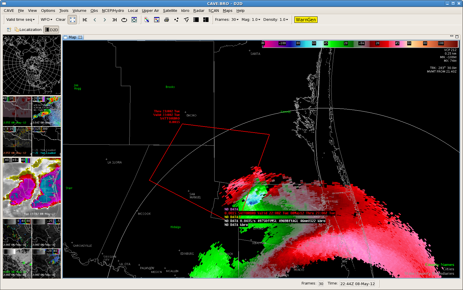
We operated in 5 different WFOs today, although out “bread and butter” was the Brownsville, TX (BRO) area, where several large supercells tracked across their CWA.  However, since they were mostly over open terrain, there were very few reports.  This is where we kept our MRMS domain most of the day.  Simultaneously, we had another team working the El Paso, TX (EPZ) WFO, concentrating on storms mainly in southern New Mexico.  These storms were mostly non-severe, except for one golfball hail report.

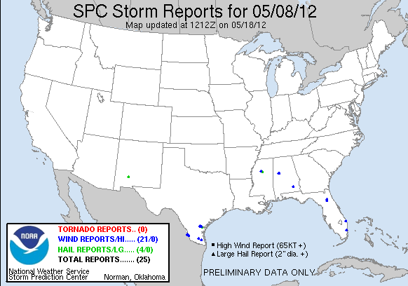
After dinner, we salavaged some storms in Midland, TX (MAF), and in Florida, hoping for the some PGLM action.  Both areas received no severe reports.  Here’s is the pretty meager storm report map:

120508_rpts Reports Graphic

Greg Stumpf, EWP2012 Week#1 Coordinator

Tags: None

EWP STATUS FOR 9 MAY 2012: 12-8pm SHIFT

EWP STATUS FOR 9 MAY 2012:  12-8pm SHIFT

We will be conducting a 12-8pm shift for Wed 9 May 2012. There are two areas of interest, and both will probably see their chances of severe convection die off at sunset, hence the early shift.

Area #1 would be coastal South Carolina and Georgia, as a cold front may fire off some marginally severe convection.  Area #2 is back to southern Texas, where the subtropical jet continues to provide strong shear.  However, boundaries may set up too far south (in Mexico) from current convection and limit the instability.

Because both areas are marginal, we may also spend time on another WES archive case.

Greg Stumpf, EWP2012 Week #1 Coordinator

Tags: None

Changing WFOs…

Because storms near EPZ have gone below severe limits, we’ve moved our EPZ folks to WFO MAF to work some storms in the Big Bend area.

Because the BRO storms have moved offshore, or are staying in Mexico, we’ve moved our BRO folks to Florida.  One is working JAX (recent “real” warning issued there), and one working MLB (PGLM data possibilities).

Otherwise, things are getting rather quiet across the nation, and we still have until 9pm!  We’ll be done at 815 however to start feedback surveys.

Greg Stumpf, EWP2012 Week #1 Coordinator

Tags: None

BRO-Possible Tornadic thunderstorm west of BRO @ 2240z

Severe/possibly tornadic thunderstorm…currently located over northern Mexico west of BRO…has been showing an increasing trend.  Updraft helicity have have increased to 87 m/s2 with surface vorticity values to 16 s-1.  It appears a rear flank downdraft has now developed on the south side of the storm.  Hovis/Barnes

Tags: None

BRO – Tornadic Thunderstorm continues @ 2220Z

Possible Tornadic thunderstorm continues to push east across northeast Hidalgo county.  Maximum Surface vorticity values have increase to 22 s-1 and updraft helicity values have increase to 447 m/s2.  Have not received any reports from this storm.  However…it has been moving across an area where not many people live.  Hovis/Barnes

Tags: None

BRO – Tornadic Thunderstorm? @ 2135Z

Impressive storm continues to move east across portions of south Texas.  Max Vorticity values have increased to 21.5 s-1…with updraft helicity values to 539 m/s2.   Maximum updraft values are much lower than expected with 19 m/s.  However…feel these numbers are low because radars are all examining the storm around 7500 ft AGL. Hovis/Barnes

Tags: None

BRO: The Mexican storm

Here are a couple of FSI images of the storm that is still in Mexico.  Definitely a supercell, worthy of a SVR for large hail.  TOR?  Perhaps.  But alas, it is not in the U.S.

Greg Stumpf, EWP2012 Week #1 Coordinator

Tags: None