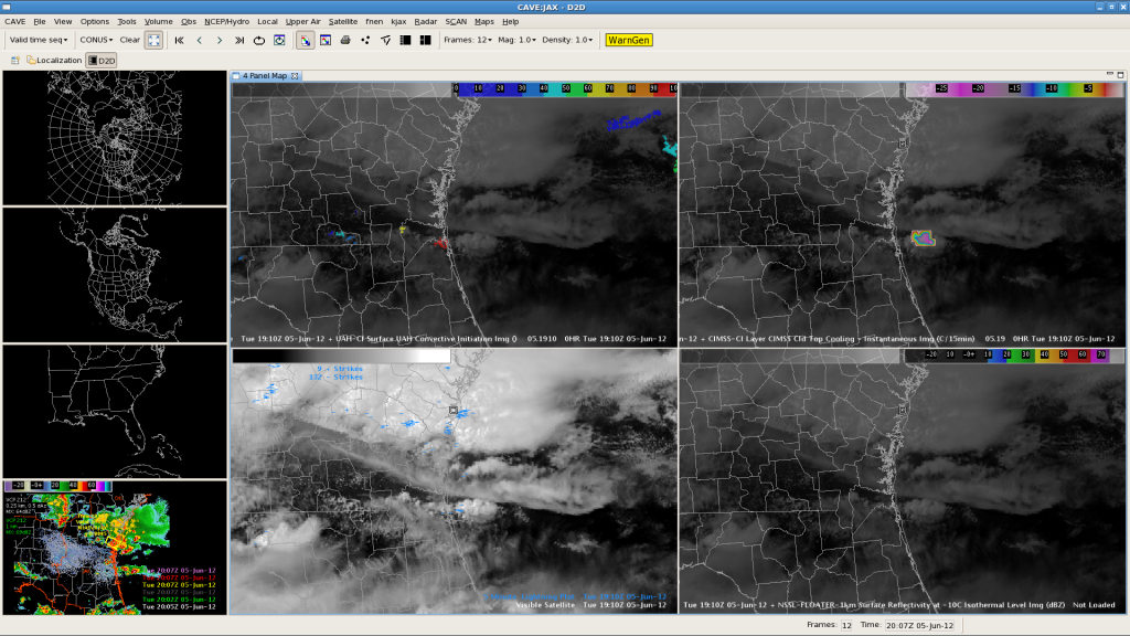
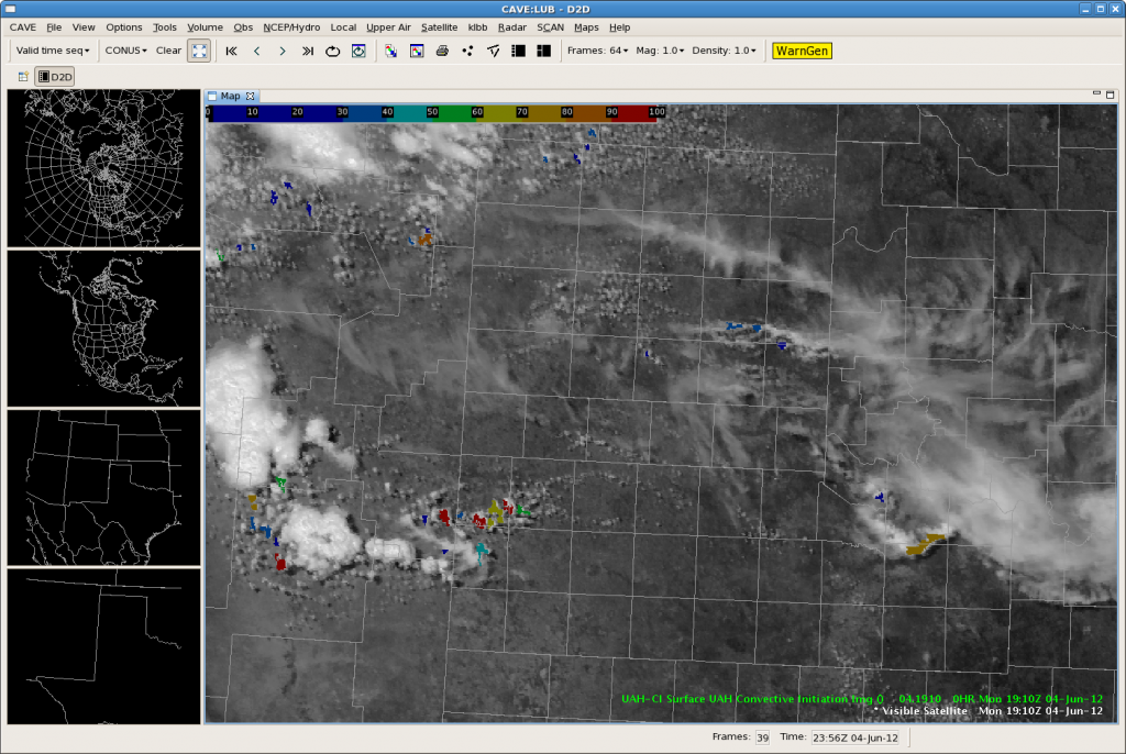
CTC and CI products have shown promise today despite shield of cirrus/anvil blowoff. The above image illustrates large CTC at 1910z. Within 15 minutes of this image, a line of small discrete supercells developed just offshore.
Author: Greg Stumpf
LZK: PULSEY STORMS
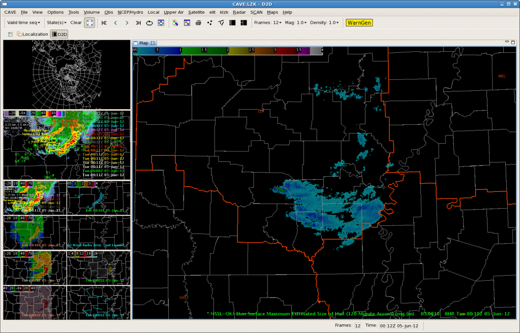
Storms have been pulsey this afternoon. 19Z OUN WRF did not accurately diagnose the decaying storms. Instead daytime heating has allowed the storms to increase, and some have become briefly severe. Though wind has been the primary threat as a convective line has bowed eastward at the edge of the CWA, there were some indicated areas of severe hail in the MESH data. Below shows the 2-hour Maximum Estimated Hail Size.
LUB: Day 1 – Getting Familiar with Products
Shortly after entering the lab, thunderstorms quickly fired up over our area of responsibility. While getting familiar with the new forecasting and diagnostic tools, we were quickly thrown into a “warning operations” situation.
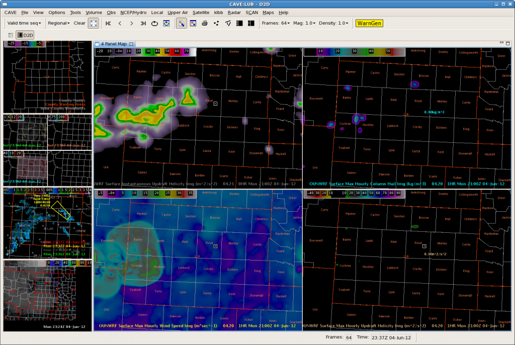
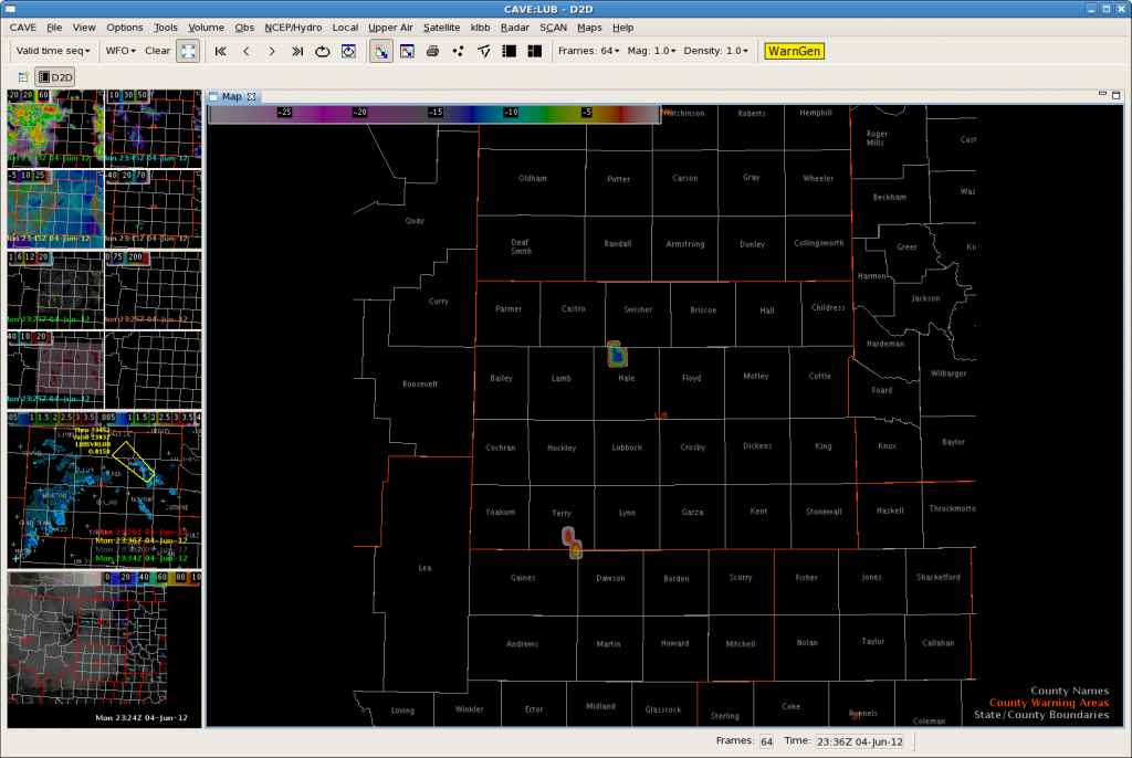
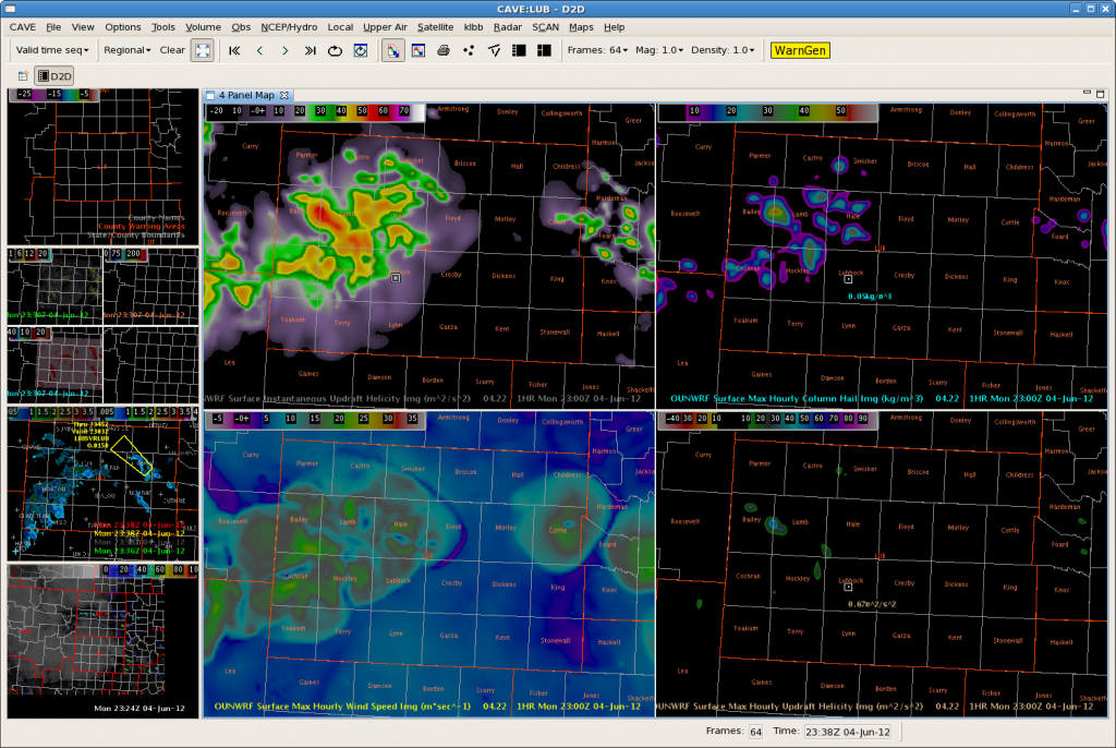
The OUNWRF did a fairly good job handling the timing and location of convective initiation this afternoon (Figure 1). Along with using the OUNWRF, we also tested the UW-CIMSS Cloud Top Cooling tool. The UW-CTC tool did a great job picking up the areas of developing convection across the CWA This afternoon. UW-CTC algorithm seemed to have only two”false alarms”, one of which being the result of some high clouds. It was pretty easy to identify the “false alarm” as the CTC rates were extremely low (on the order of -5C/15min), compared to CTC rates around -20C/15min (observed with most of the developing activity).
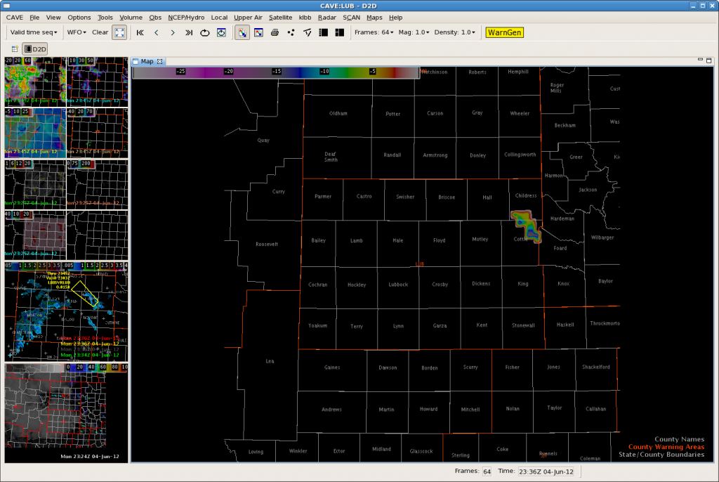
The second “false alarm” occurred when the CTC algorithm tagged a developing storm with CTC rates from -15 to -20C/15min (figure 3). After warning on this storm, we waited for LSRs and never saw a report to verify the warning.
Despite a couple of false alarms, we were very pleased with the performance of the OUNWRF with respect to the storms becoming outflow dominate and producing more wind damage than hail. We received wind gust reports greater than 60mph in the LBB area, as well as numerous downed trees. Figure 4 below illustrates the surface max hourly wind speed. Typically winds greater than 20m/s should raise heightened awareness and the potential for damaging winds.
Had we a little more time to become familiar with the products and get “spun up” with our procedures and whatnot…the Convective Initiation tool would have helped us greatly. Figure 5 below shows the CI application combined with vis sat imagery. The algorithm picks up the CI very nicely…this storm eventually blew up and was one of the larger storms of the day. The storm produced very large hail.The UAH-CI application continued to be quite helpful to us during the rest of the shift.
AMA: Warn on CI “miss?”
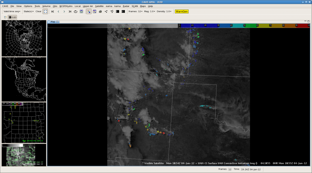
We have issued a couple warnings on marginal storms that did not give strong CI signals. On this image, I warned on the middle cell in Hansford County (reflectivity on bottom left). Note the lack of instantaneous or accumulated cloud top cooling for this area. We are looking for downburst winds and maybe some subsevere hail from this storm. The CI algorithms have been doing well in other CWAs like Lubbock, but may have missed one here, pending verification. CL
LZK: OUN-WRF trends vs Radar (CI possibilities)

19Z OUN-WRF indicates that the small complex of storms will diminish with time (over the coming hour). However, it does maintain a modest outflow, weaken with time. Location/strength of initial outflow is pretty close (WRF a little fast to the east).
 New 20Z OUN-WRF run now show southern flank of decay complex re-intensifying. This is confirmed on radar, though orientation of convection is off slightly. Progged max wind speeds up to 15 m/s with decaying/bowing segment agree with latest velocity data.
 Weak to moderate indication of new development possible on the western flank of the complex.
AMA: OUNwrf on storm mode
 Another capture above from the OUN wrf model output max hourly surface winds at 21z. Regardless of storm coverage, the OUN wrf shows great skill in predicting storm mode. Nearly annular outflows predict pulse storms with a threat of mainly damaging winds. Based on lack of upper flow and high surface instability, the model seems to have the right idea. Values in the image above indicate wind speeds from the strongest individual cells could approach 60-70 mph, which is certainly reasonable given the “inverted-V” nature of surrounding model soundings.
AMA: First potential UW/CI cell
AMA:Convective initiation in a non-supercell environment
OUTLOOK: 4 June 2012
For the week of 4-8 June, our distinguished NWS guests will be Marc Austin (NWS WFO Norman, OK), Rich Grumm (NWS WFO State College, PA), Chris Leonardi (NWS WFO Charleston, WV), Jennifer Palucki (NWS WFO Albuquerque, NM), Kristen Schuler (NWS CWSU Kansas City, MO), and Gary Skwira (NWS WFO Lubbock, TX), Other visiting participants this week will include Kathrin Waplir (Deutscher Wetterdienst, Germany), and Wayne Feltz (CIMSS/UW-Madison).
Austin, Marcus NOAA/NWS WFO Norman, OK
Grumm, Richard NOAA/NWS WFO State College, PA
Leonardi, Chris NOAA/NWS WFO Charleston, WV
Palucki, Jennifer NOAA/NWS WFO Albuquerque, NM
Schuler, Kristen NOAA/NWS CWSU Kansas City, MO
Skwira, Gary NOAA/NWS WFO Lubbock, TX
Wapler, Kathrin DWD, Germany
Sea breeze along W-coast of Florida
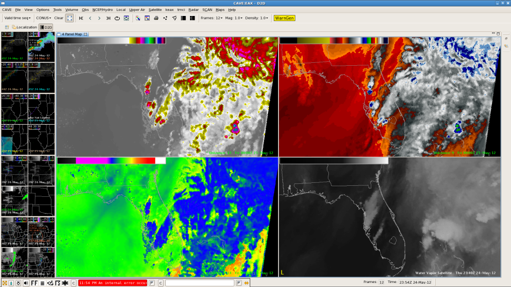
The synthetic IR/WV forecast did a good job in placing strongest activity over Florida along the W coast, where eastward moving sea breeze probably caused strongest convergence in easterly wind regime. Pulsating storms featured reflectivity peaks in excess of 50 dBz.
Helge


