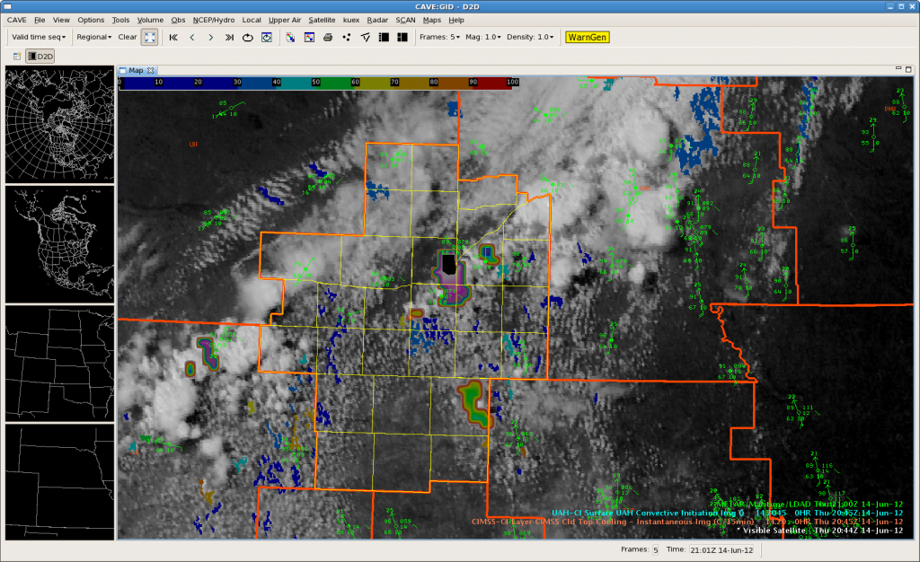
 Strongest CTC indication yet on latest pass. Would issue an outlook for strong storms may be developing in the next hour based on environment and what we are seeing in the CTC rates.
Garmon/Skov
 CTC did a good job forecasting 45 minutes out the development of the Polk county cluster that really got going as it crossed over into Butler county in Omaha’s area.
 The 2030Z pass of the CTC and CI products are starting to hint at convective initiation across our area in the next hour or so. Here is a look at the regional radar…
Well, I issued a TOR for Rice County storm, but it should have been a SVR. Total User Error. Anyhow, it may end up working out. We were thinking that the original azimuthal shear was associated with the storm bowing out. However, in the past few volume scans that circ tightened up and became more distinct. It would make sense for a brief tornado to occur given that this storm is right along the boundary left from the morning MCS. -MRD
Cloud cover seems to be inhibiting convective initiation in FSD CWA. Looking toward OAX, CTC signature showing up over eastern Nebraska. CTC showing cooling rate of -24 degrees C/15 mins over Dodge/Cuming Counties in Nebraska. It also shows -19 degrees over Polk County NE at 2015z.
Reflectivity is increasing in the storms in these counties.
We have shifted to OAX and issued warning for Butler County. This storm was associated with the previous CTC signature over Polk County in Nebraska.
Tim/Steve
 Quiet on the southwestern front at this hour…but we are starting to see a few echoes along the boundary. Latest OUNWRF wants to gen up a few storms along the boundary in the next hour or two…but then really gens up quite a bit of convection with a fairly large cold pool generating towards the 5 PM hour.
Not many signals being noted in the CTC or the CI products at this time, but we did get a CI 72 indication with a small tower going up on the boundary on the previous pass…will see if anything comes of it. Looking to the southwest upstream in the environmental flow, we note a few Cu towers going up at a faster rate and thinking this activity could move up into our area in the next 3 hours. See no reason why it won’t get going to the southwest given available instability.
NRE theta-e products showing a fairly unstable airmass over the area…and with near full insolation on the Cu field southeast of the boundary we expect initiation in the next 2 hours across the forecast area…
Garmon/Skov
Watching convection developing just past the FSD CWA line in Des Moines area as Cloud Top Cooling is showing a steady decrease in cloud top cooling rates from -8 degrees C/15 minutes over Pocahontas County IA at 1915z to -19 degrees C/15 minutes over Palo Alto County IA at 1932z.
Here is the KFSD reflectivity and enhanced echo top. Echo top was up to 37 kft on the storm in Pocahontas County IA at 1950z.
Update…this appears to be a false alarm as cell has continued to weaken and no cloud to ground lightning was indicated. Echo top reached 39kft before collapsing.
Tim/Steve